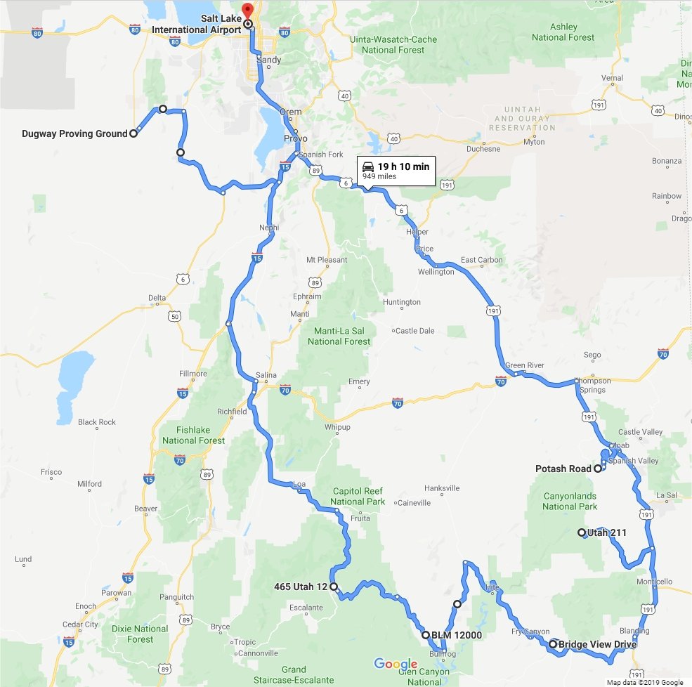
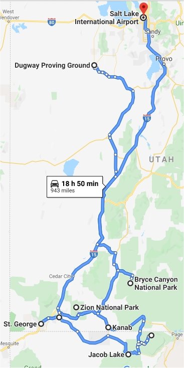
Utah & Nevada & Arizona, September - December 2019
Chris returned home on 14
September from being overseas in Sweden, Norway, and Denmark for 7 weeks,
which included 5 weeks of flight testing
in Sweden. He was home for 10 days, then headed out
west for more flight testing at Dugway Proving Grounds, Utah
starting on 24 September. That flight test ended up lasting all the way
into December.
He visited parks in Utah and Nevada on the weekends, and then at
the end of this first part of flight testing he took a couple days of vacation to spend
four days in southern
Utah at several parks from 2 - 5 November. He flew
home on 6 November, stayed home for 11 days, and then returned to Dugway for another
week of flight testing starting on 17 November. When that was completed, he
spent three more days out west at parks in Utah and Arizona, before flying
home for Thanksgiving, which we spent at Tami's parent's house in Charleston, WV. Then it was back to Dugway for another week of flight
testing, and finally home for the rest of
2019.
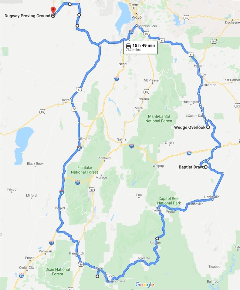
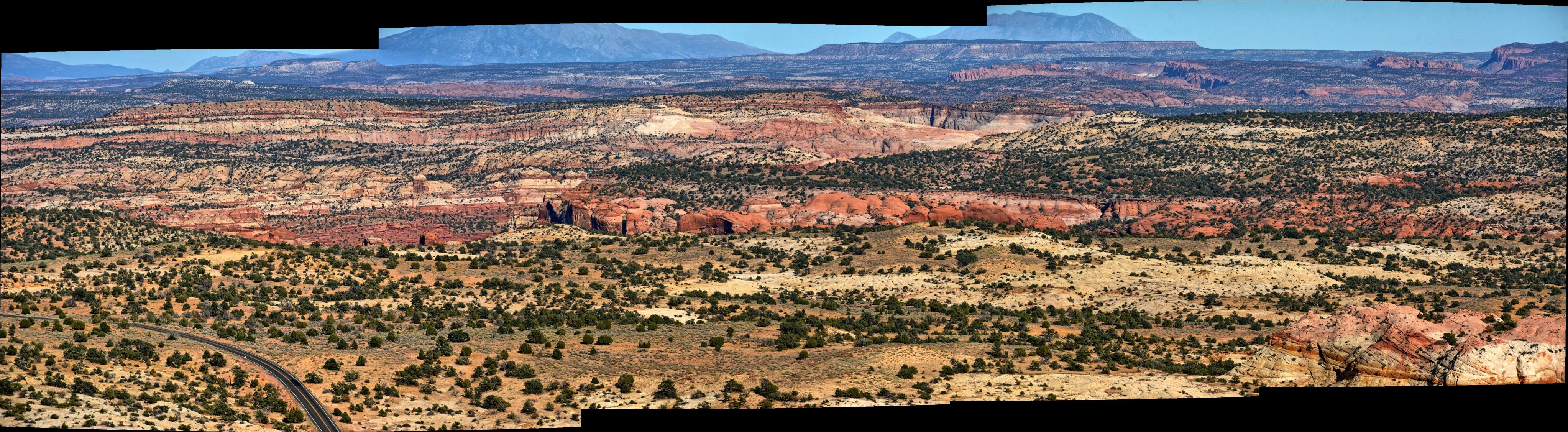
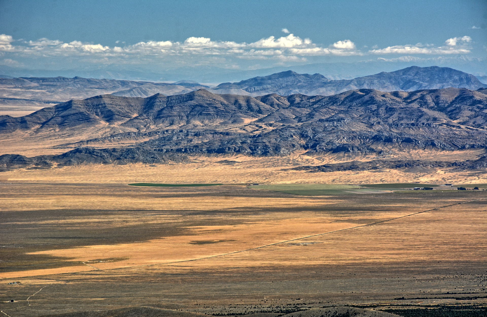
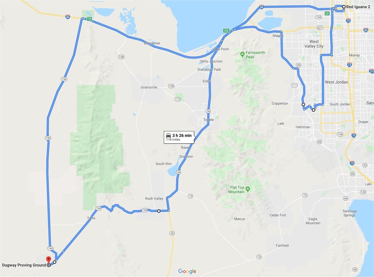
Chris was home for three weeks between 29 July and 8 December. The map below shows all of Chris' travels in Utah, Nevada,
and Arizona from September to December 2019.
Weekends
28 - 29 September 2019
Simpson Springs, Timpanagos Cave
National Monument, Salt Lake City
4 - 6 October 2019
Red Cliffs National Conservation
Area, Zion National Park
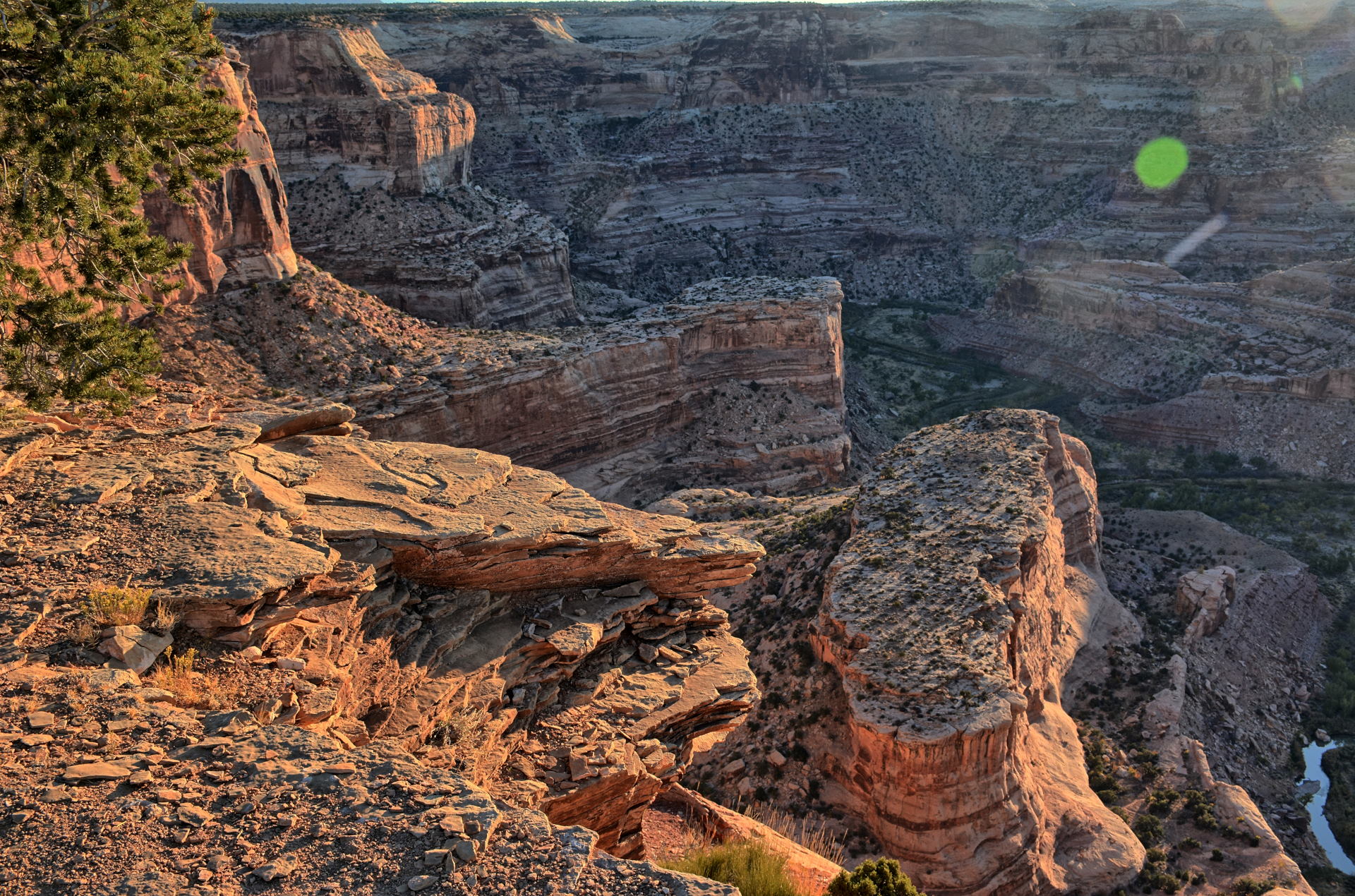
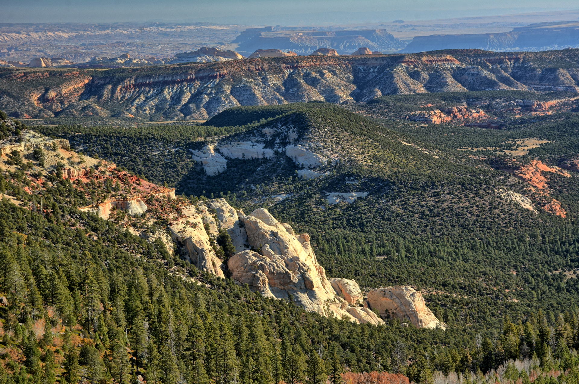
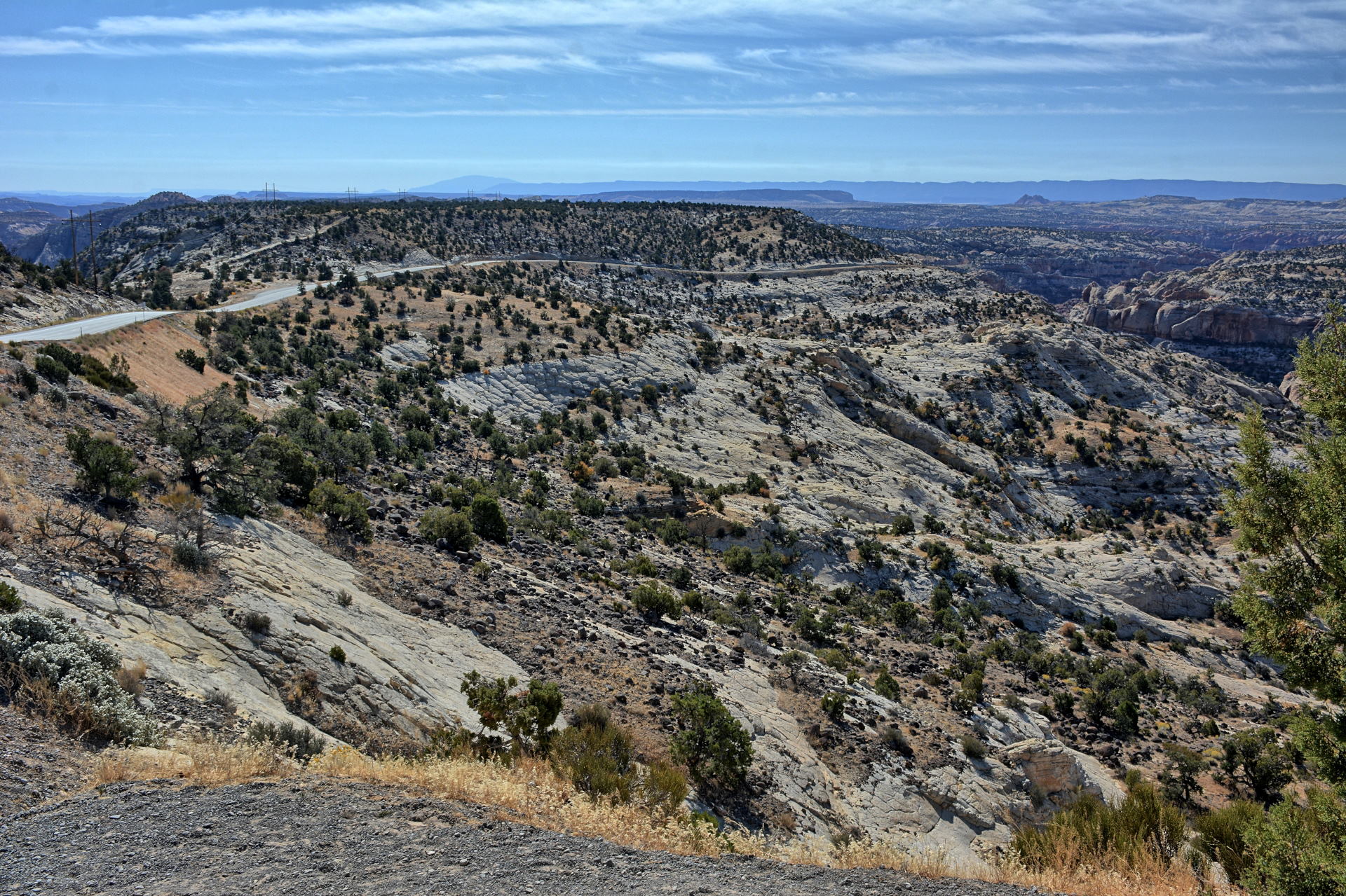
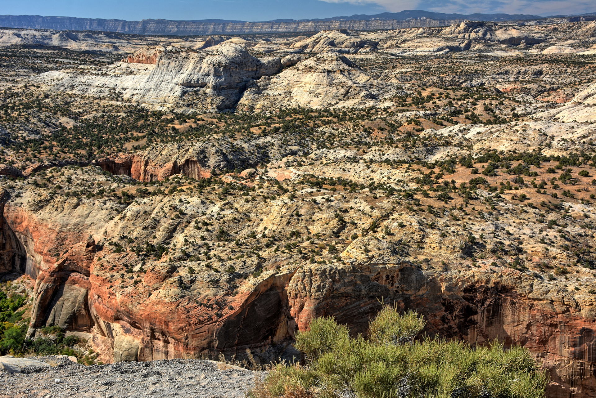
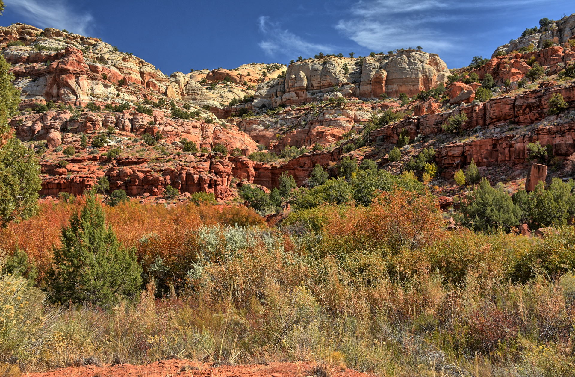
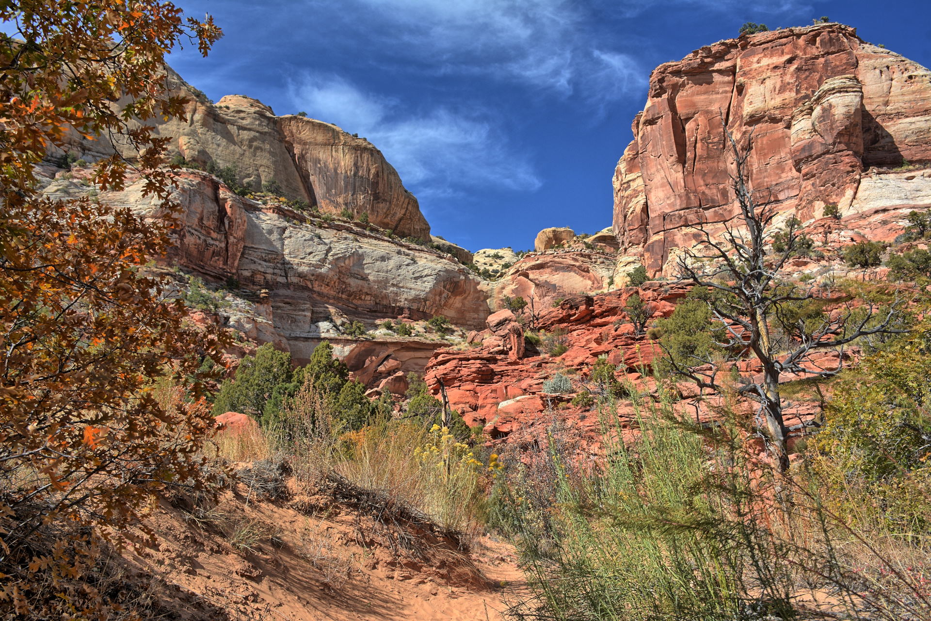
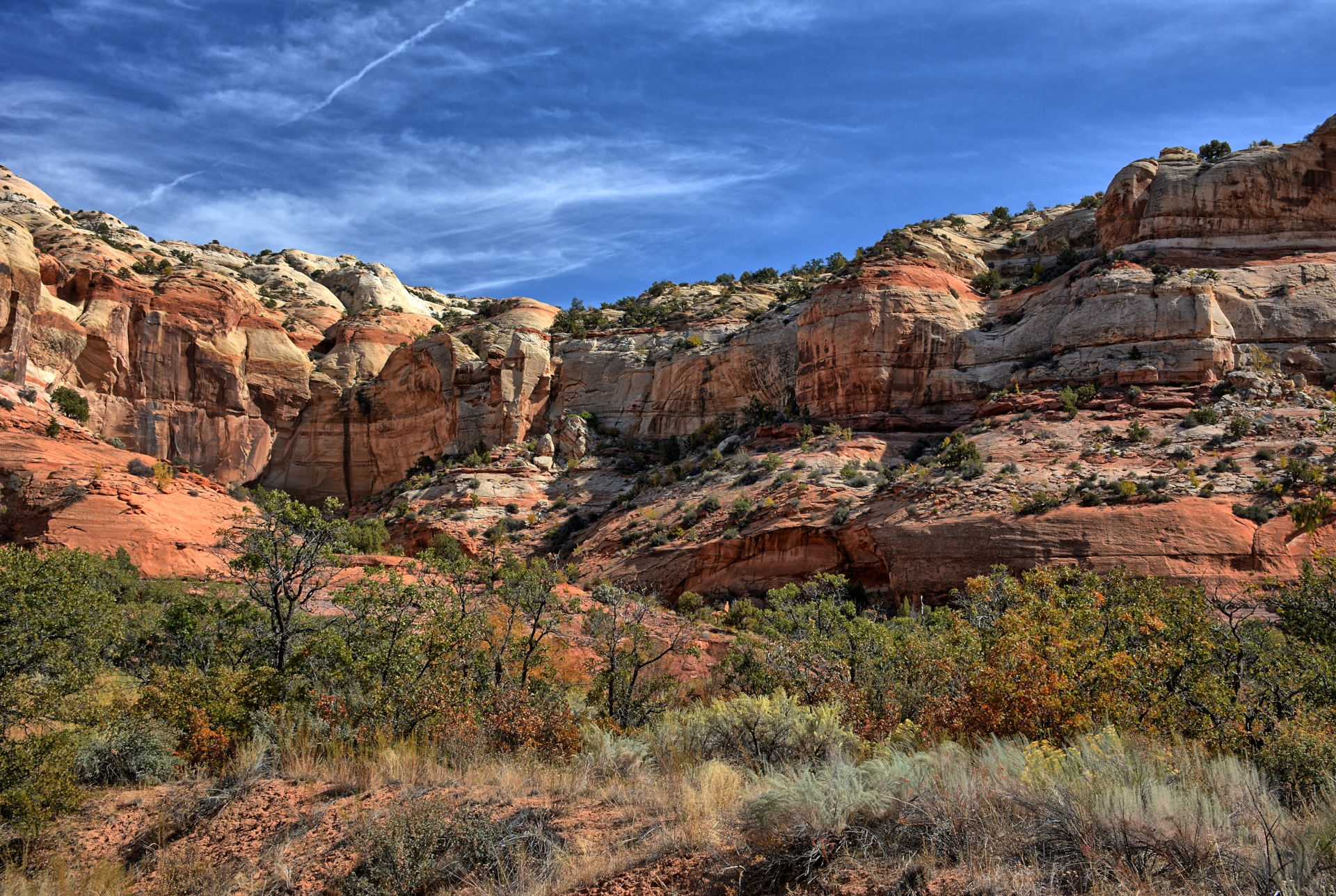
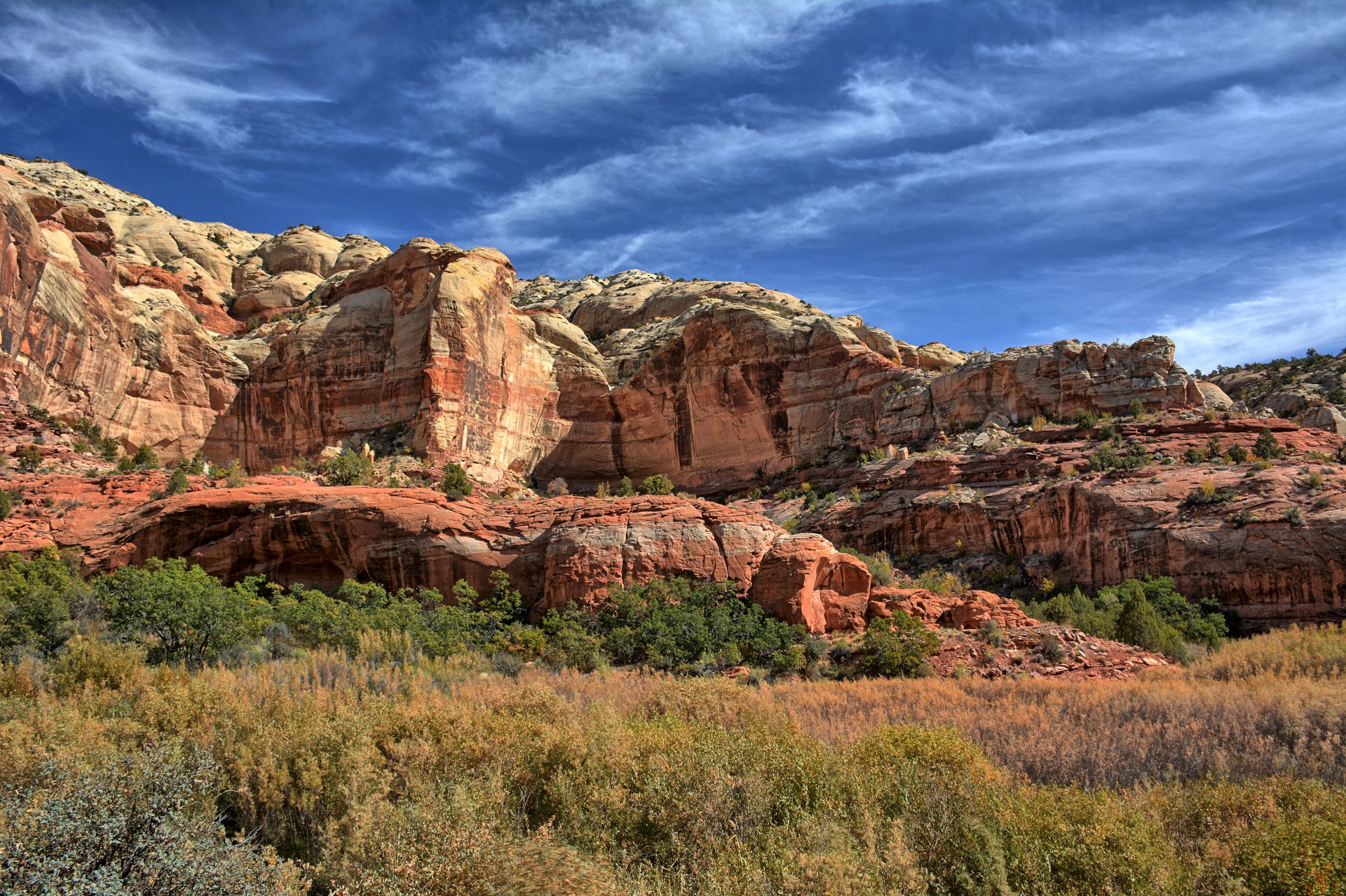
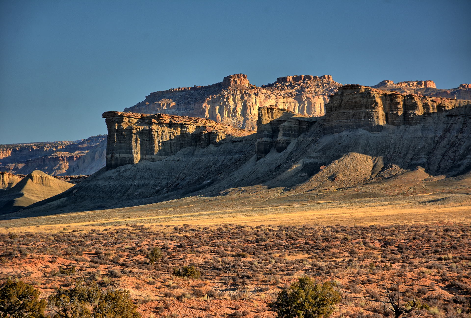
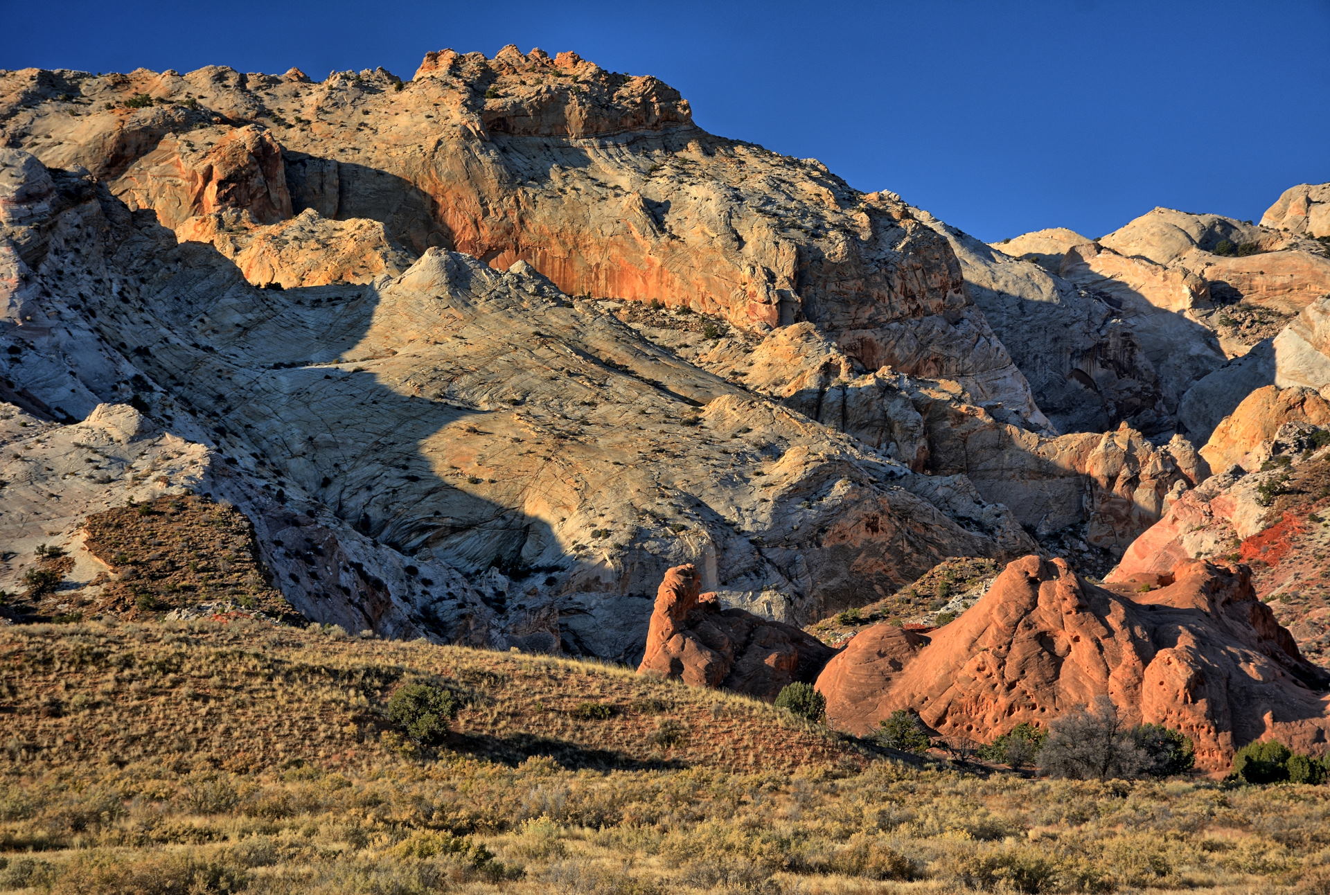
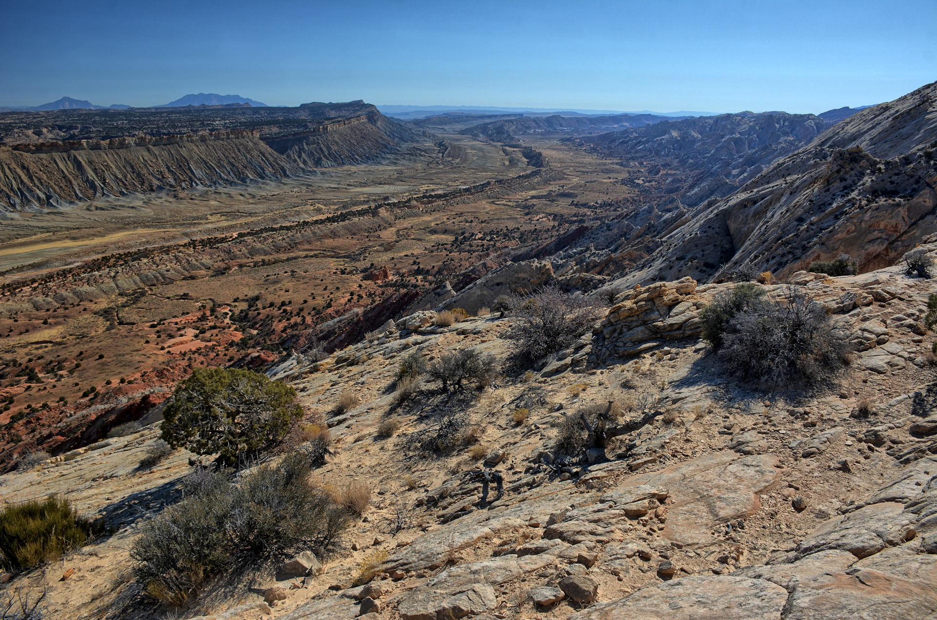
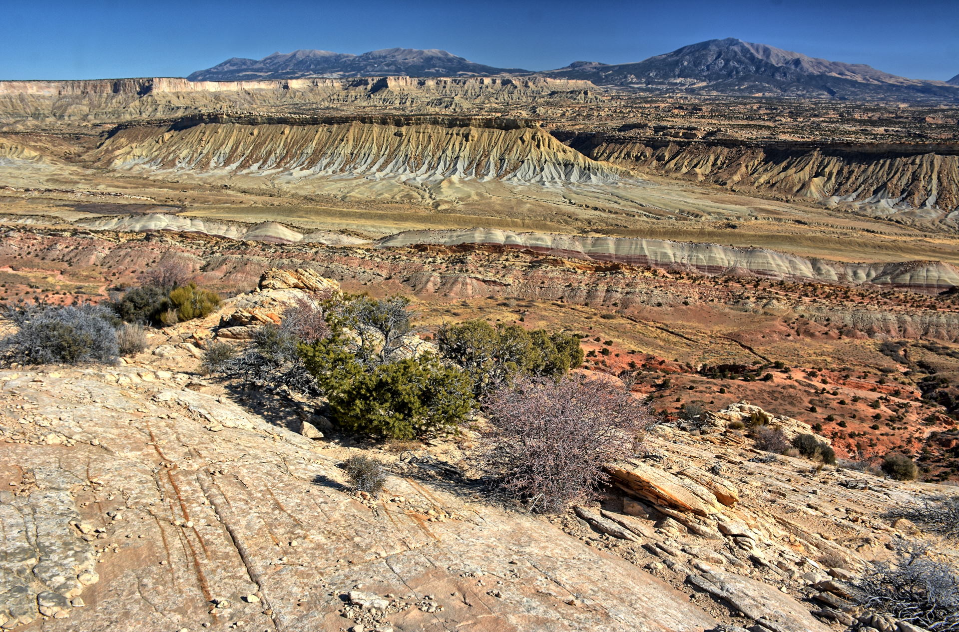
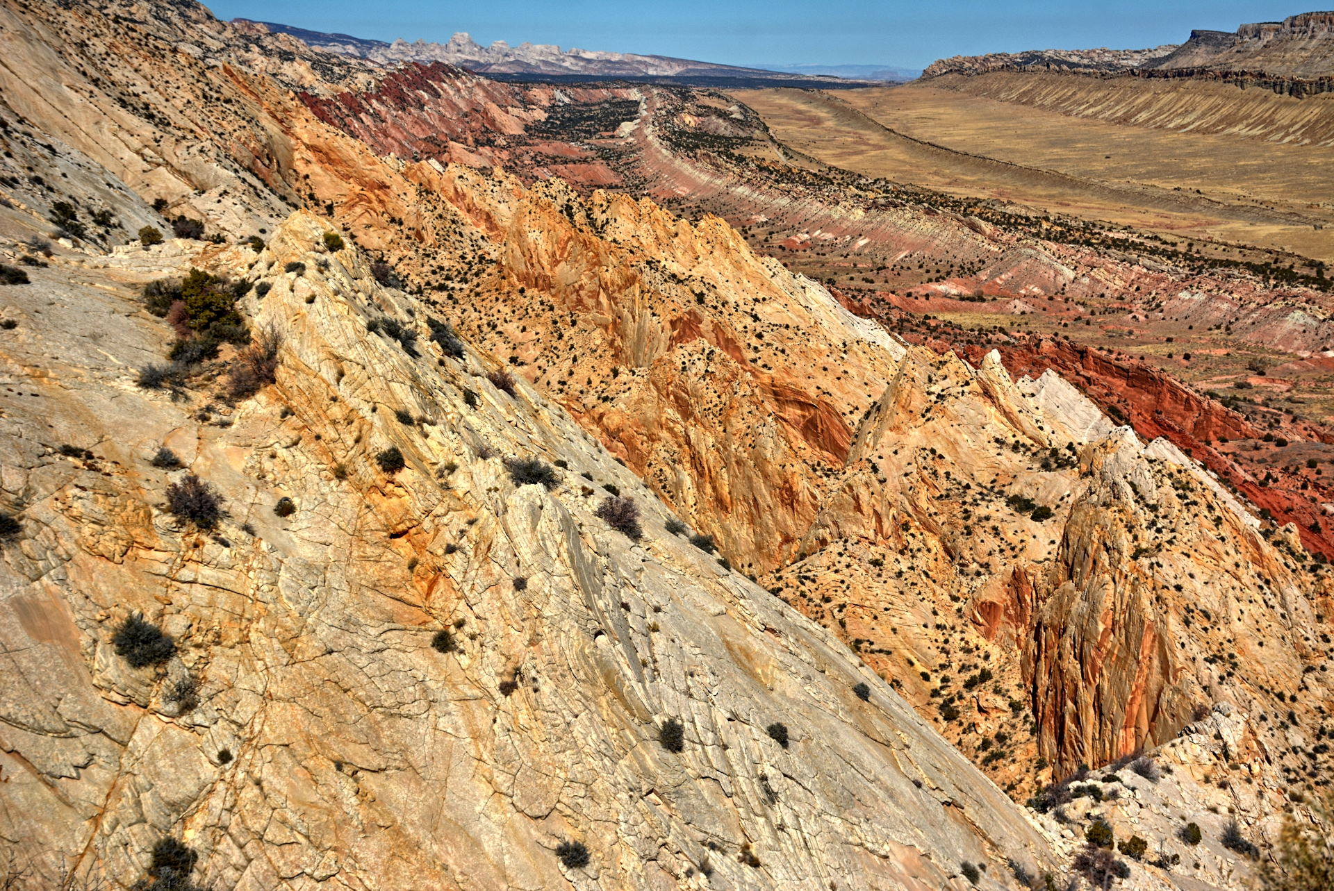
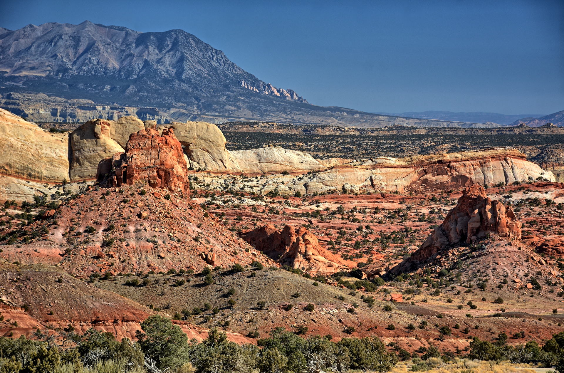
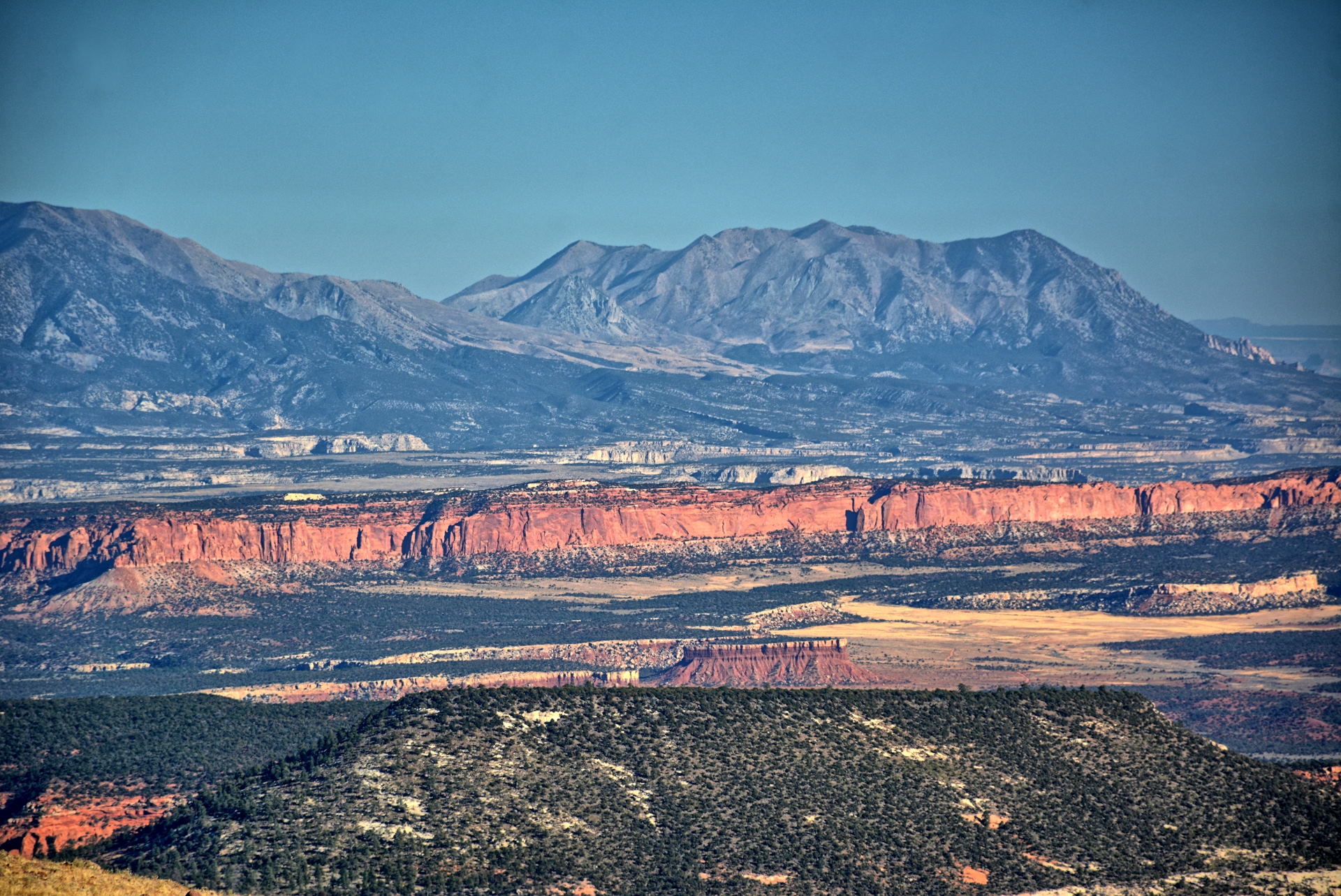
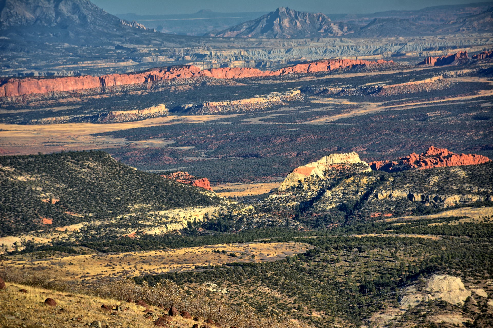
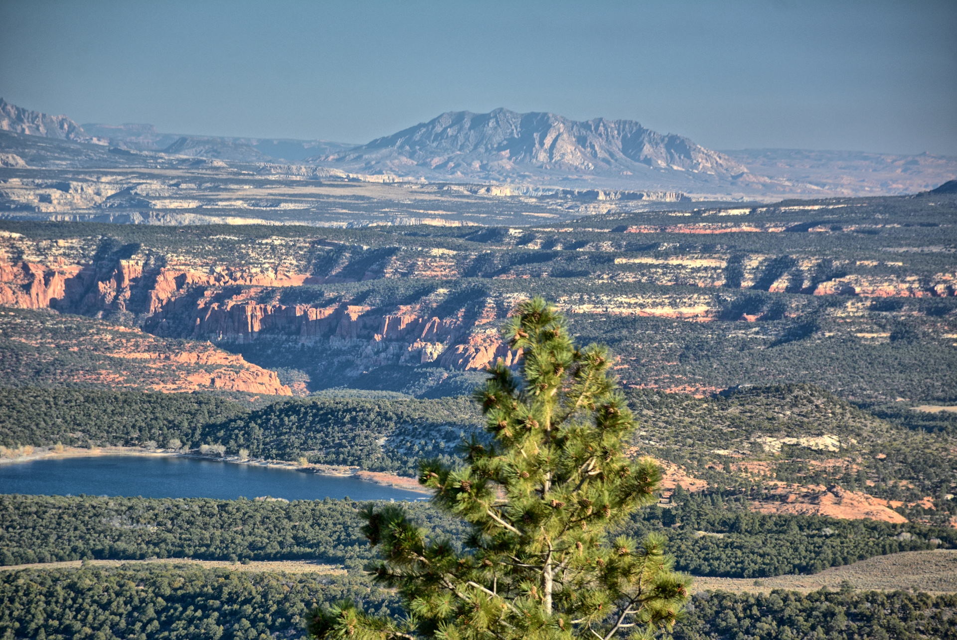
11 - 14 October 2019 San Rafael Swell, Capitol
Reef National Park, Grand
Staircase-Escalante National Monument, Bryce
Canyon National Park
19 - 20 October 2019
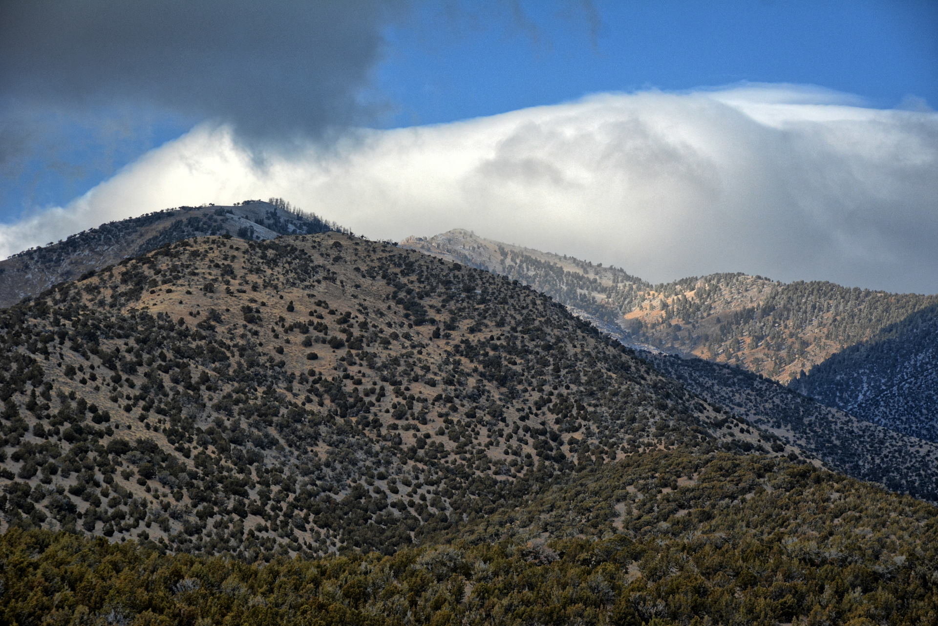
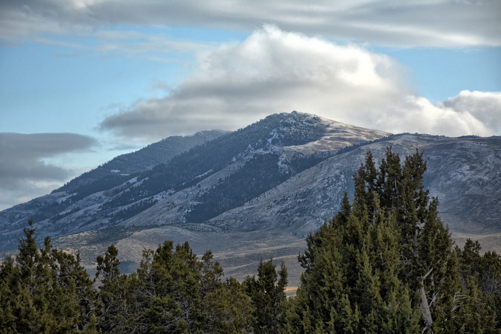
Great Basin National Park
27 October 2019
Salt Lake City
2 - 5 November 2019
Arches National Park, Canyonlands
National Park, House On Fire, Natural Bridges
National Monument, Glen Canyon National
Recreation Area, Grand Staircase-Escalante
National Monument, Capitol Reef National Park
24 - 26 November 2019
Bryce Canyon National Park, Zion
National Park, Vermillion Cliffs National
Monument, Pipe Spring National Monument
Flight testing at Dugway consists of long hours Monday through Friday, and
working some Saturdays. Because Dugway is so isolated, there is not time
to do much after work other than drive to the hotel, eat dinner, work a few more
hours on data analysis of the day's flights, and sleep. On the weekends
when not working Saturdays, I was able to visit a bunch of parks around Utah,
venturing into Nevada and Arizona on two occasions. I stayed on post for almost
the entire trip, having to stay in Salt Lake City for just a few nights when the
lodging on Dugway was full.
I took along two RC airplanes and two quadcopters,
and flew those for aerial video everywhere I went. Video links are
contained on this web page, and aerial video links and the locations where each video was shot are also available on my
Aerial Video webpage.
Sunday
Monday
Tuesday
Wednesday
Thursday
Friday
Saturday
September - December 2019
22 September Home
23
Home
24
Fly home to SLC
Drive to Dugway
25
Dugway Flight Test
26
Dugway Flight Test
27
Dugway Flight Test
28
Dugway Flight Test Simpson Springs
29 Timpanagos Cave NM
30
Dugway Flight Test
1 October
Dugway Flight Test
2
Dugway Flight Test
3
Dugway Flight Test
4
Dugway Flight Test Drive to Yant Flats
5 Yant Flat
Zion Canyon
6 Zion West Rim Trail
Zion Kolob Canyons
Drive to Dugway
7
Dugway Flight Test
8
Dugway Flight Test
9
Dugway Flight Test
10
Dugway Flight Test
11
Dugway Flight Test Drive to Wedge Overlook
12 San Rafael Swell
Capitol Reef NM
Boulder Mountain
13 Lower Calf Creek Falls
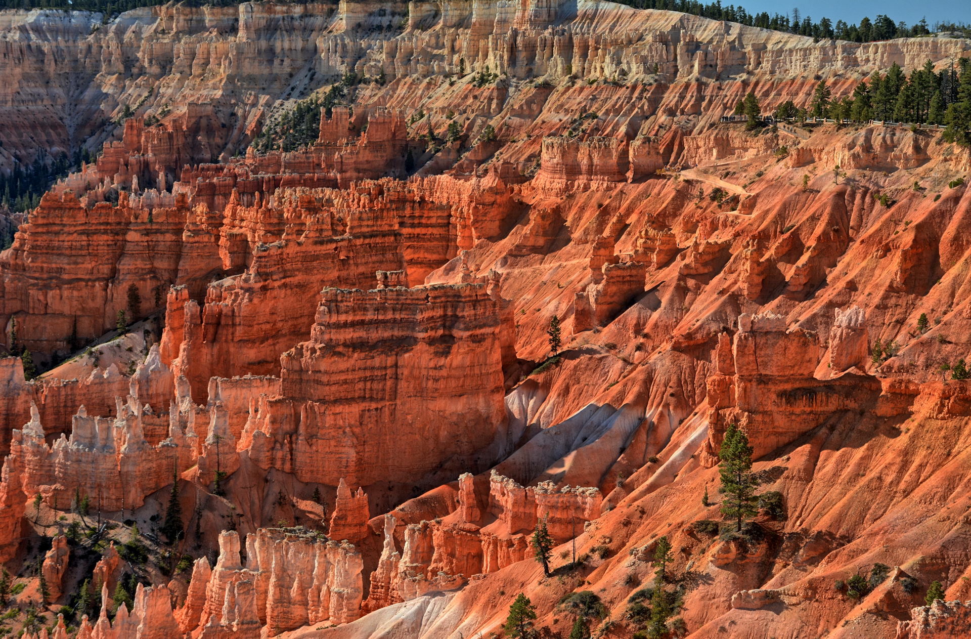
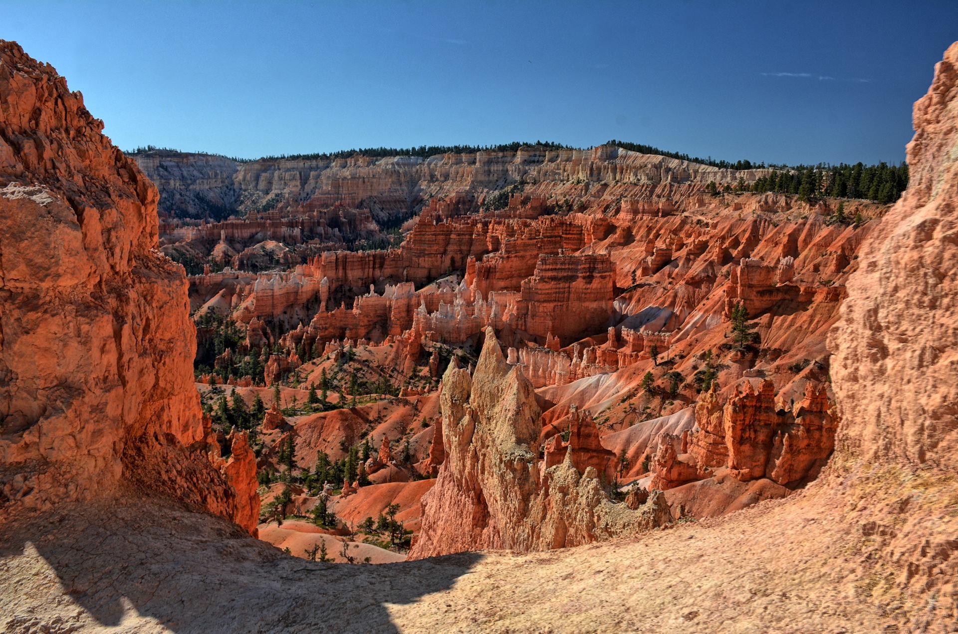
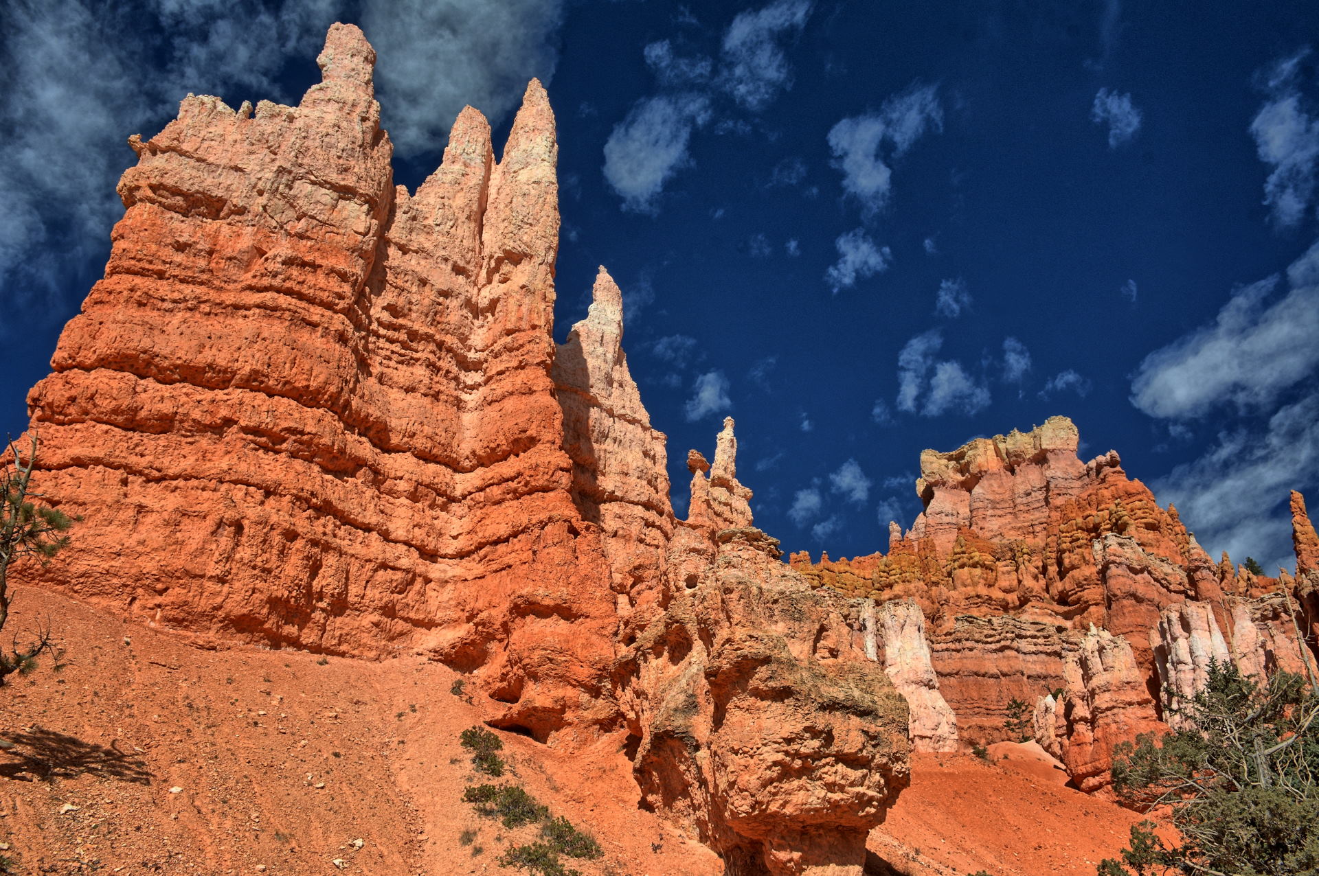
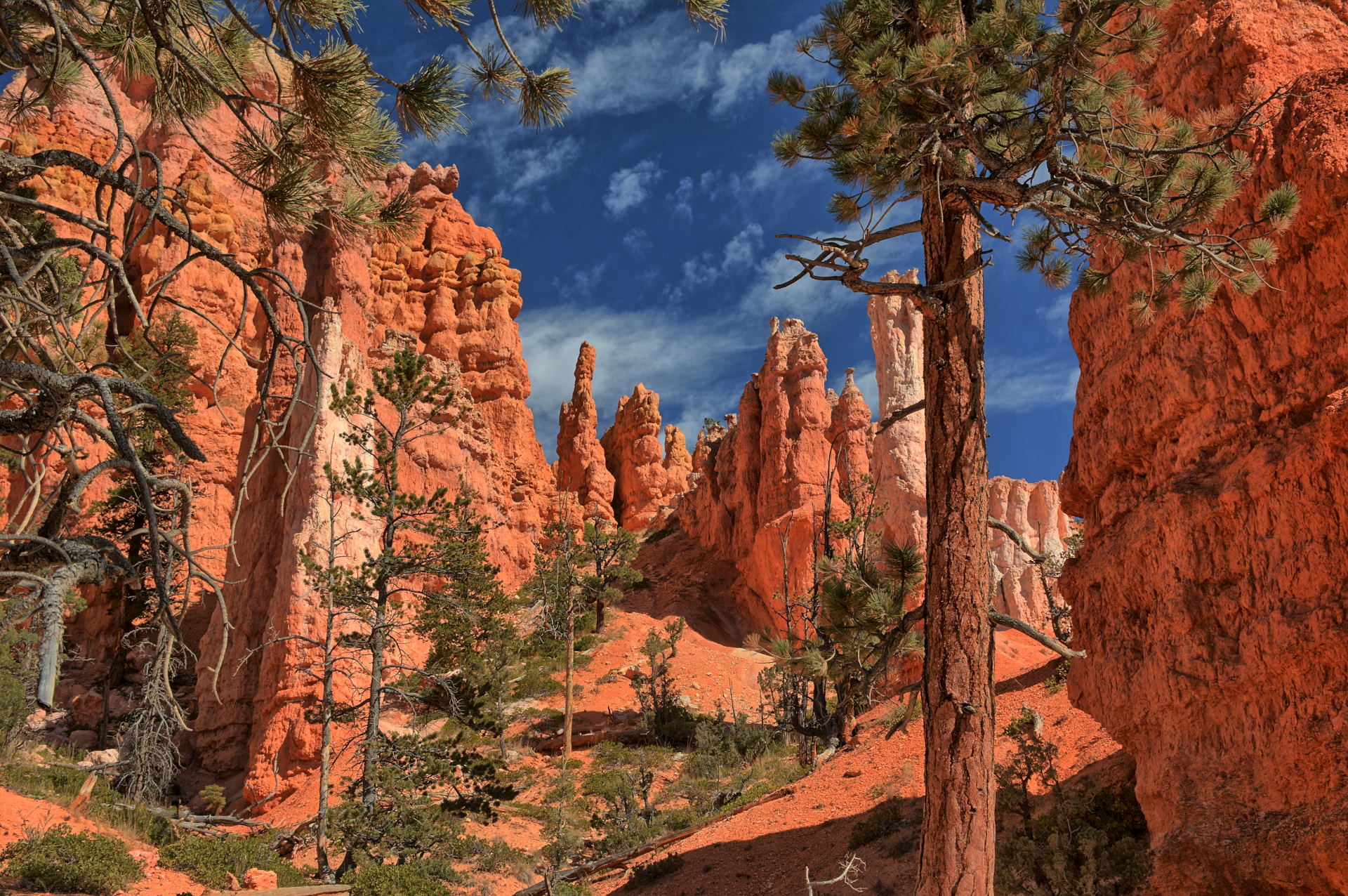
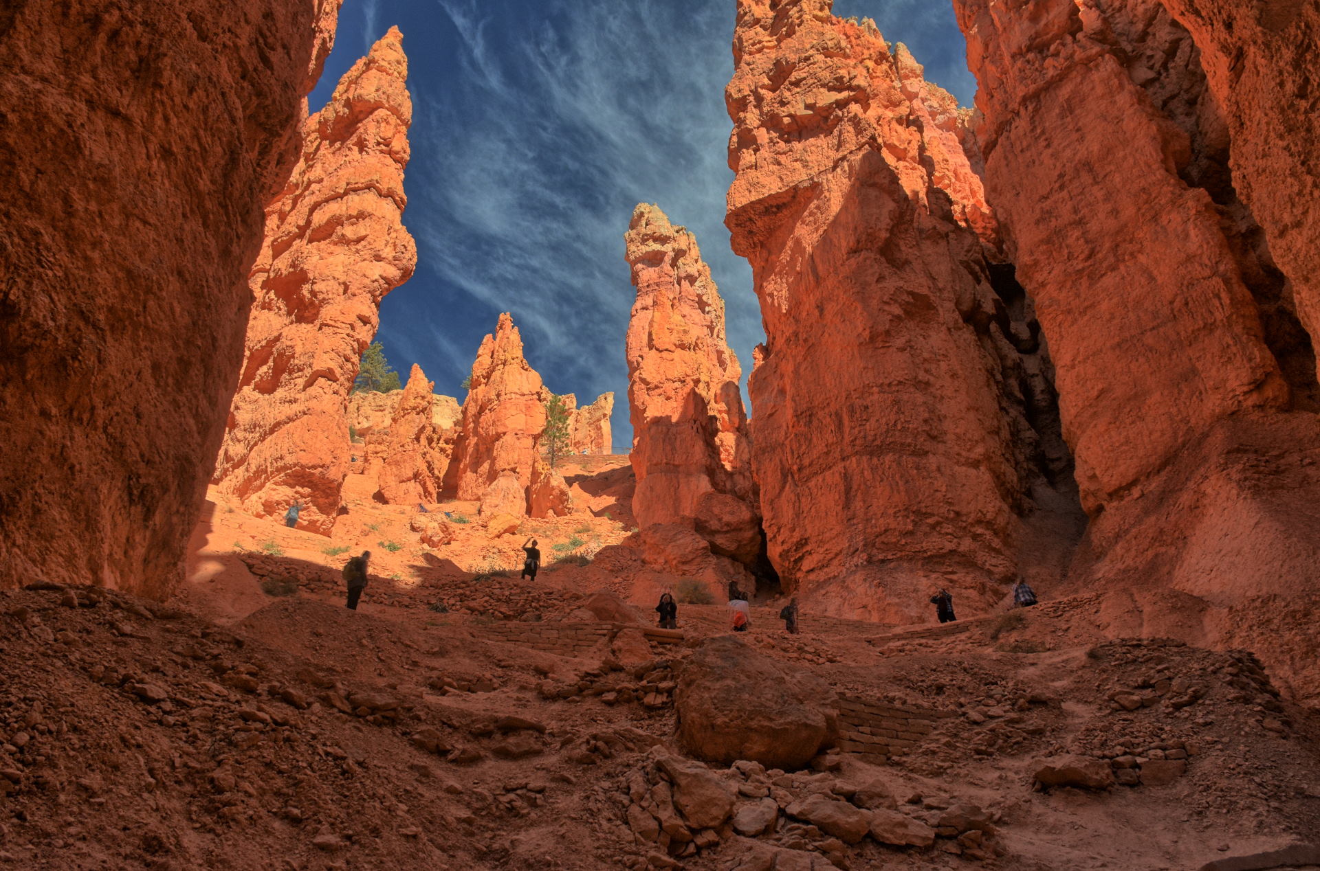
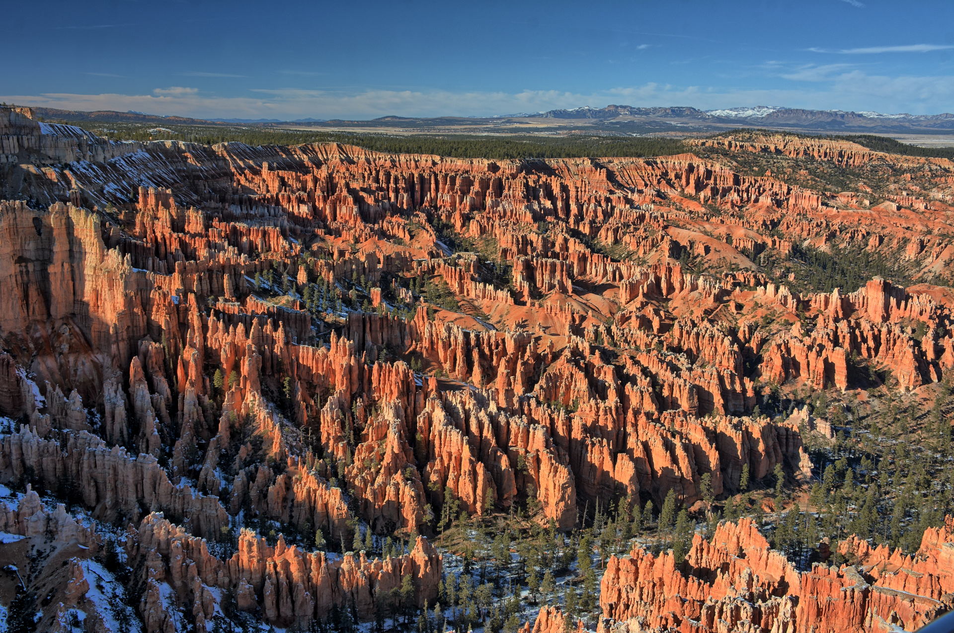
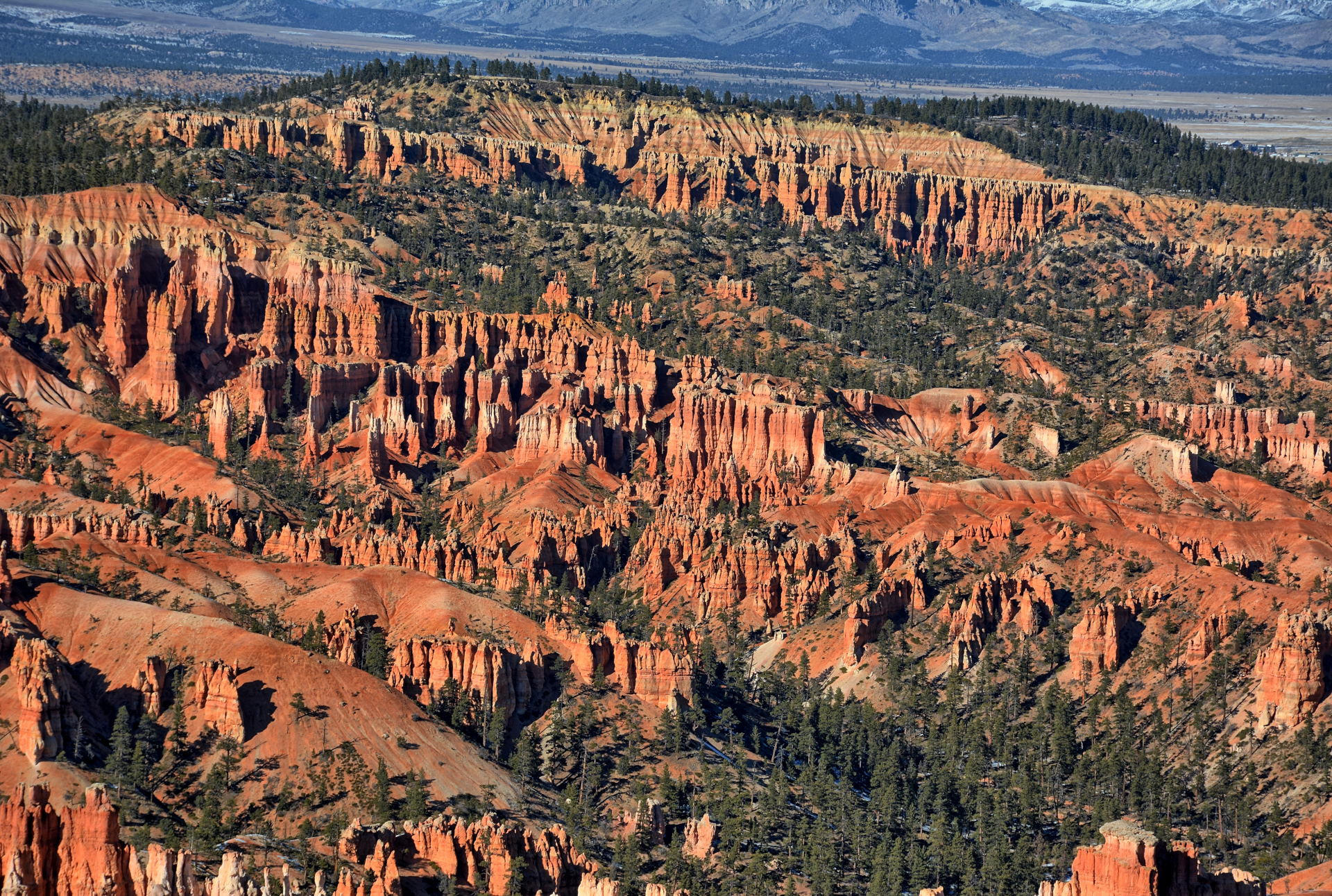
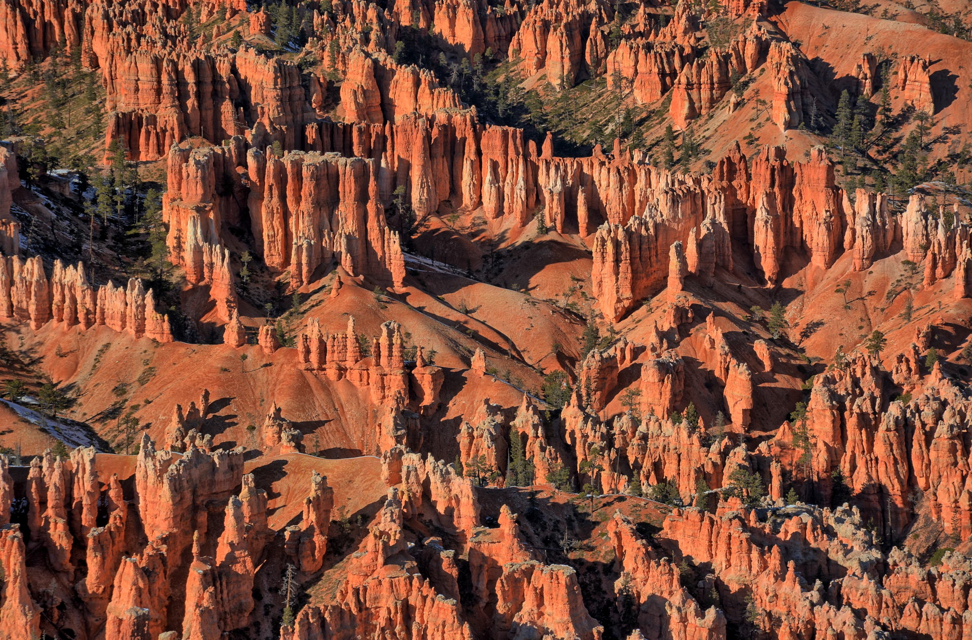
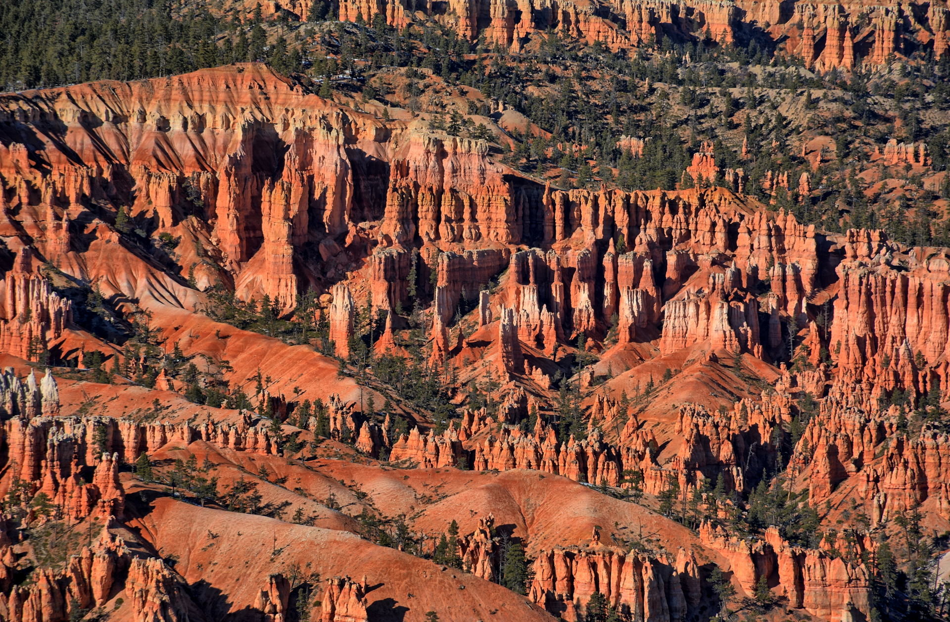
Bryce Canyon
14 Columbus Day Queens Garden & Navajo Loop Trail
Drive to Dugway
15
Dugway Flight Test
16
Dugway Flight Test
17
Dugway Flight Test
18
Dugway Flight Test
19
Dugway Flight Test Drive to Great Basin NP
20 Great Basin NP
Wheeler Peak
Lehman Cave
Drive to Dugway
4 House On Fire
Natural Bridges NM
Glen Canyon NRA
Bullfrog - Notom Road
5 Capitol Reef NP
Burr Trail Road
Drive to SLC
6
Fly SLC to home
7
Home
Work
8
Home
Work
9
Home
10
Home
11
Home
Work
12
Home
Work
13
Home
Work
14
Home
Work
15
Home
16
Home
17
Fly home to SLC
Drive to Dugway
18
Dugway Flight Test
19
Dugway Flight Test
20
Dugway Flight Test
21
Dugway Flight Test
22
Dugway Flight Test
23
Dugway Flight Test
24 Drive to Bryce Canyon NP to St George
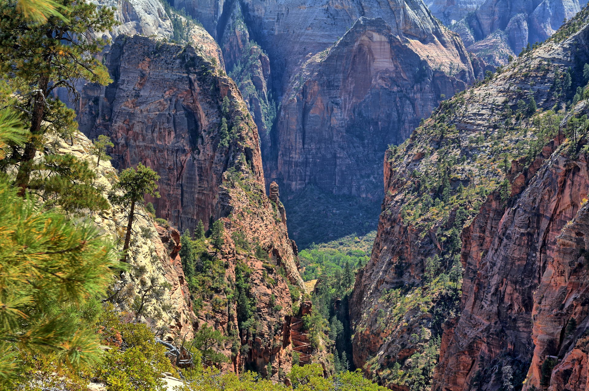
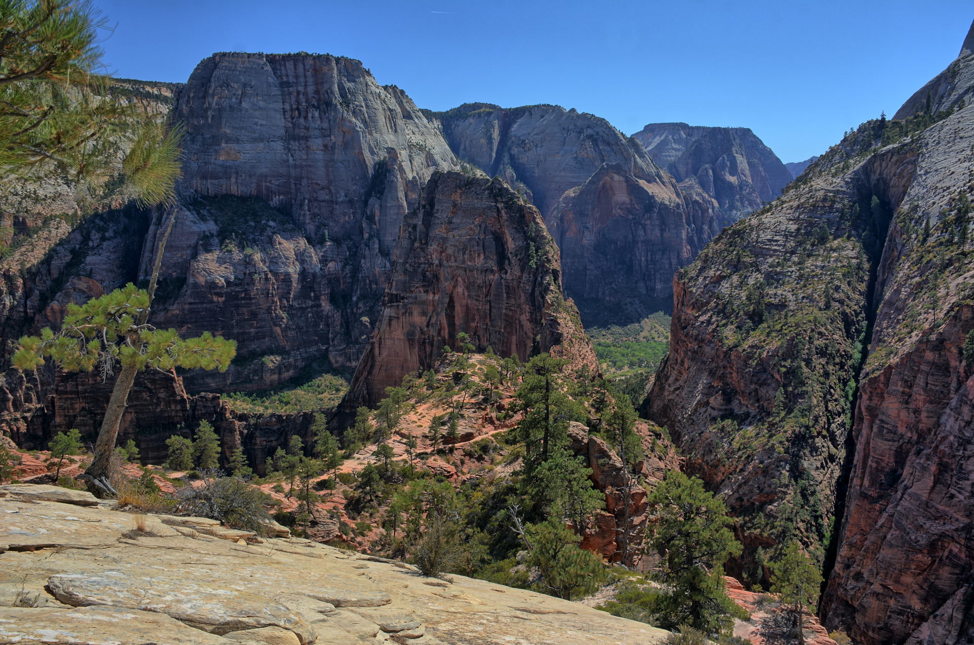
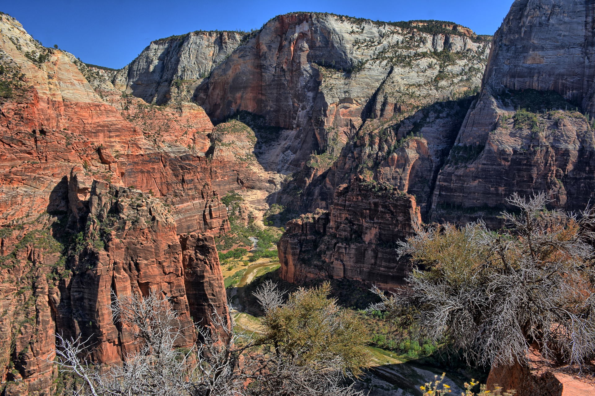
25 Zion NP Angels Landing
Drive to Kanab
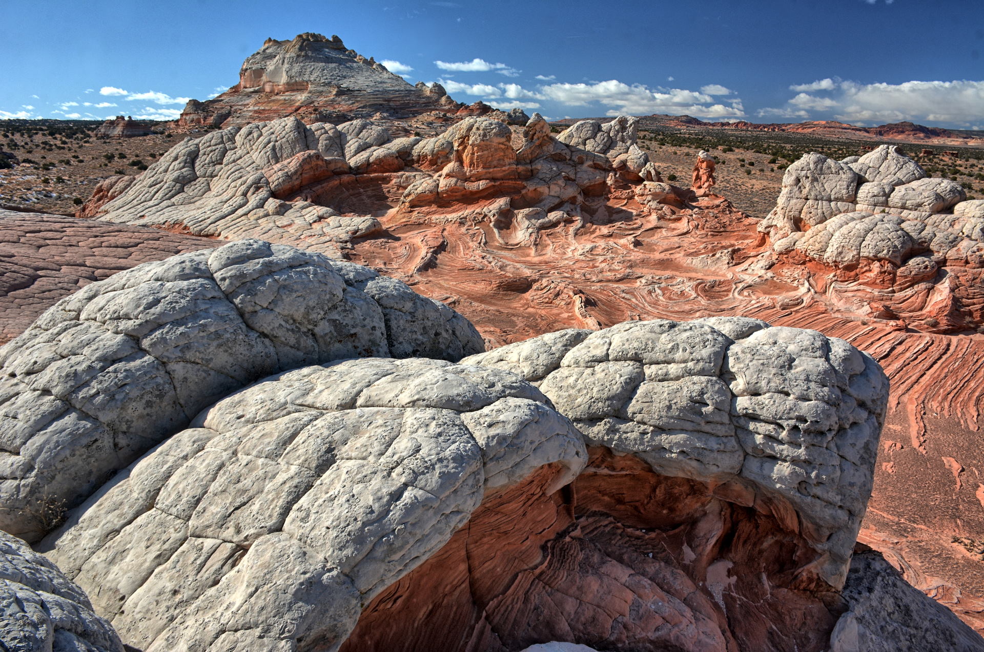
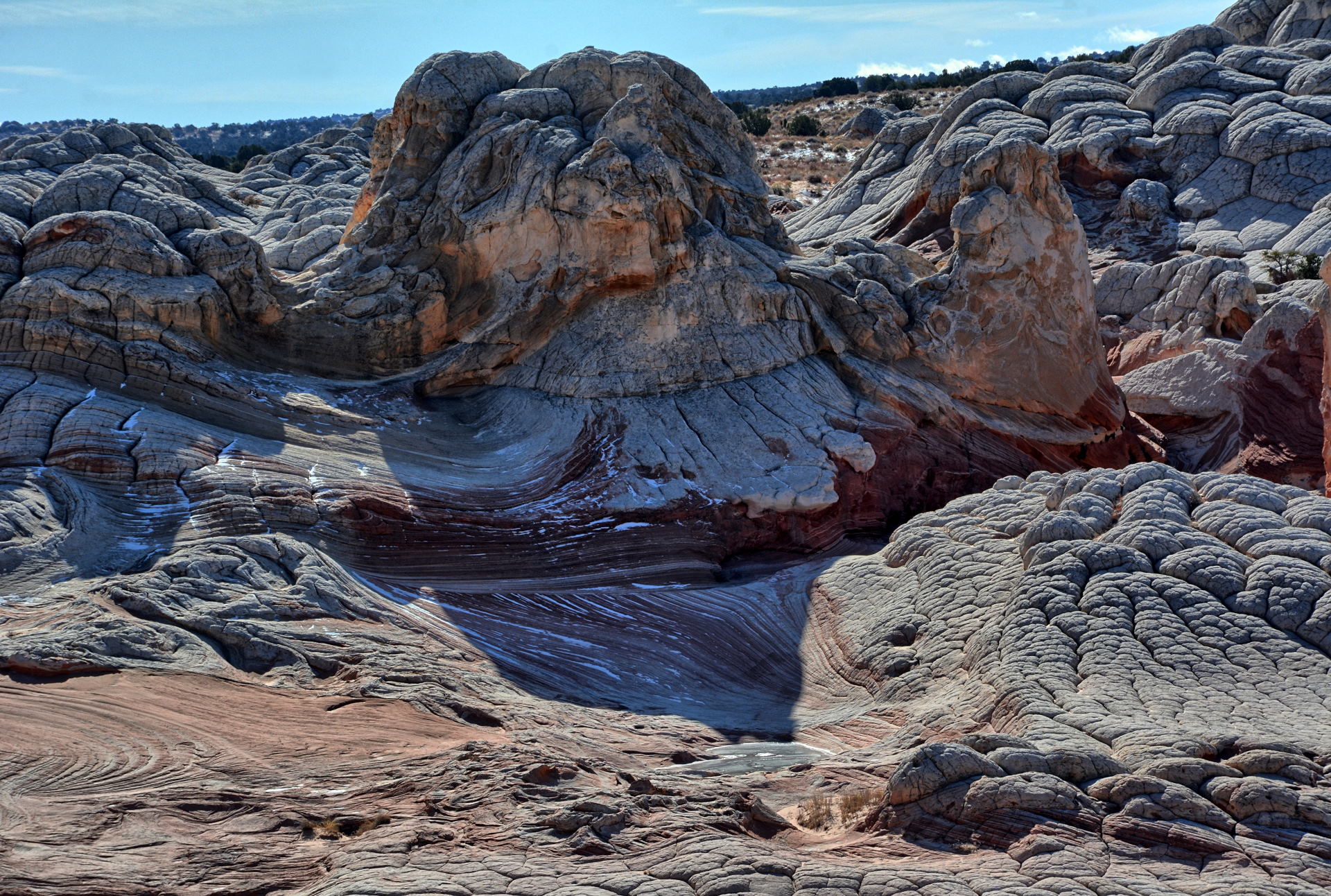
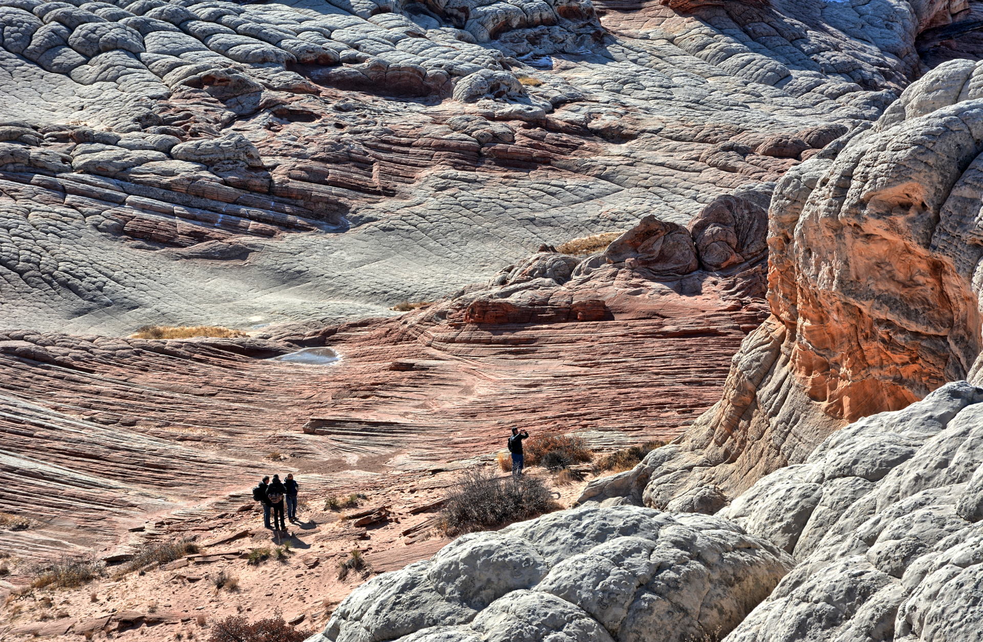
26 White Pocket
Kaibab Plateau
Pipe Spring NM
Drive to SLC
27
Fly SLC to home
28 Thanksgiving
Drive to Charleston, WV
29
Charleston
30
Charleston
1 December
Drive Charleston to home
2
Fly home to SLC
Drive to Dugway
3
Dugway Flight Test
4
Dugway Flight Test
5
Dugway Flight Test
6
Dugway Flight Test
Drive to SLC
7
Fly SLC to home
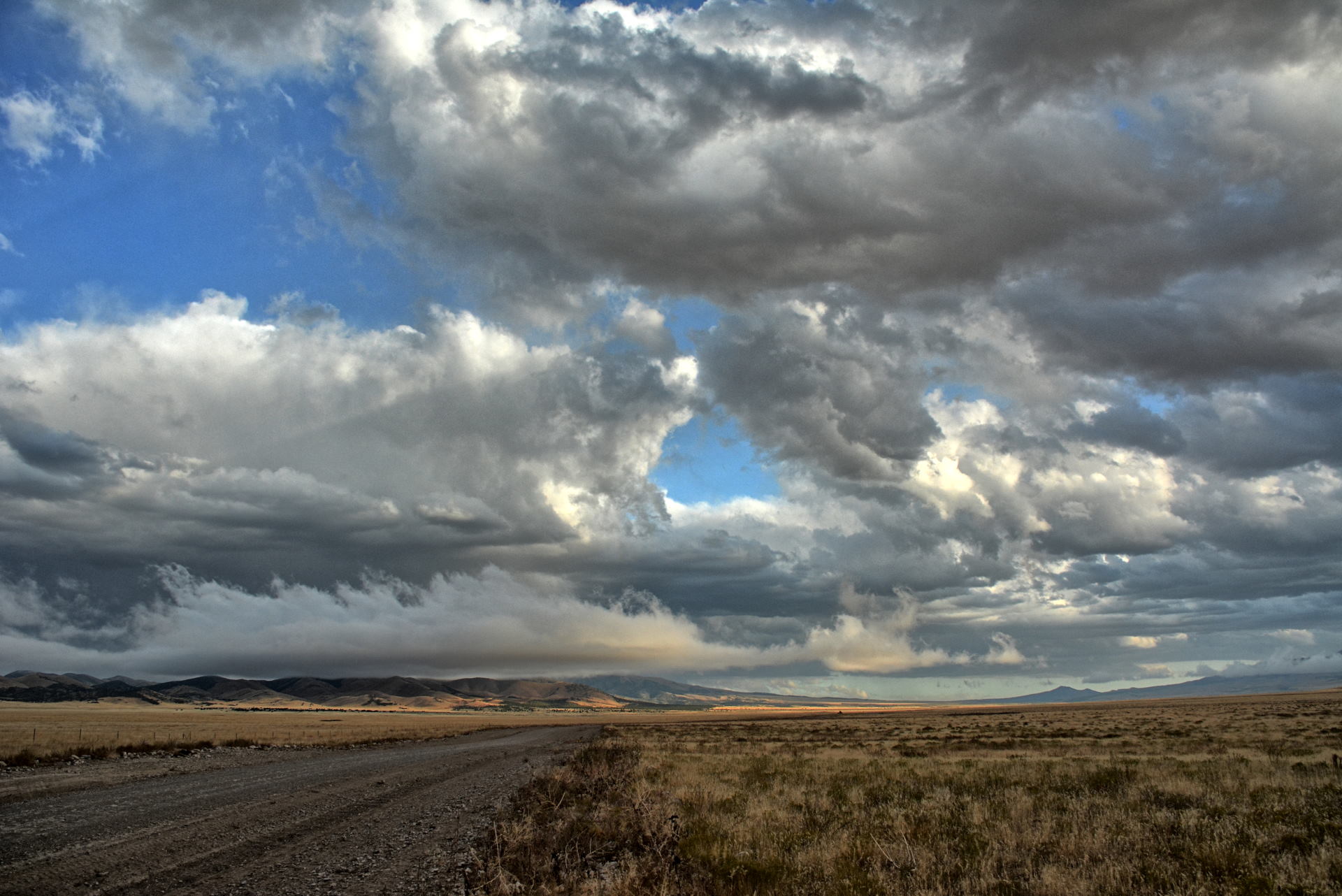
Aerial Video, Skull Valley,
Utah, 25 September 2019
Aerial Video, Skull
Valley, Utah, 27 September 2019
Aerial Video, Skull Valley, Utah, 27 September 2019
Aerial Video, Skull Valley, Utah, 27 September 2019
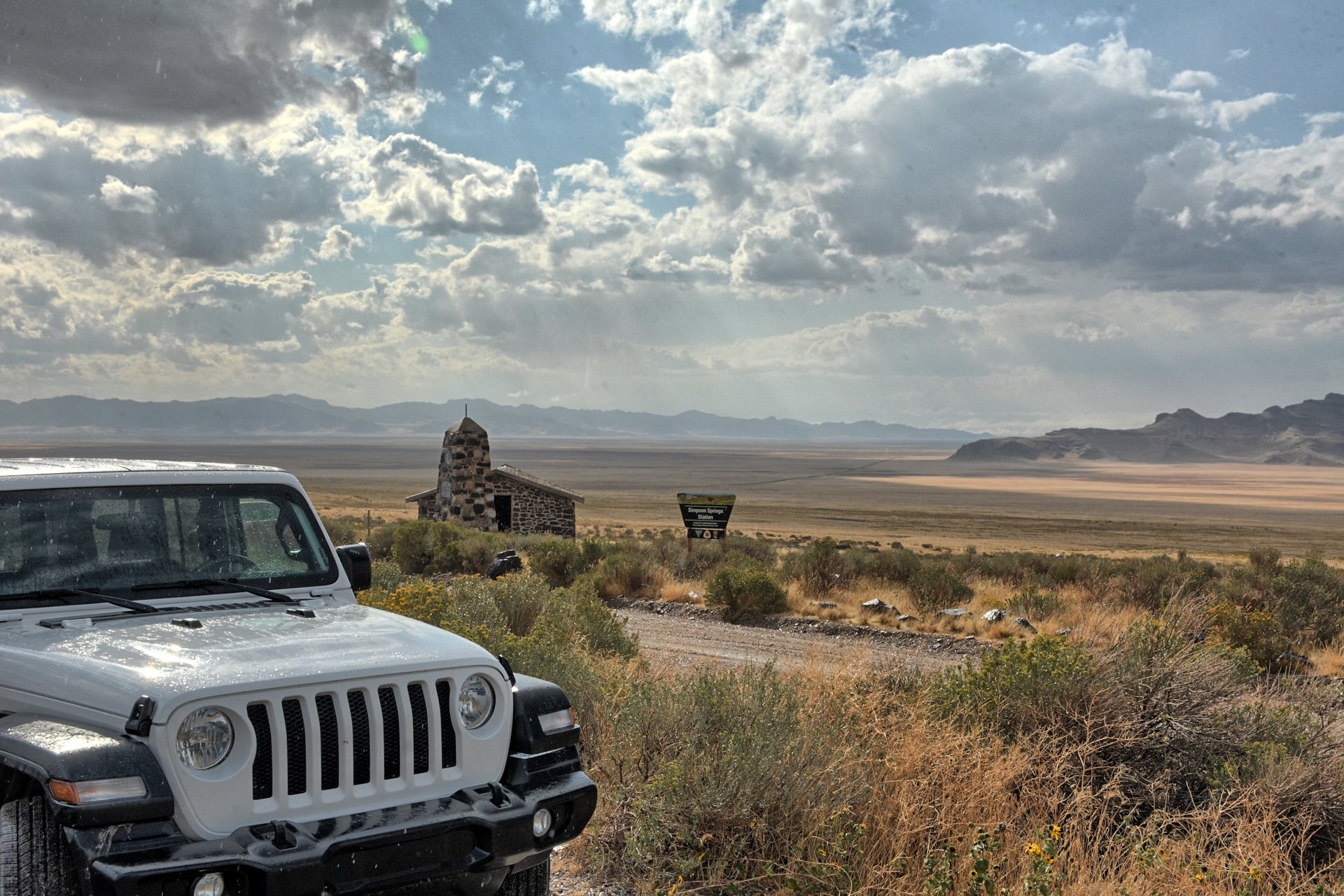
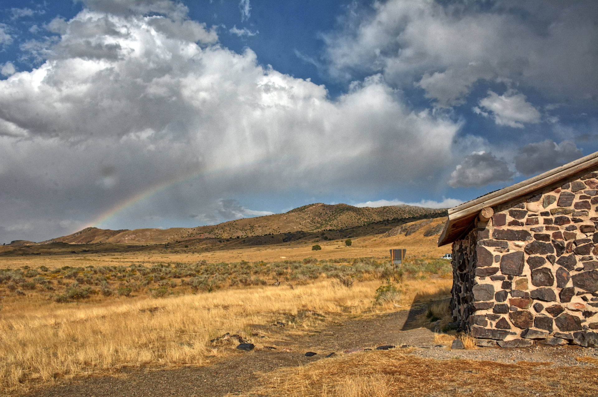
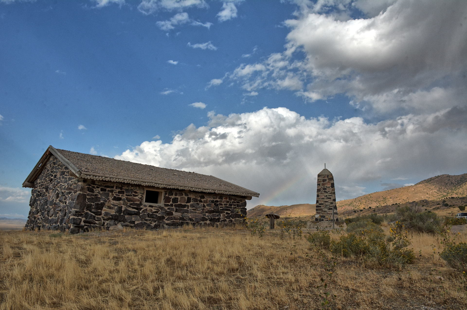
During weekend #1, Saturday, 28 September to Sunday, 29 September, we worked on Saturday, so I was not able to get
very far on this weekend. I explored nearby on Saturday evening, driving to
Lookout Pass and then the Simpson Springs Pony Express Station, about 15 miles
off post. I had visited both places in 2018 as well.
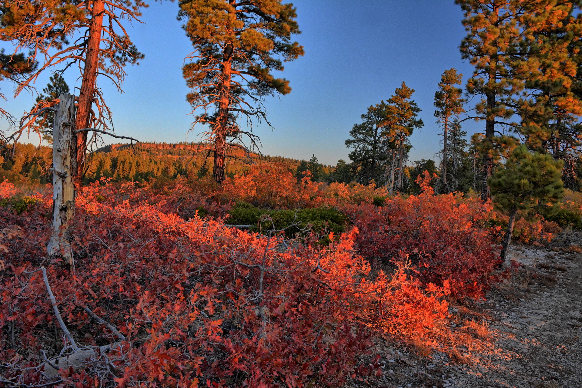
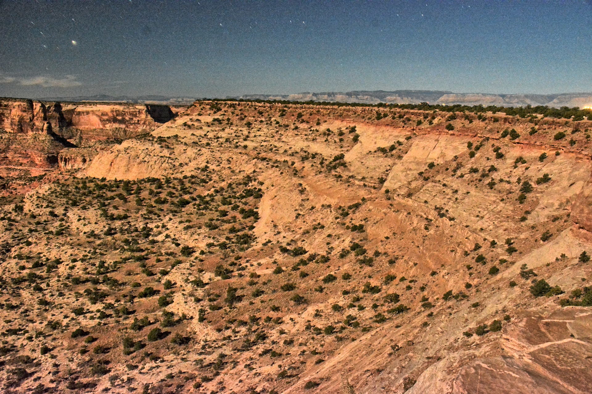
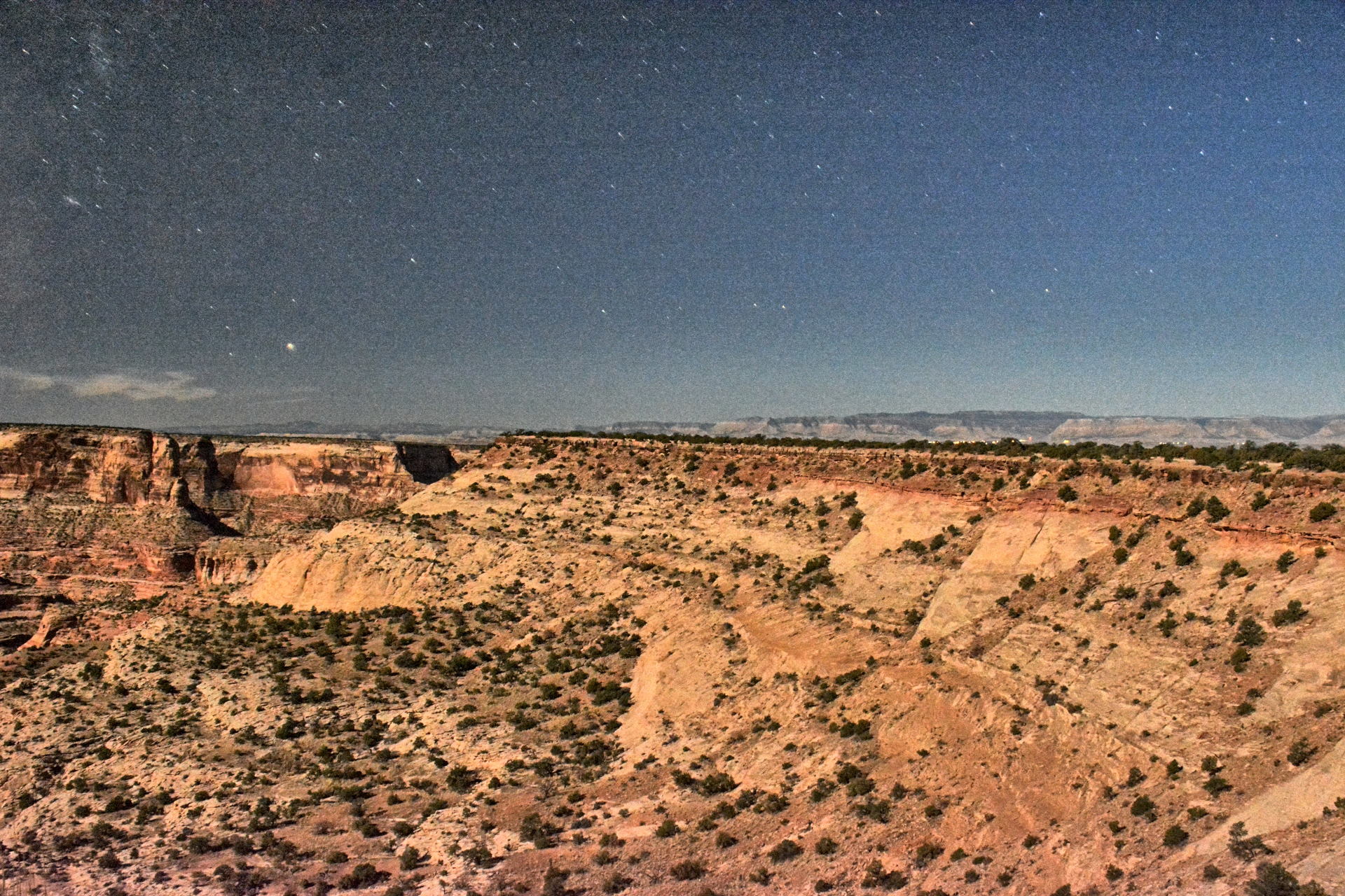
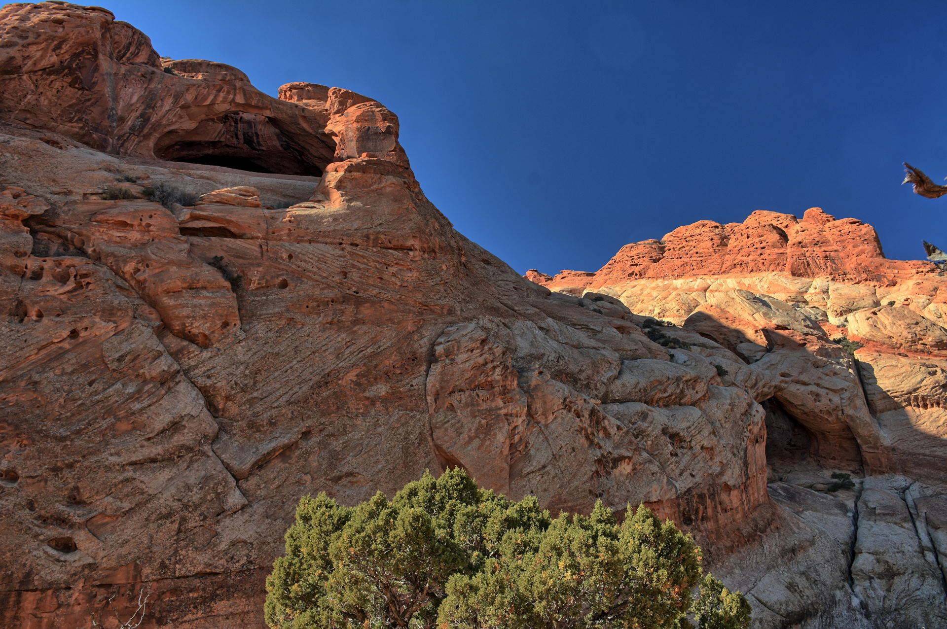
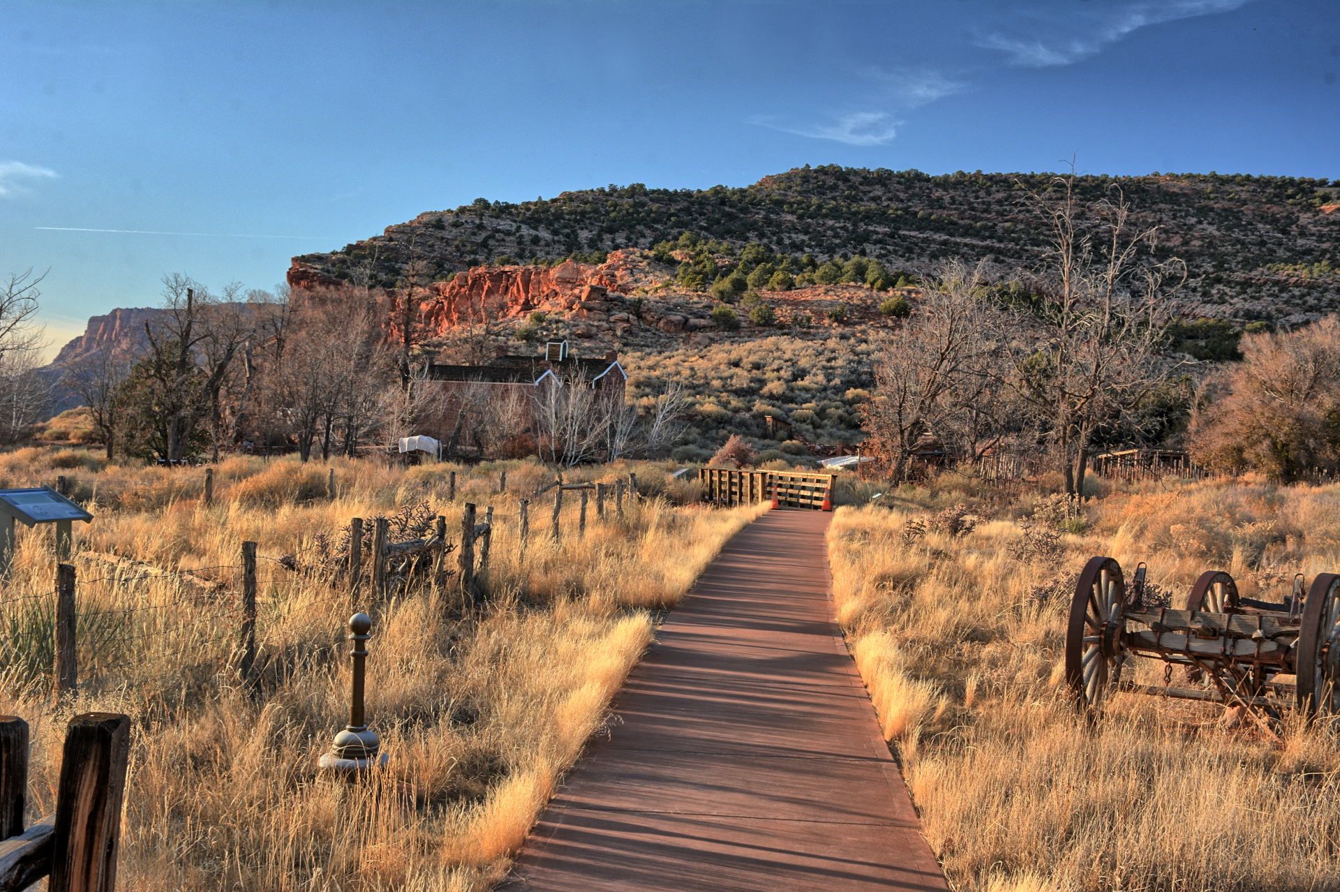
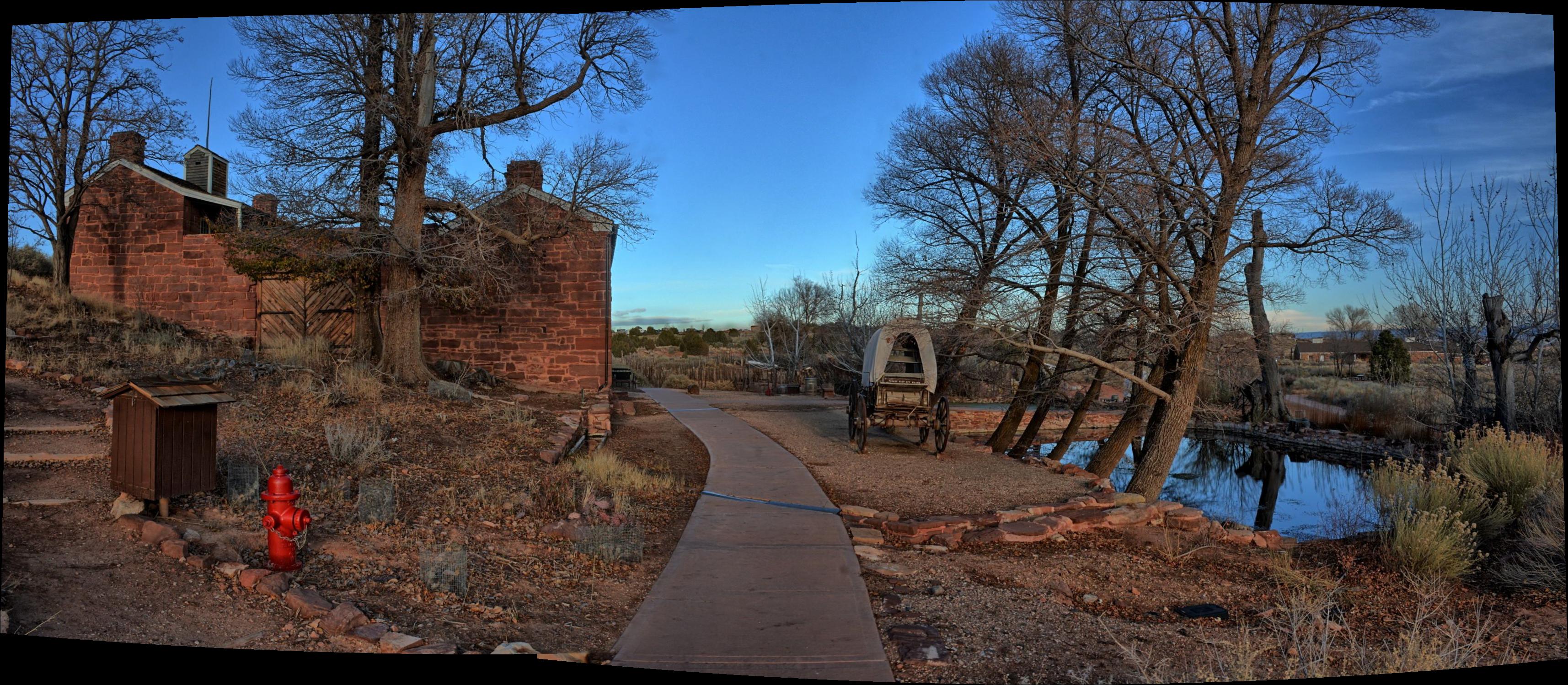
Skull Valley, Simpson Springs Pony Express Station, 28 September 2019
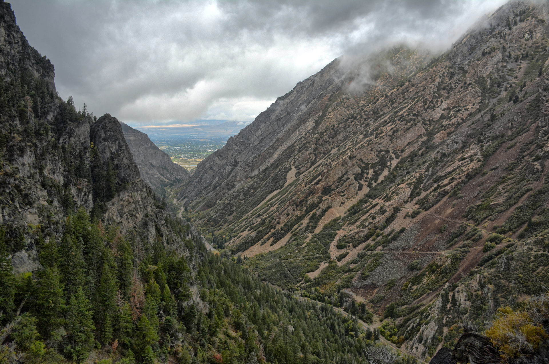
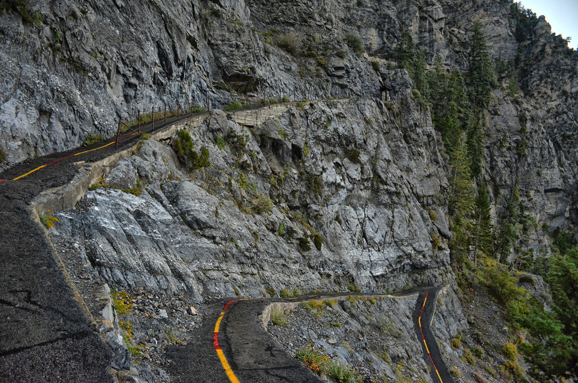
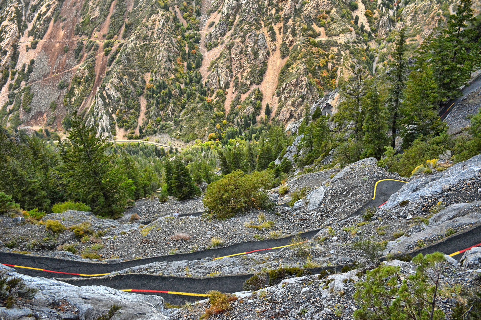
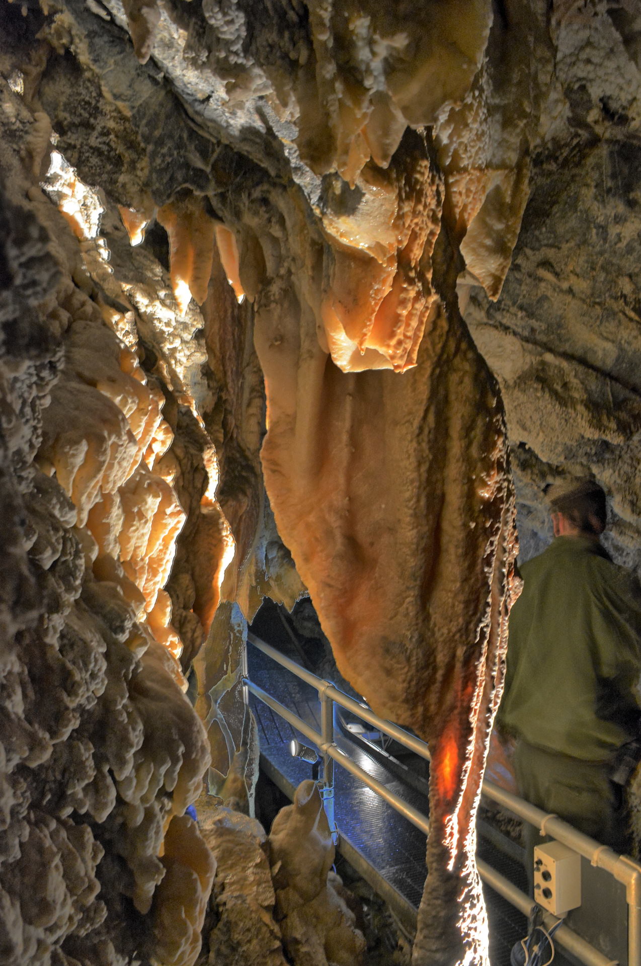
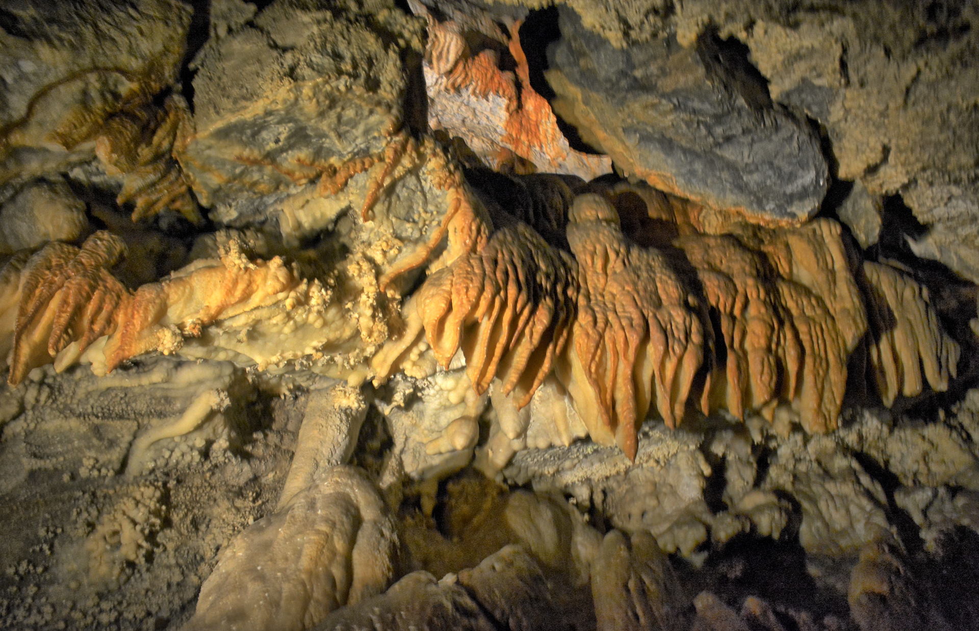
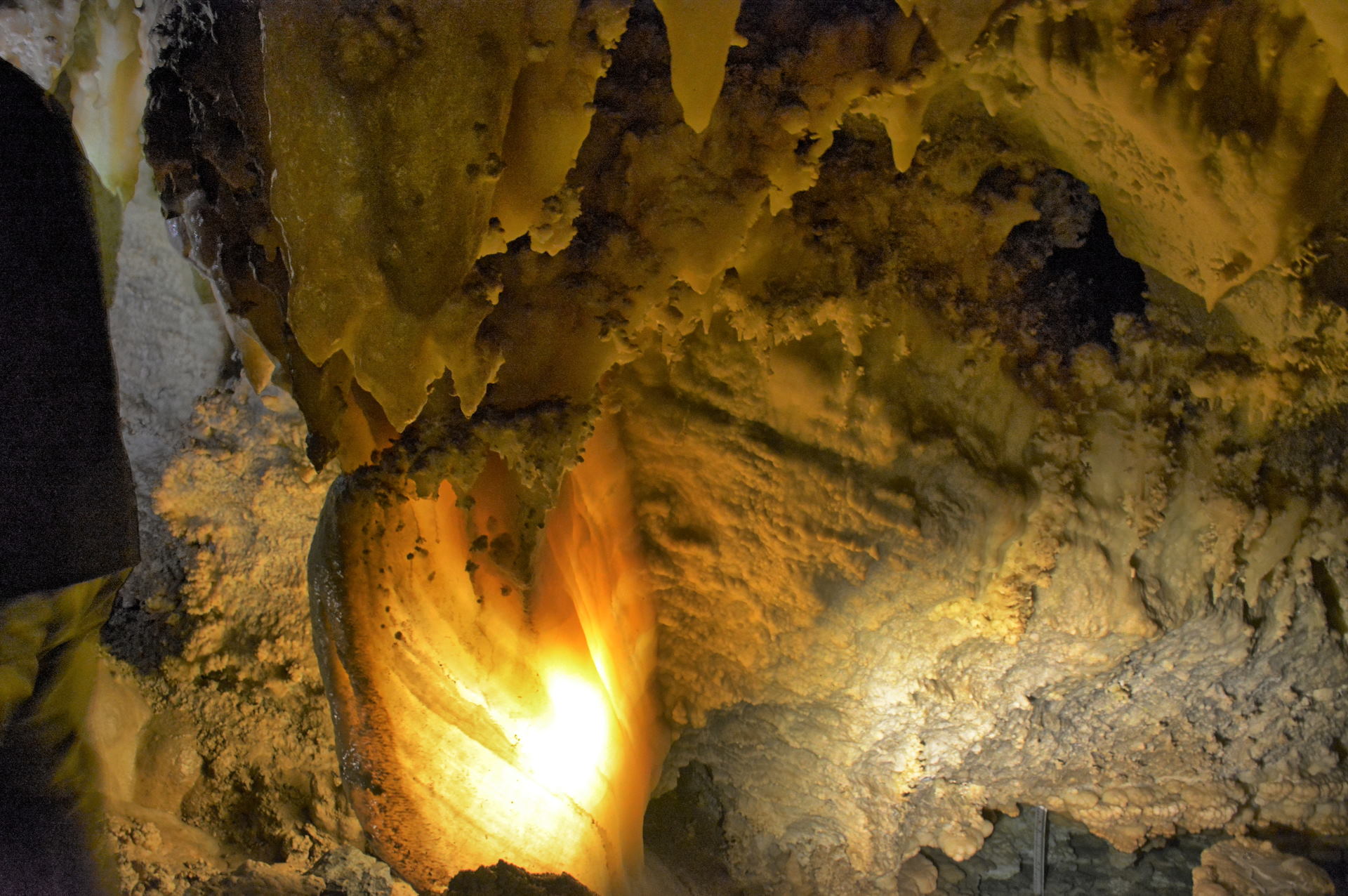
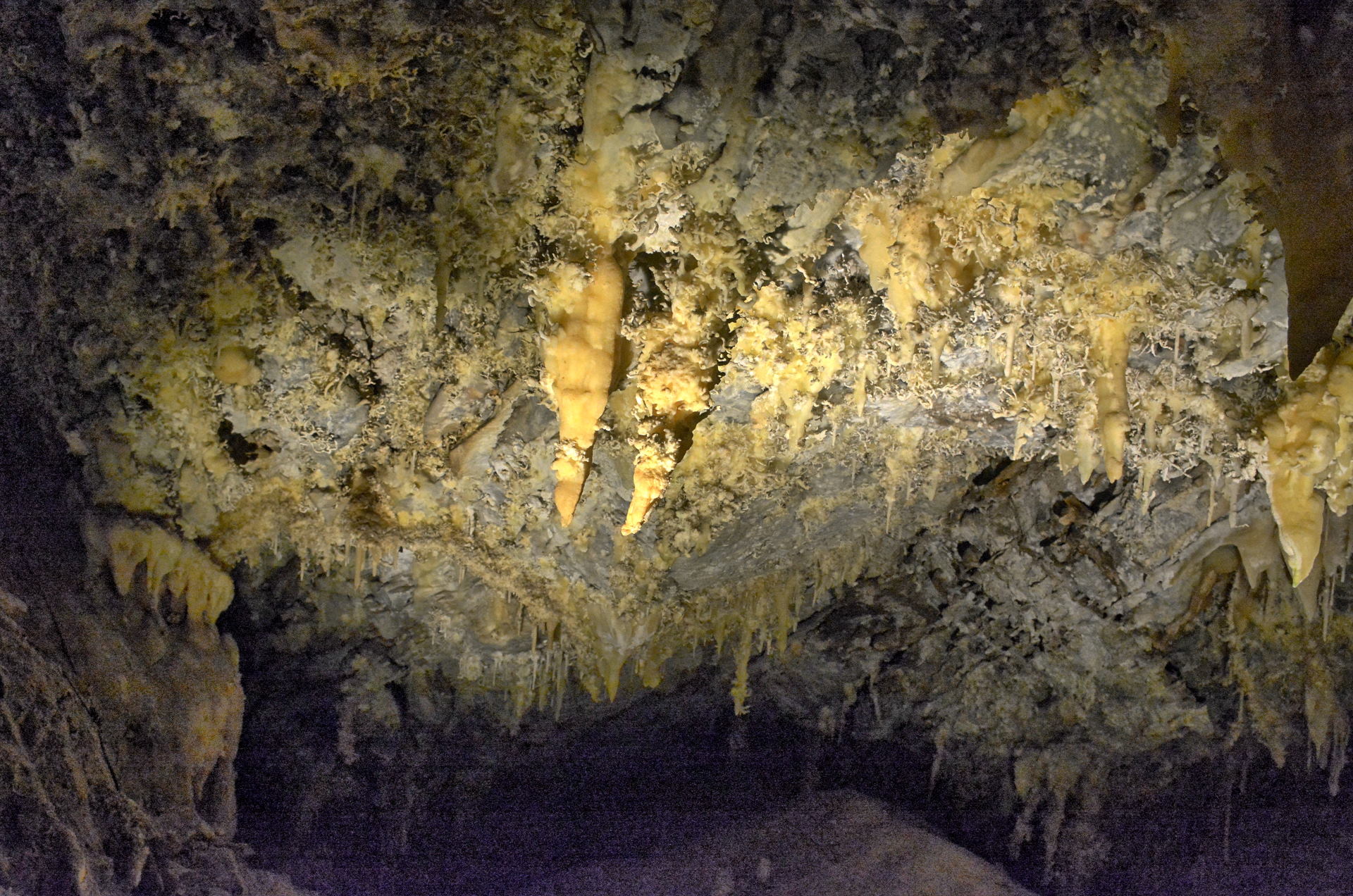
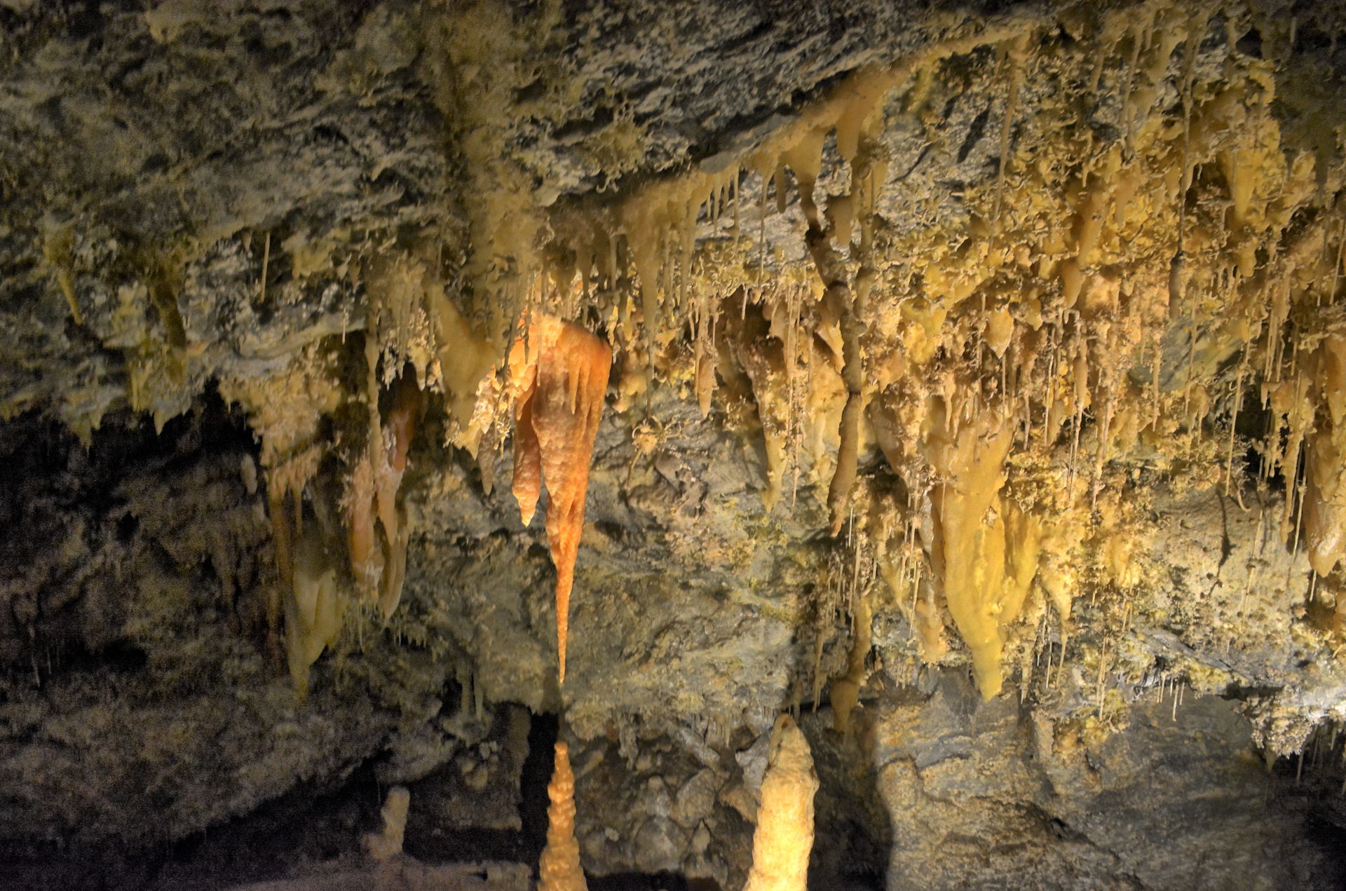
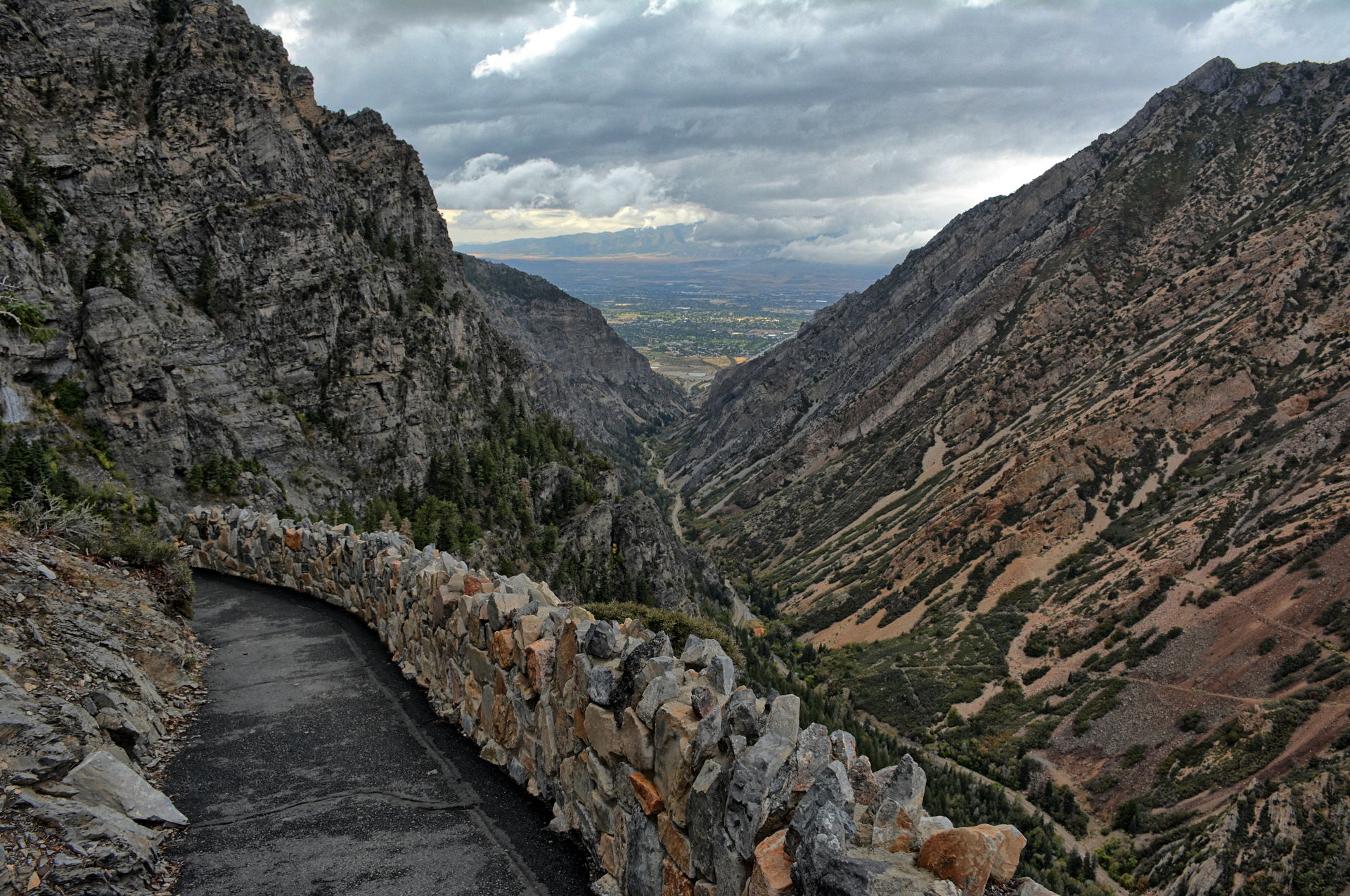
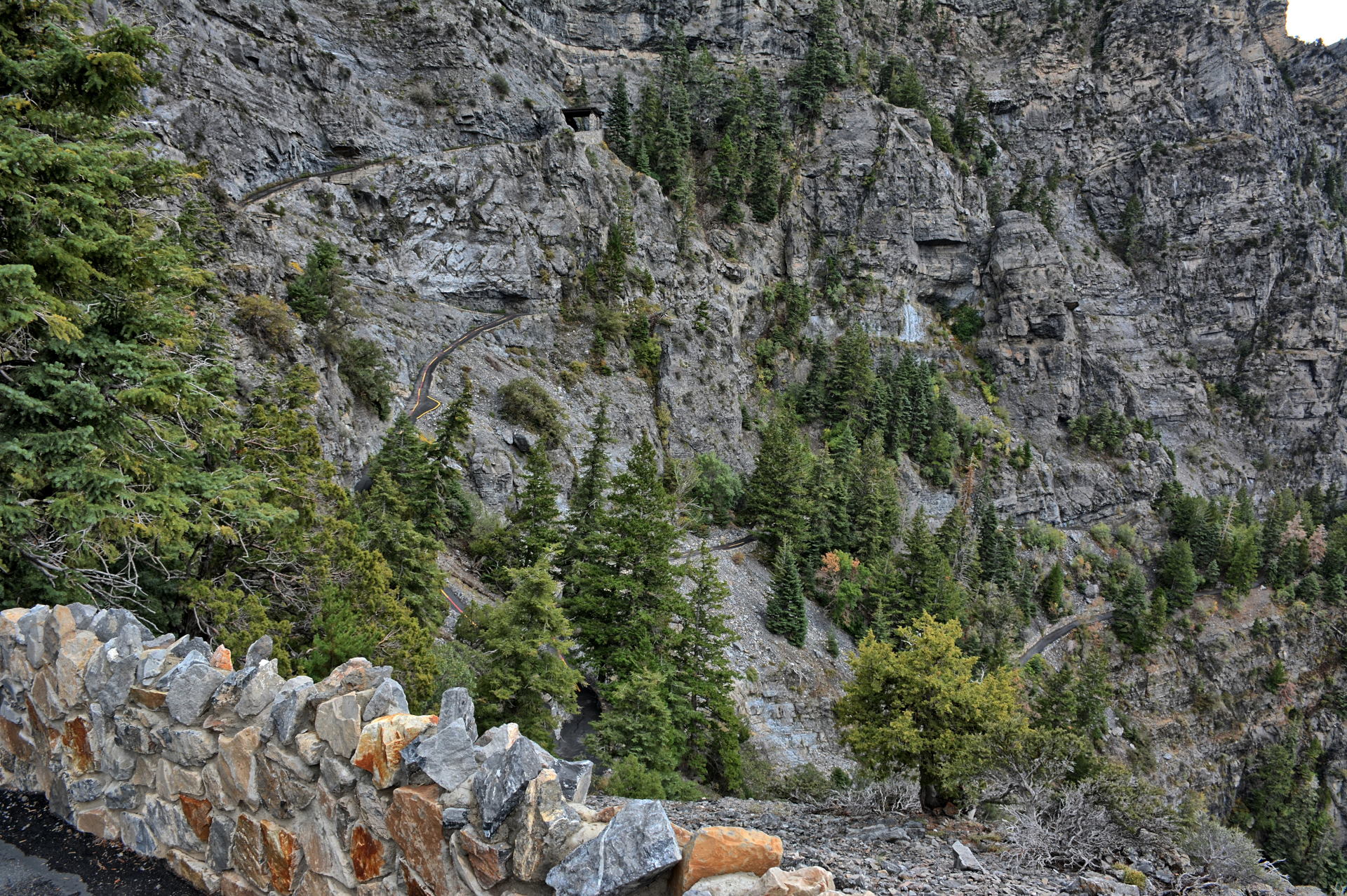
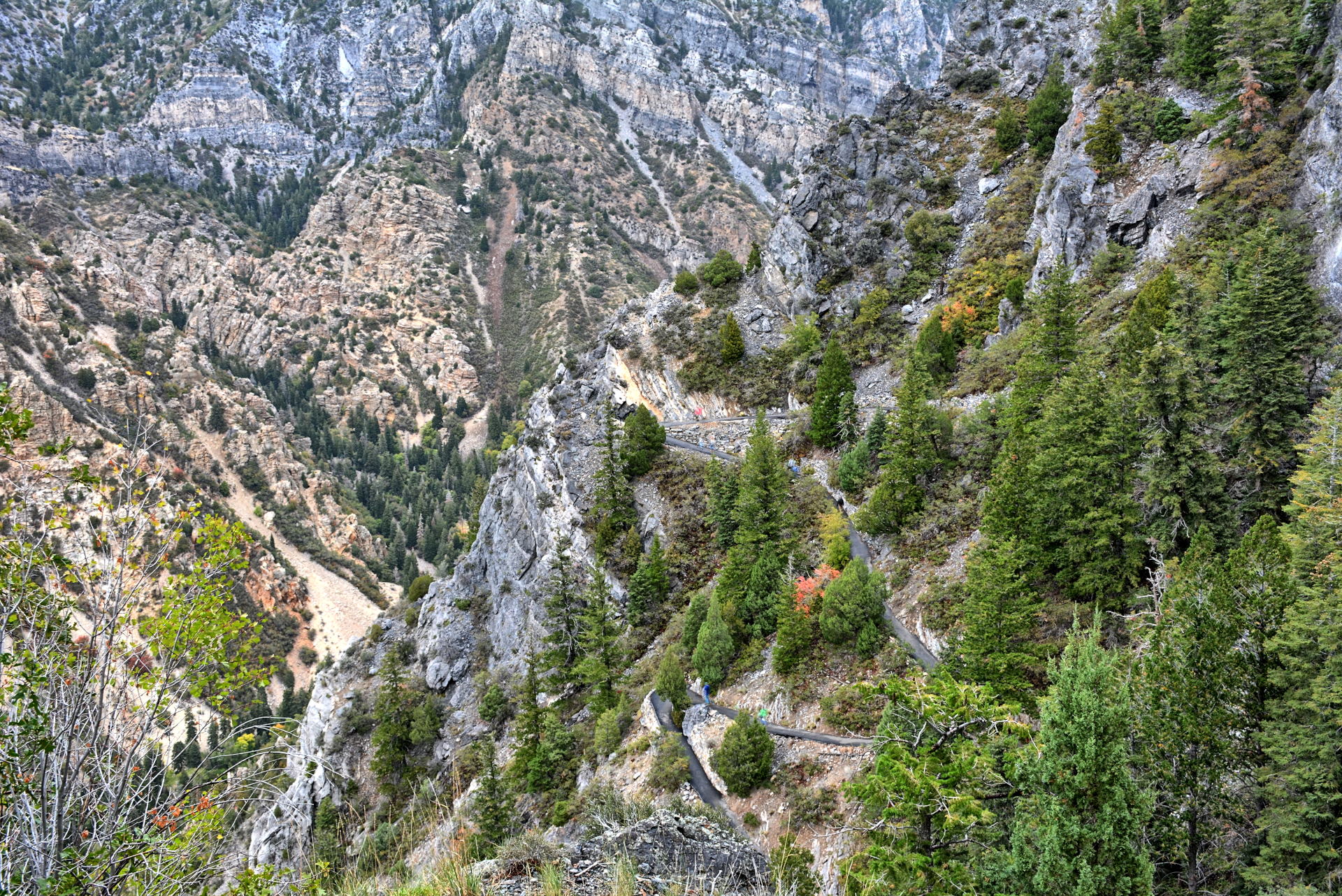
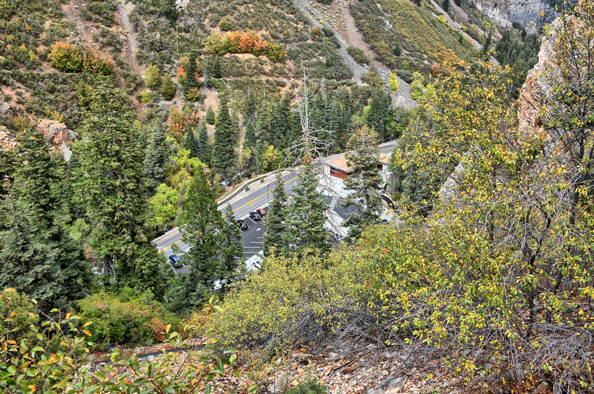
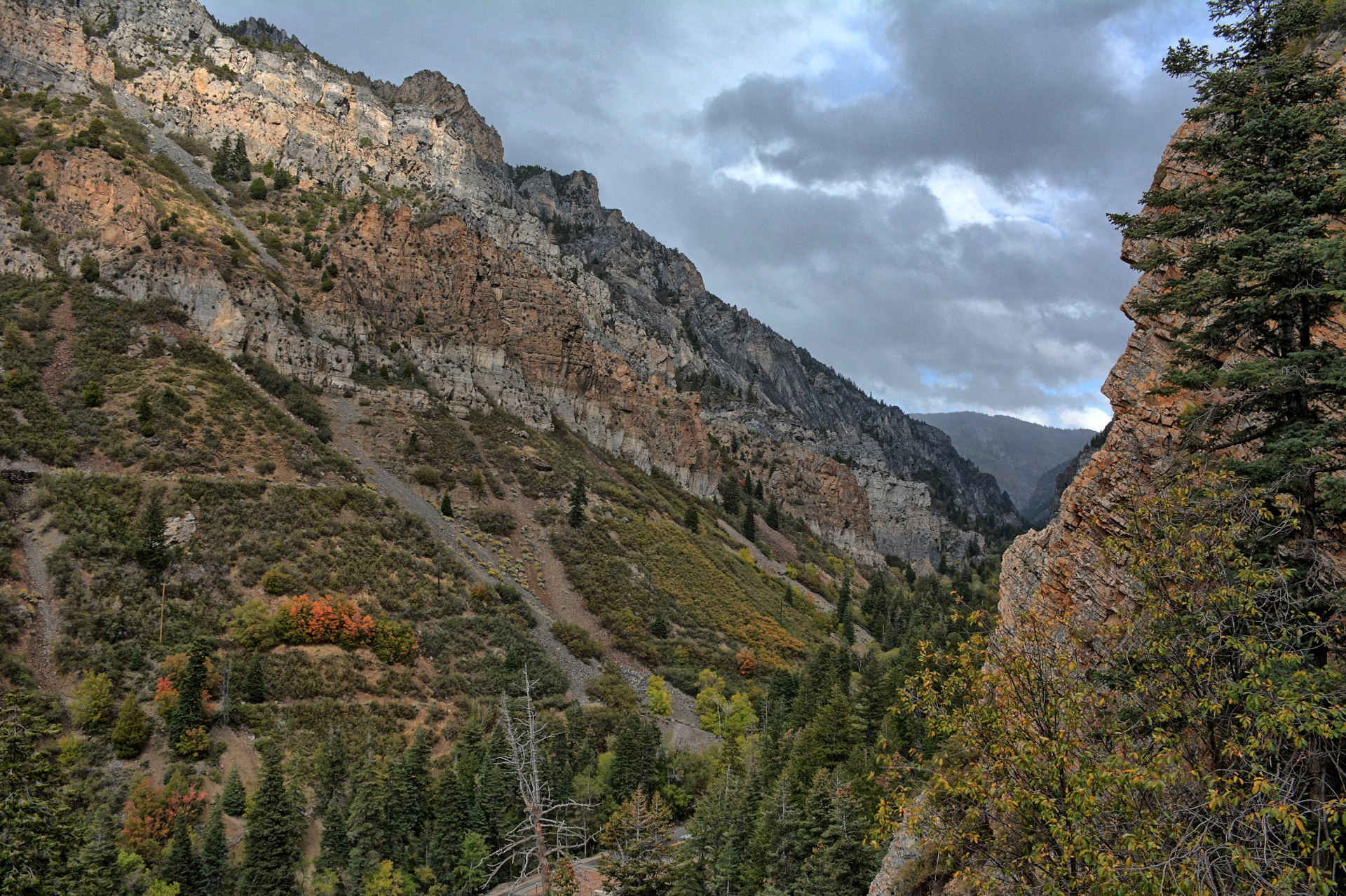
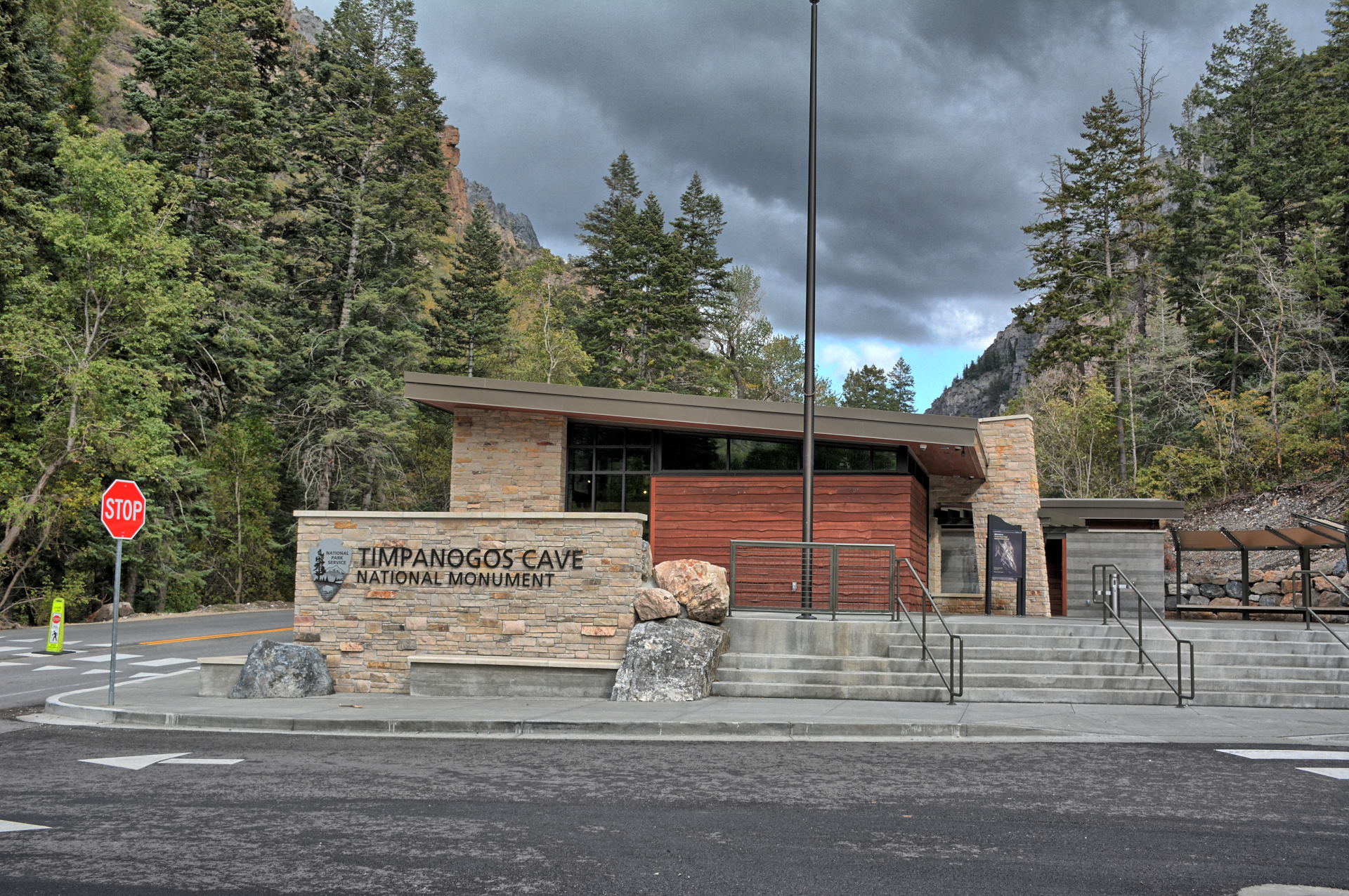
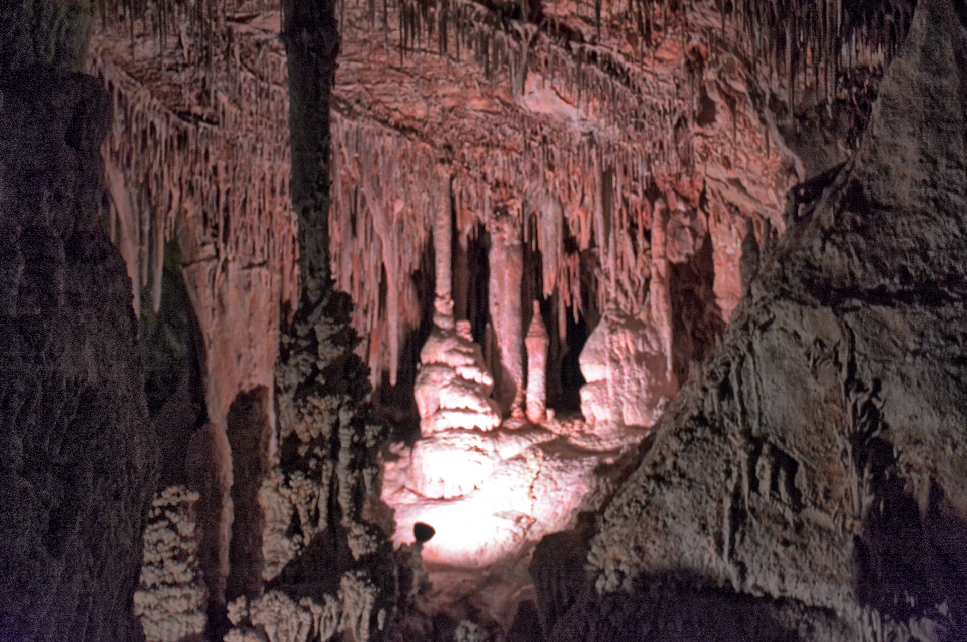
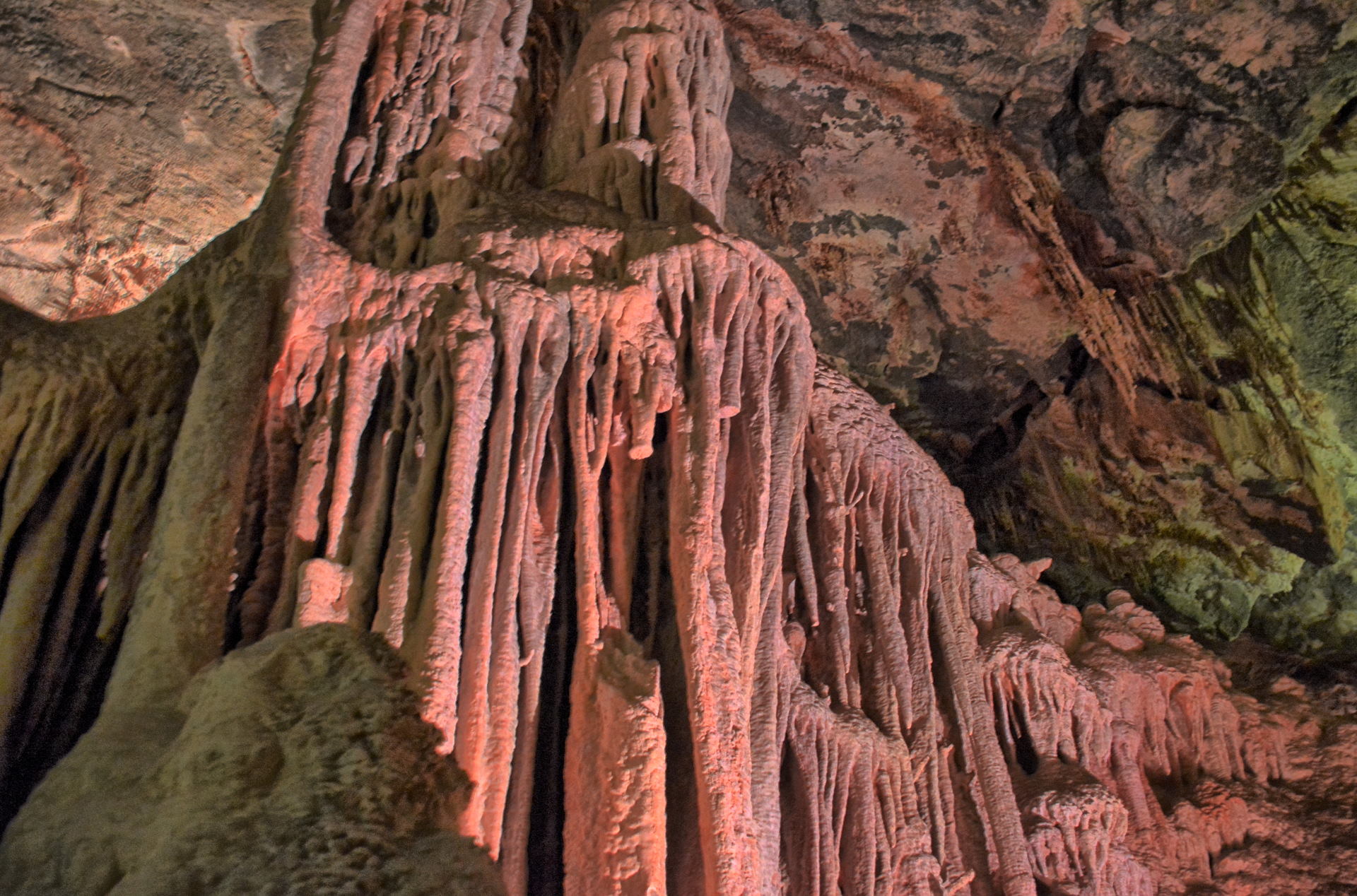
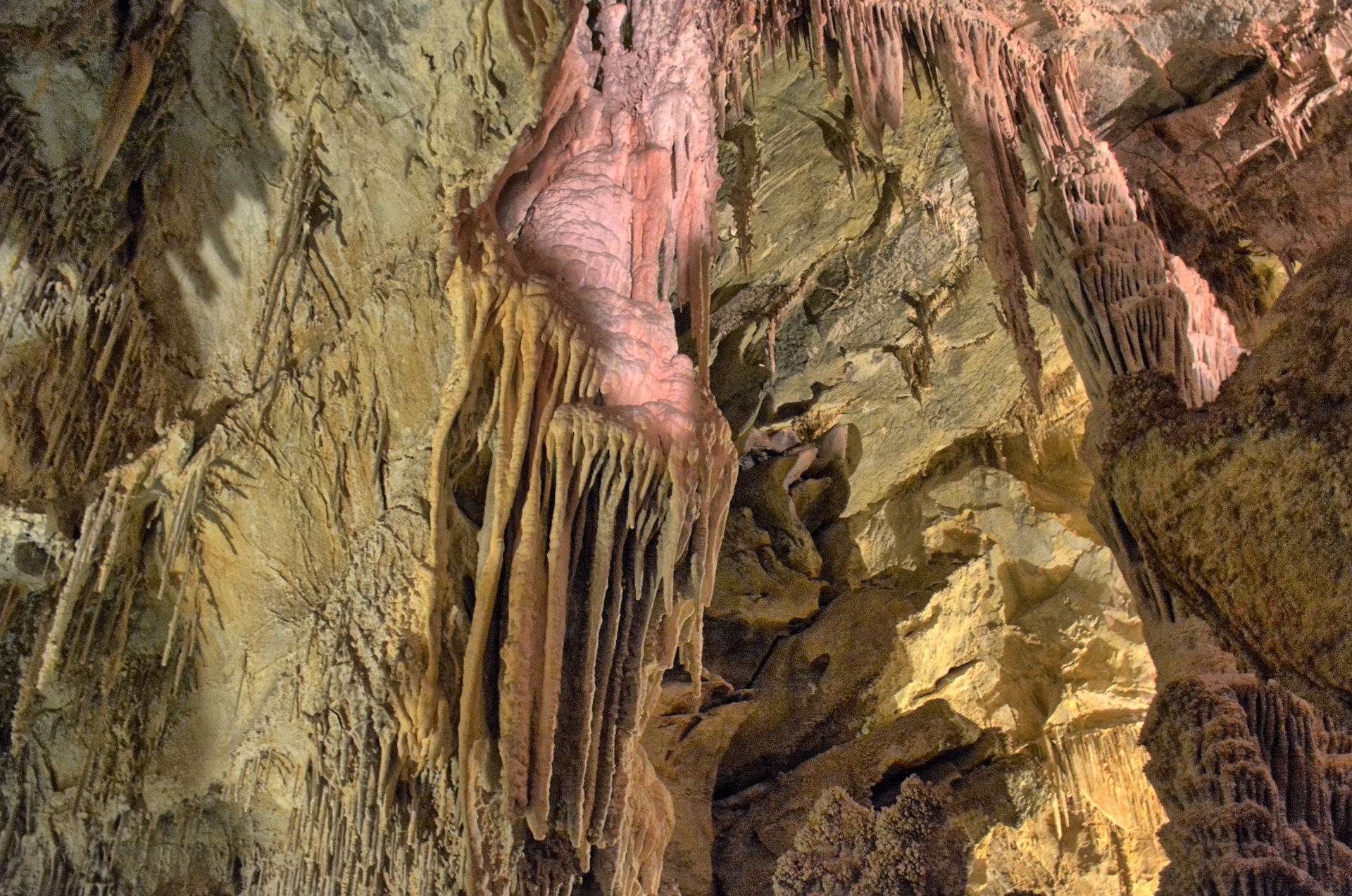
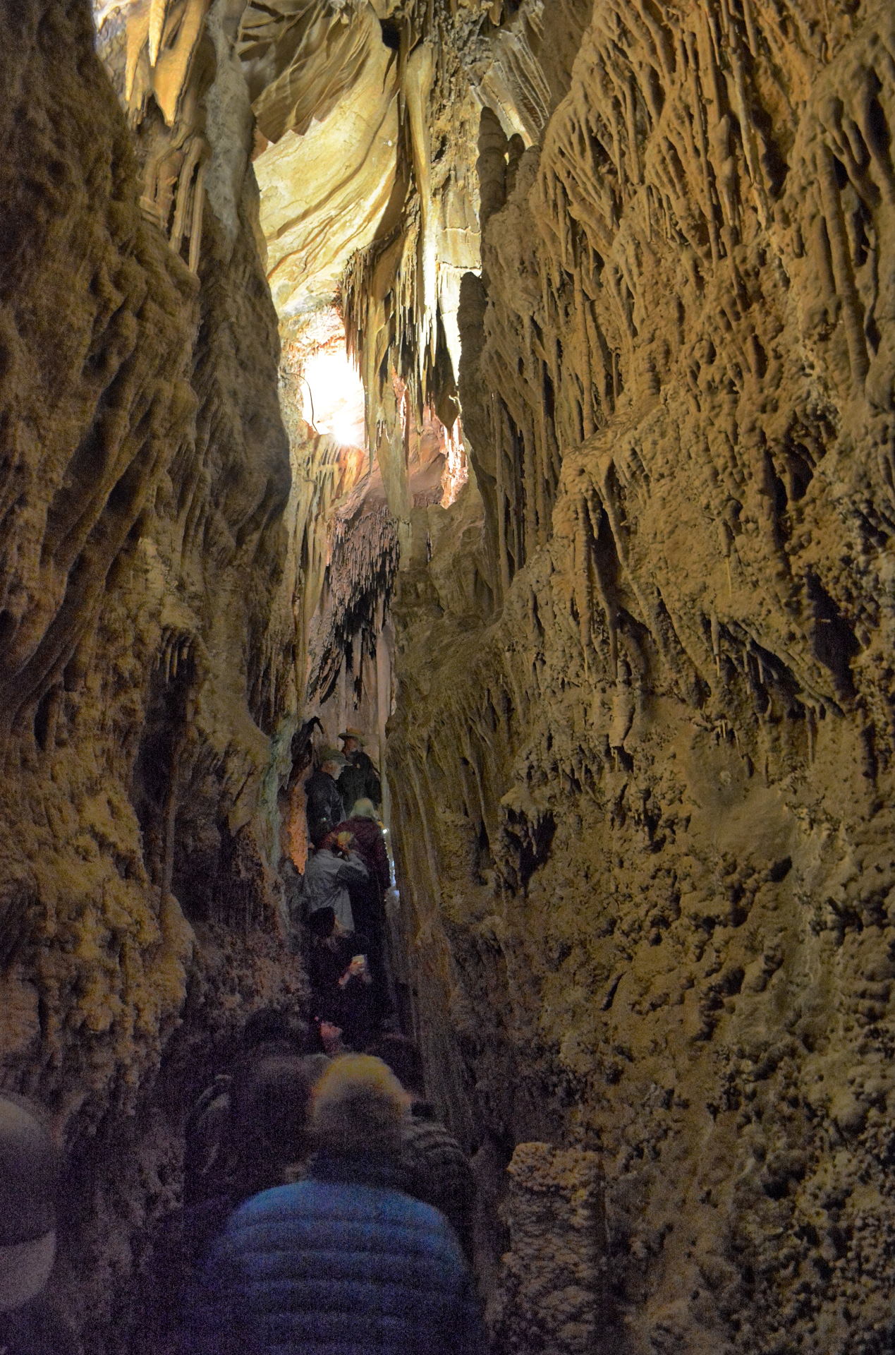
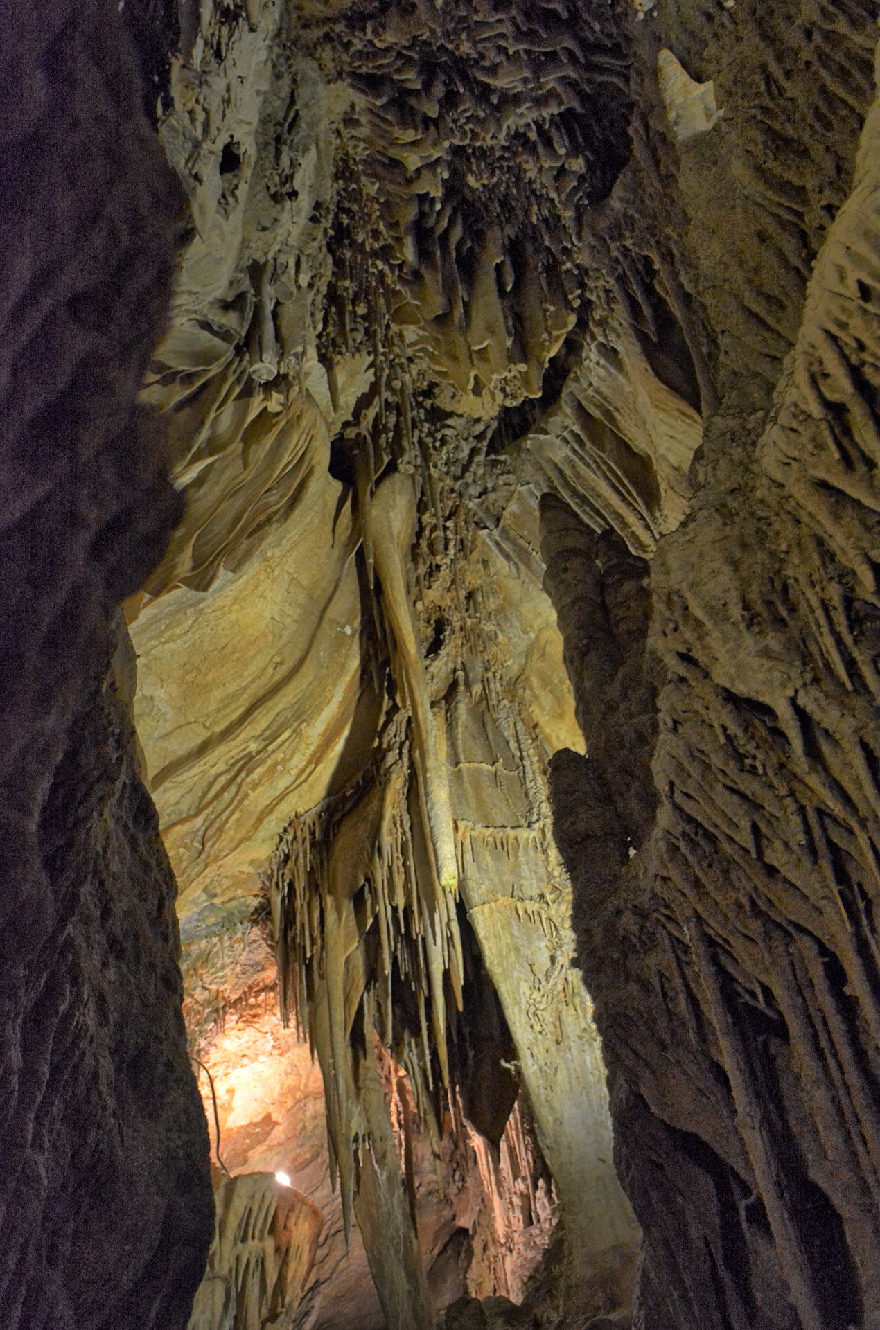
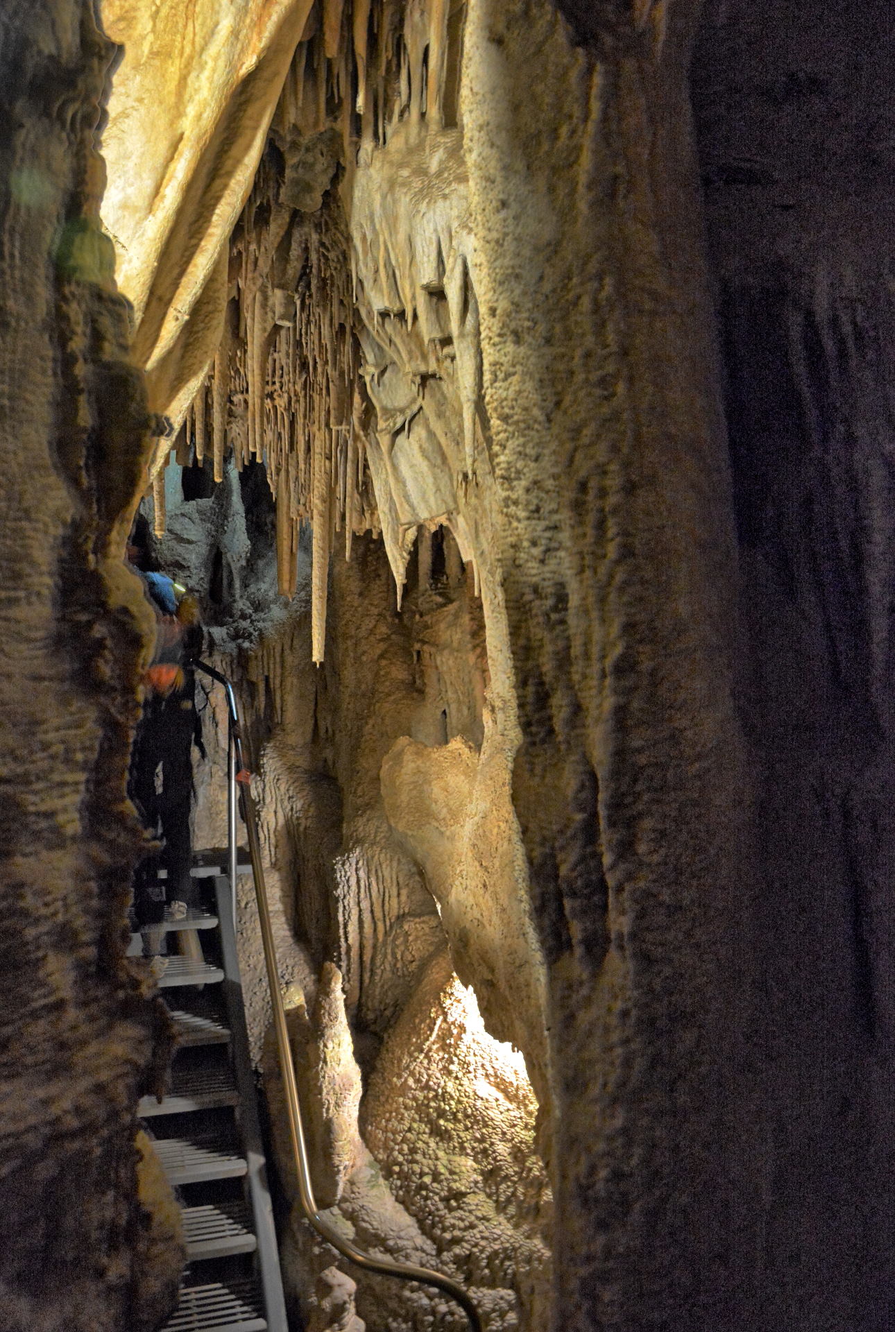
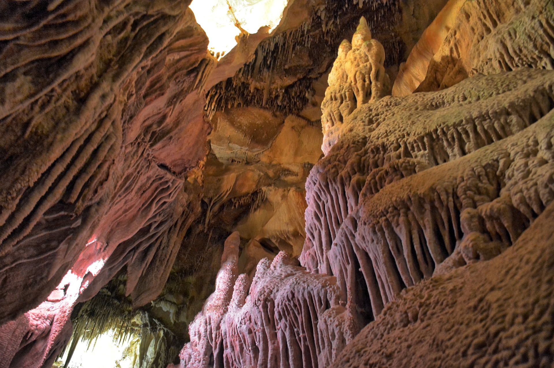
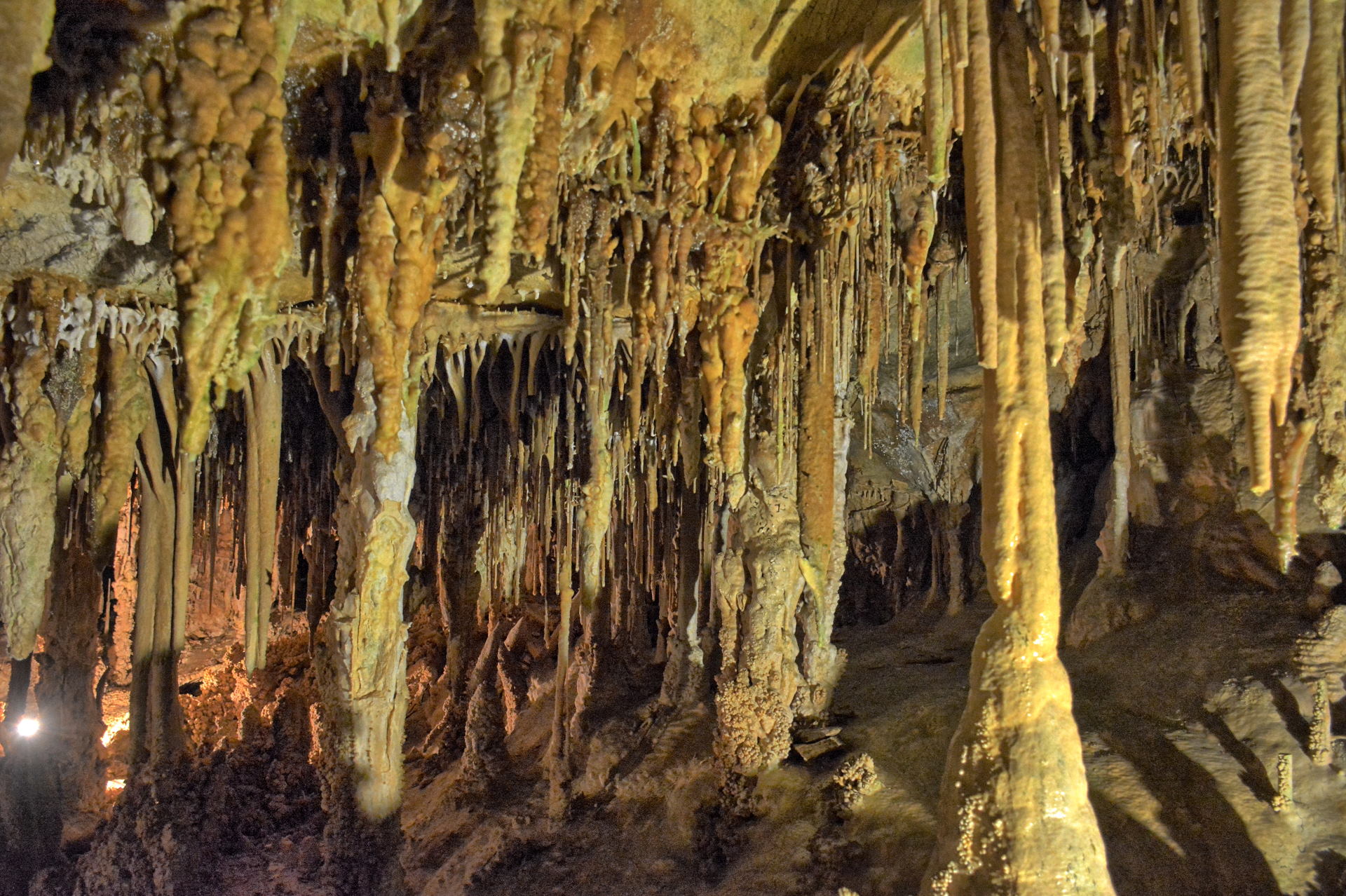
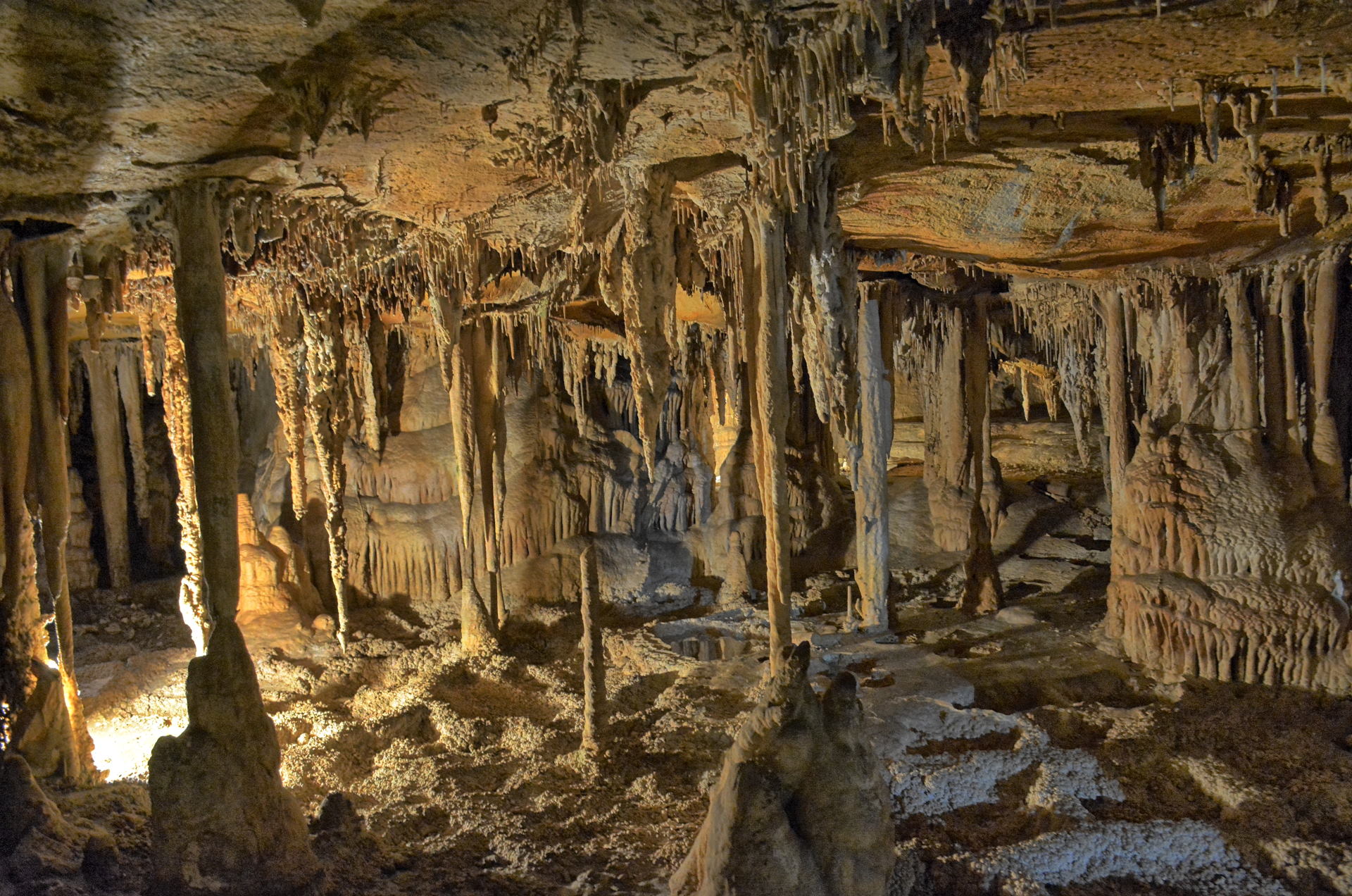
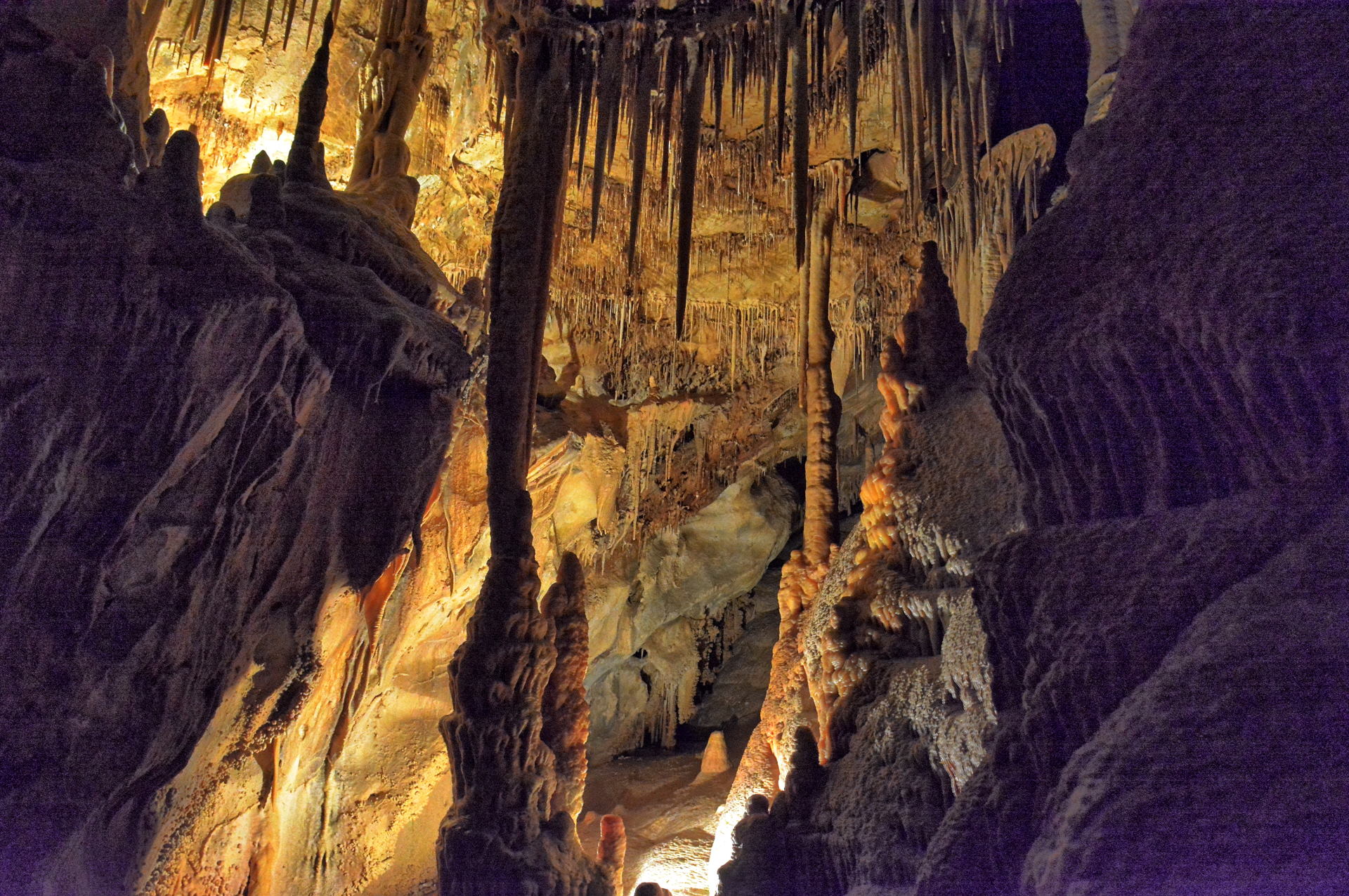
Timpanogos Cave National Monument is only about 1.5 hours
away, just east of Salt Lake City. The cave tour was about to close for
winter, so I booked a reservation for Sunday at noon and drove over for the tour. You
check in at the visitor center on the valley floor and then climb about 1000
feet up a cliff-side trail to get to the entrance. It is a nice tour, and
while not nearly as grand as Carlsbad Caverns, it does have some nice rock formations
within the three interconnected caves. I also flew my RC aircraft at a few
places along the way and on the return trip to Dugway.
Timpanagos Cave National Monument, Utah, 29
September 2019
Utah Lake, Mount Timpanagos on the left, 29
September 2019
Aerial Video, Lookout Pass,
Utah, 28
September 2019
Aerial Video, Simpson Springs,
Utah, 28 September 2019
Aerial Video, North of Simpson Springs,
Utah, 28 September 2019
Aerial Video, South Skull Valley, Utah, 28 September
2019
Aerial Video, Simpson Springs, Utah, 28 September 2019
Aerial Video, Dry Hollow overlook, Timpanagos Highway, 29 September 2019
Aerial Video, Five Mile Pass
Utah-73, 29 September 2019
Aerial Video, Fisher/Johnson Pass, Utah, 29
September 2019
During
weekend #2, Saturday, 5 October
to Sunday, 6 October, we did not work on
Saturday, so I had both days for a visit to the
Zion National Park area.
On Friday evening after work, I drove south to
the Red Cliffs National Conservation Area, just
west of Zion, and camped in my car. I had
driven up along a 4-wheel drive road in the
dark, to get near the trailhead for Yant Flat,
which is where the Candy Cliffs are located.
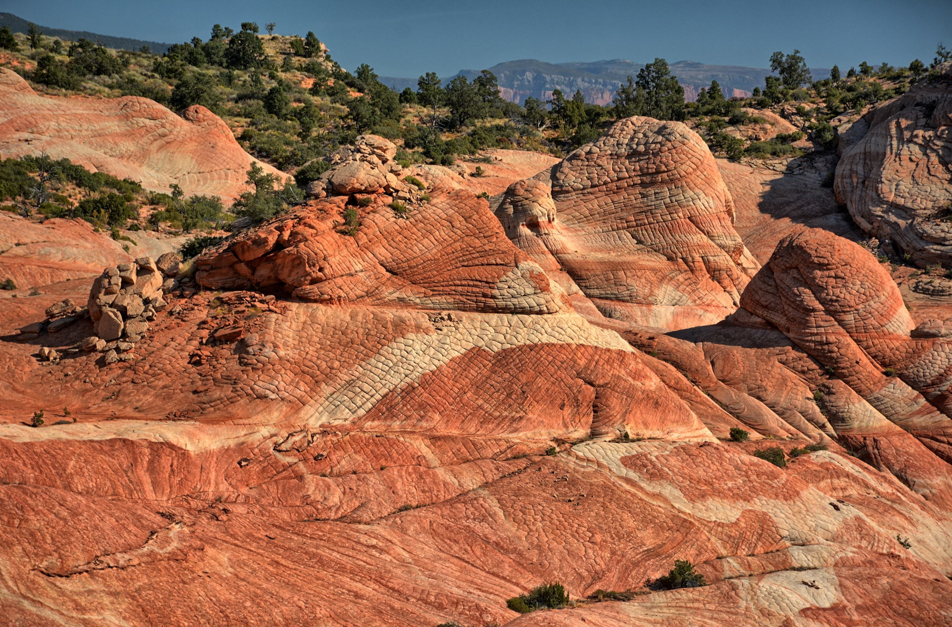
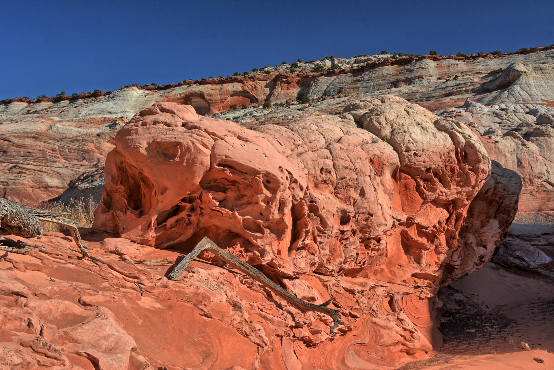
The Candy Cliffs are a very nice set of red,
pink, and white rock formations and cliffs
overlooking St George, Utah.
I spent Saturday morning on this hiking trail.
It is less than four miles round trip, but the
views are incredible. After spending
several hours hiking up and down over these
cliffs, I returned to my car and headed in the
direction of Zion National Park, passing through
Hurricane for lunch. This
video shows the drive back from the
Yant Flat trailhead to I-15. I made it to the Zion
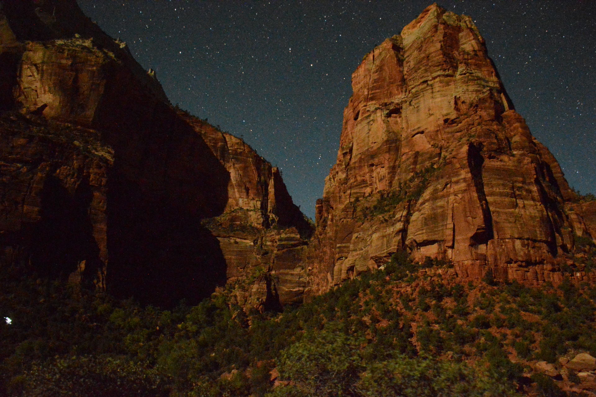
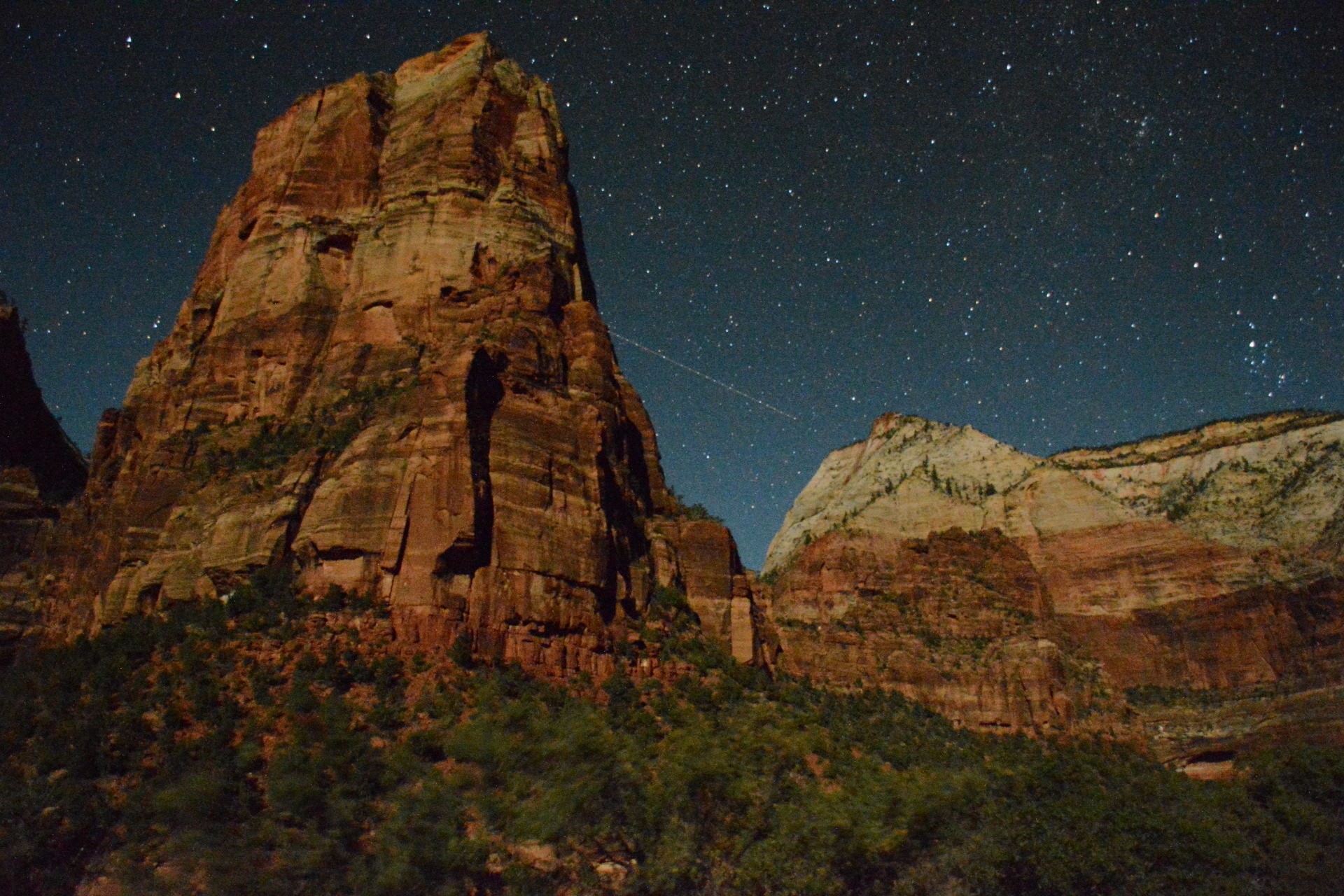
visitor center and snagged a night-time
photography pass for Zion Canyon. Zion
Canyon is closed to private cars most of the
year, but if you get one of these passes, you
can drive up the canyon after dark. After
getting the pass, I spent a few hours in the
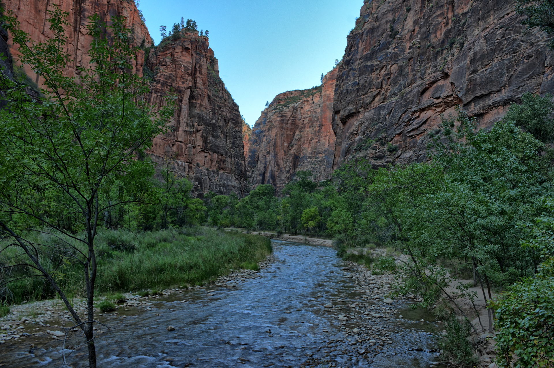
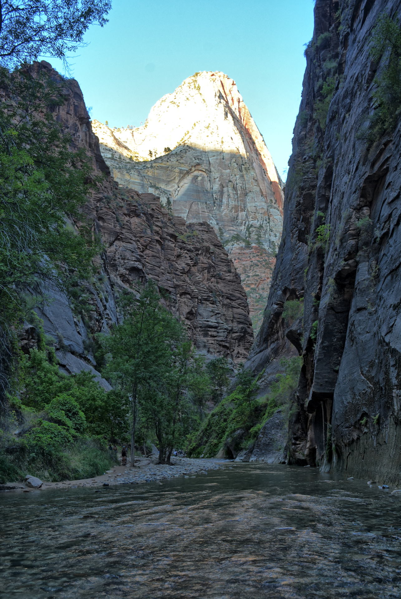
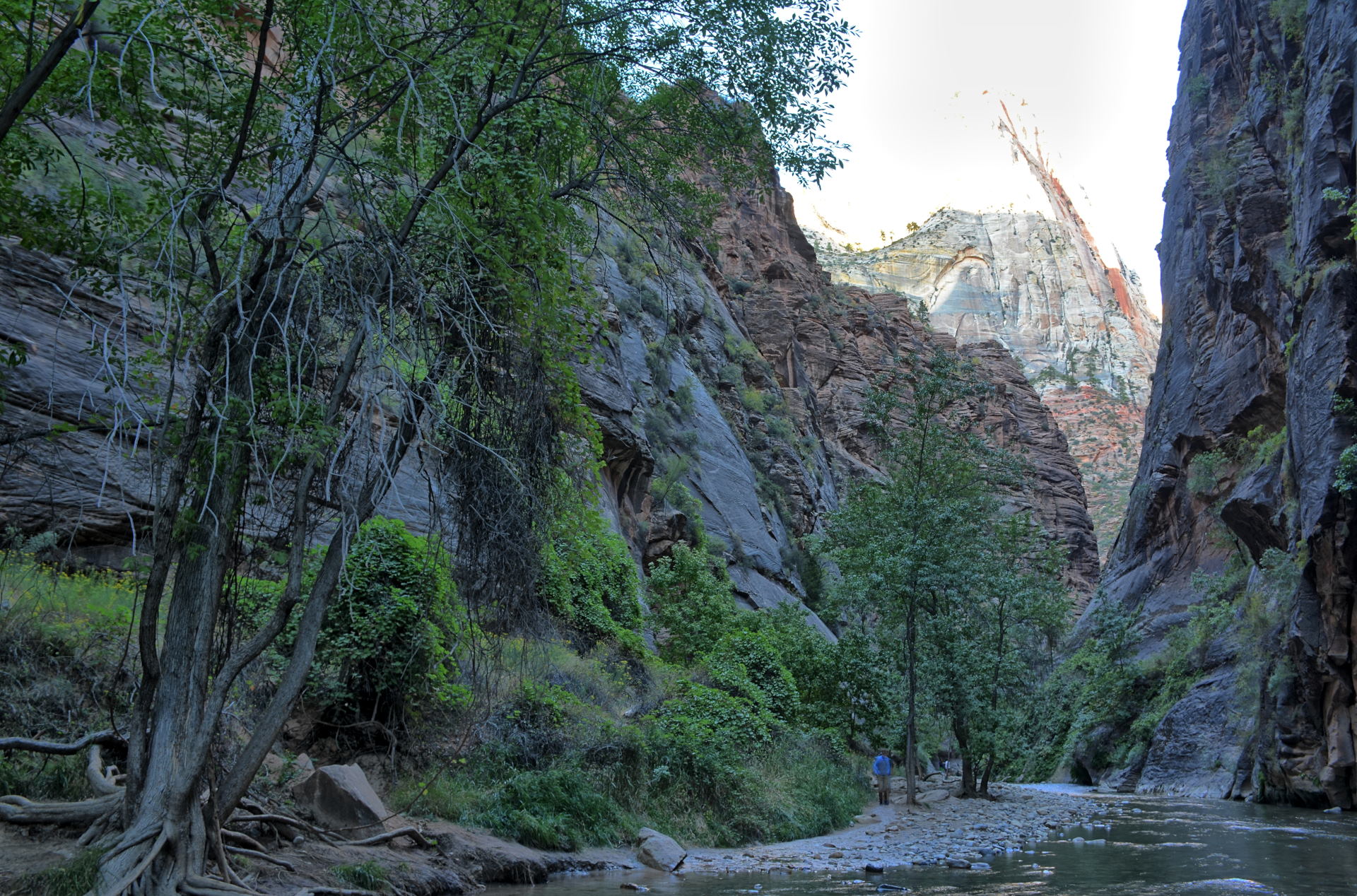
afternoon hiking to the Narrows and along the
canyon floor near Angels Landing, before going
back into Springdale for dinner. Then I returned
to the canyon and spent several mores hours in
the dark taking long exposure photos, looking up
the canyon walls at the starry night sky.
I camped in the park Saturday night.
I had made a reservation for a shuttle to Lava
Point on Sunday morning, using the same company
that I had used a few years earlier for the same
ride. I got up early on Sunday morning,
drove my car to the main parking lot at the Zion
visitor center, and walked the last mile to Zion
Adventures, just outside the park.
Springdale has started charging parking in the
town, but the visitor center parking in the park
is free (other than the normal park entrance
fee). I caught the private shuttle to Lava Point,
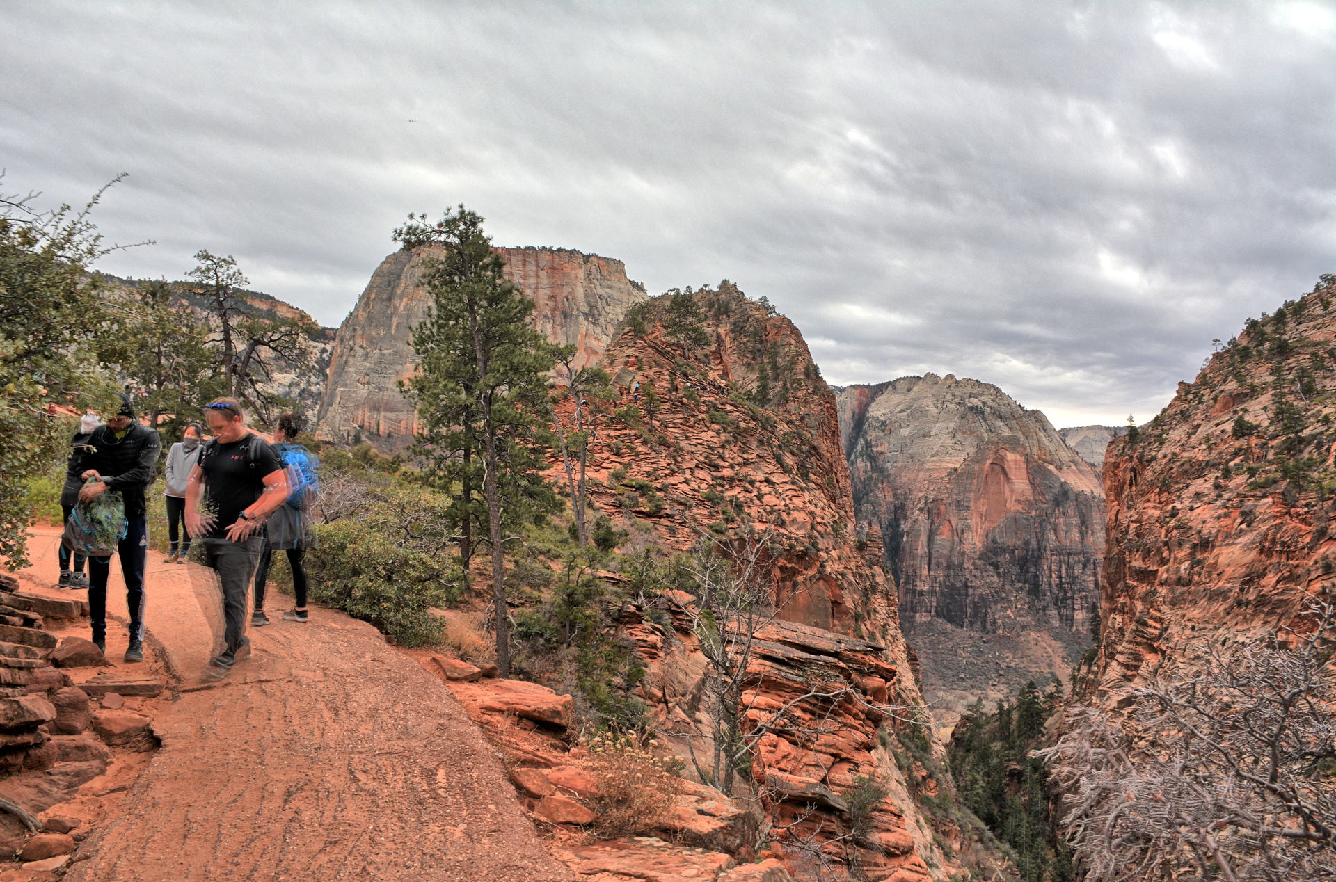
and then hiked the 15 mile West Rim Trail from
Lava Point to the Grotto. This was the
second time I have hiked that trail, which is an
incredible hike with the fantastic views the
whole way, and very few people. The last few
miles you go past Scout Lookout and Angels Landing on the way
down, and finish up in Zion Canyon at the Grotto
shuttle stop. This
video shows that final section of the hike, from Cabin Spring
to the Grotto. I took hundreds of photos along
this hike, enjoying the bright sunshine, great
views, cool temperatures, and quiet. I
took the park shuttle from the Grotto back to the
visitor center, got my car, and started the
drive back to Dugway. Off of I-15, I drove
up into the Kolob Canyons area of Zion, and
enjoyed sunset overlooking those red mountains.
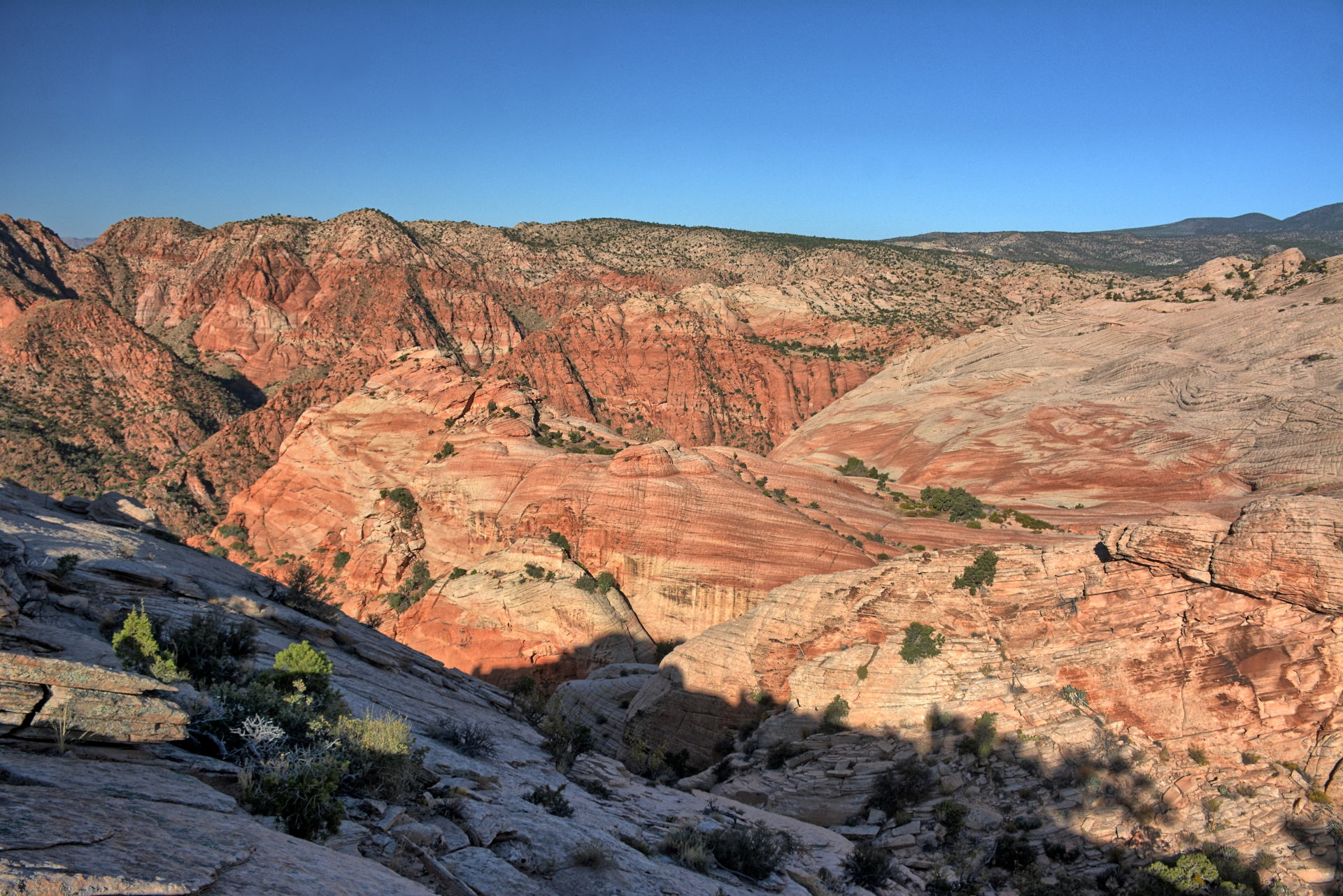
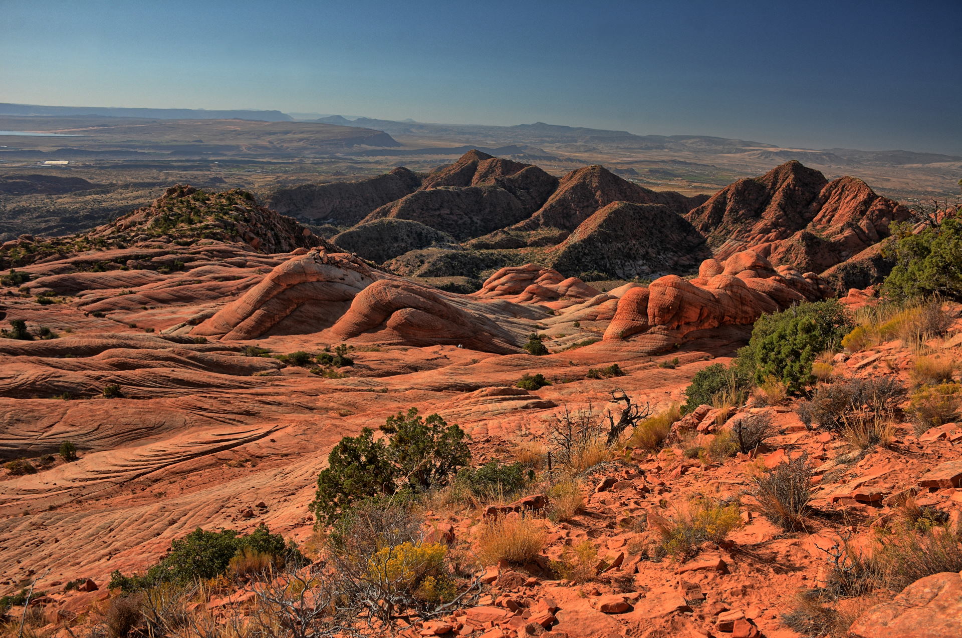
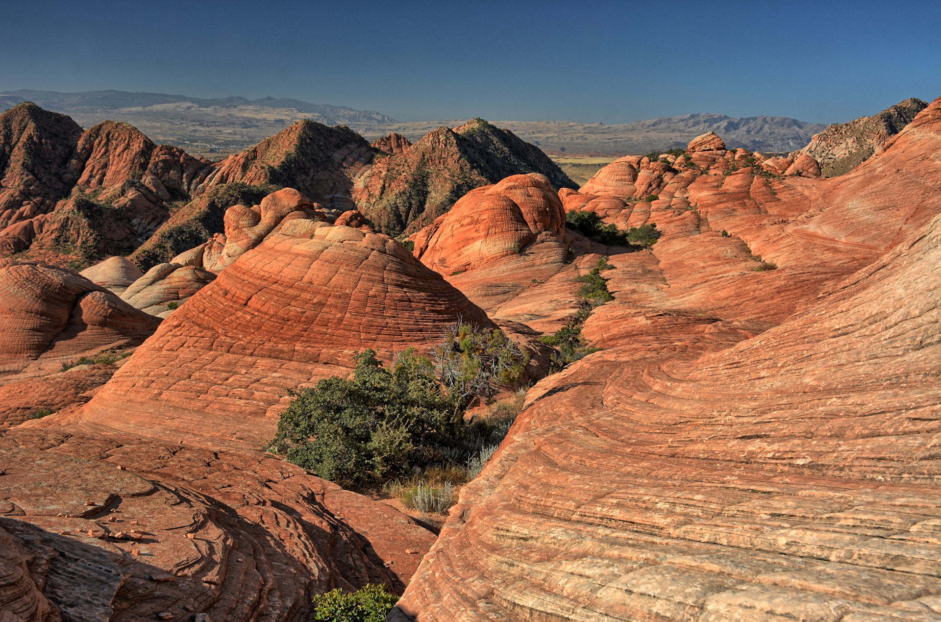
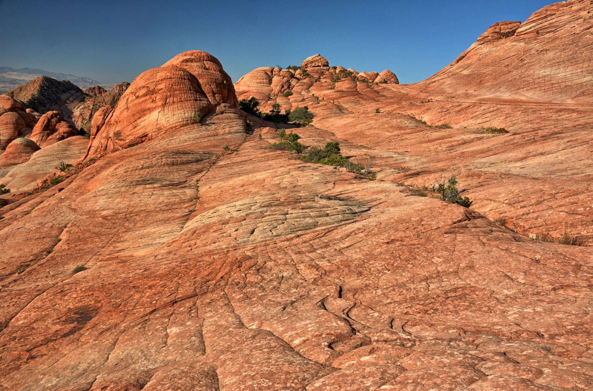
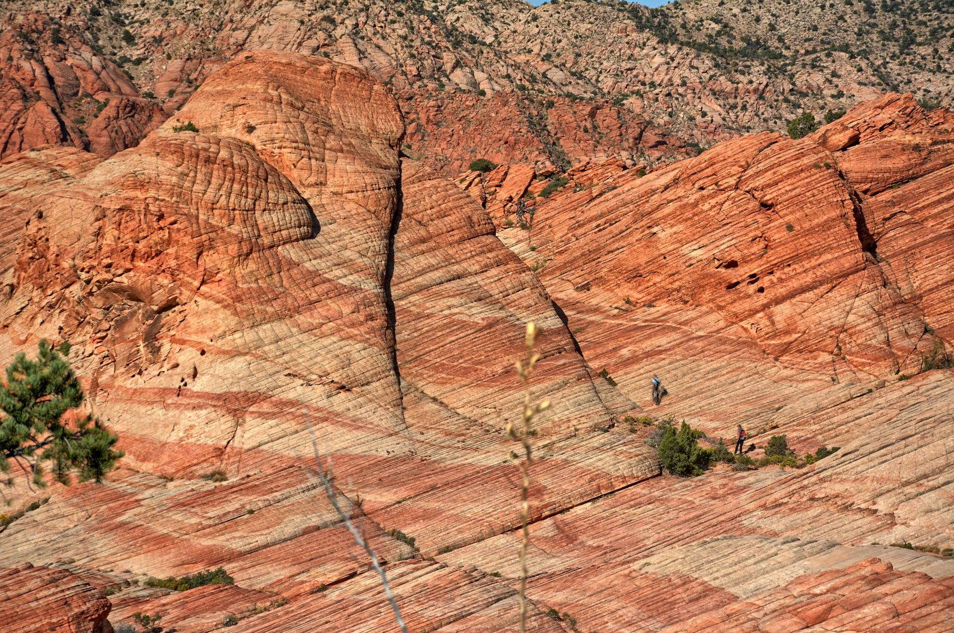
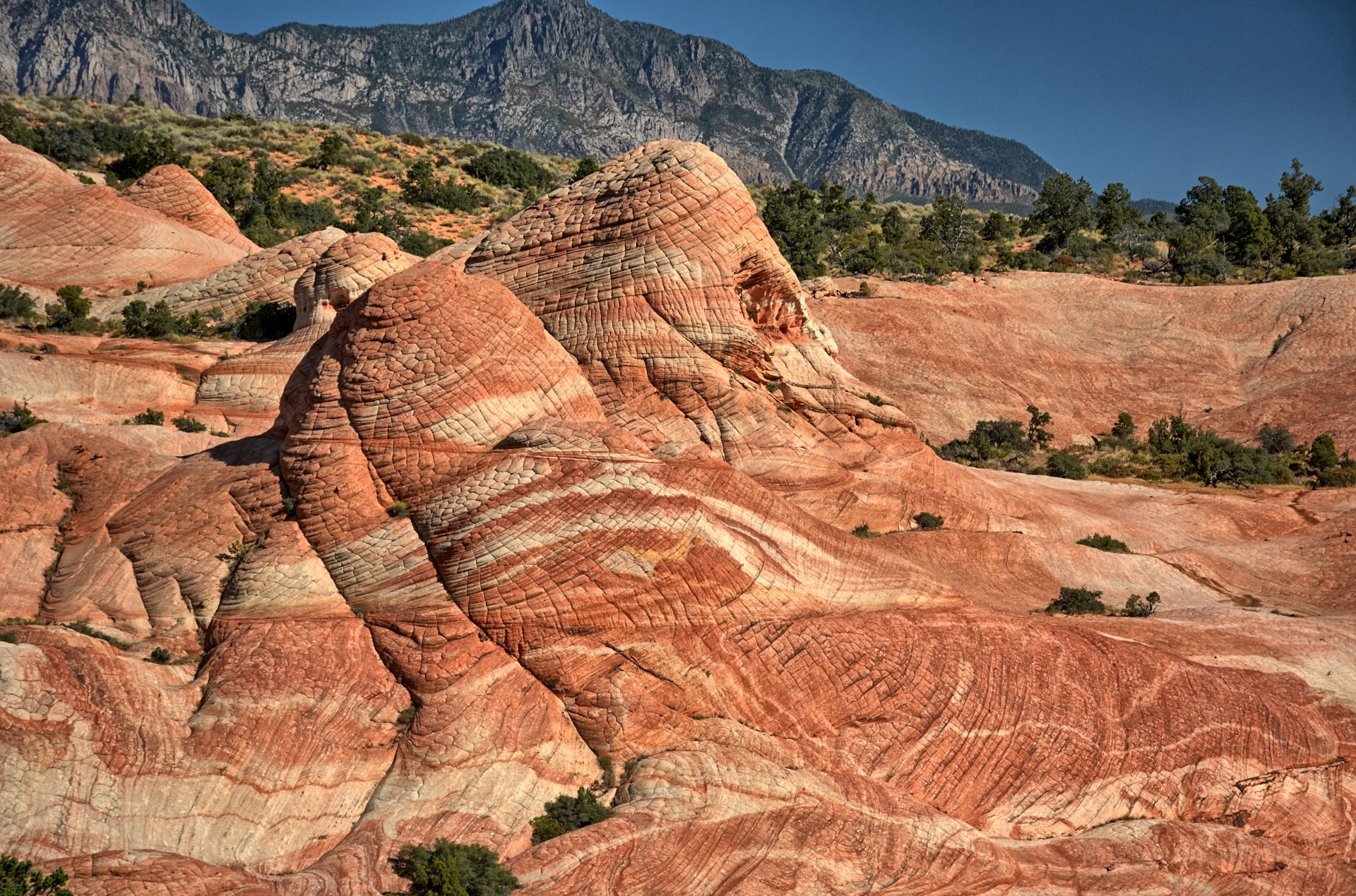
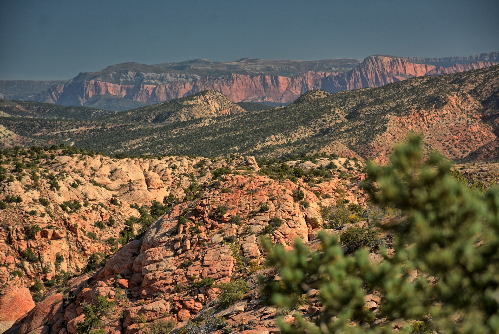
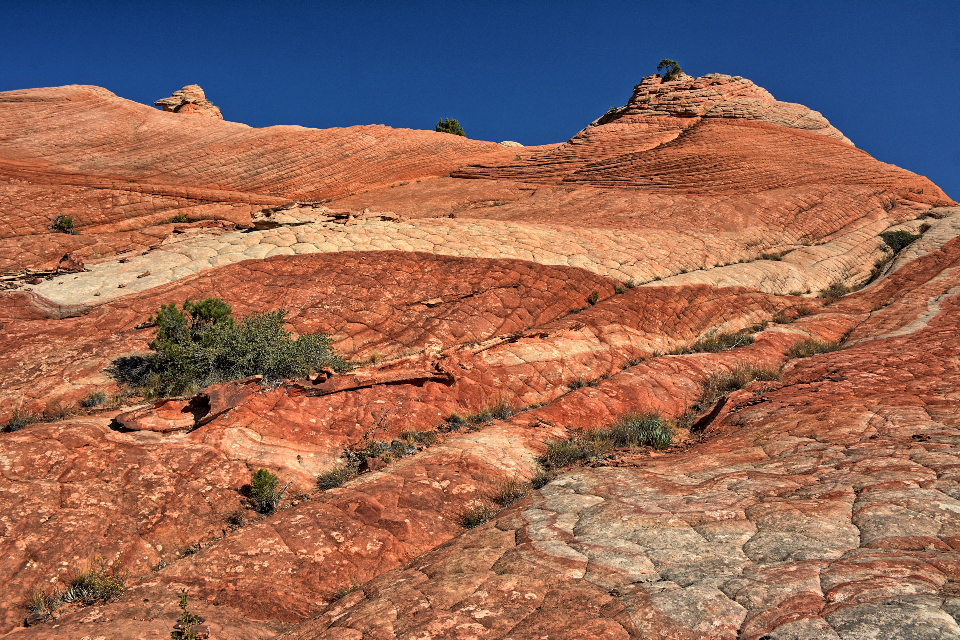
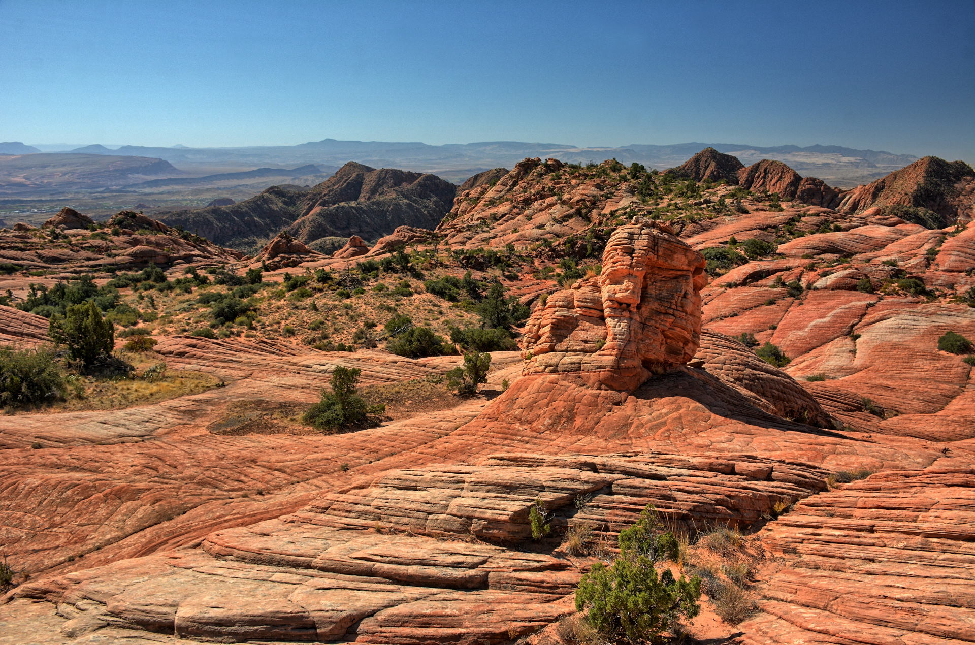
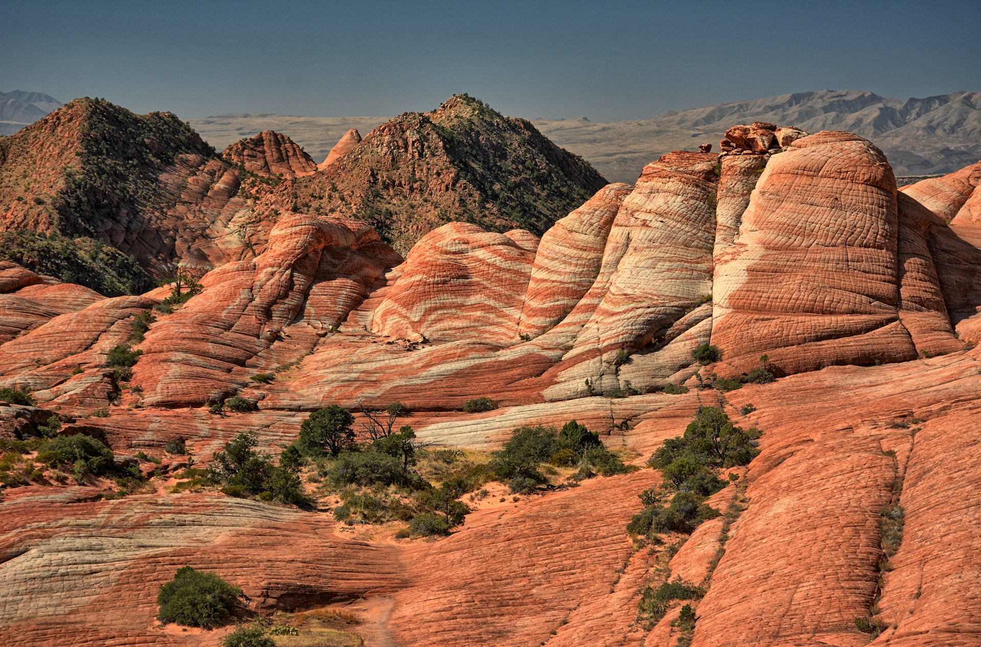
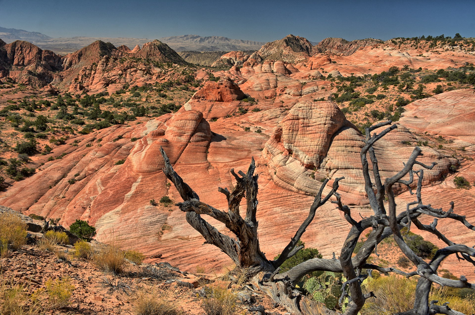
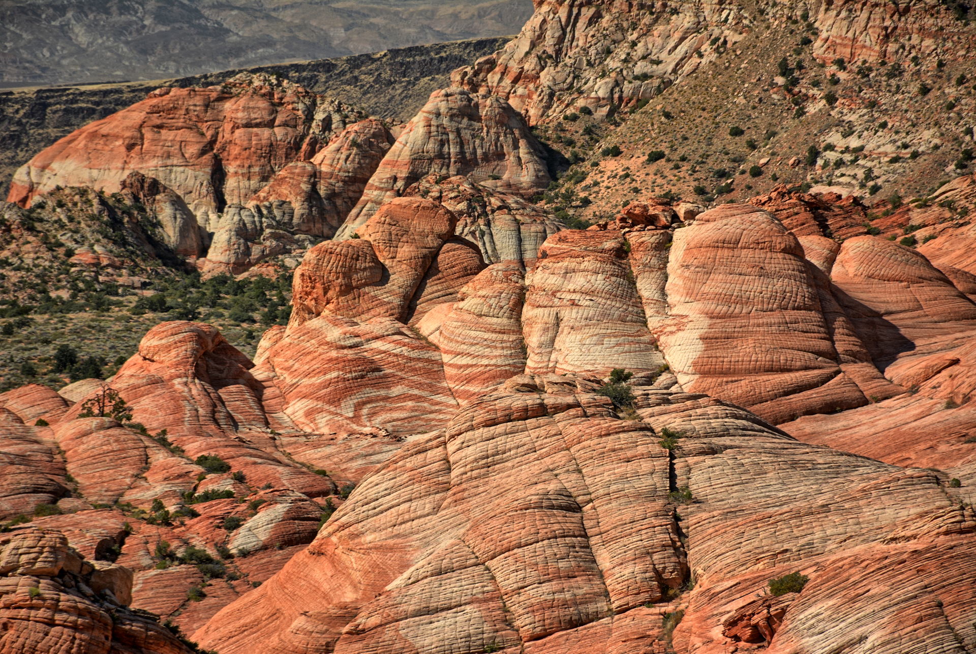
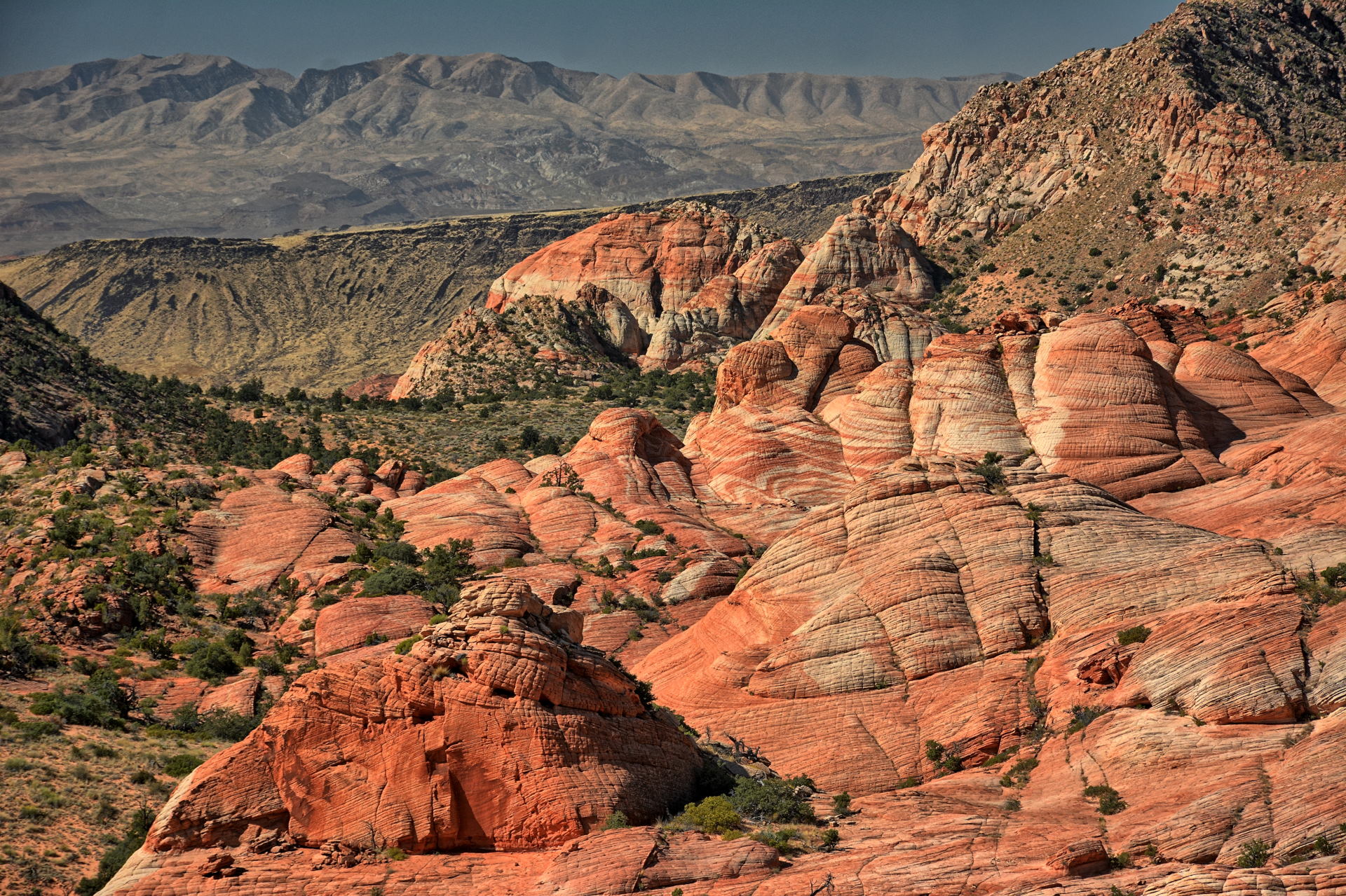
Yant Flat - Candy Cliffs, Red Cliffs Conservation Area, St
George, Utah, 5 October 2019
Drive from Yant Flat trailhead to I-15, Leeds,
Utah, 5 October 2019
West Rim Trail hiking, Cabin Spring to the Grotto, 6
October 2019
Aerial Video, Yant Flat, Utah, 5 October 2019
Aerial Video,
Access Rd 031, Red Cliffs Conservation Area,
Utah, 5 October 2019
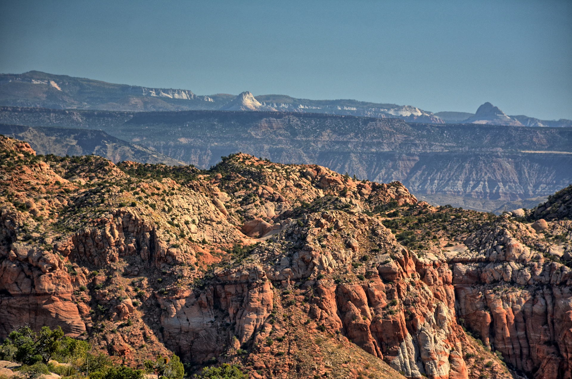
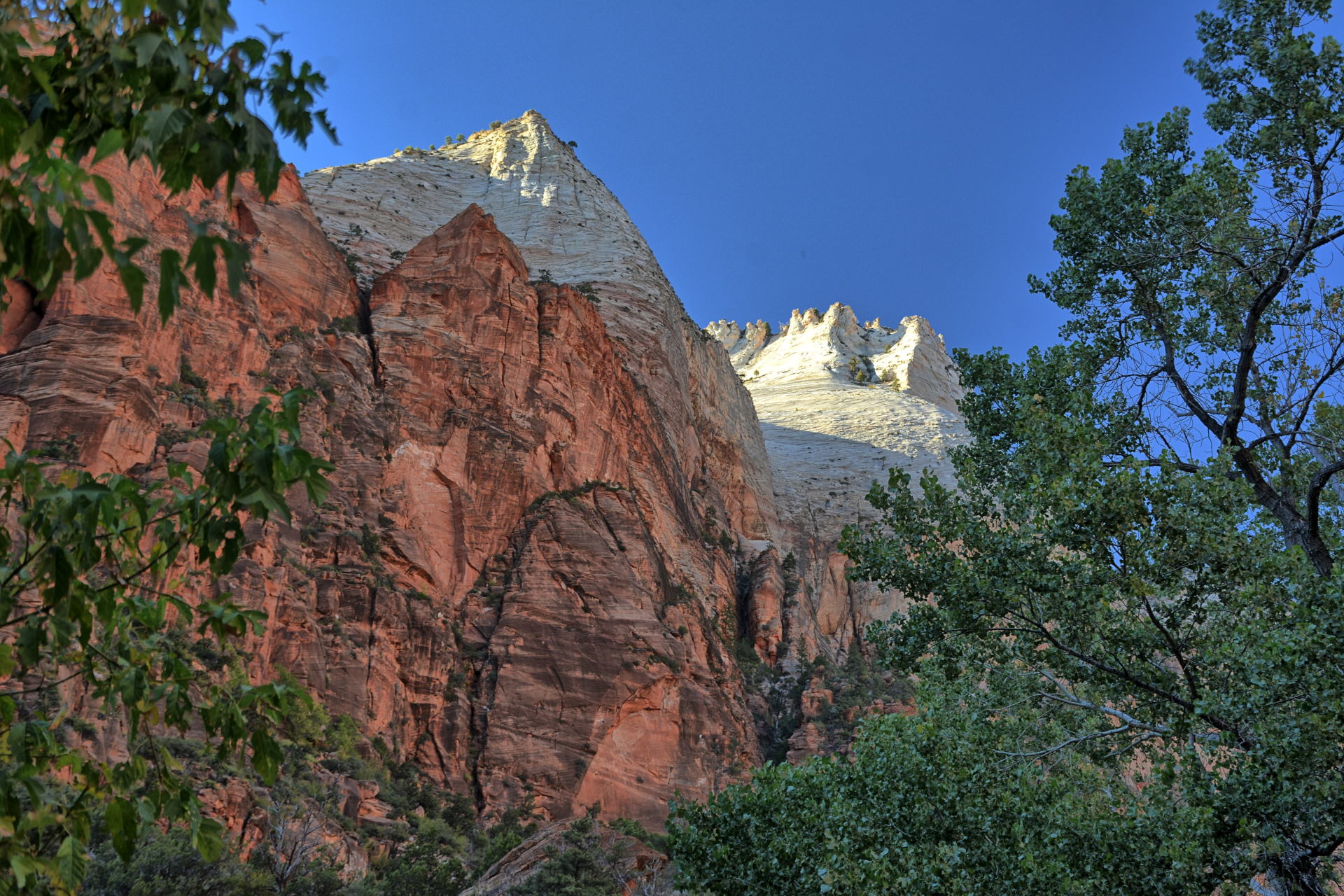
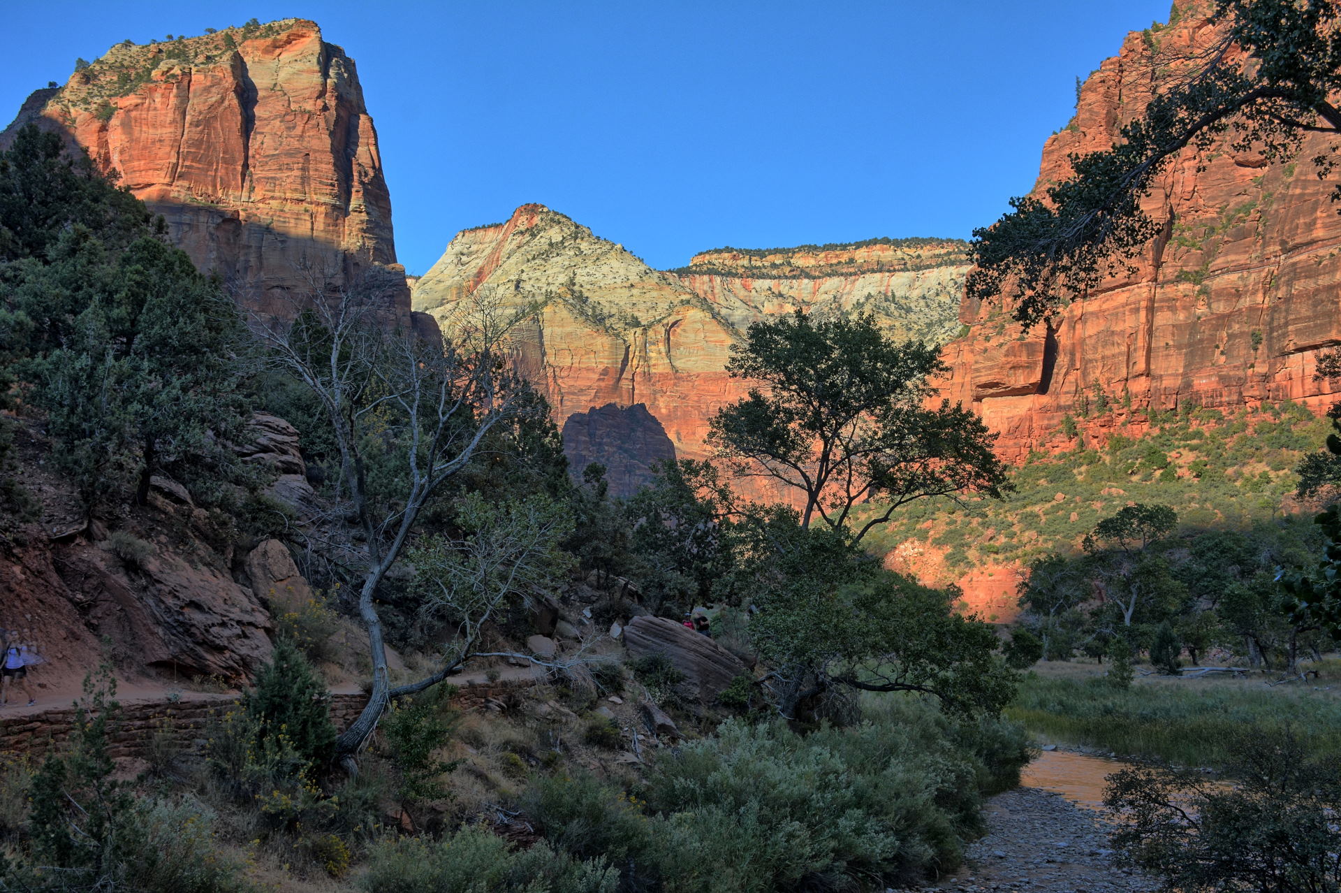
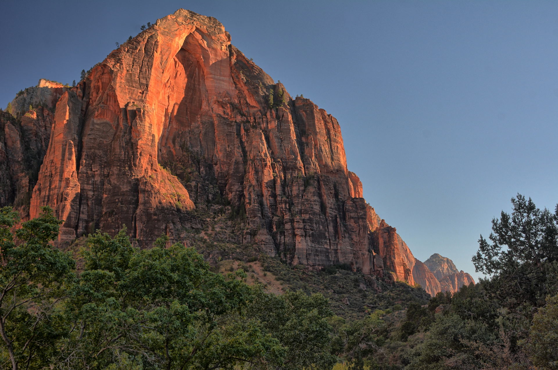
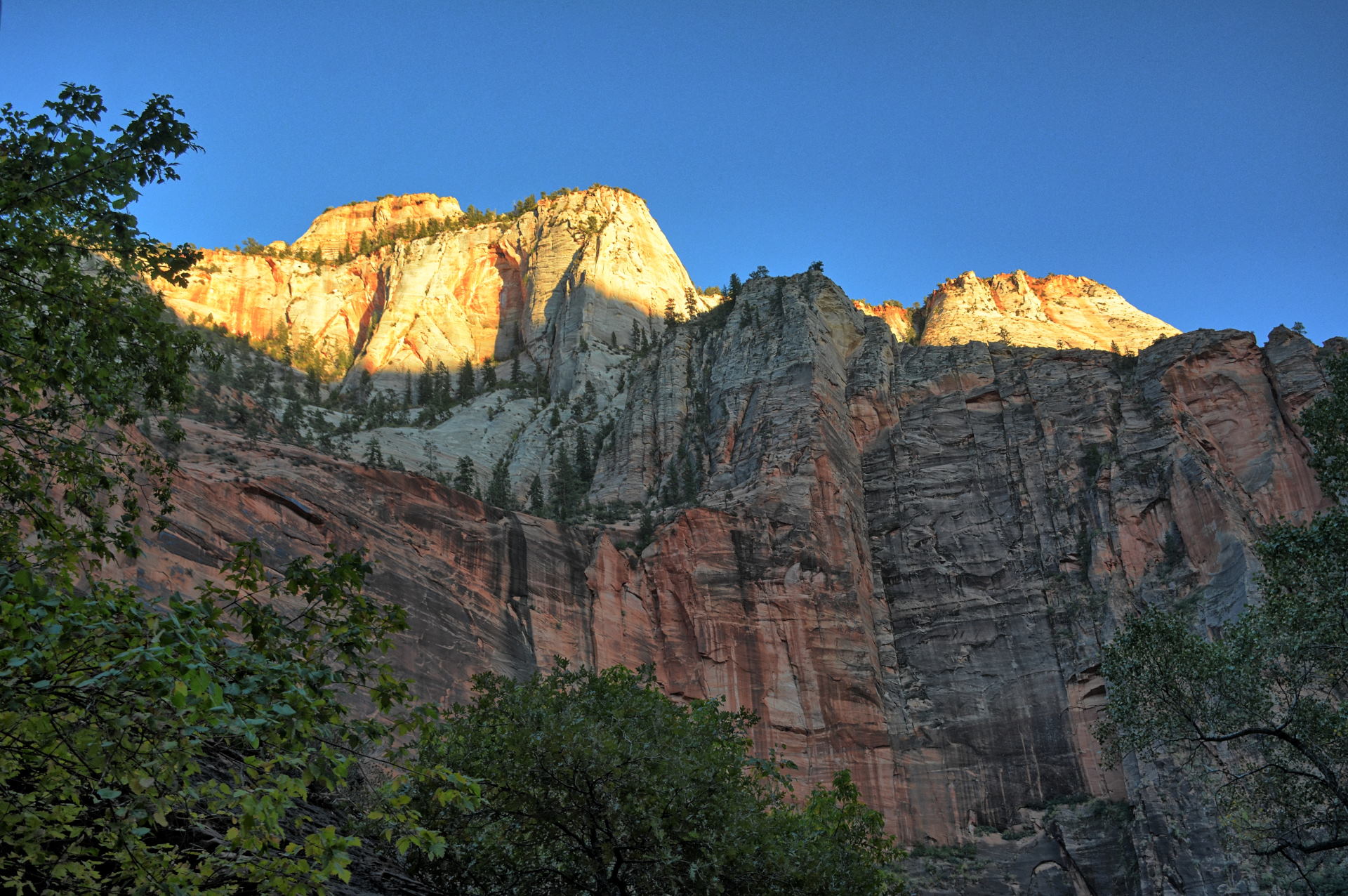
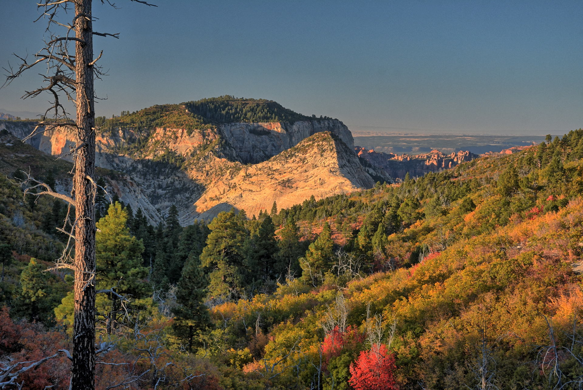
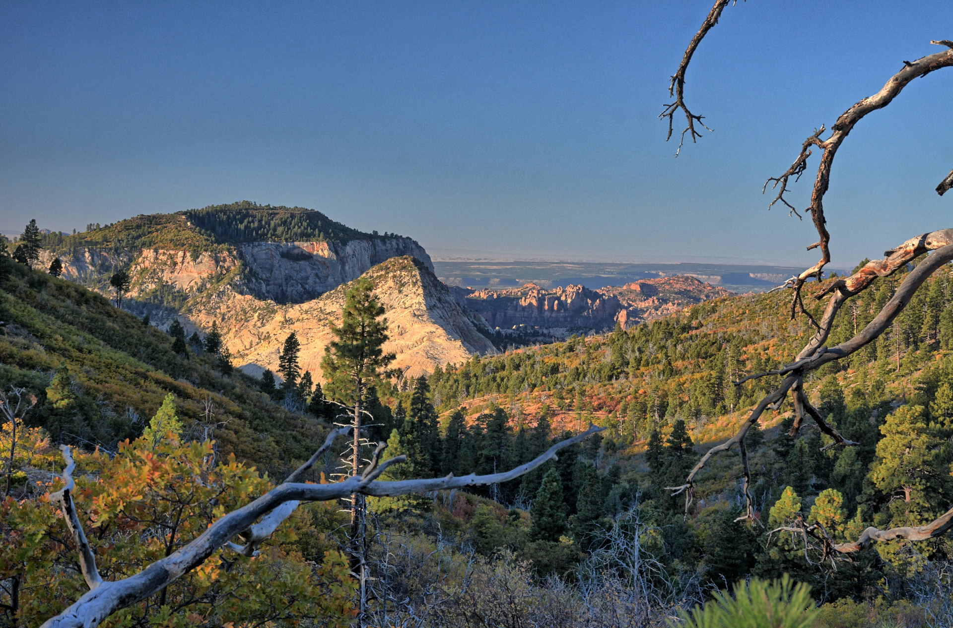
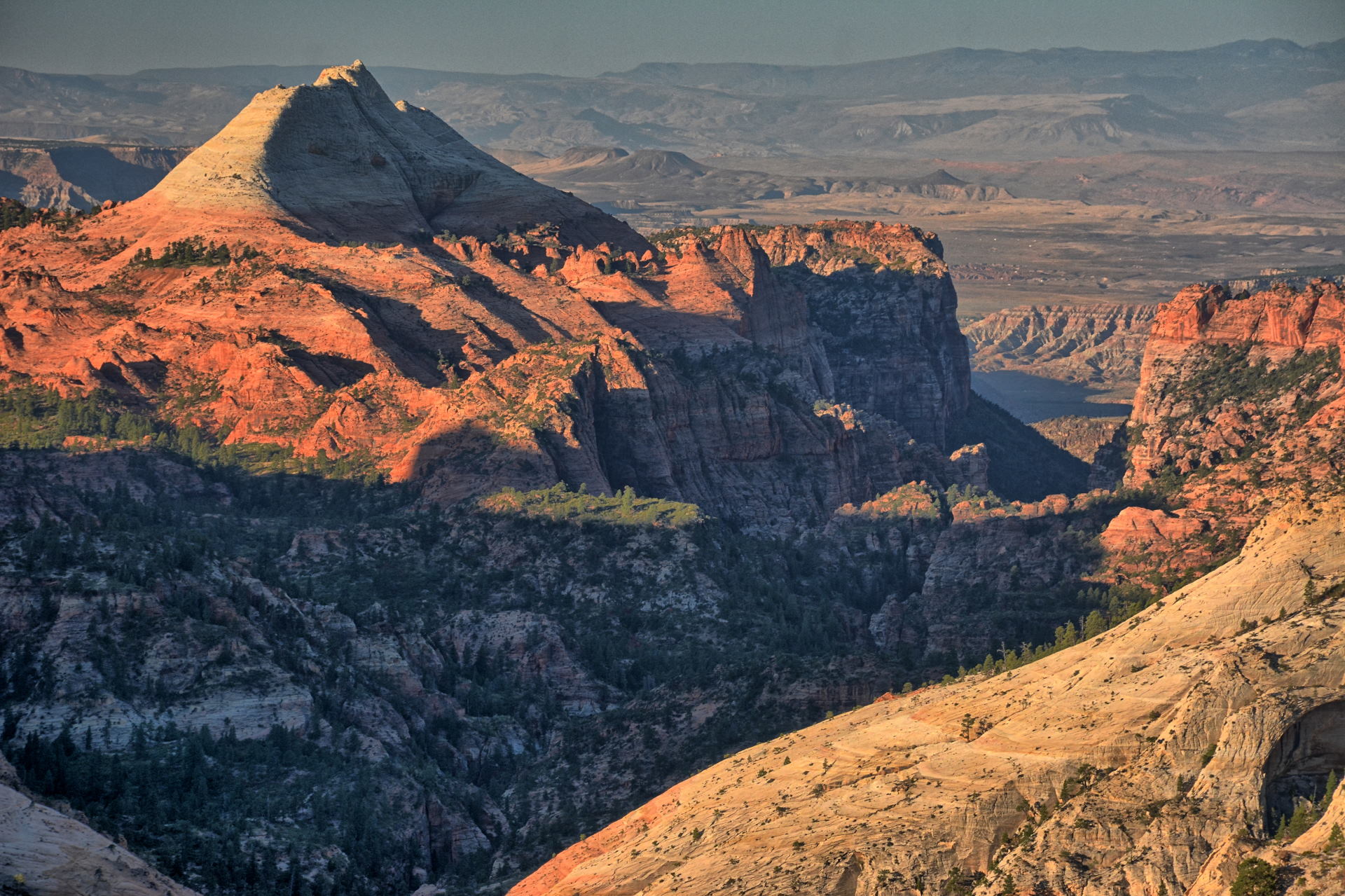
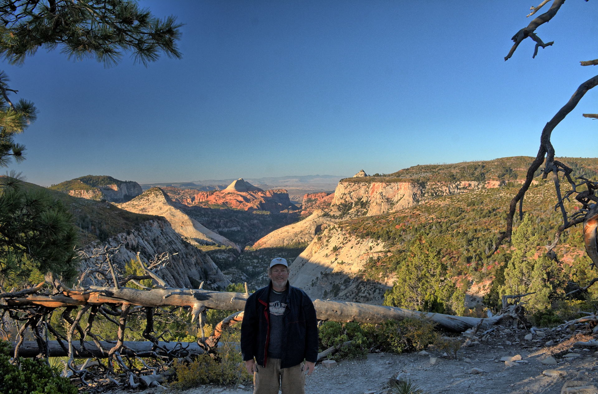
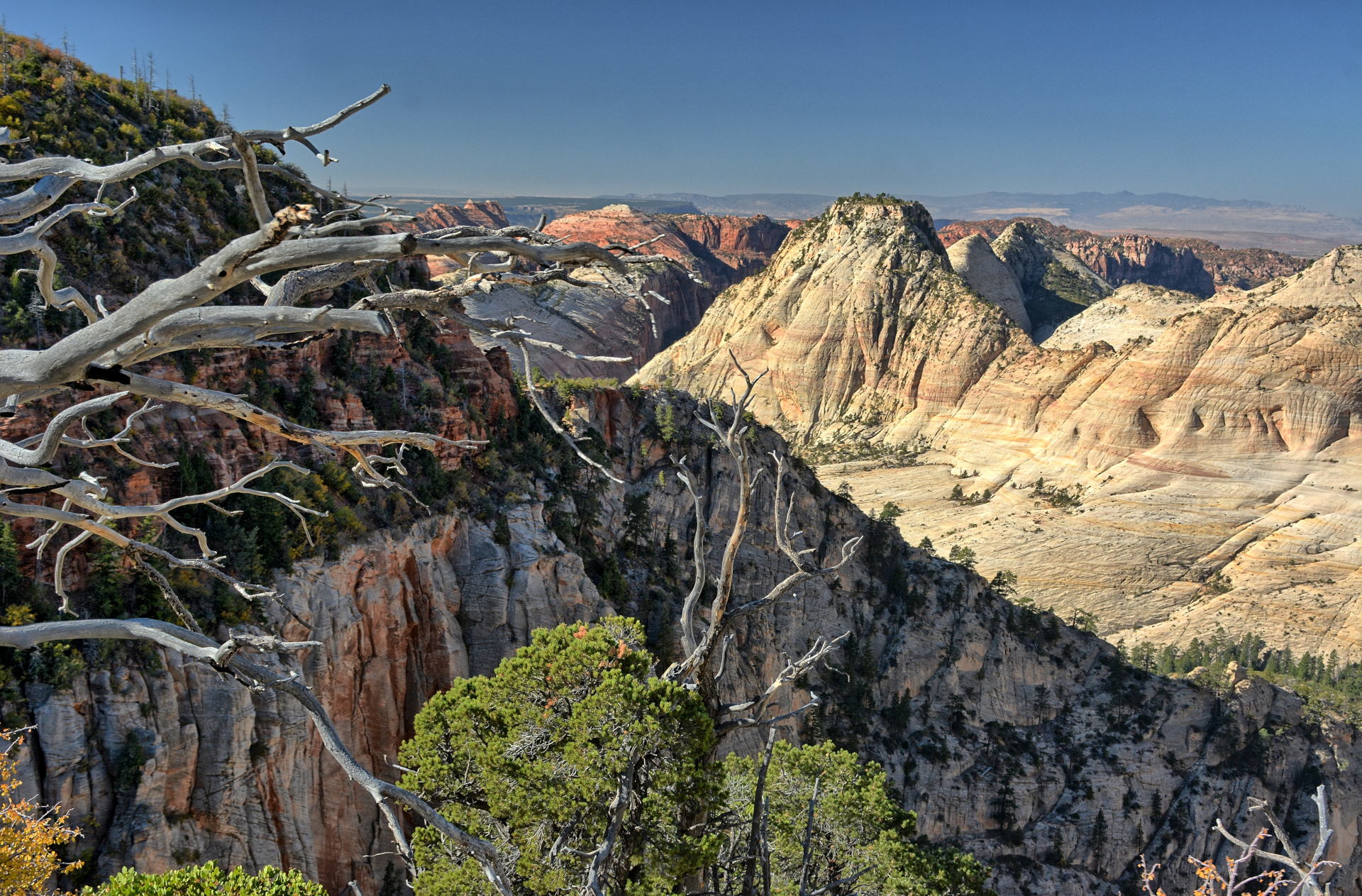
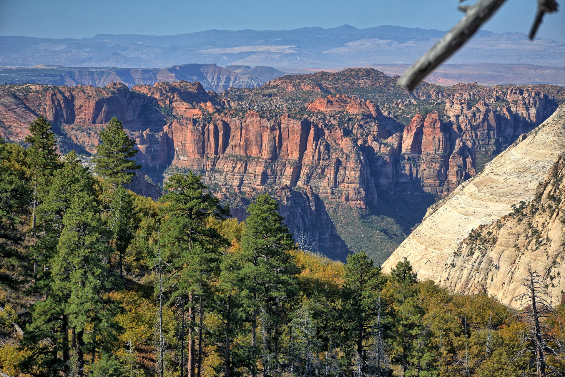
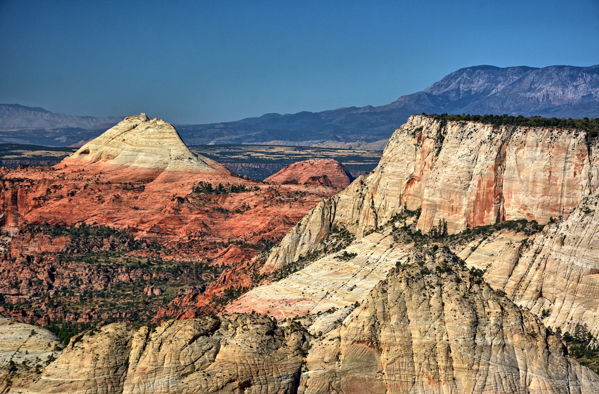
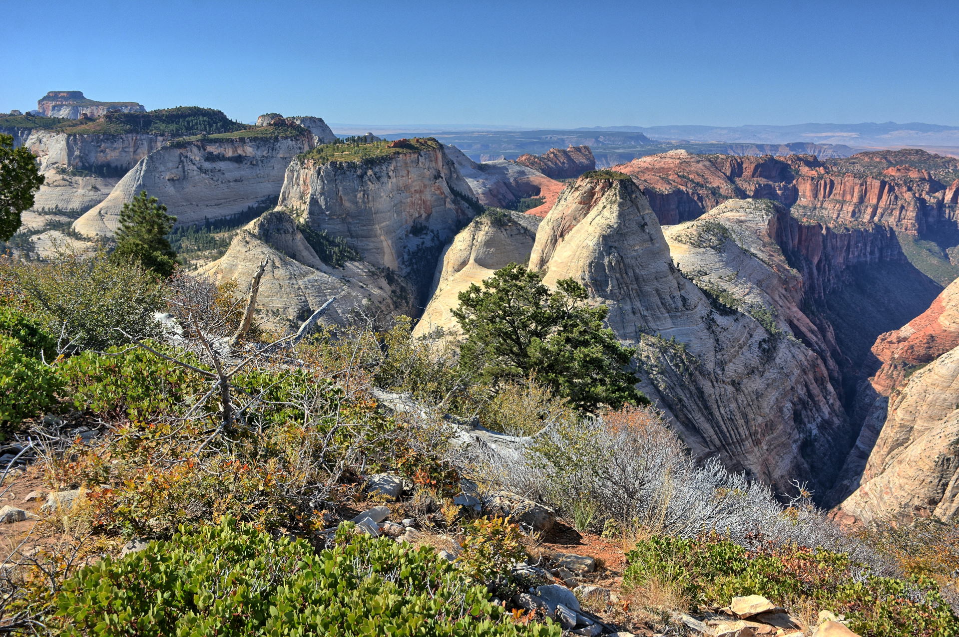
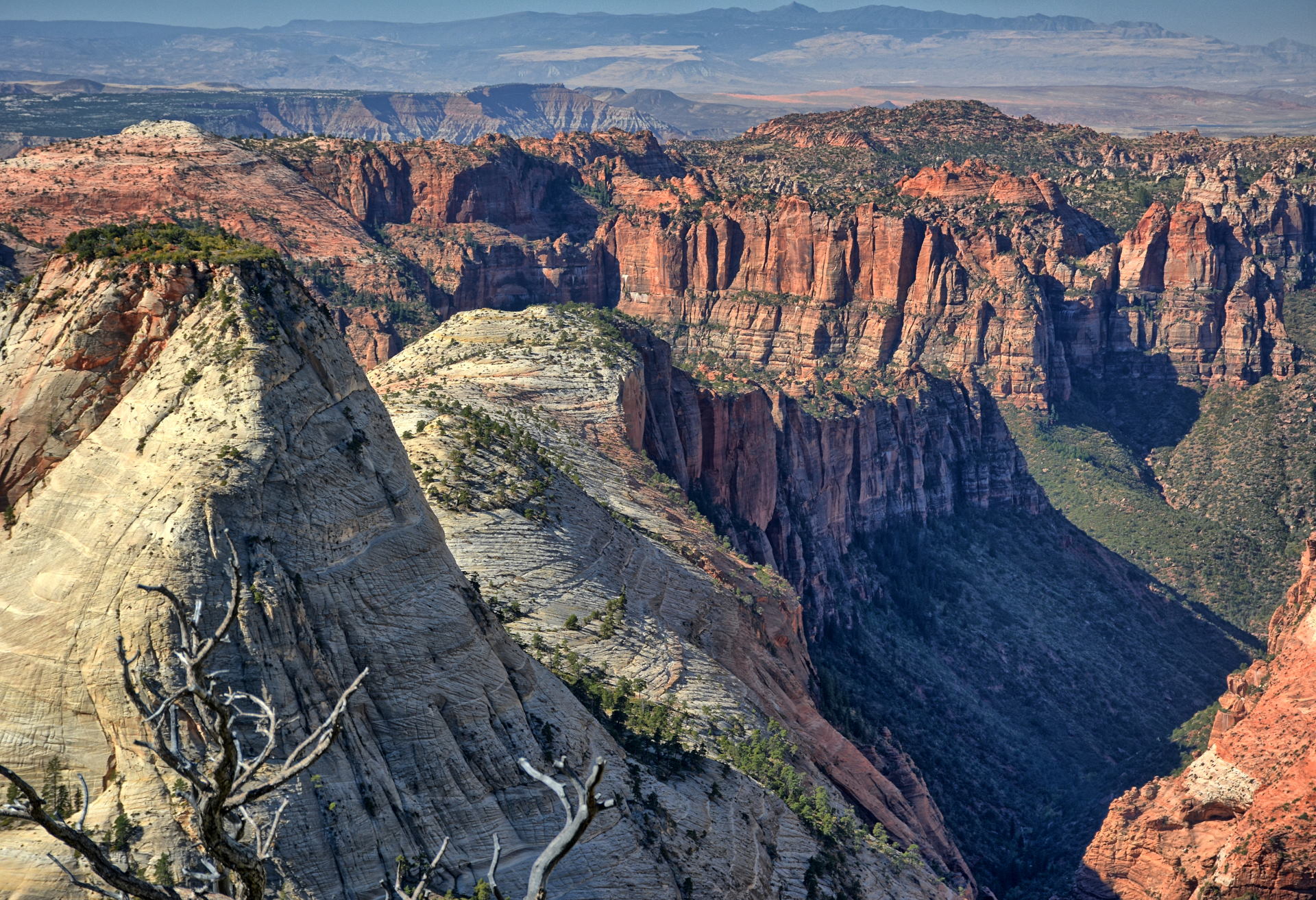
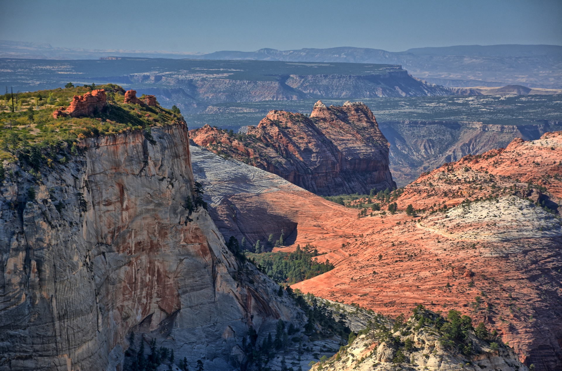
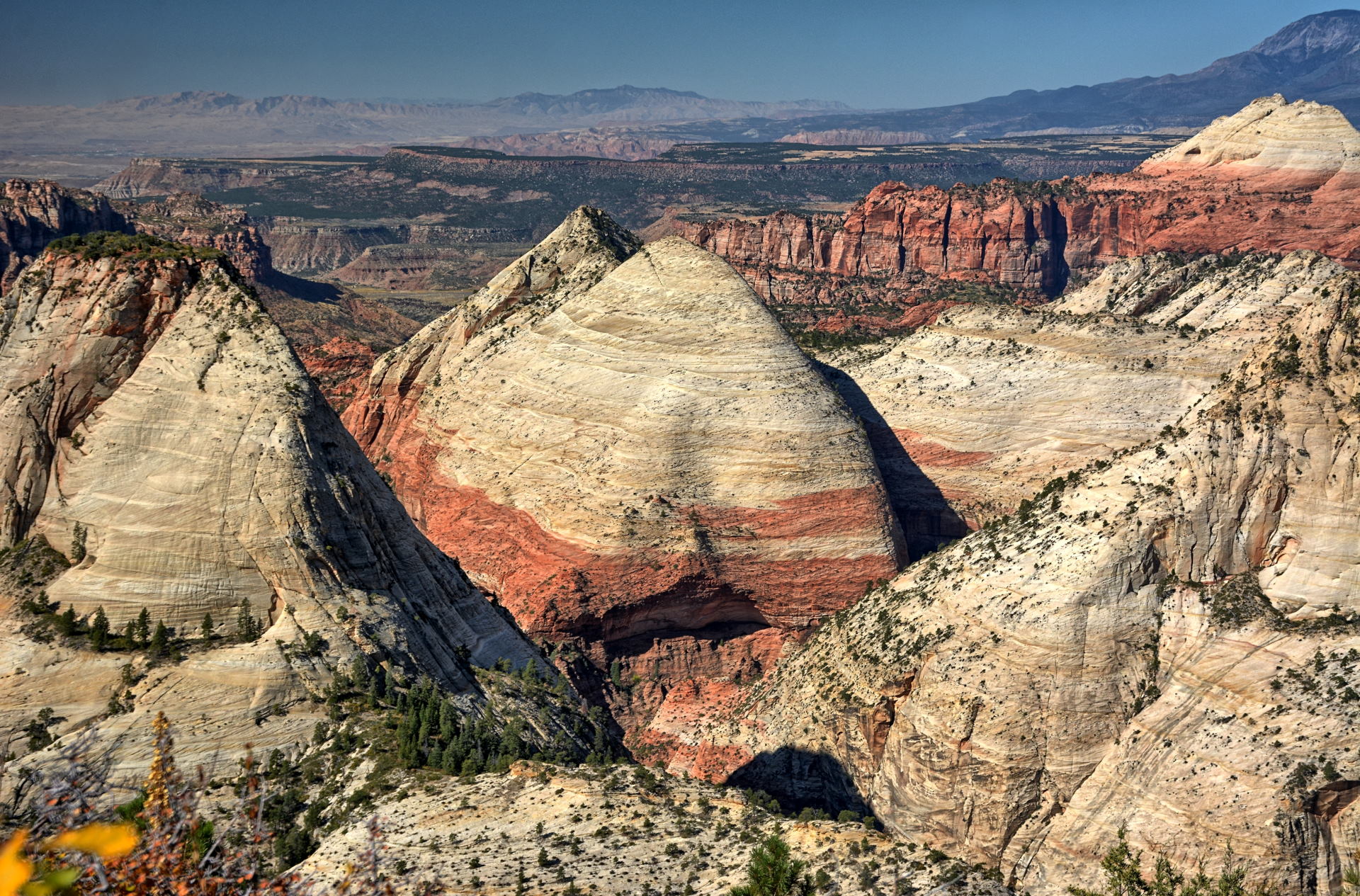
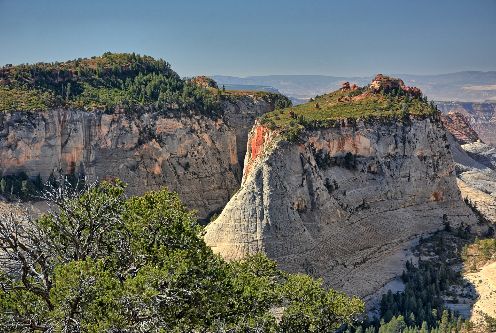
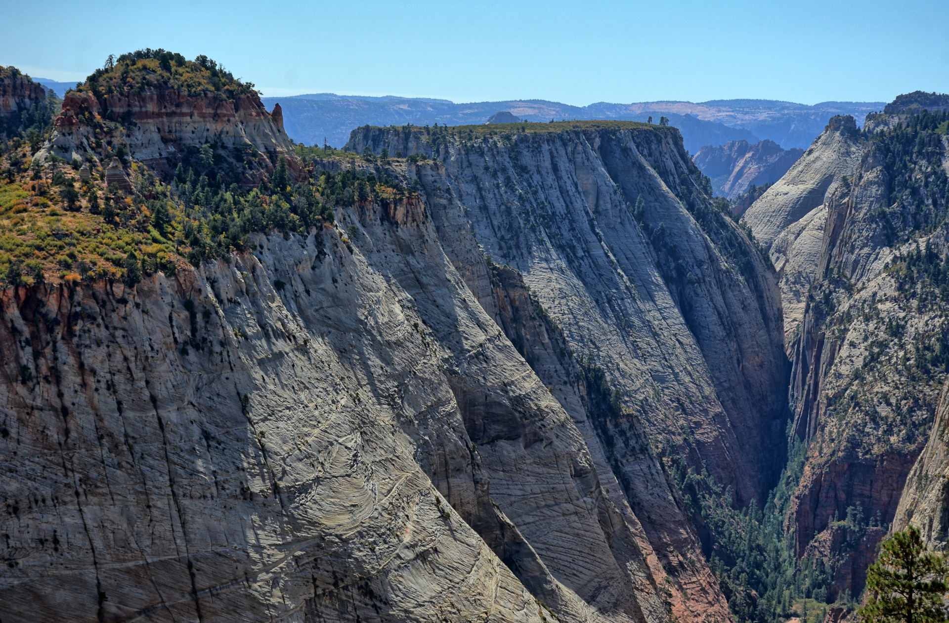
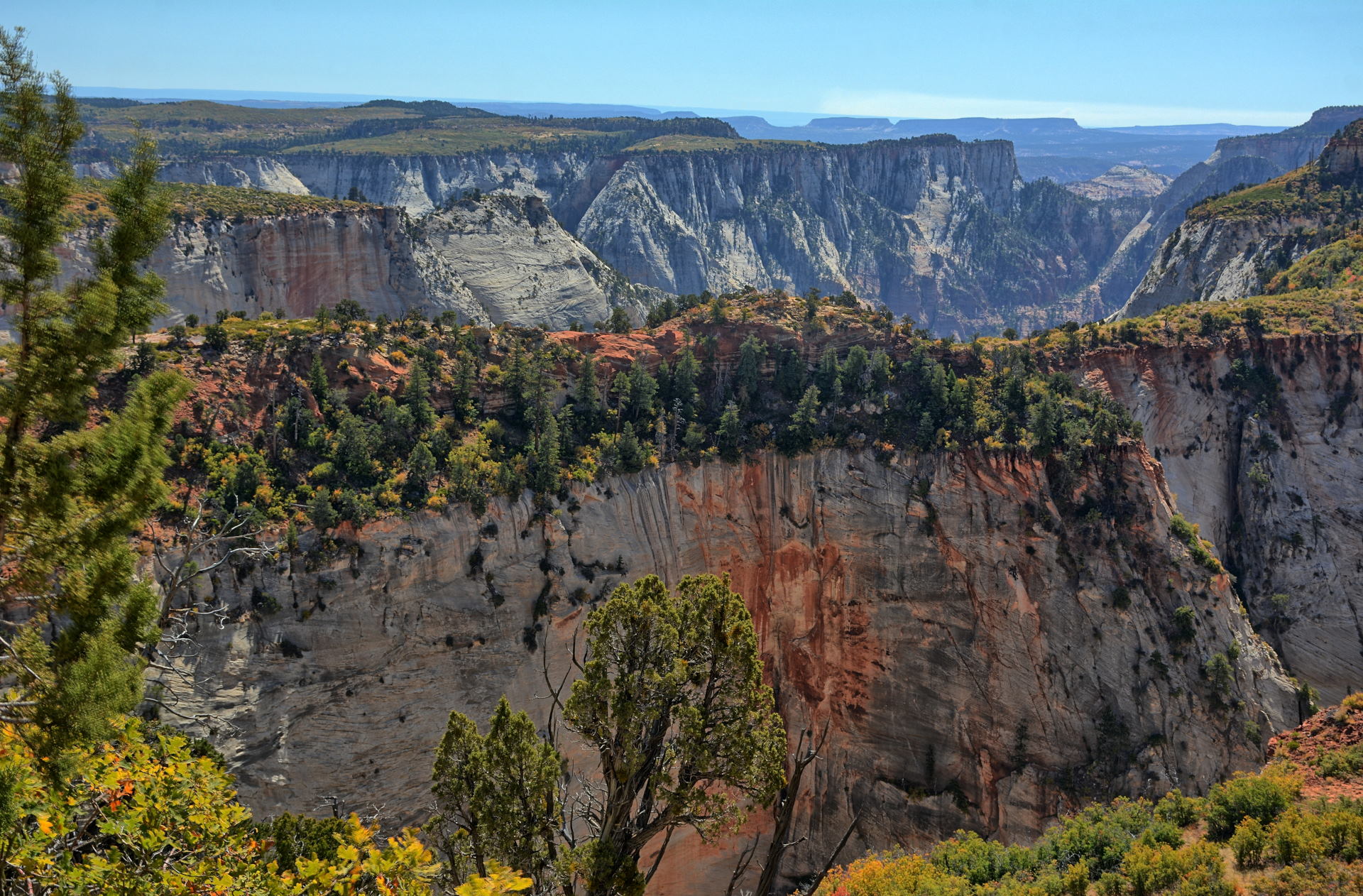
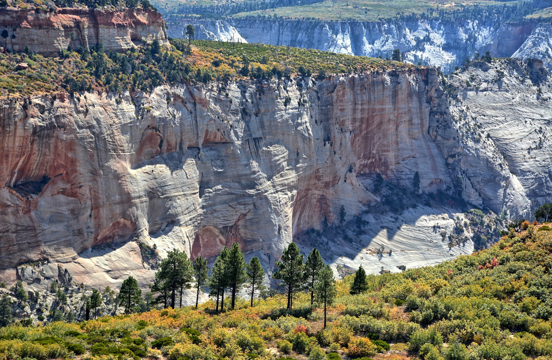
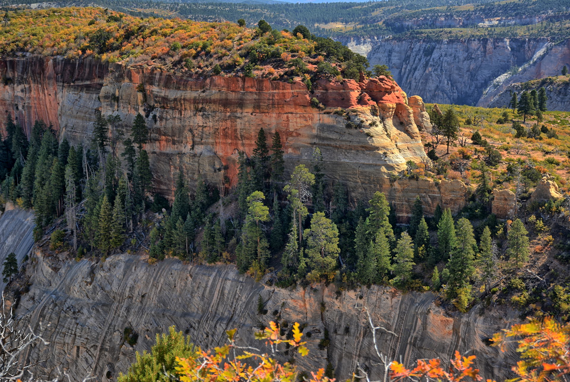
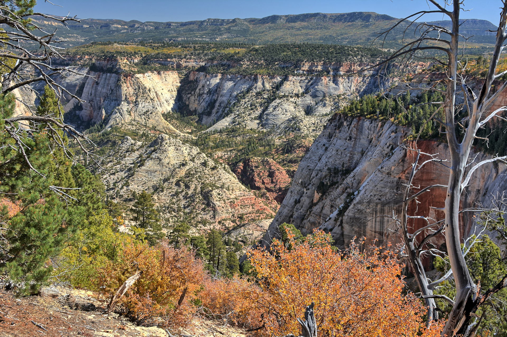
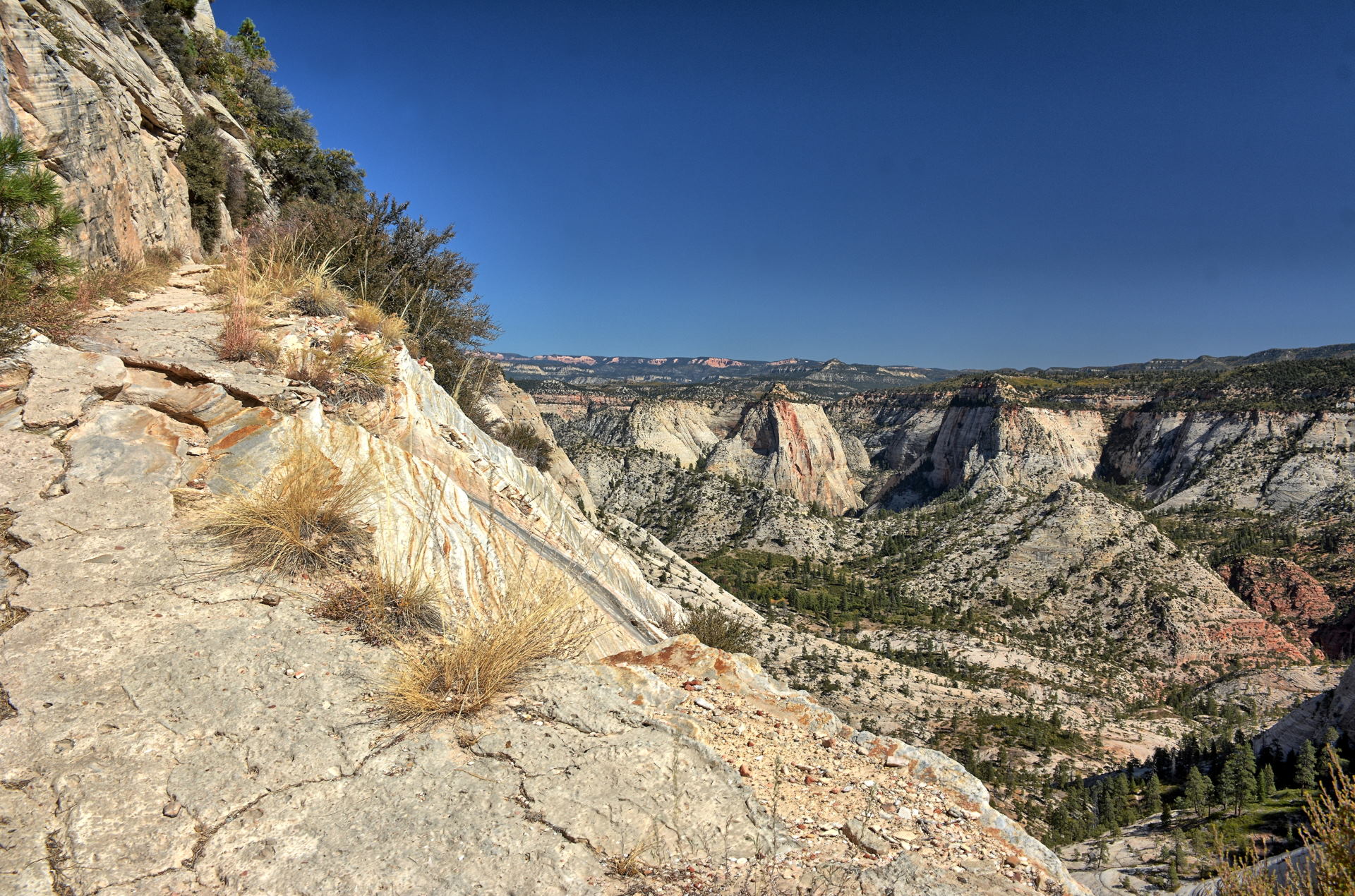
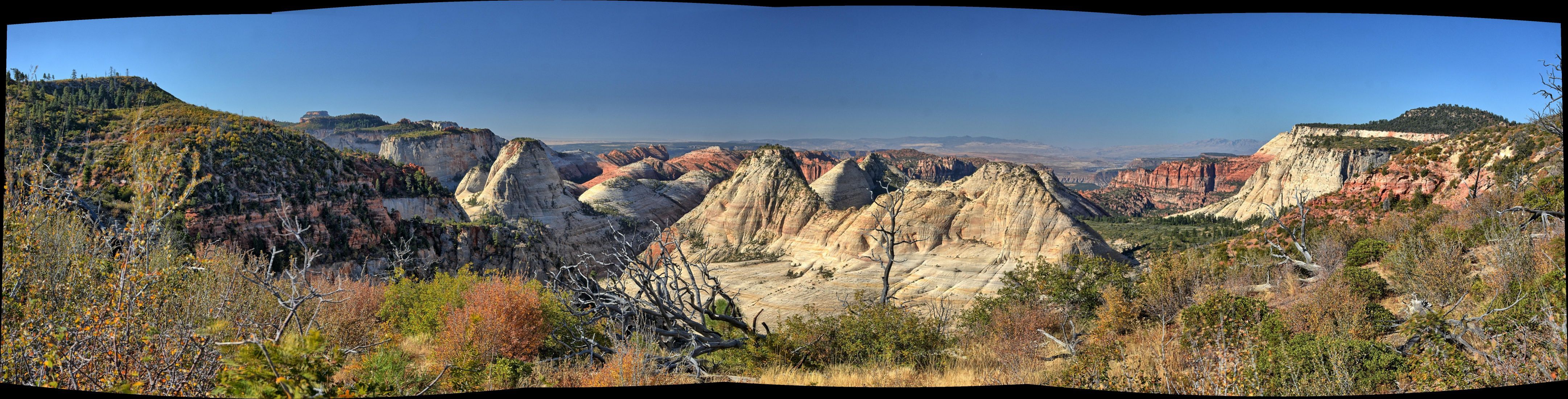
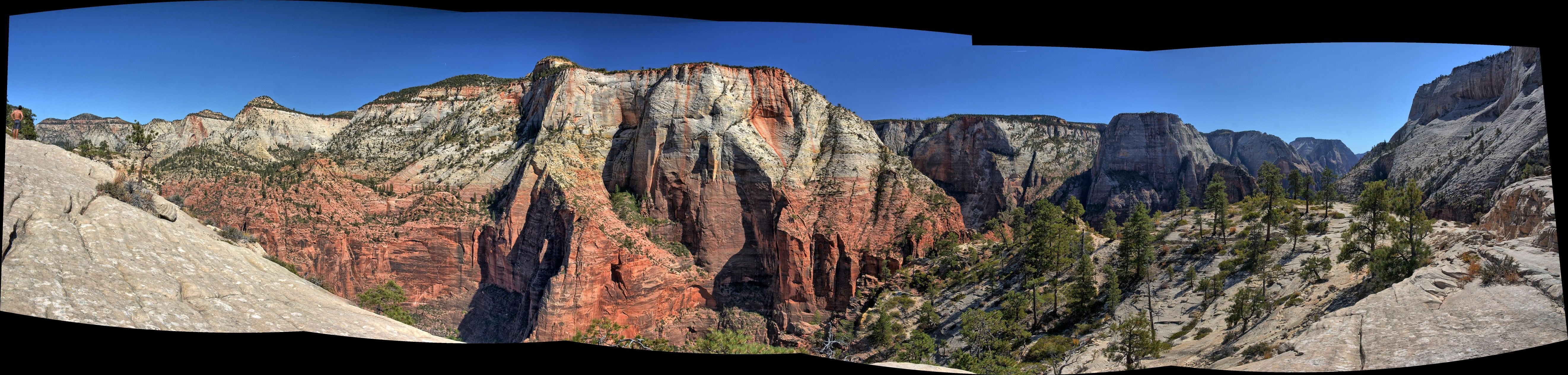
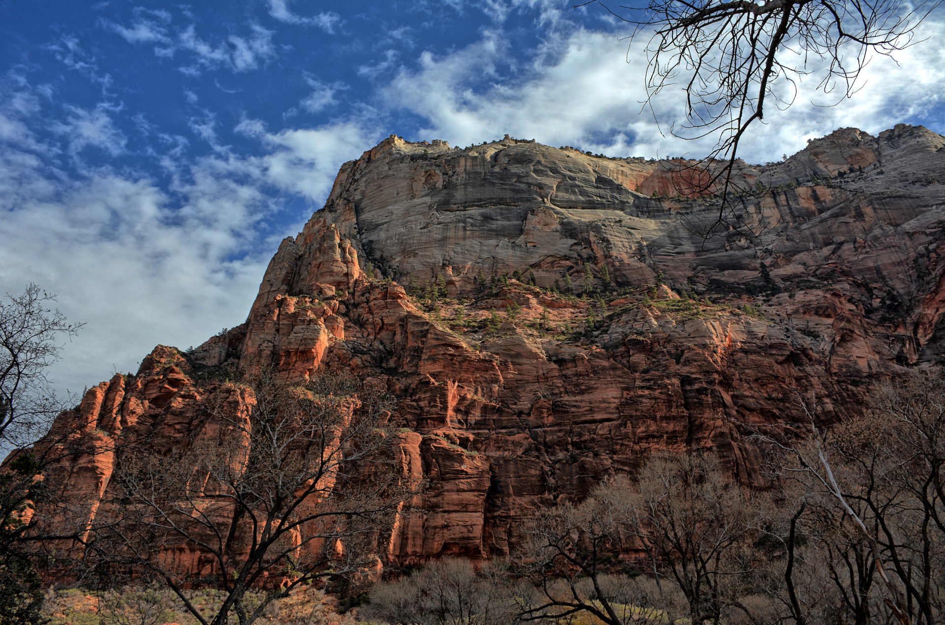
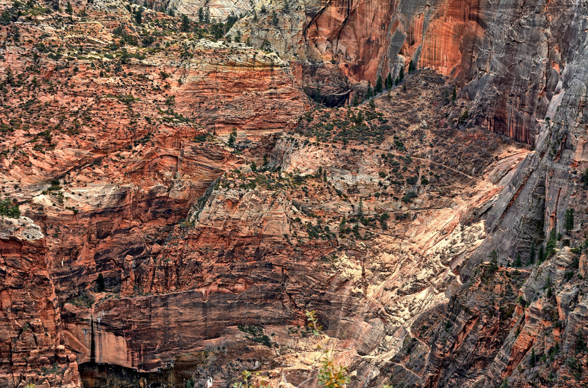
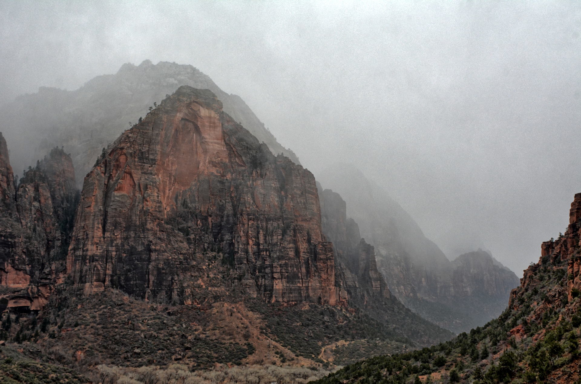
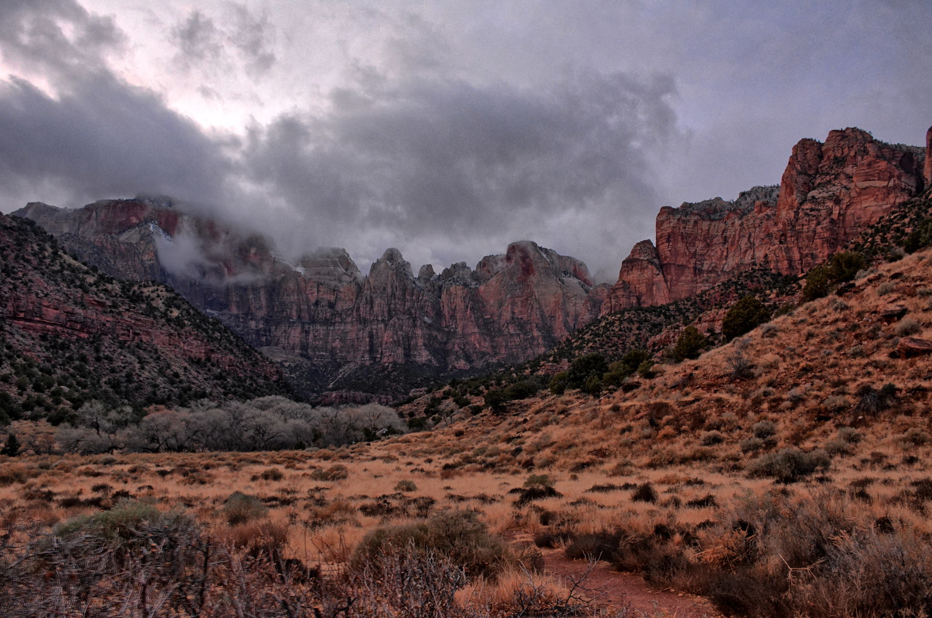
Zion National Park, Zion Canyon, 5 October 2019
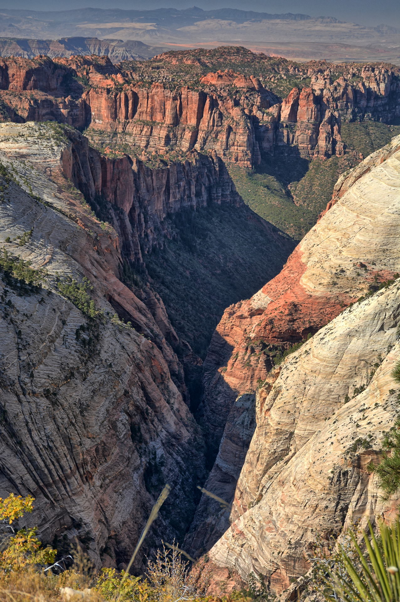
Zion National Park, West Rim Trail, Lava Point to the Grotto, 6 October 2019
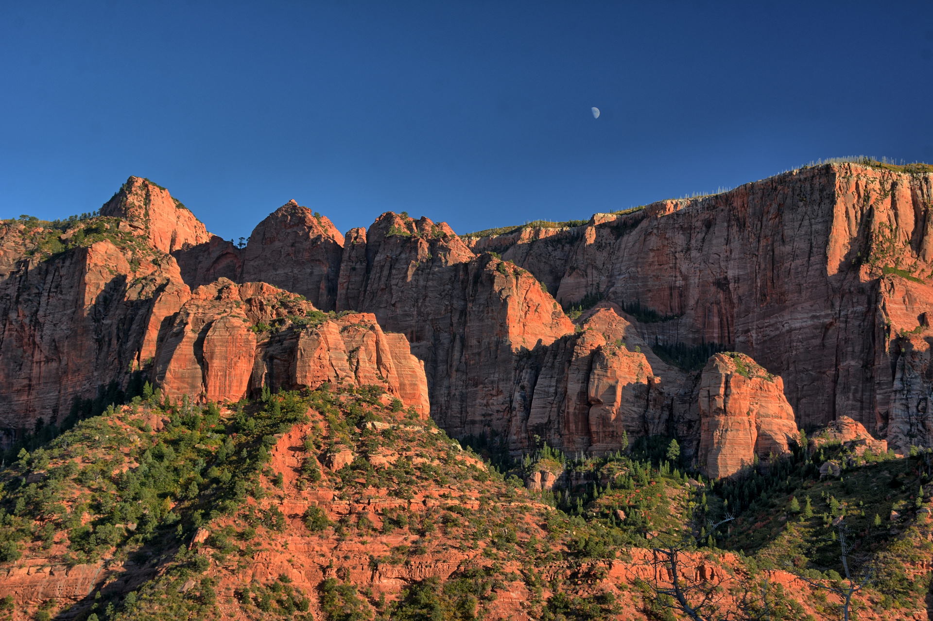
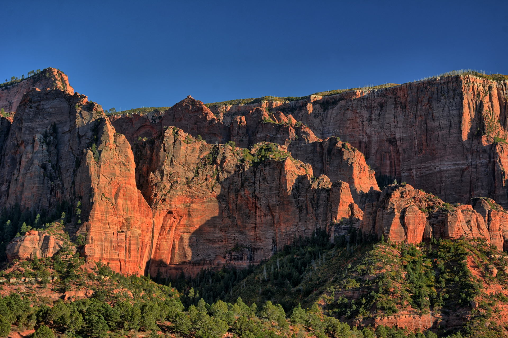
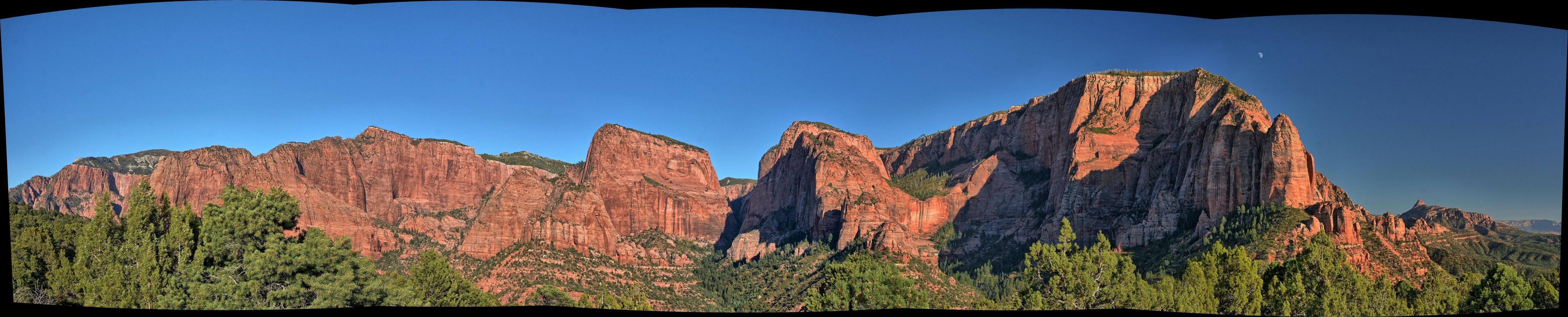
Zion National Park, Kolob Canyons, 6 October 2019
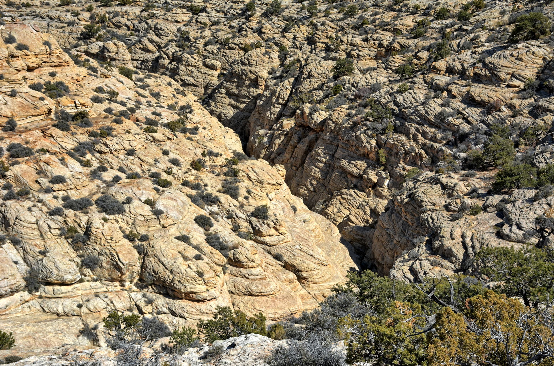
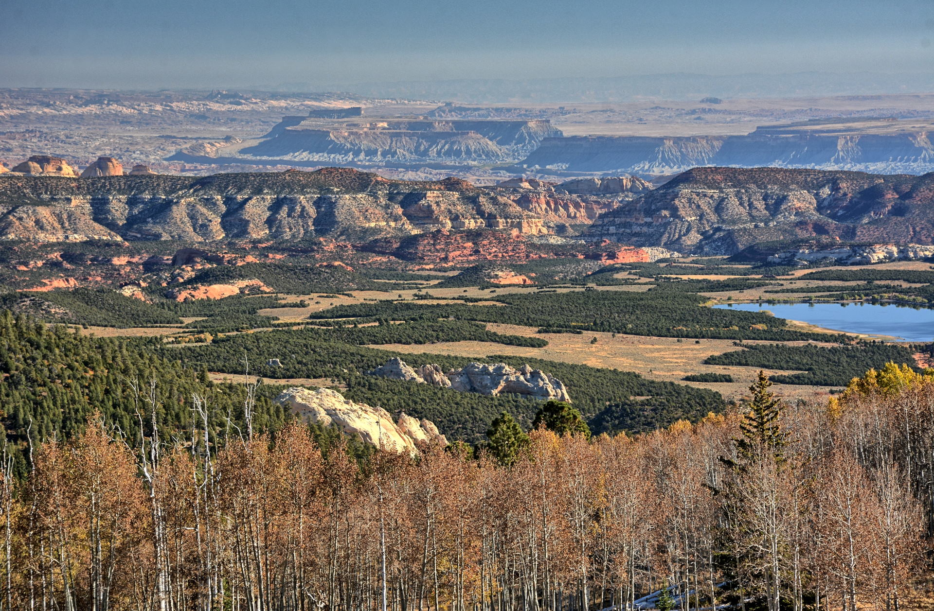
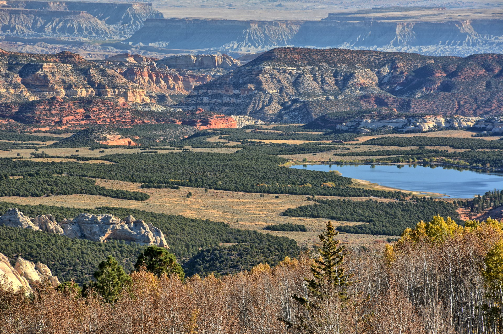
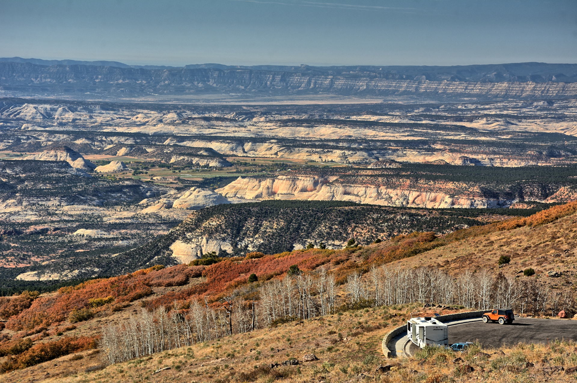
Weekend #3, Saturday,12 October
to Monday,14 October, was a
three-day weekend because Monday was Columbus
Day.
On Friday evening after work, I drove east to
Spanish Fork, and then southeast to Price for a
late dinner. I continued on in the dark to
the Wedge Overlook, on the north end of the San
Rafael Swell. I had camped here in 2018,
and camped again at the exact same campsite on this
evening. I took a few night-time long
exposure photos of the canyon that night.
On Saturday, I took morning photos and then
drove south down Buckhorn Draw Road. I stopped
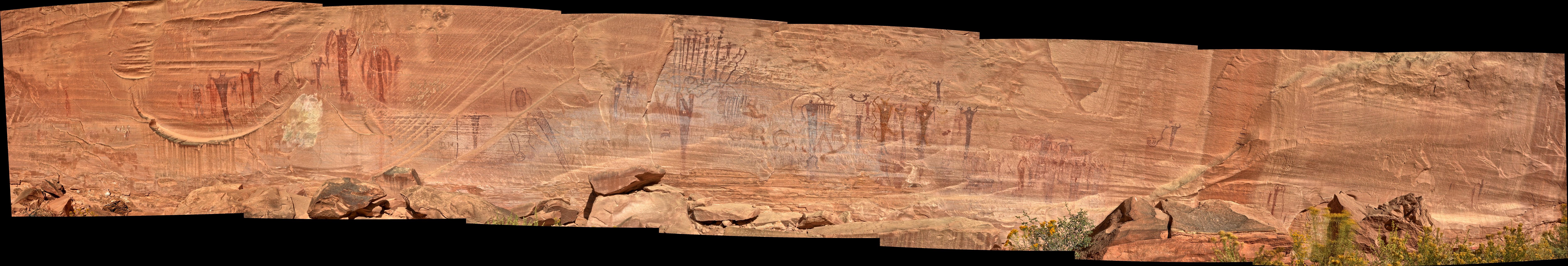
to fly RC a few times, and also at the Buckhorn
Draw pictographs and at the San Rafael River
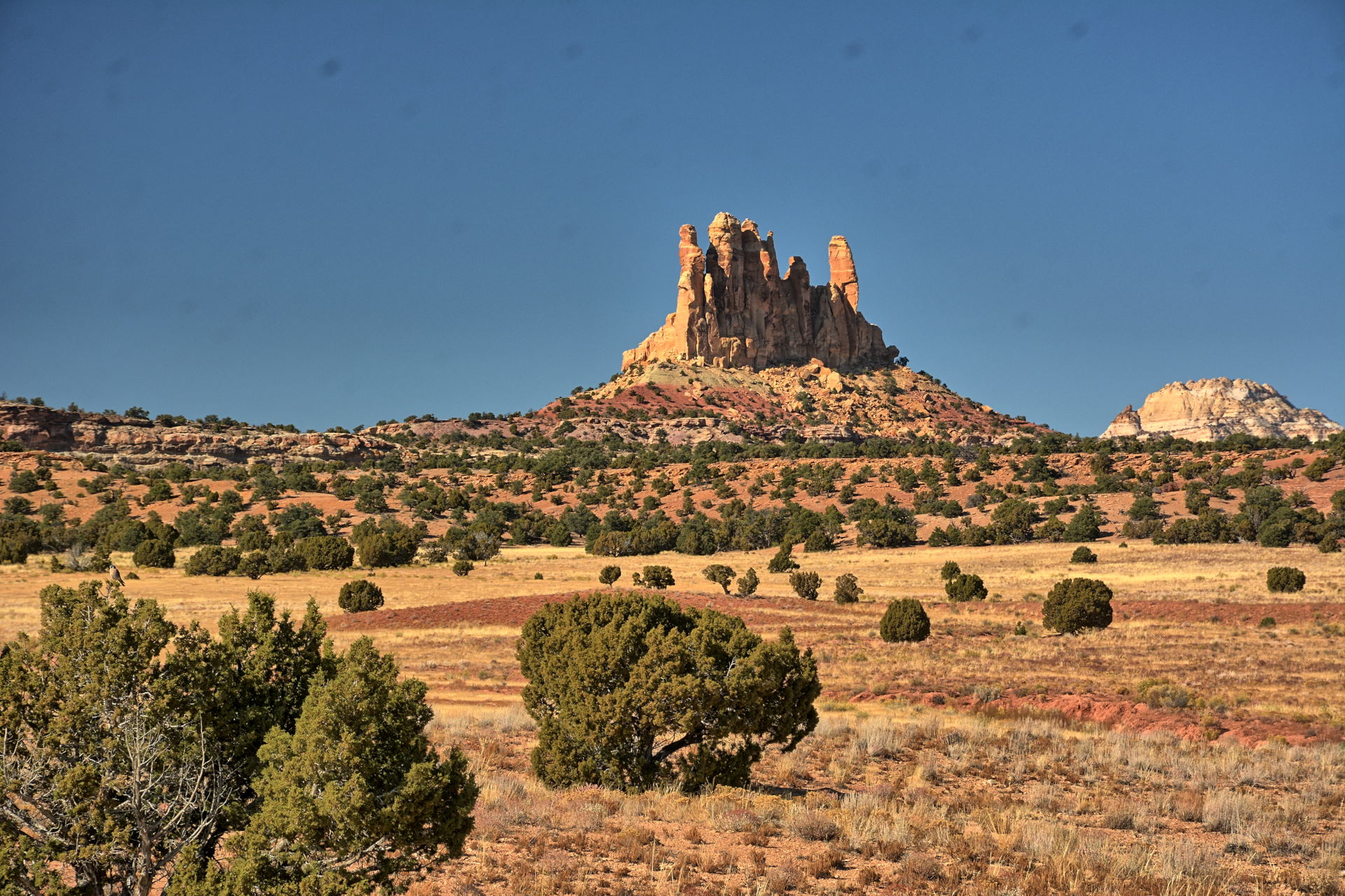
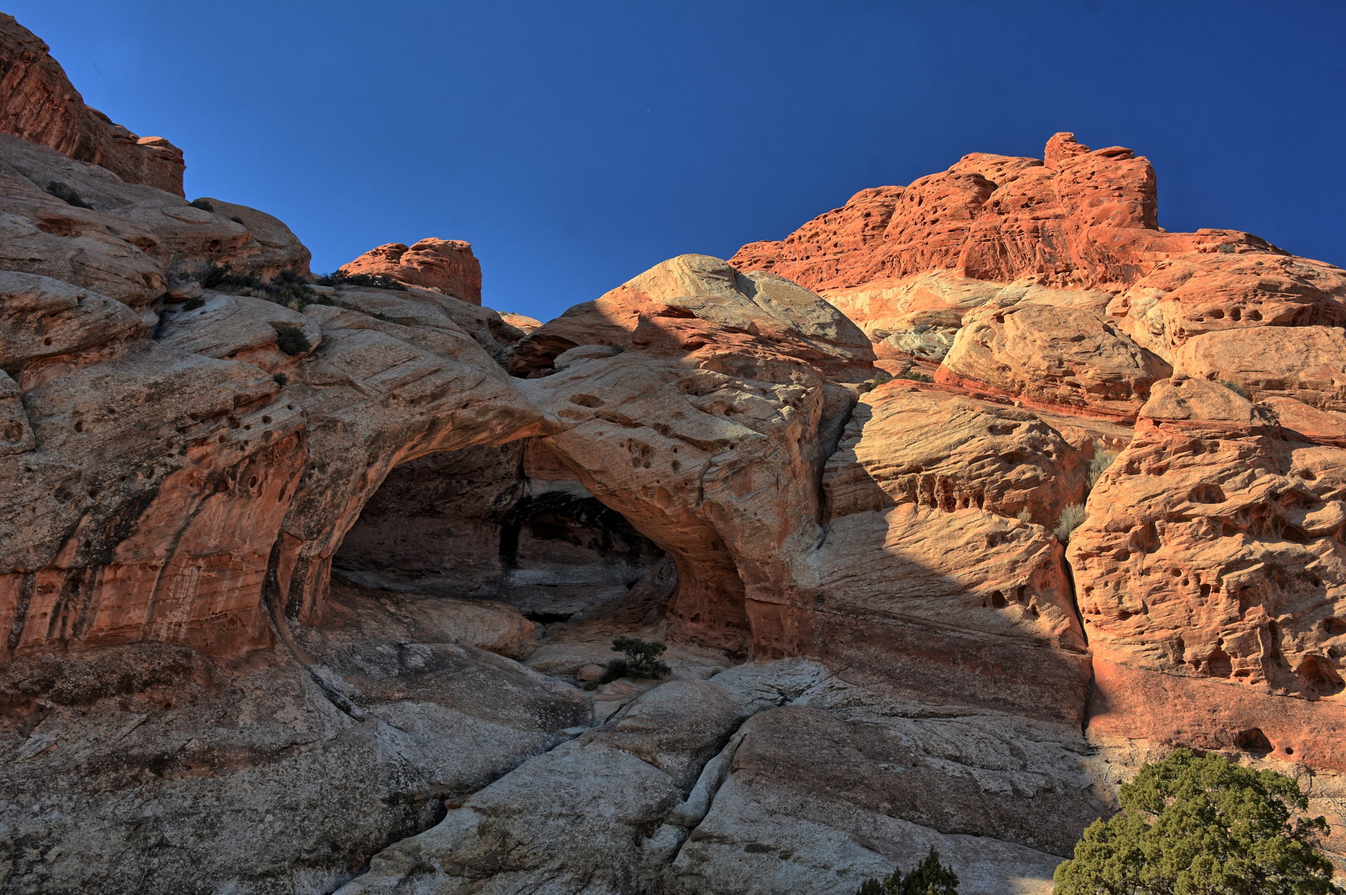
crossing. I continued south, crossing
under I-70, and found my way on and off Temple
Mount Road to the trailhead
for the
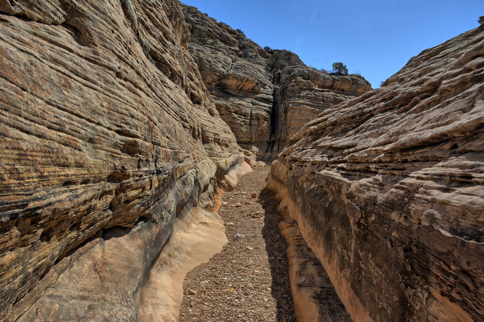
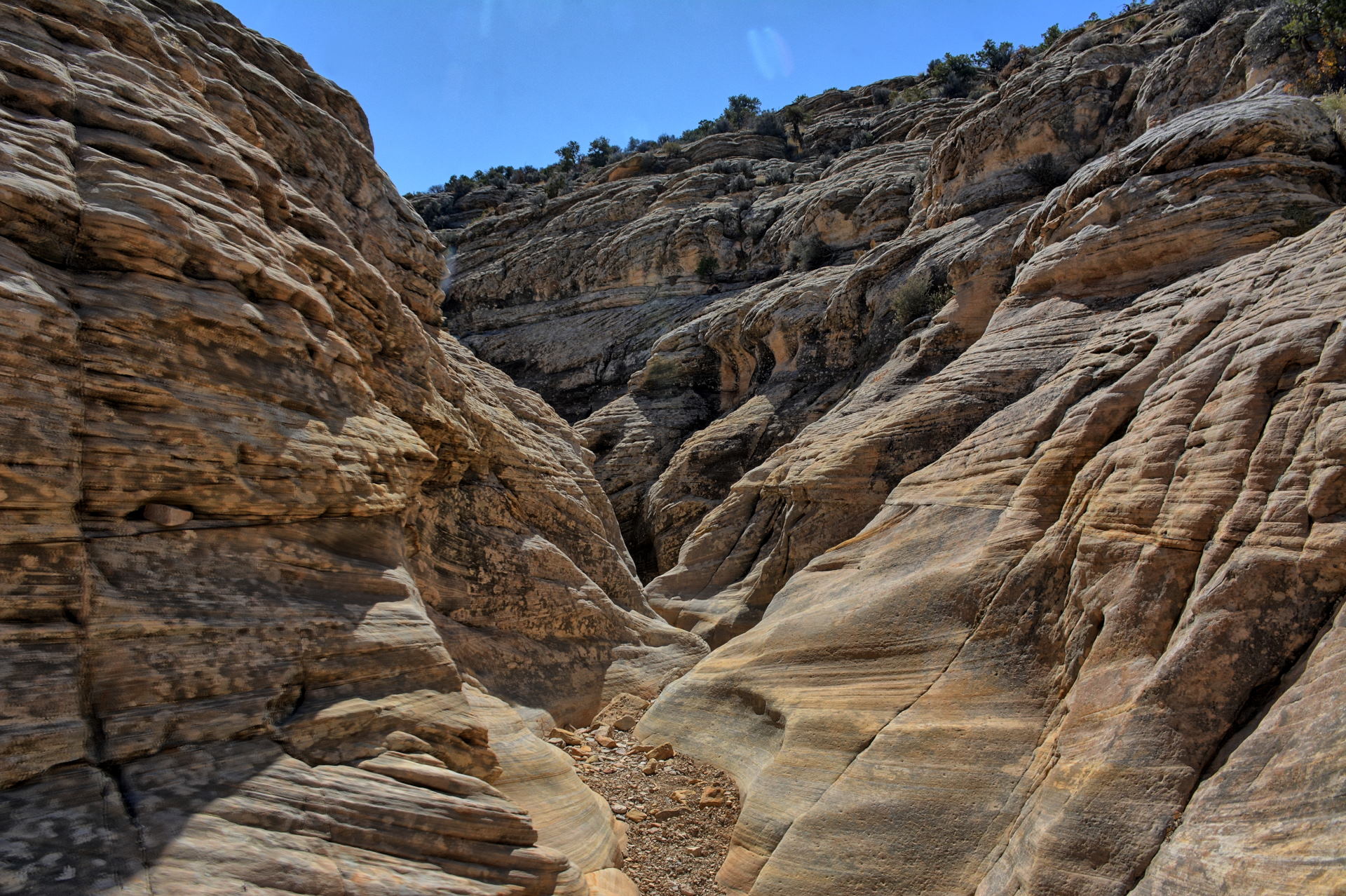
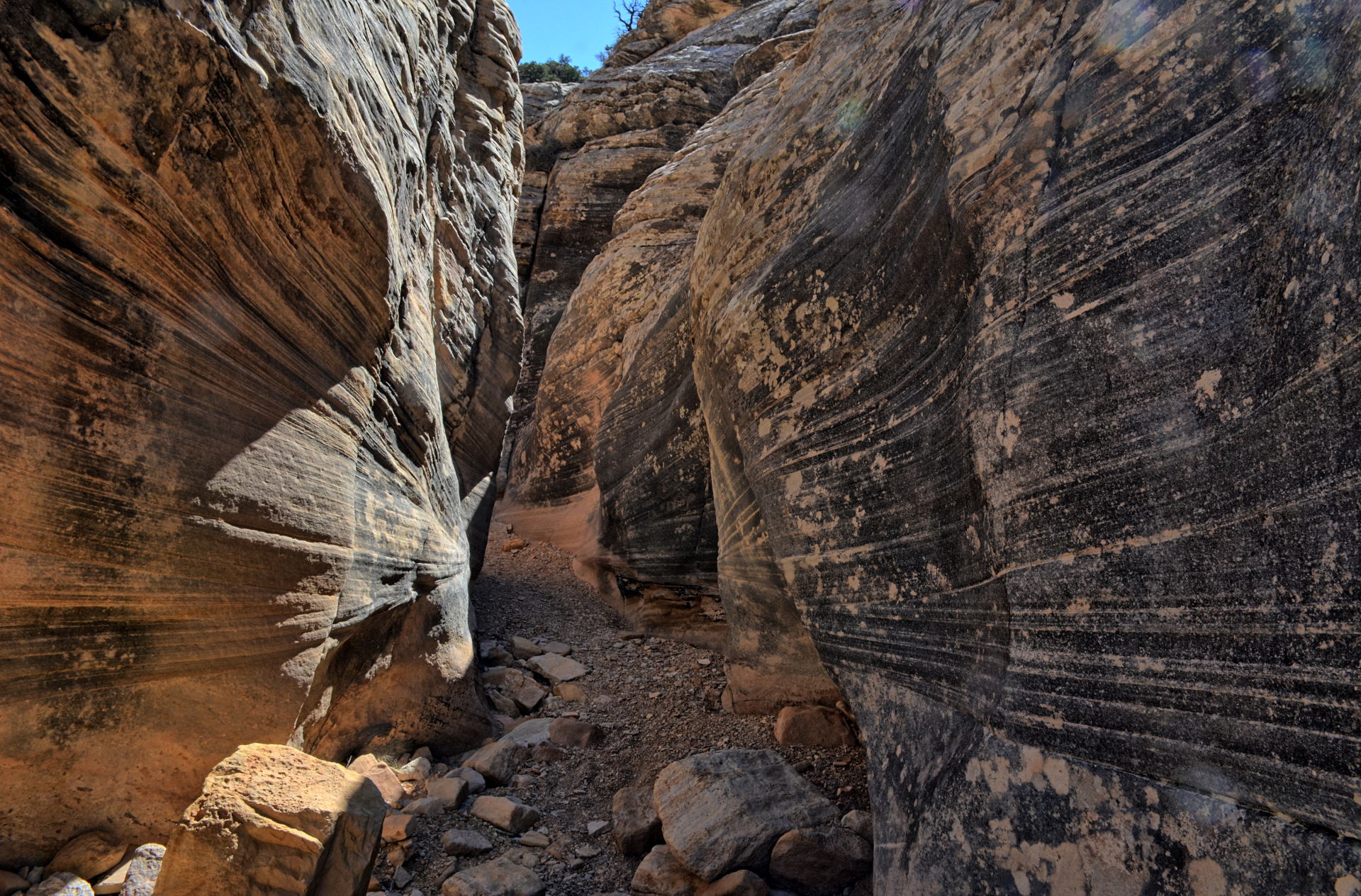
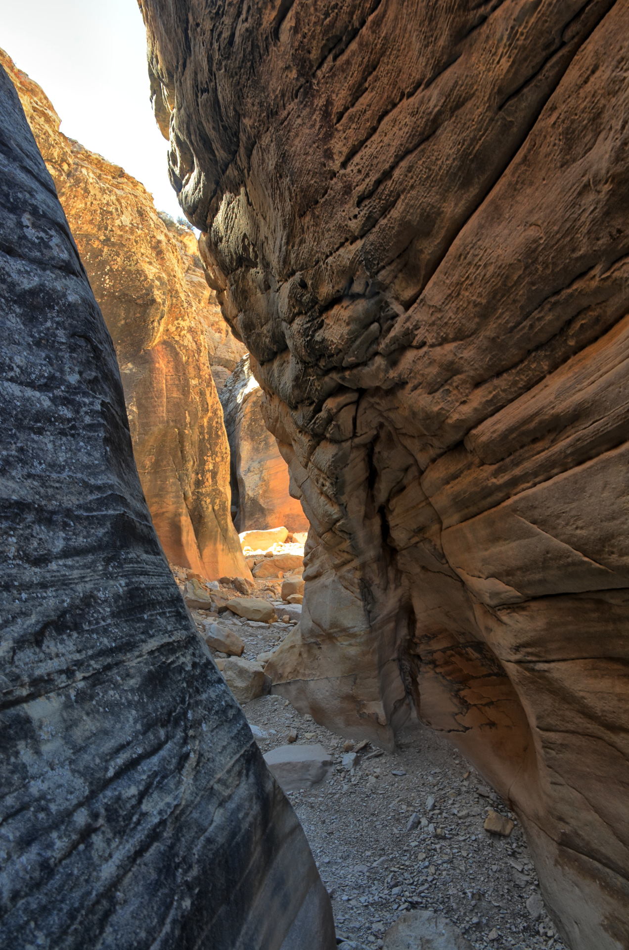
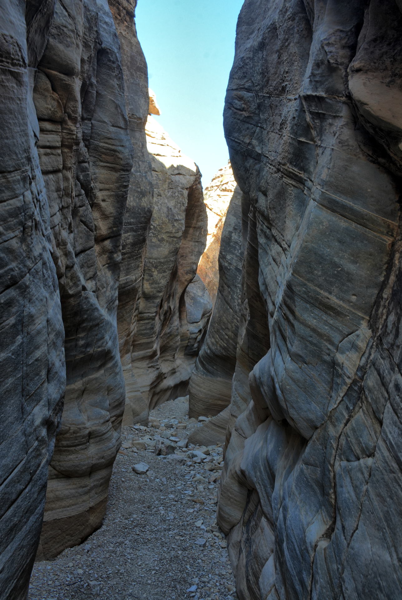
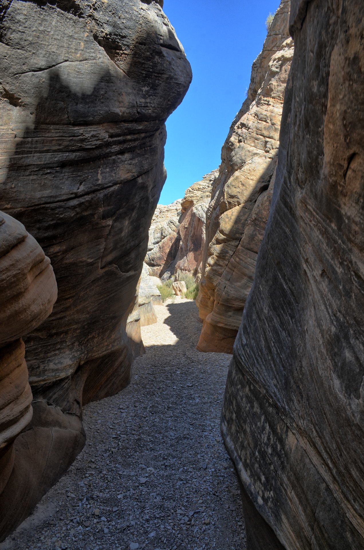
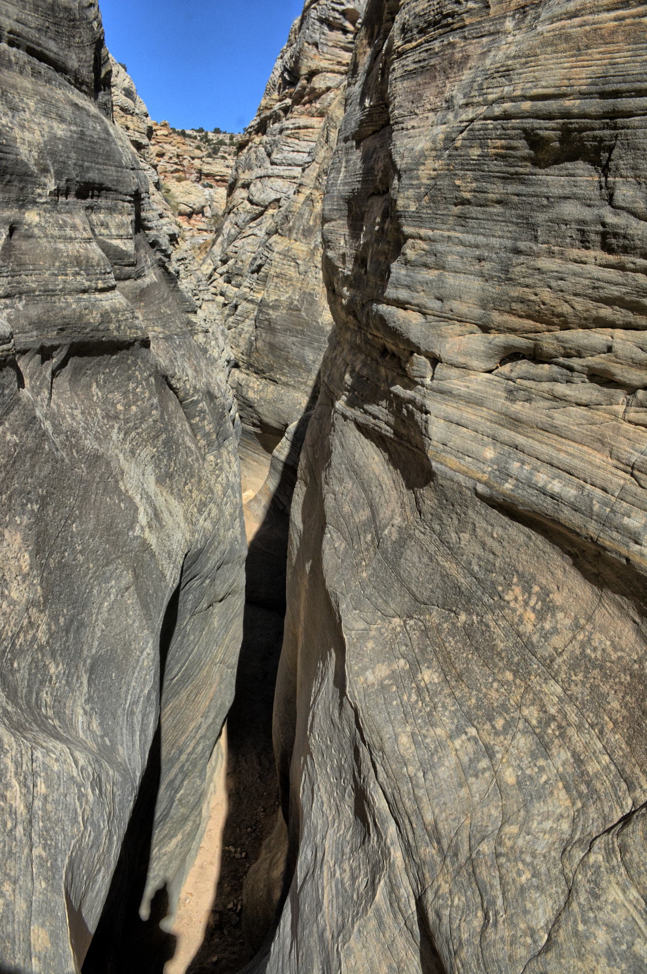
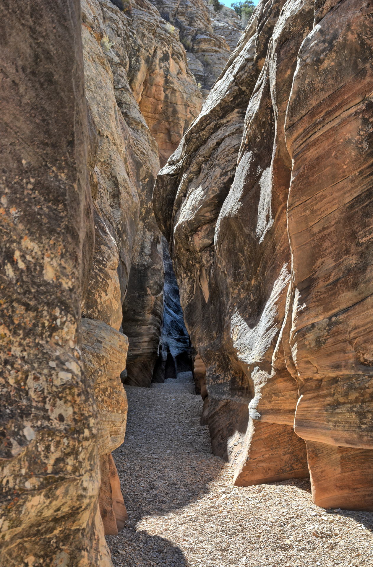
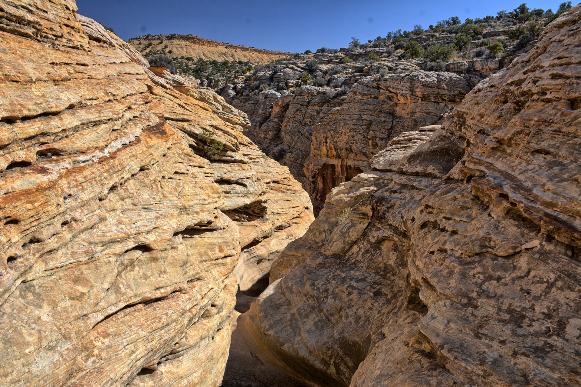
Baptist Draw slot canyon,
which is in the middle
of the San Rafael Swell. I hiked this over
a few hours, and then drove east and south off
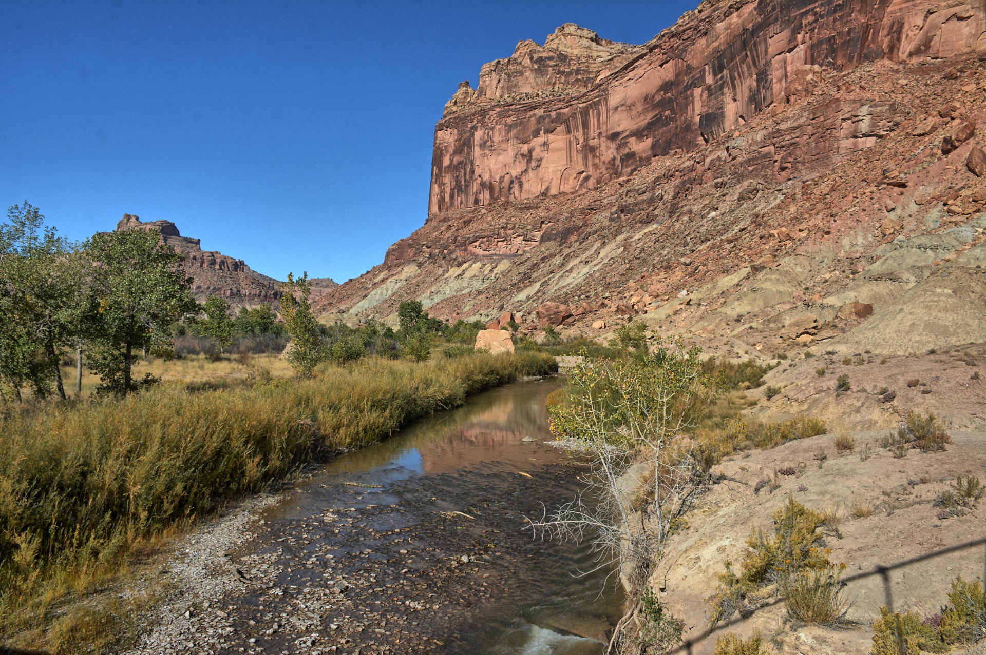
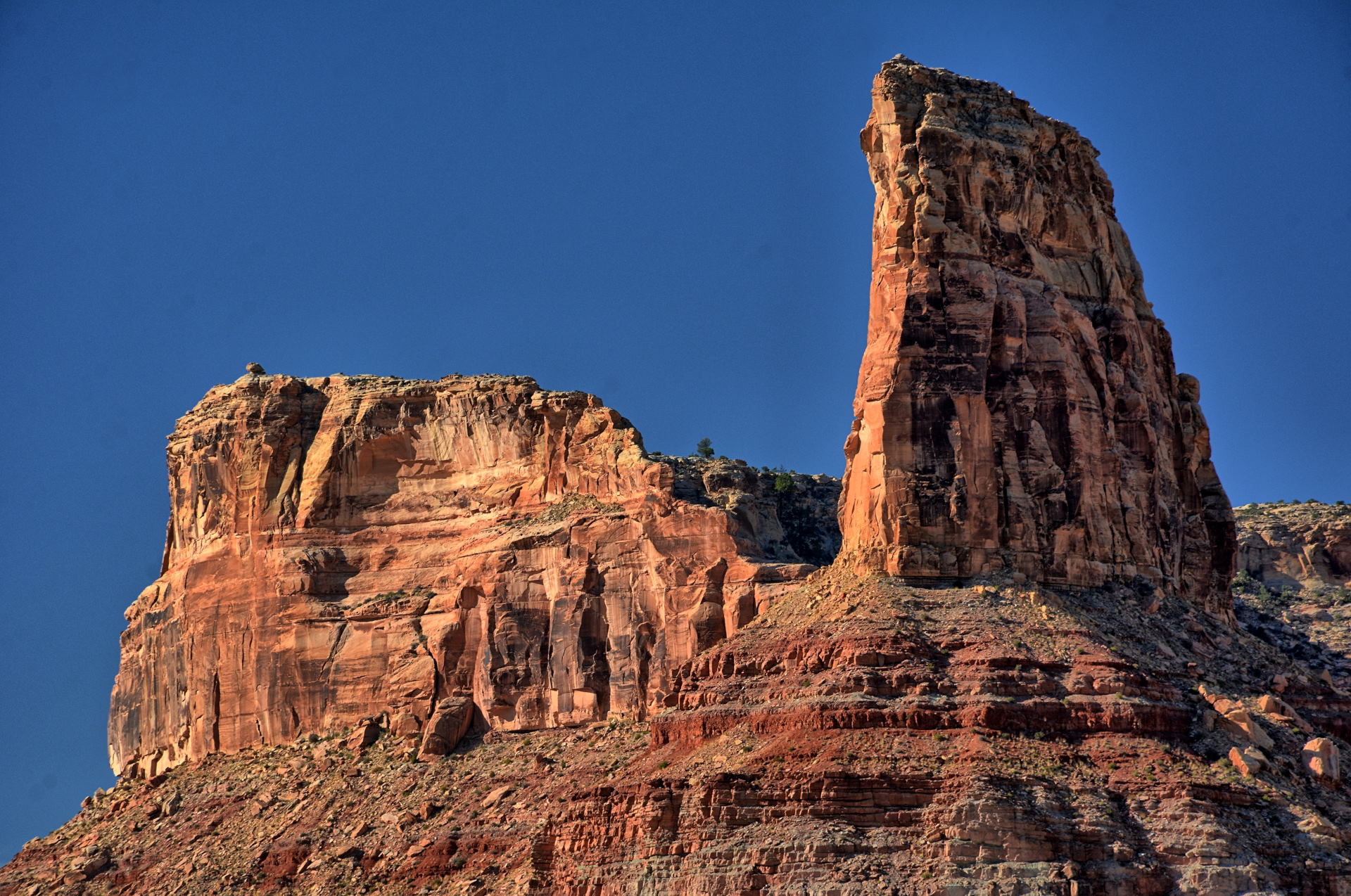
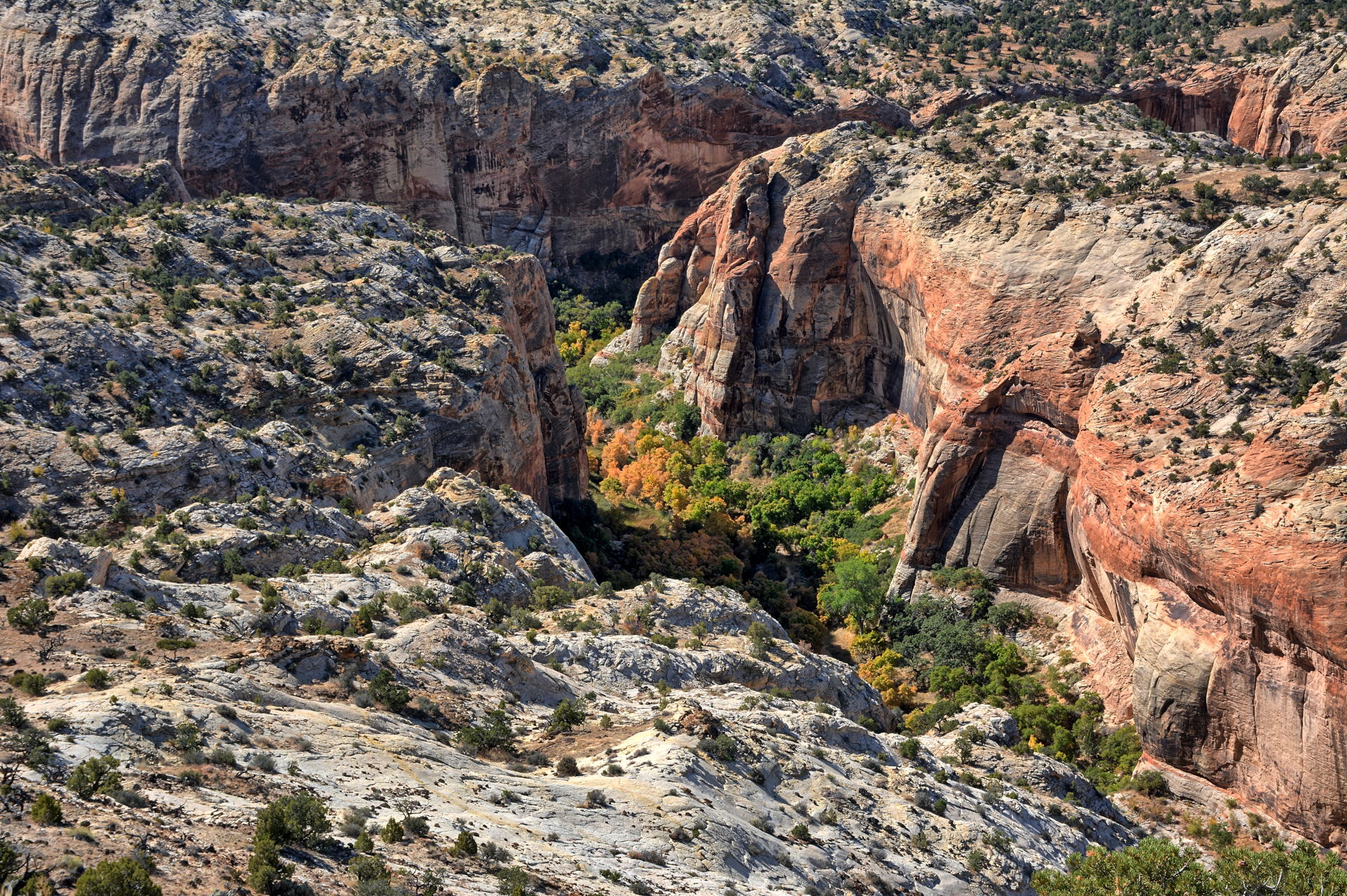
the swell, turning west at Hanksville, and
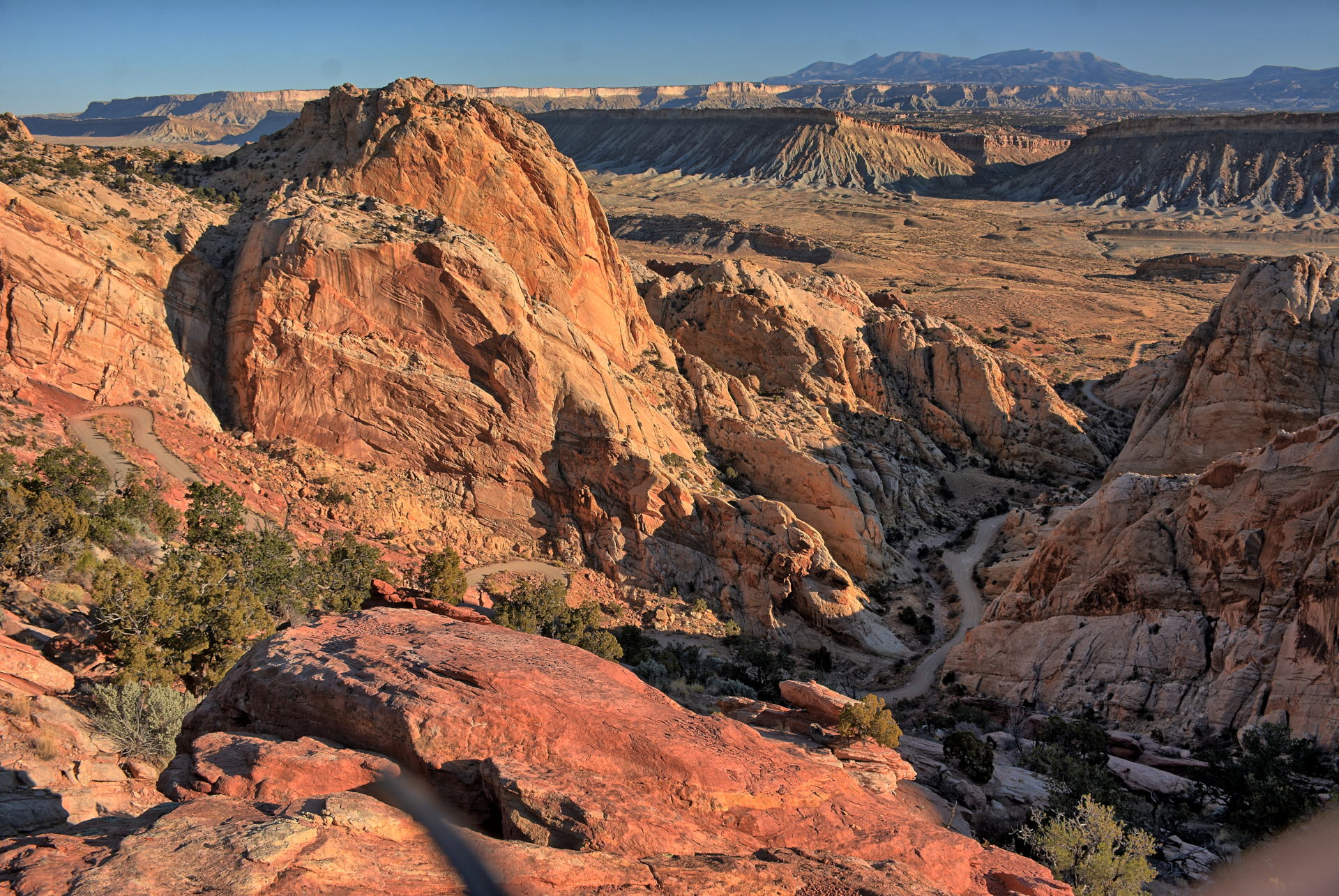
headed for Torrey, passing through Capitol Reef
National Park. I flew my RC aircraft and took many photos
as I headed west, and then had dinner in
Torrey. I camped on Boulder Mountain on Saturday night,
about half-way between Torrey and Boulder.
On Sunday, I drove south through Boulder and
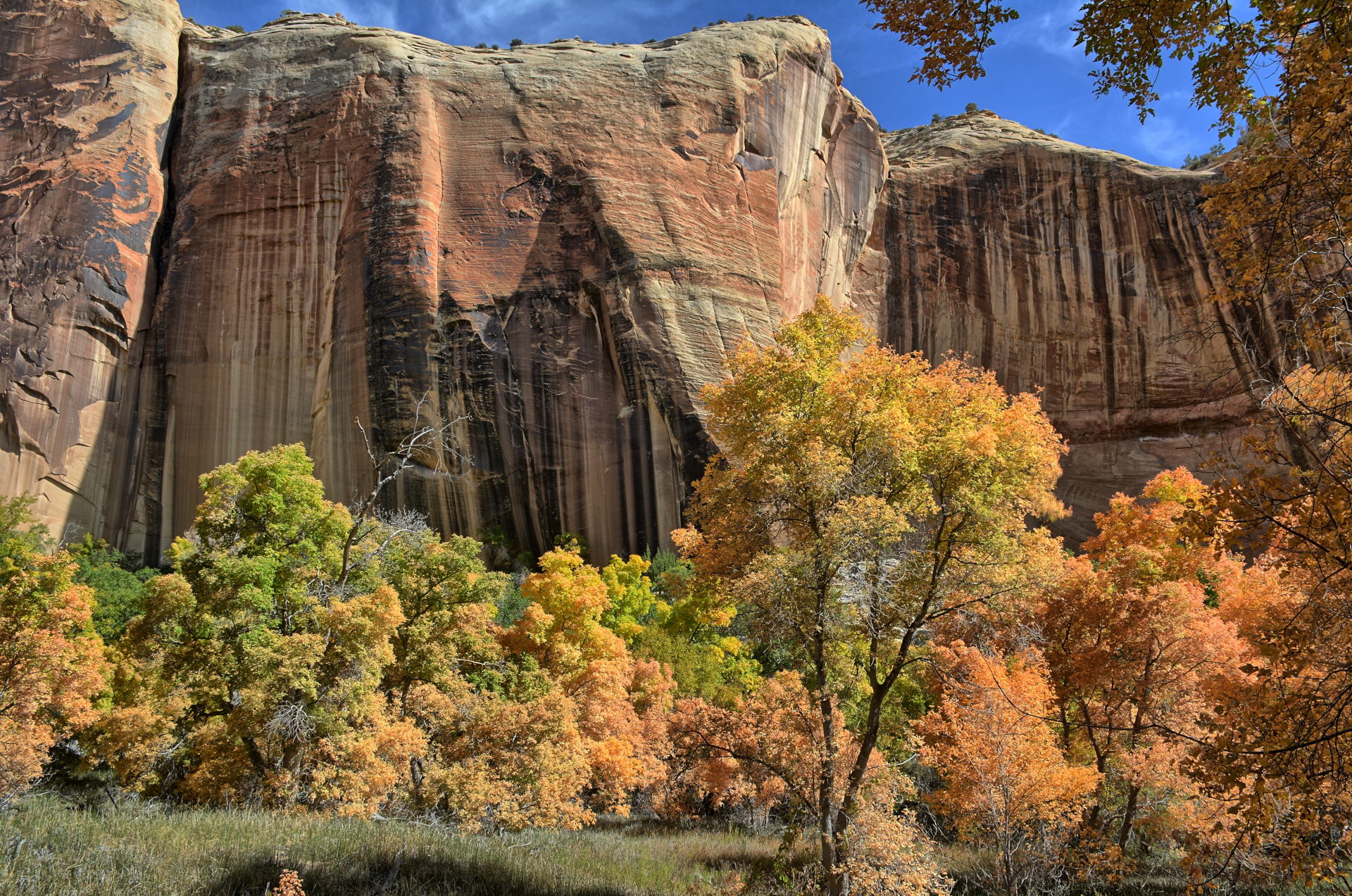
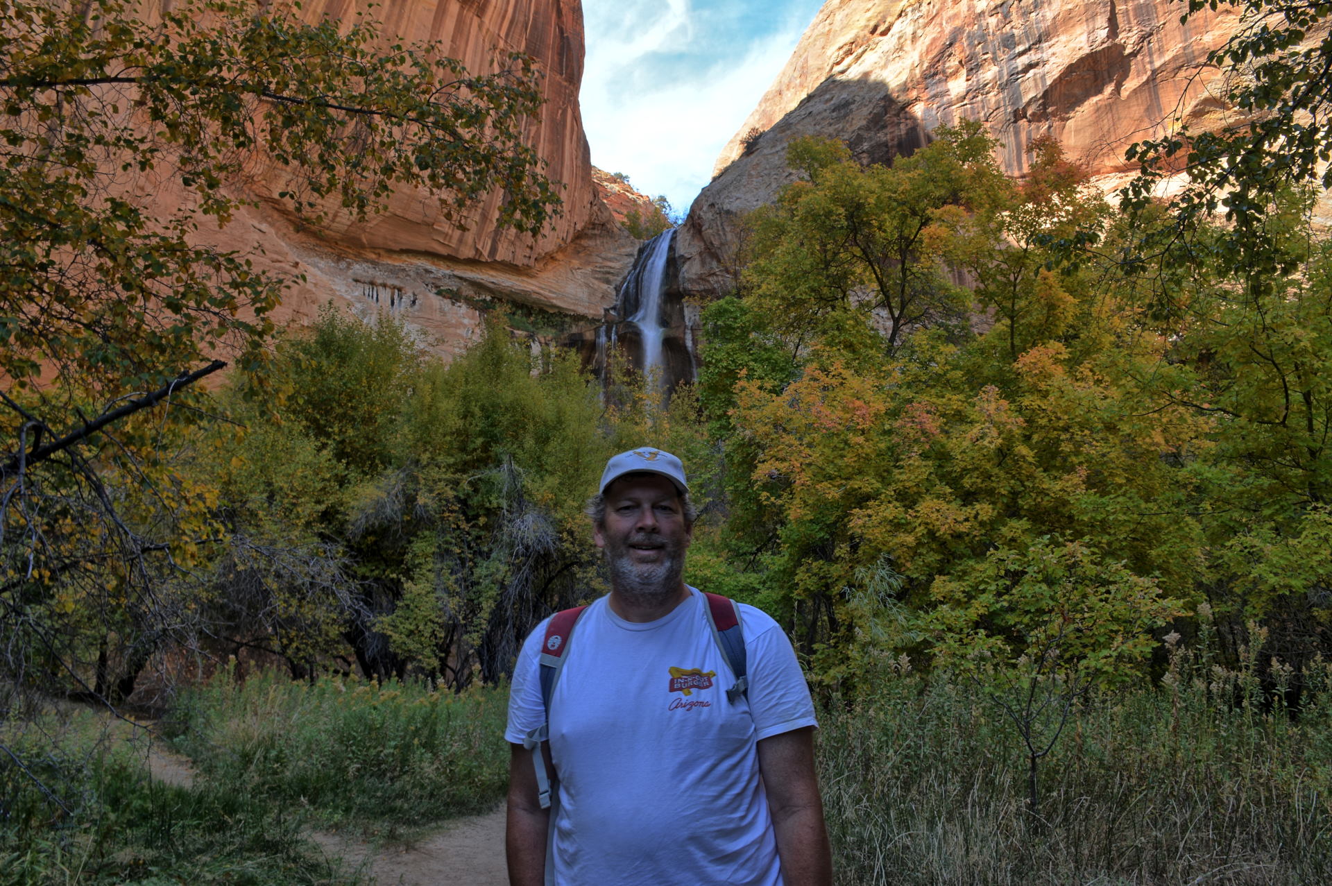
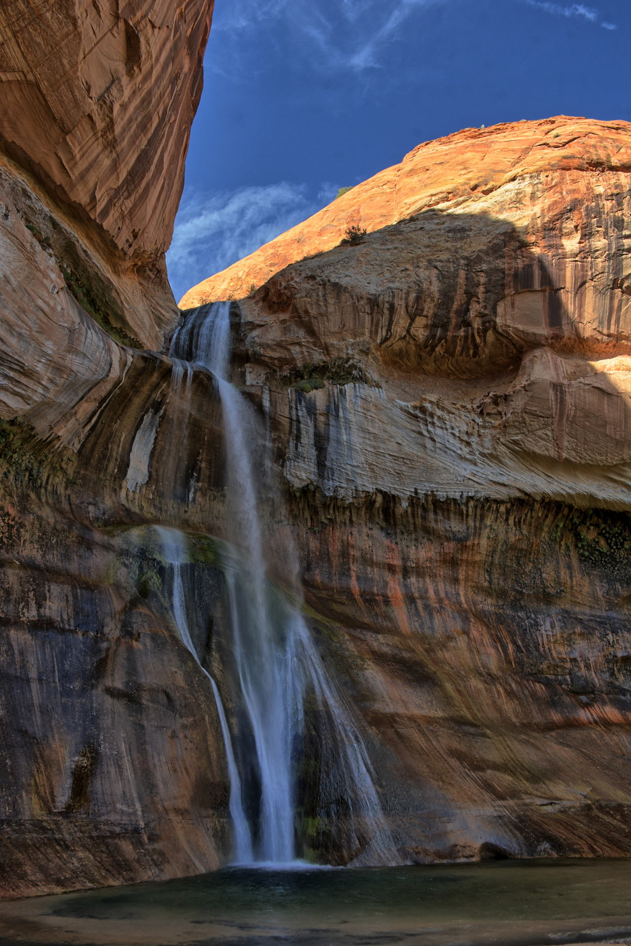
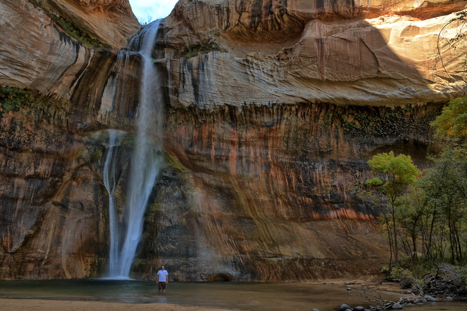
stopped at the Calf Creek camping area, which is
also the
Lower Calf Creek Falls trailhead. This is
about a 6 mile roundtrip hike to the falls, along the very
nice Calf Creek Canyon within Grand Staircase -
Escalante National Monument. I drove on
west after the hike, passing through Escalante
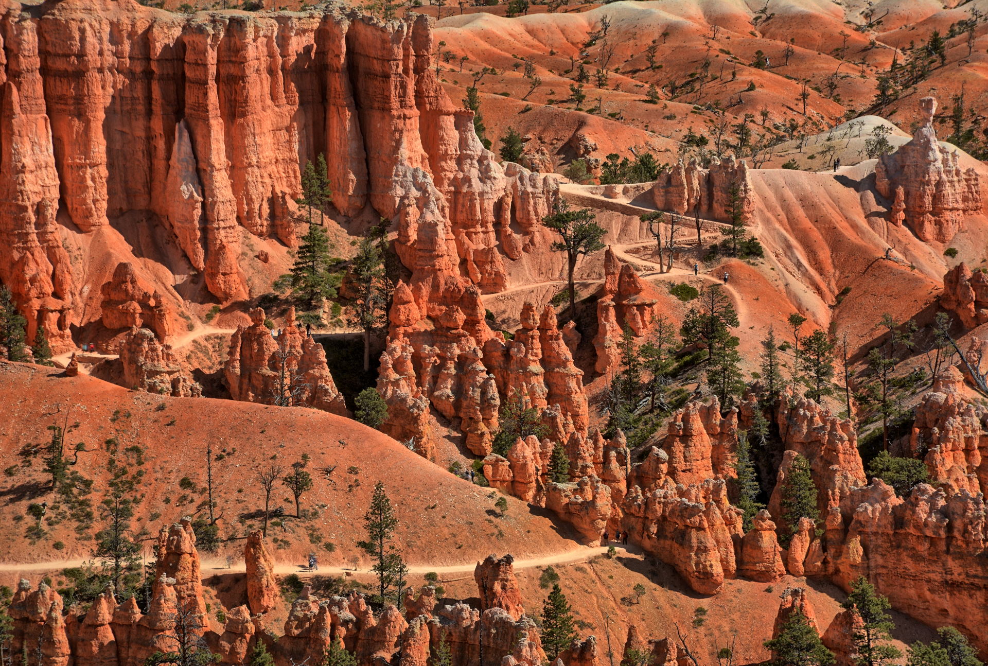
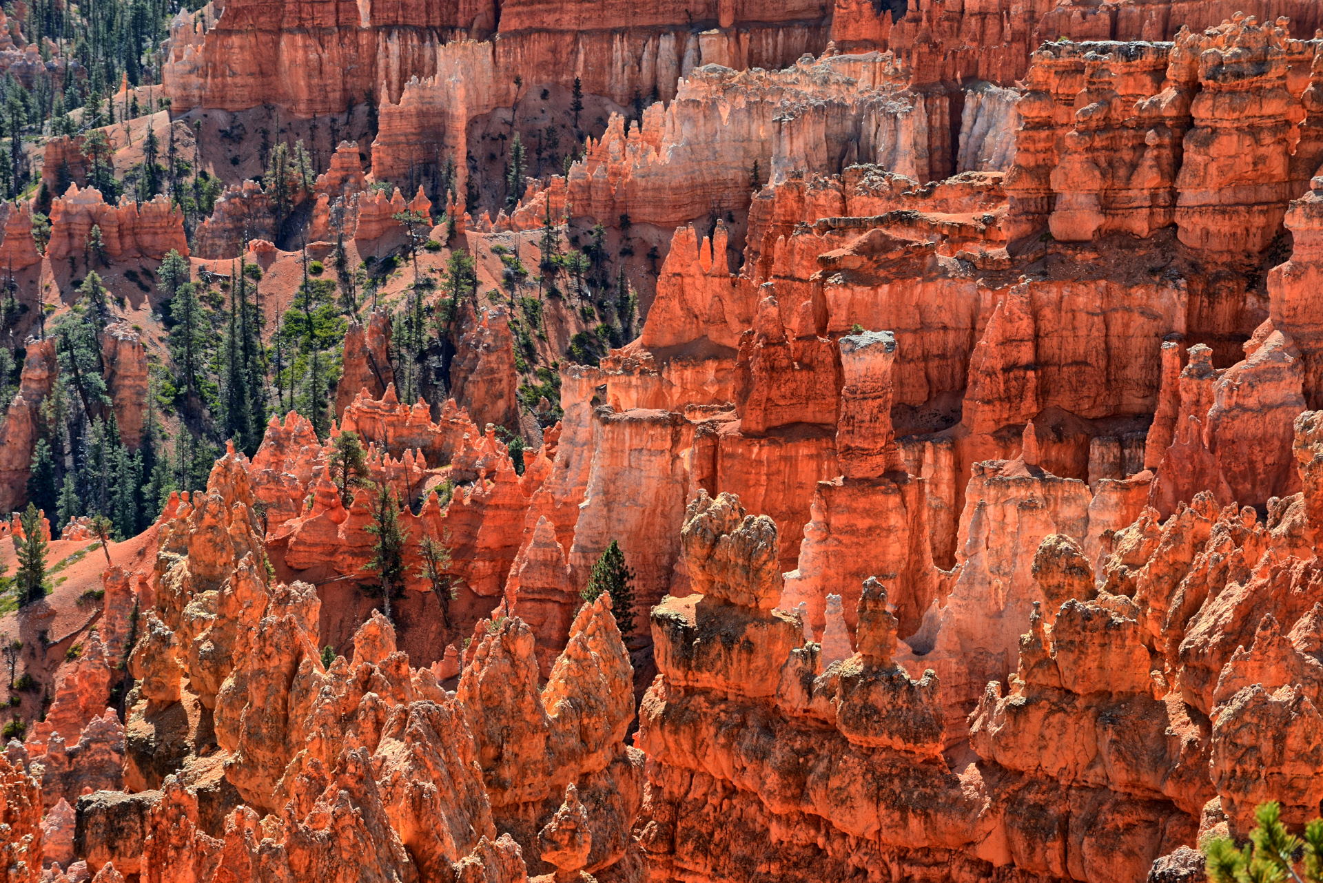
and making it to Bryce Canyon National Park for
sunset, and then dinner at Ruby's in Bryce City.
I spent the night at Ruby's Hotel.
This is the route for the
drive from Boulder to Escalante.
Video of this drive and a short section of video
from Lower Calf Creek Falls is here.
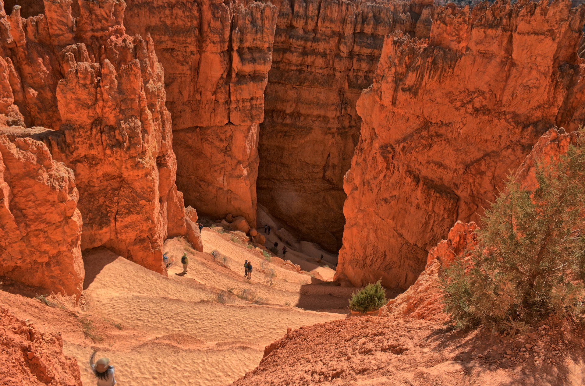
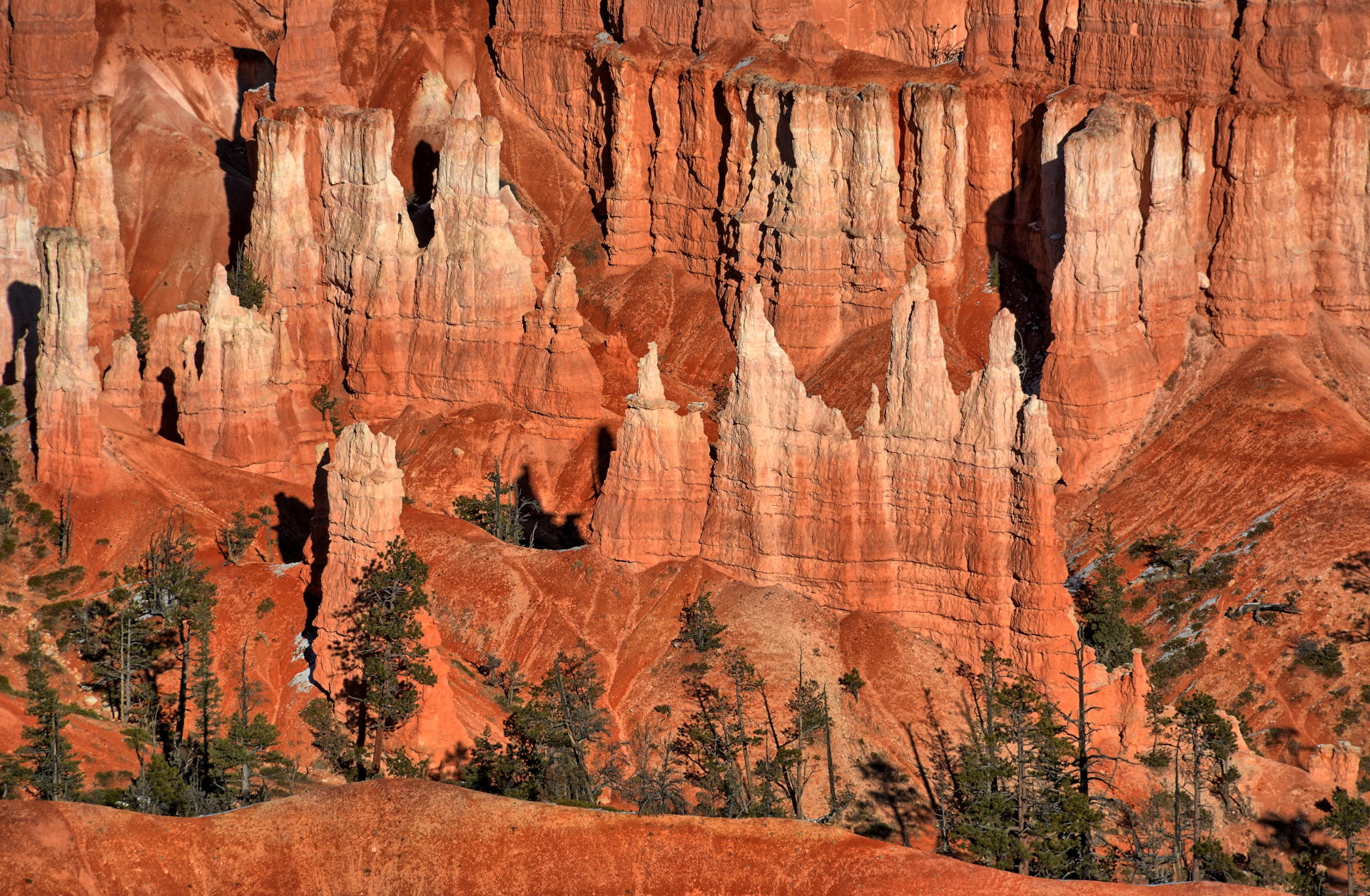
On Monday, I hiked the Queens Garden and Navajo
Loop - Wall Street trail from Sunrise Point to
Sunset Point, within the Bryce Canyon
amphitheater. I drove back to Dugway that
afternoon, arriving in the early evening.
Wedge Overlook, night photos, 11 October 2019
Wedge Overlook, 12 October 2019
Buckhorn Draw Pictographs, San Rafael Swell, 12 October 2019
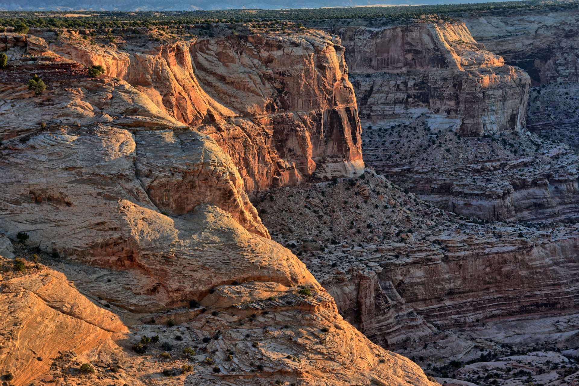
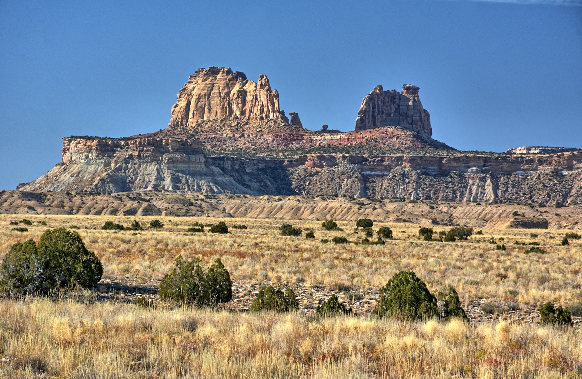
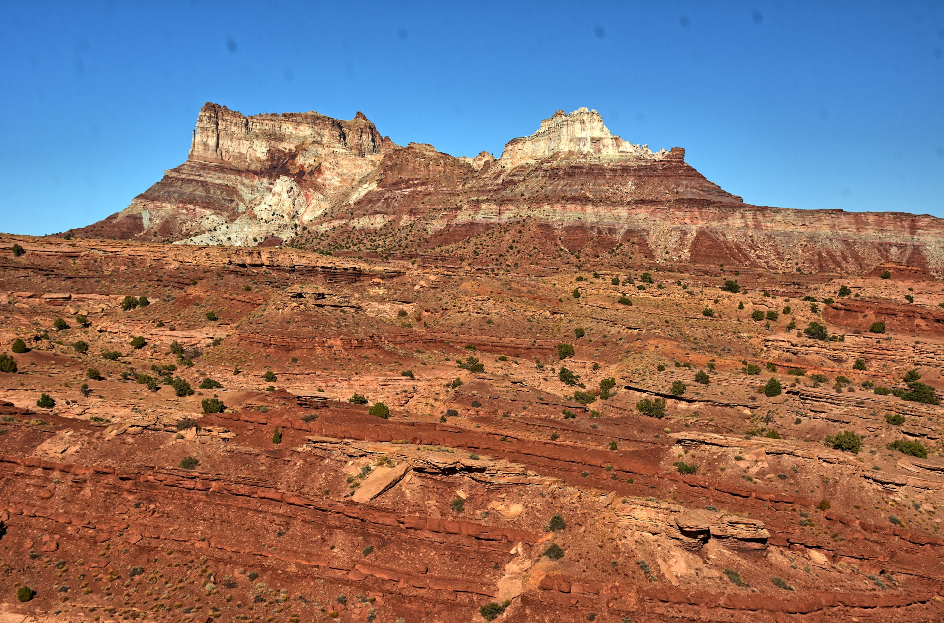
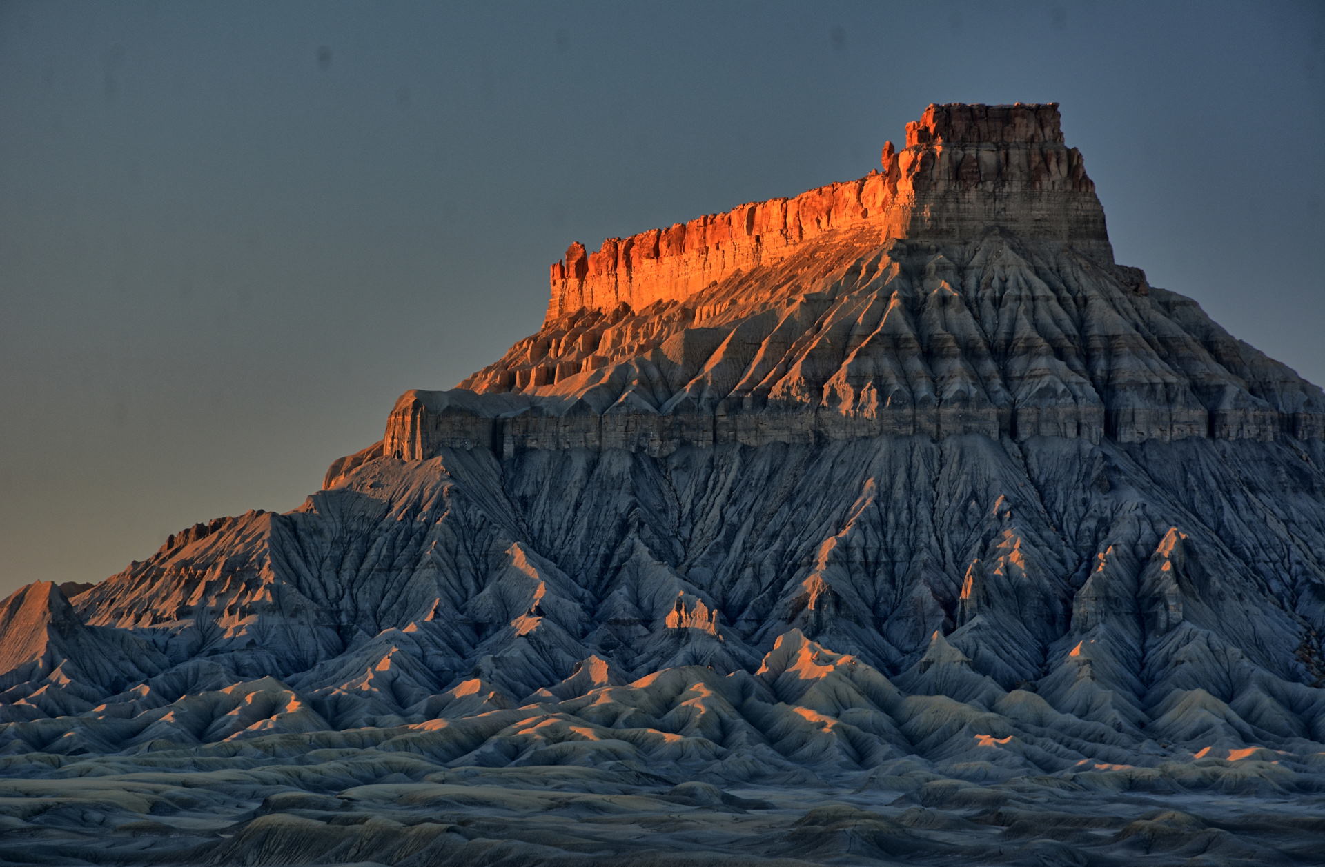
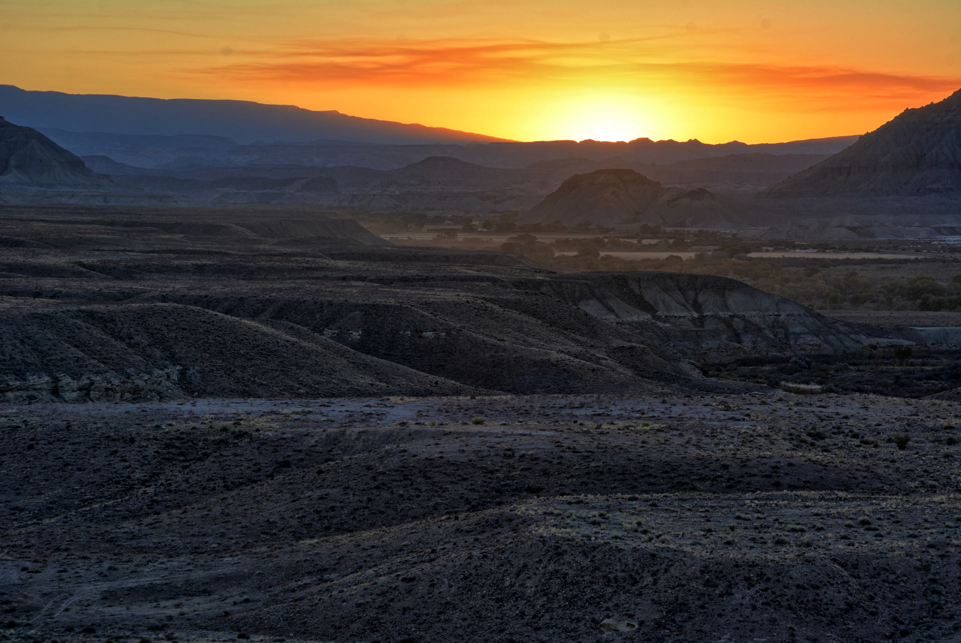
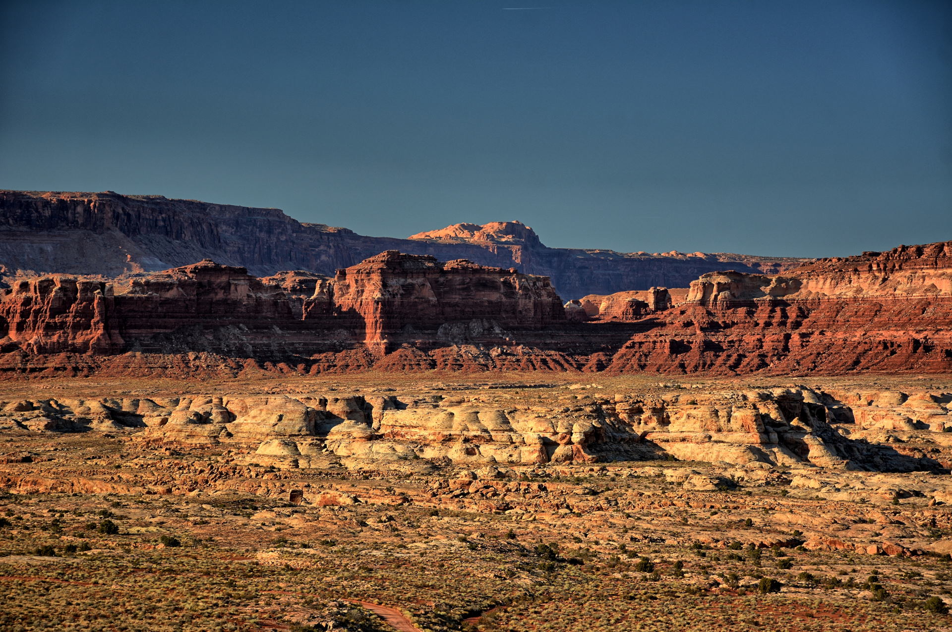
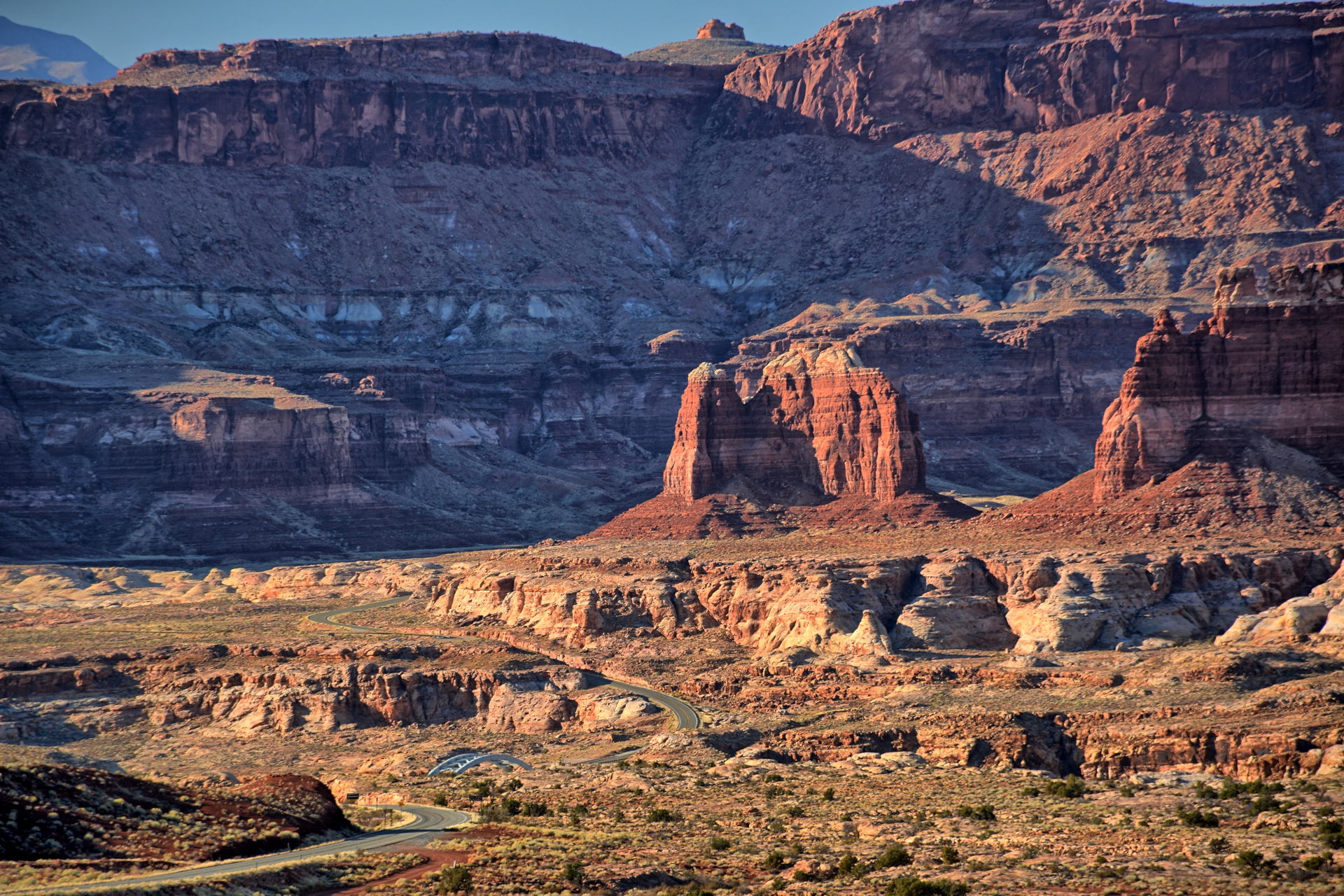
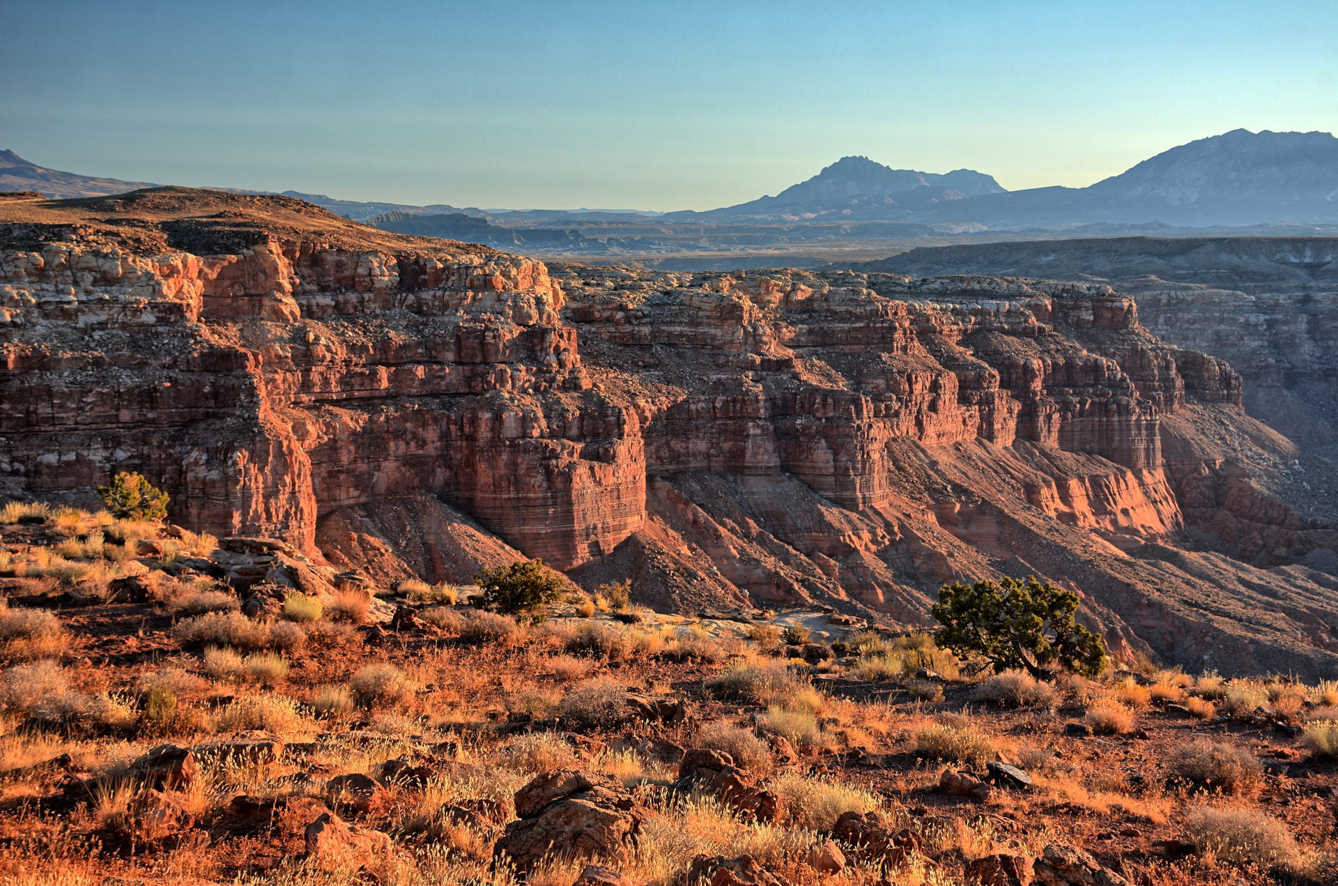
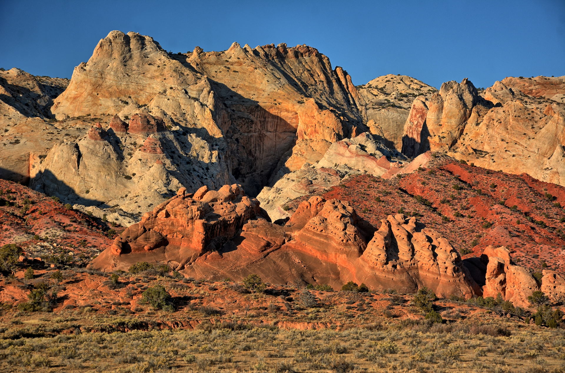
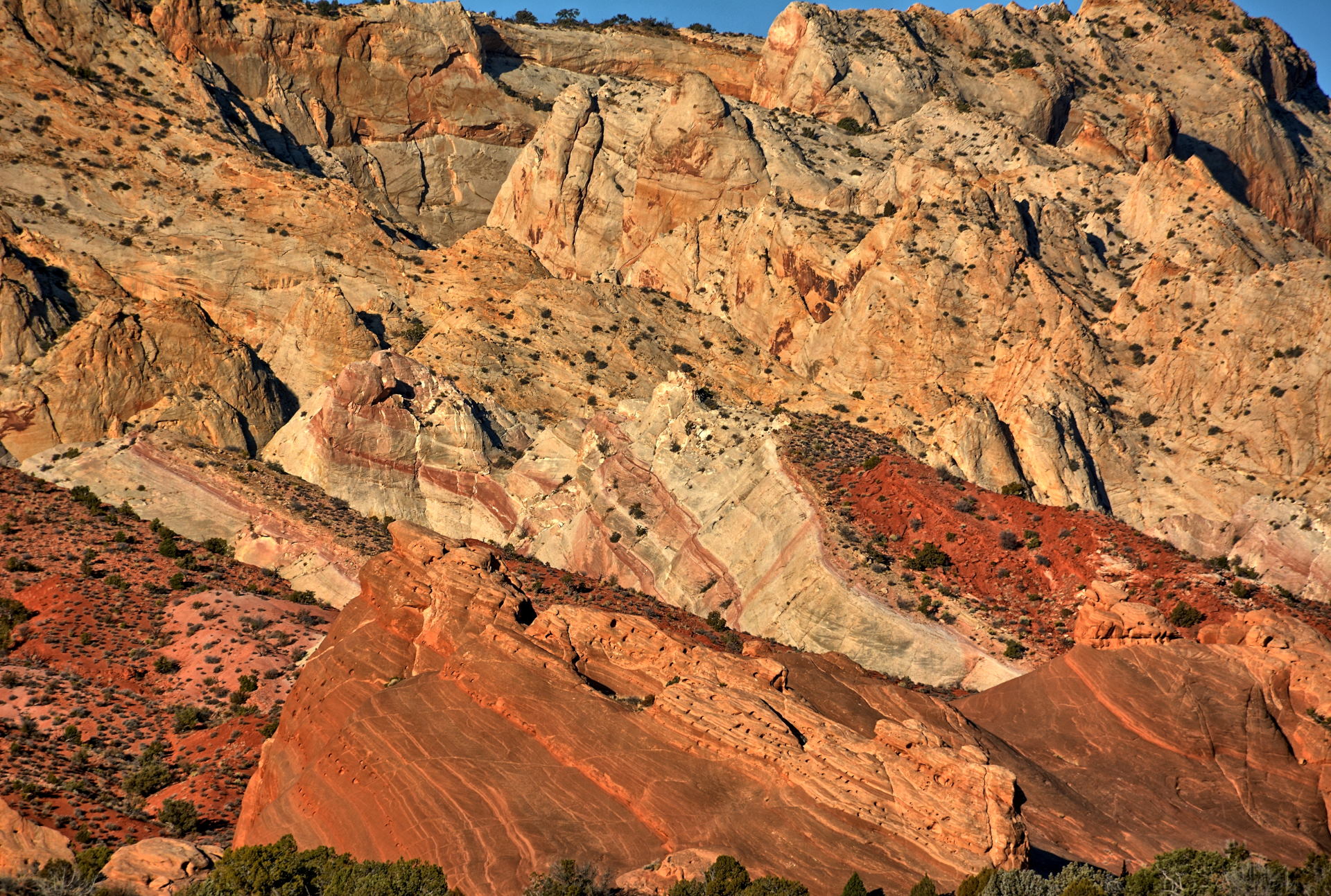
San Rafael Swell, San Rafael River, Baptist Draw, Factory Butte, 12 October 2019
Baptist Draw Slot Canyon hiking,
12 October 2019
Aerial Video, Wedge Overlook, San Rafael River, 12 October 2019
Aerial Video,
San Rafael Swell, 12 October 2019
Aerial Video,
Buckhorn Draw Road, 12 October 2019
Aerial Video, San Rafael Reef
@ Goblin Valley Rd
& near Hanksville, 12 October 2019
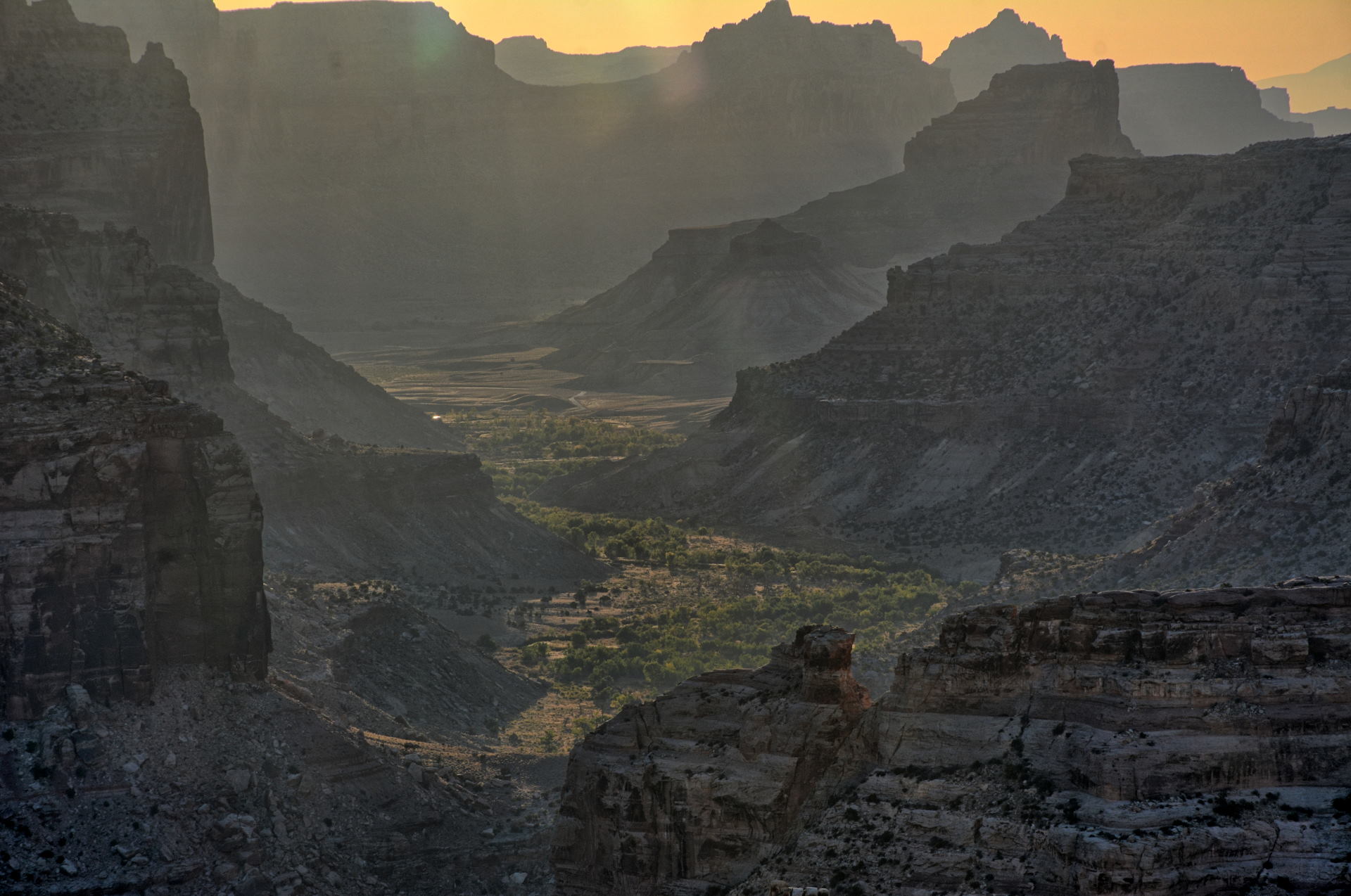
Boulder Mountain to Calf Creek, 13 October 2019
Calf Creek Canyon, Lower Calf Creek Falls, 13 October 2019
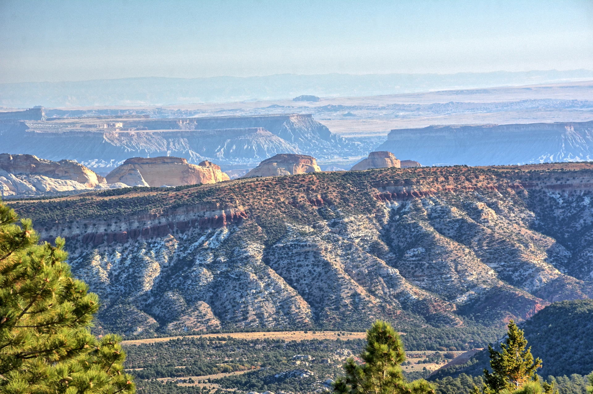
Head Of Rocks Overlook, Escalante River Gorge, 13 October 2019
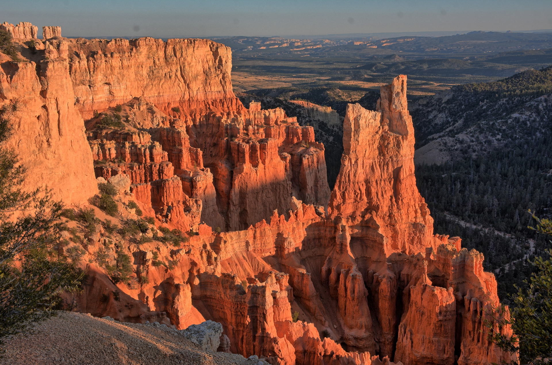
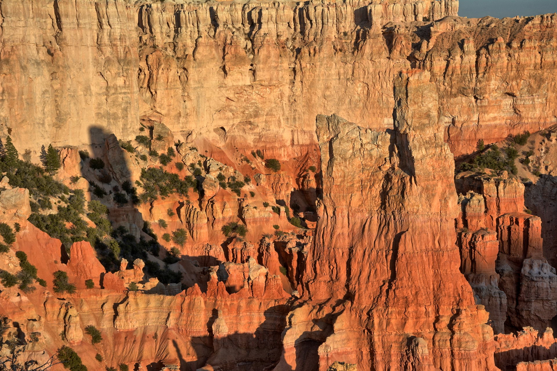
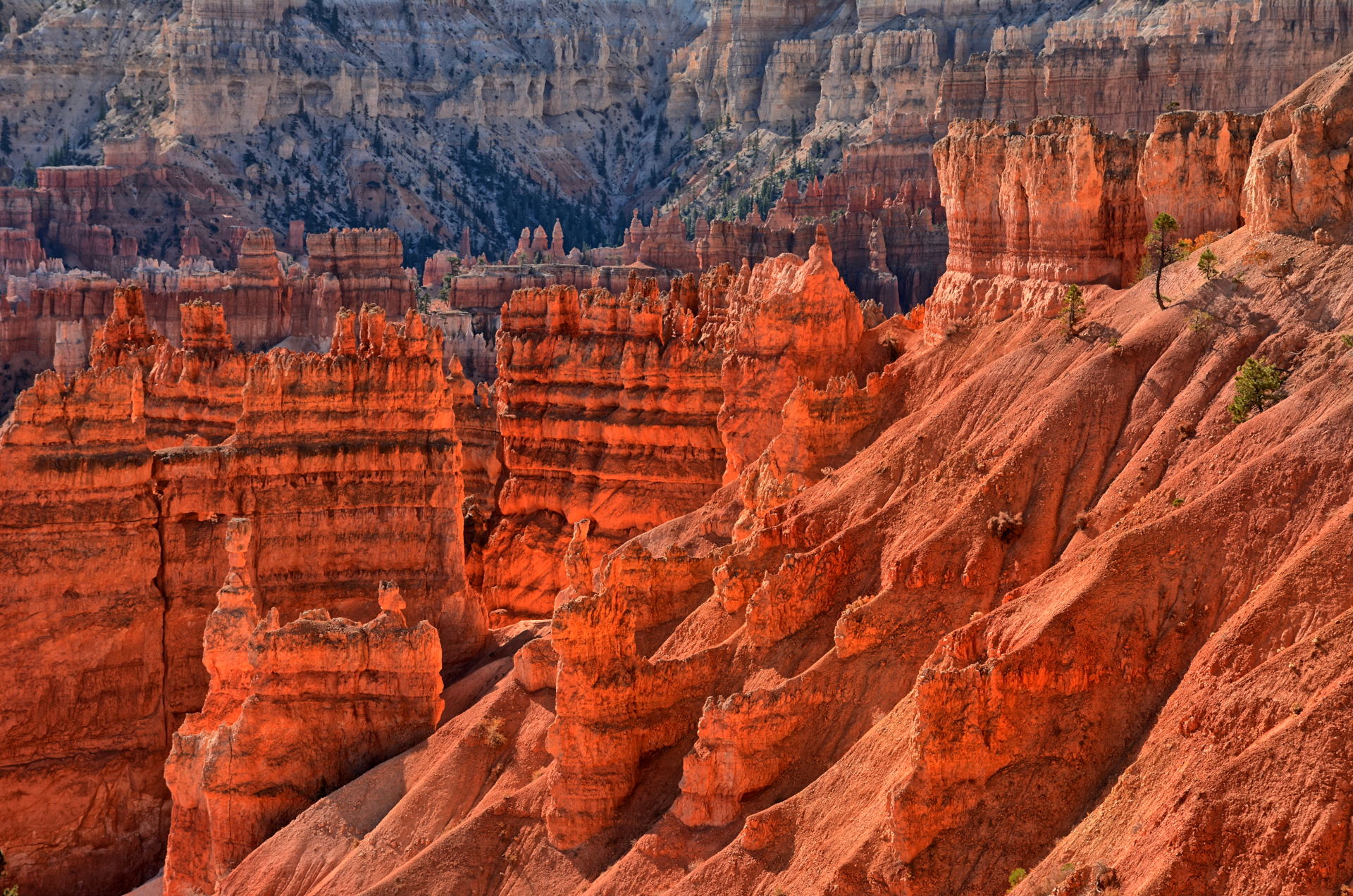
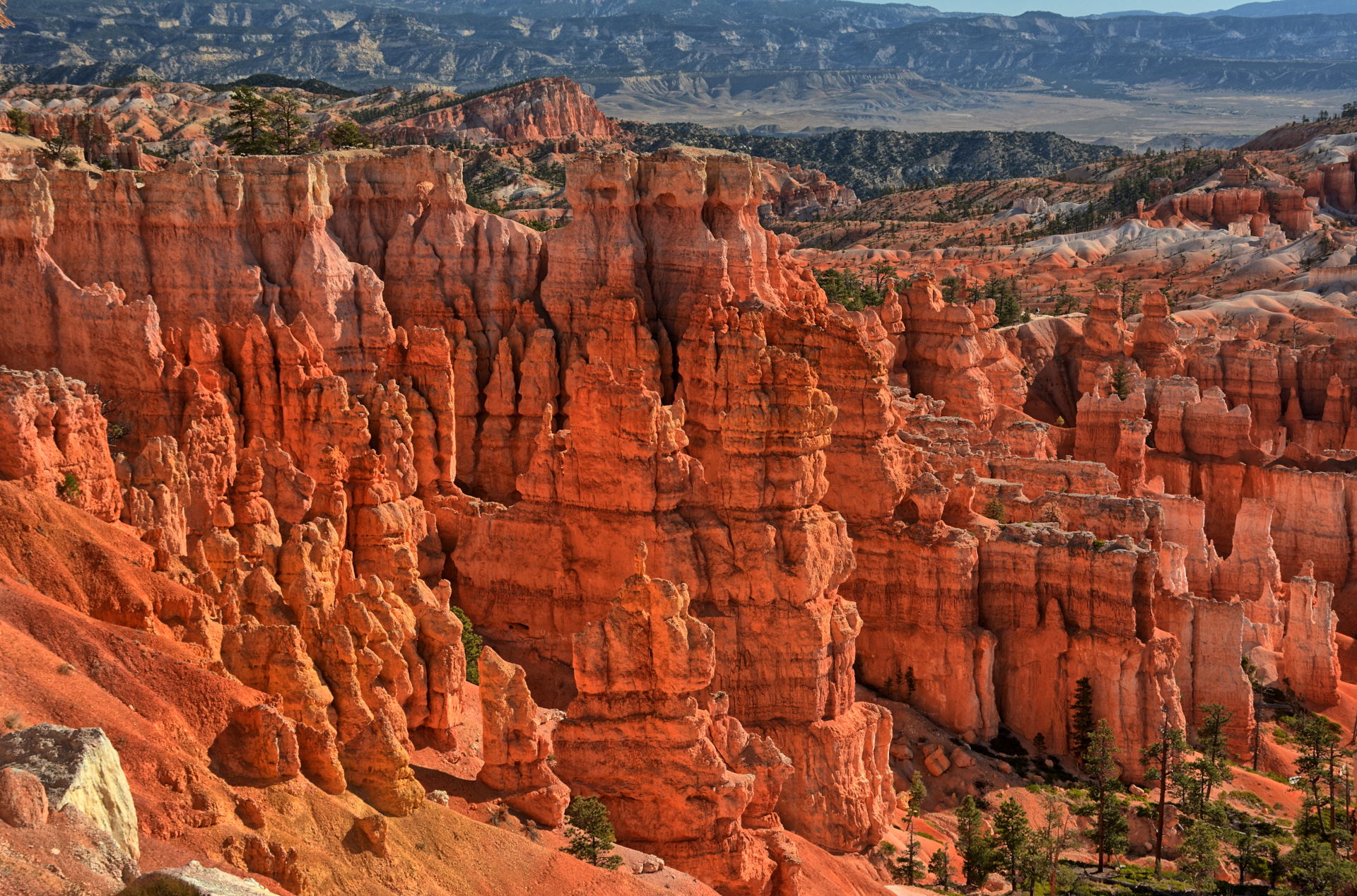
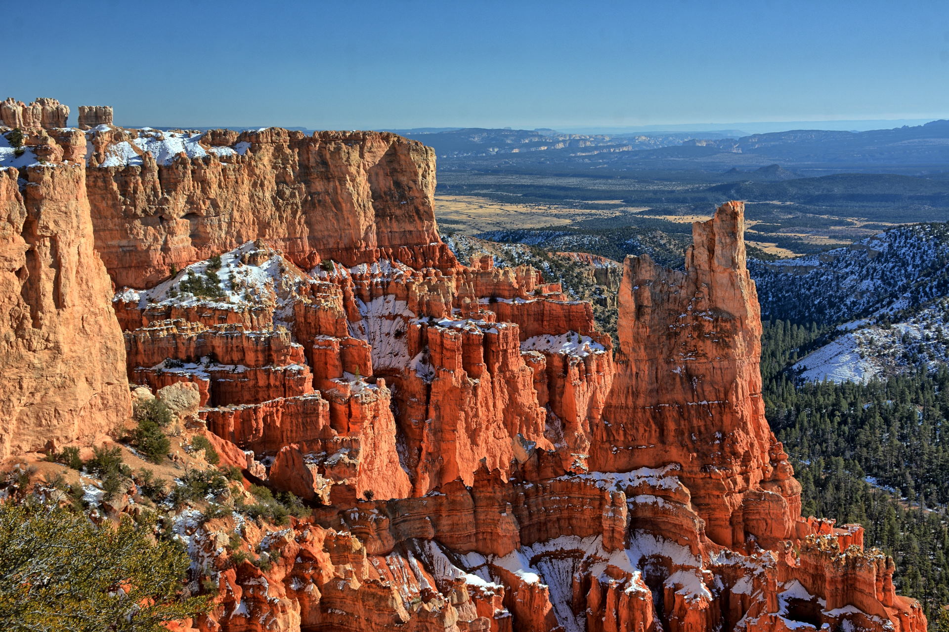
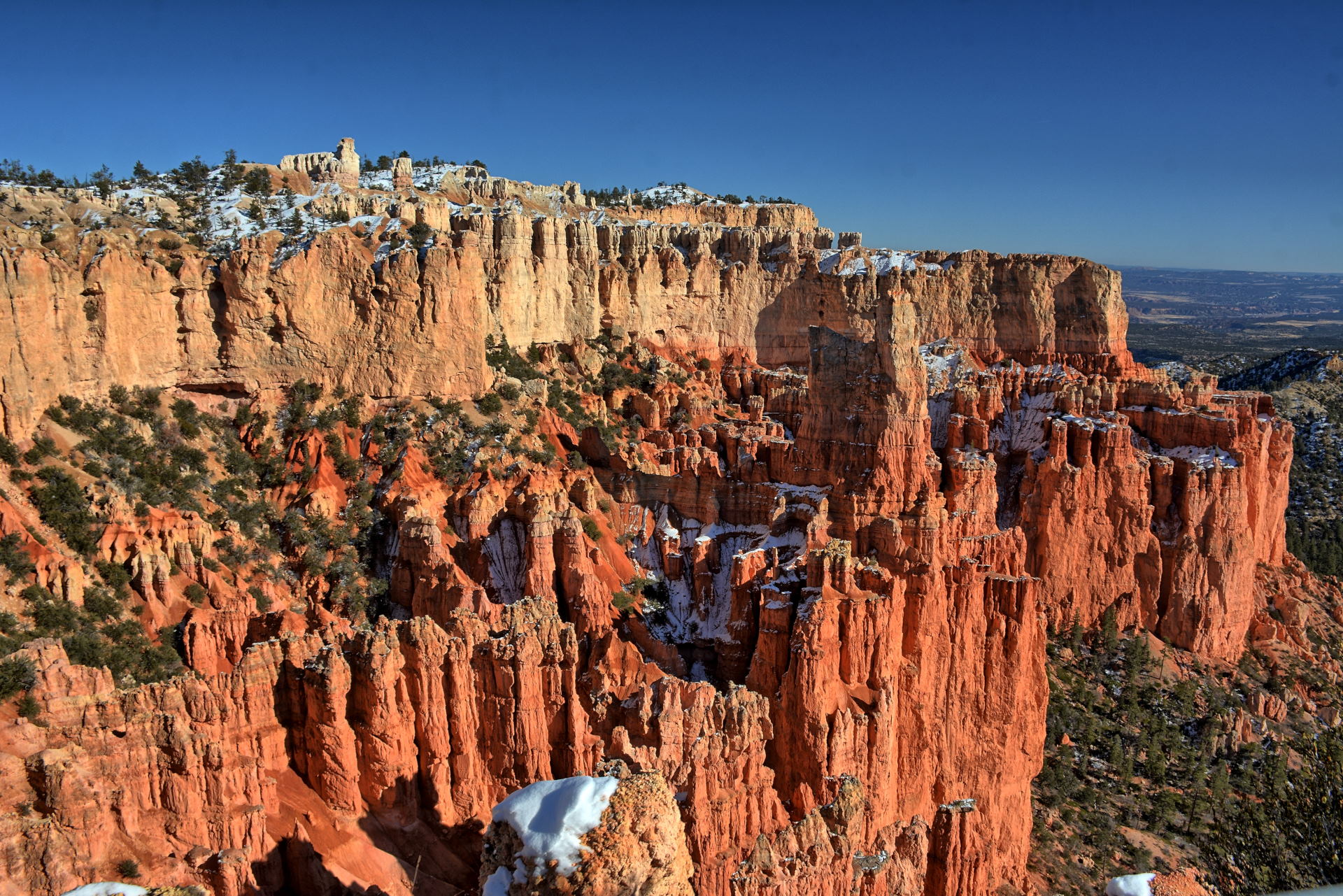
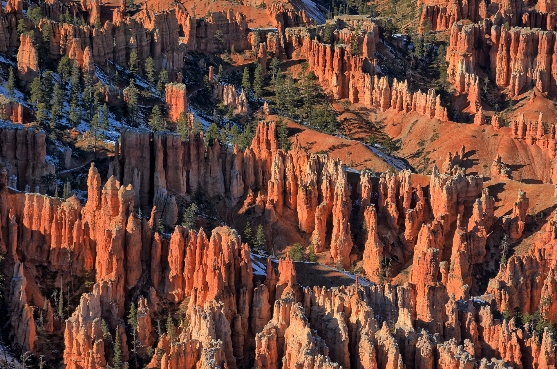
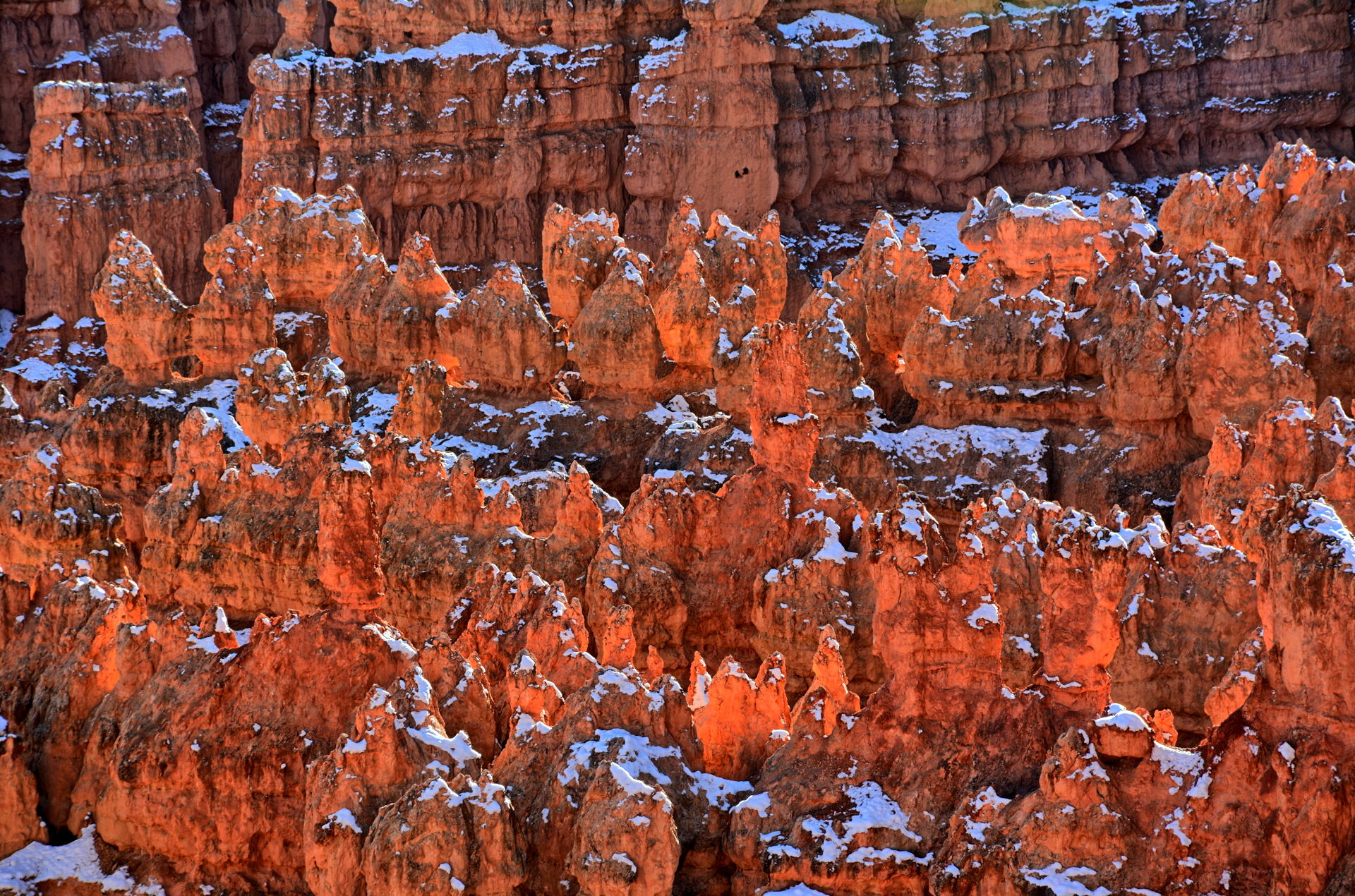
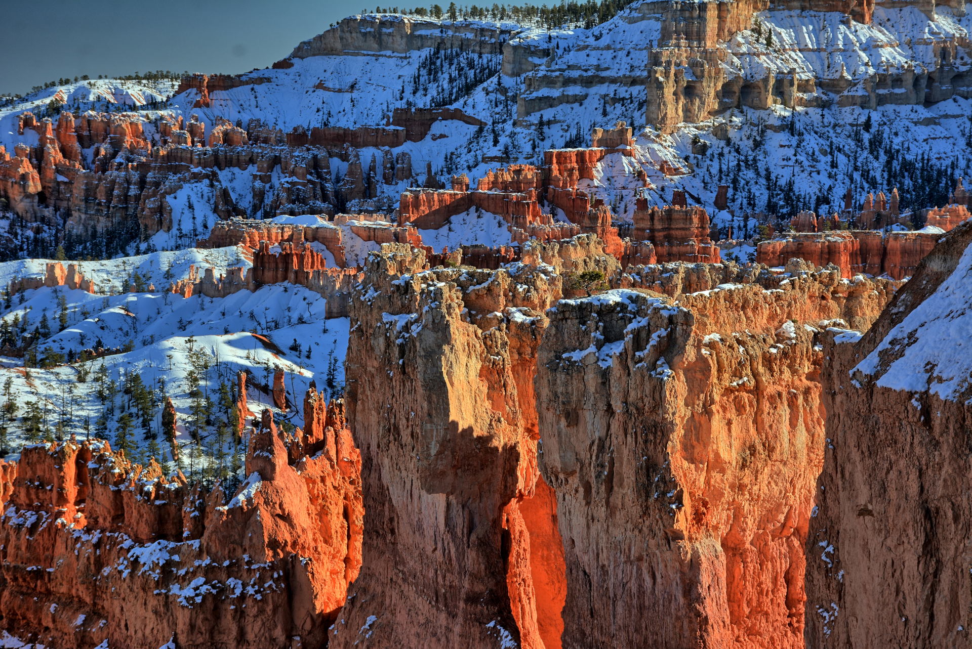
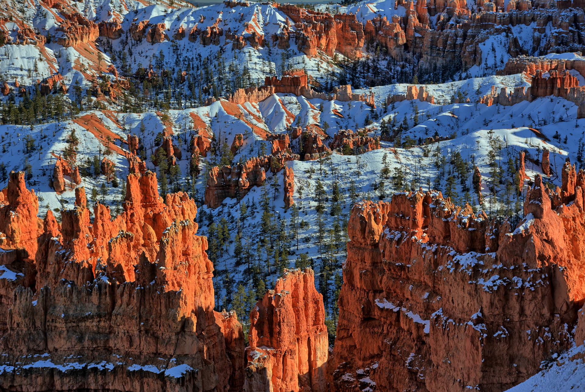
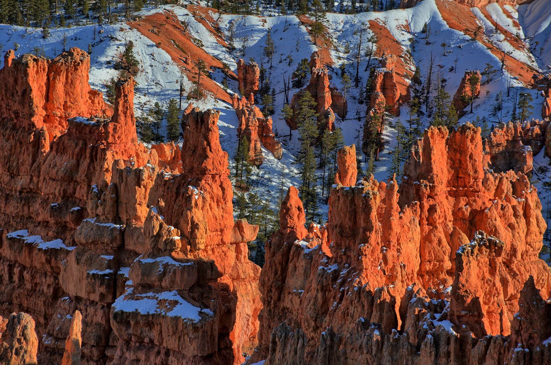
Bryce Canyon National Park, Amphitheater & Paria View Sunset, 13 October 2019
Drive from Boulder to
Escalante + Lower Calf Creek Falls, 13 October
2019
Aerial Video,
Boulder Mountain, 13 October 2019
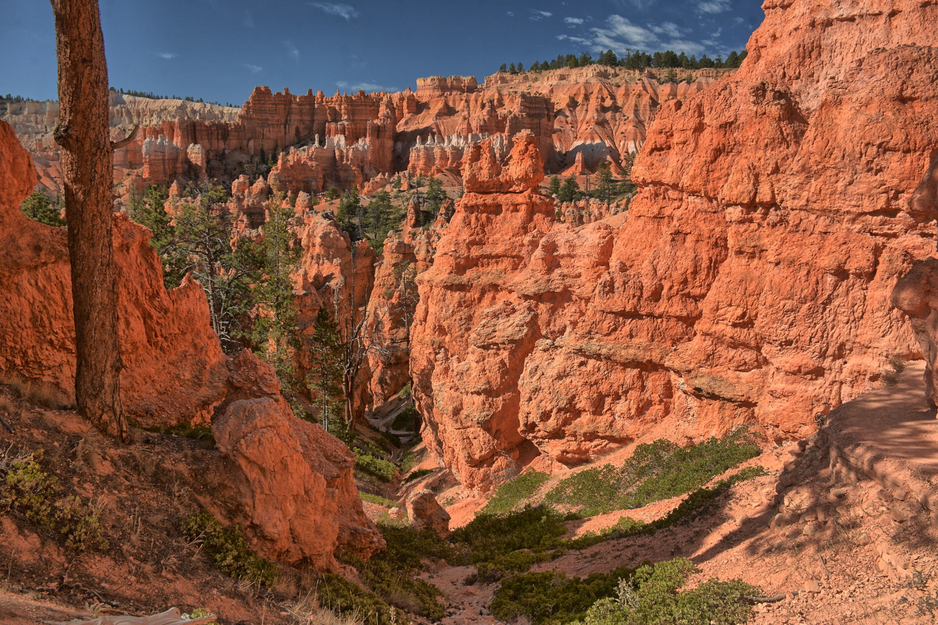
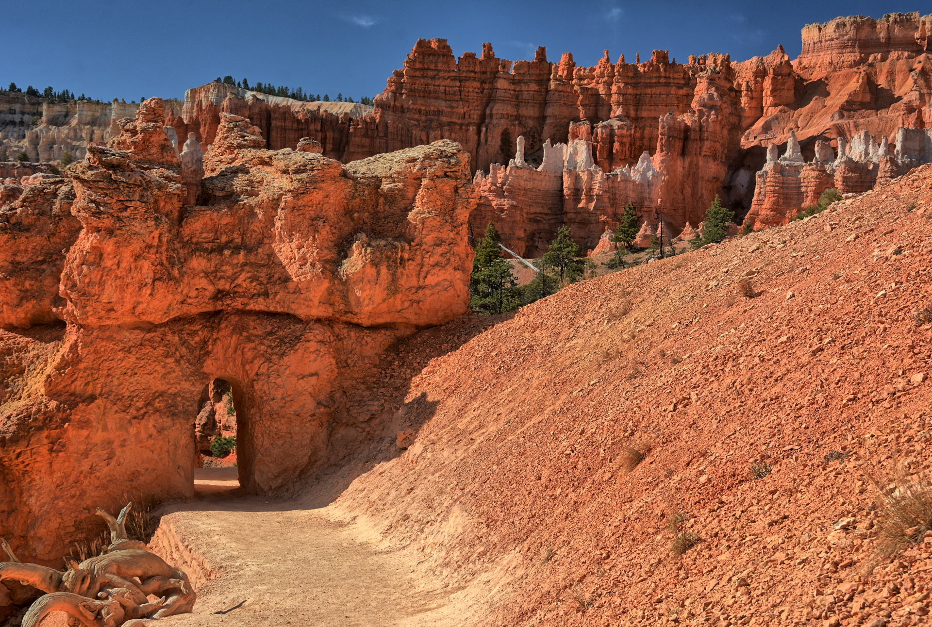
Bryce Canyon National Park, Queens Garden & Navajo Loop Trail, Wall Street, 14
October 2019
Aerial Video, Escalante Gorge, Utah-20, 13 & 14 October 2019
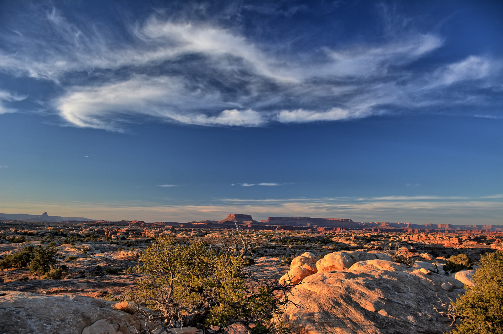
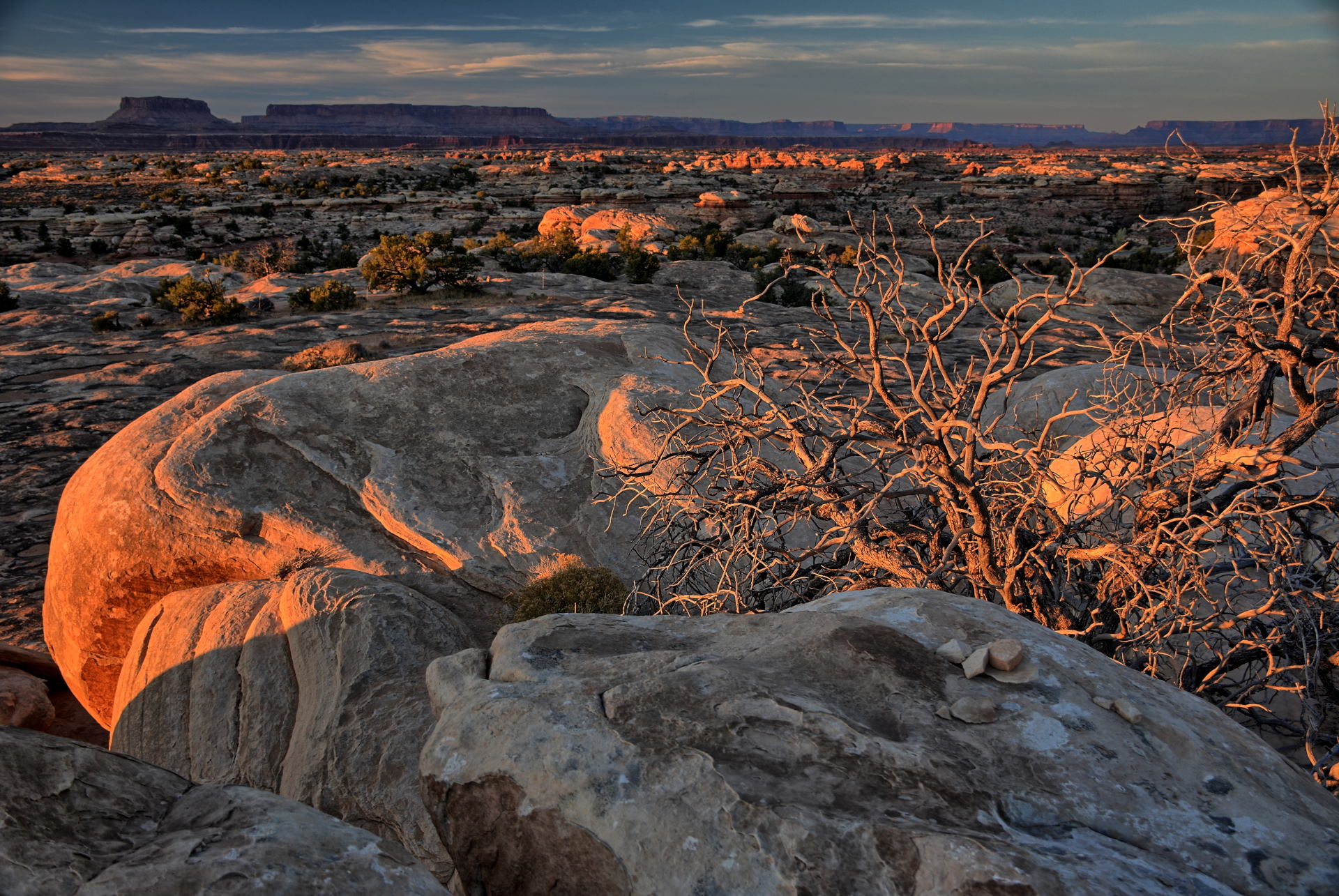
During weekend #4,
Saturday, 19 October to Sunday, 20
October, we worked Saturday again, so I stayed
relatively close. On Saturday after work,
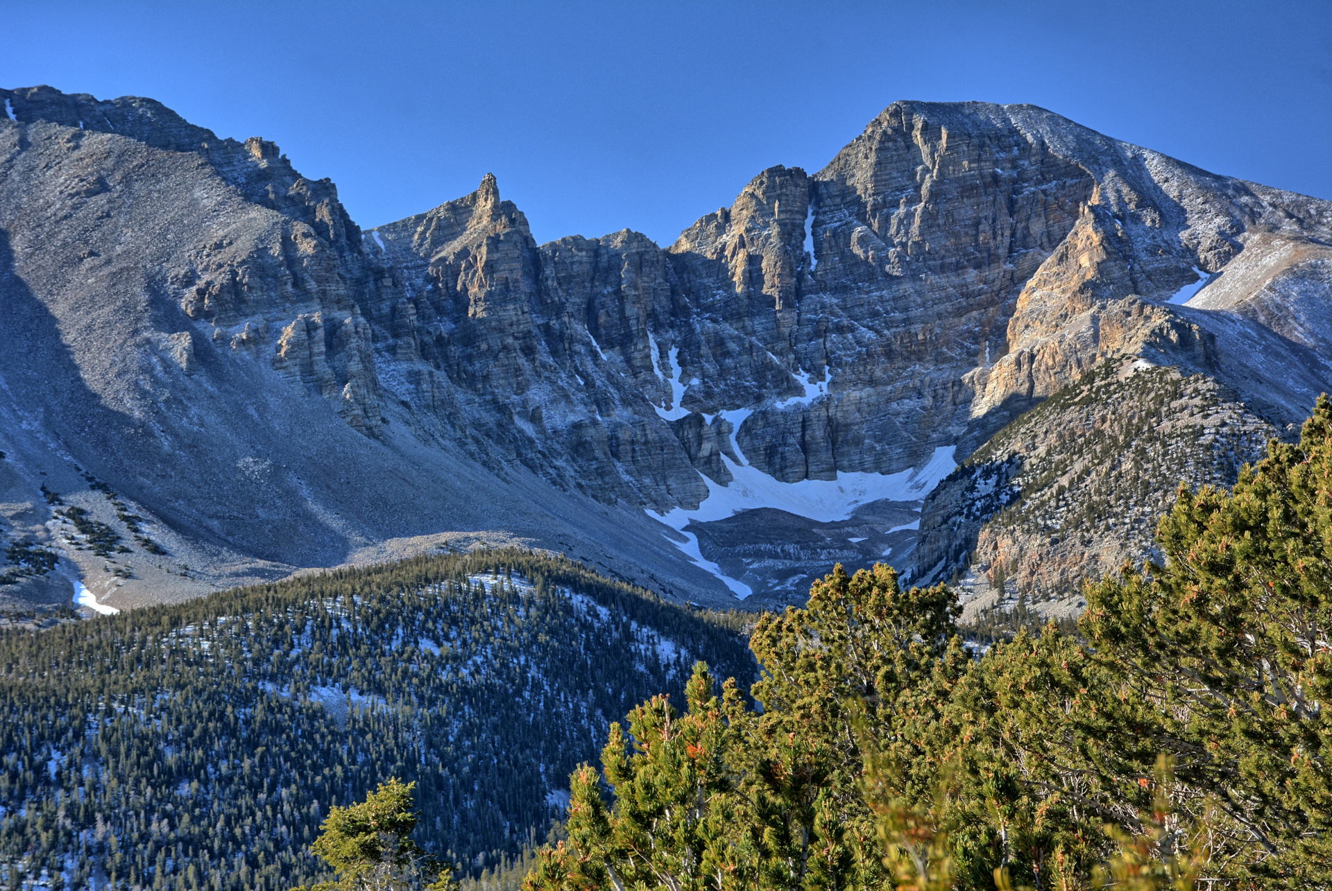
I drove a few hours to Great Basin National
Park, just across the border in Nevada. I had
dinner in Baker, Nevada and camped in the park.
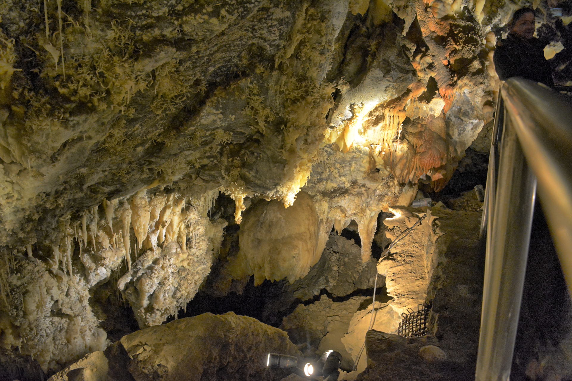
On Sunday morning, I went to the Lehman Cave
visitor center hoping to get a walk-up
spot on a cave tour. The reserved tours are
usually sold out well in advance, but at 8 AM
the rangers may schedule an extra tour in the afternoon
if there are enough people to warrant it.
I was the second person in line, and there were
plenty of people, so they made a 2 PM
tour available. After getting that tour
spot I
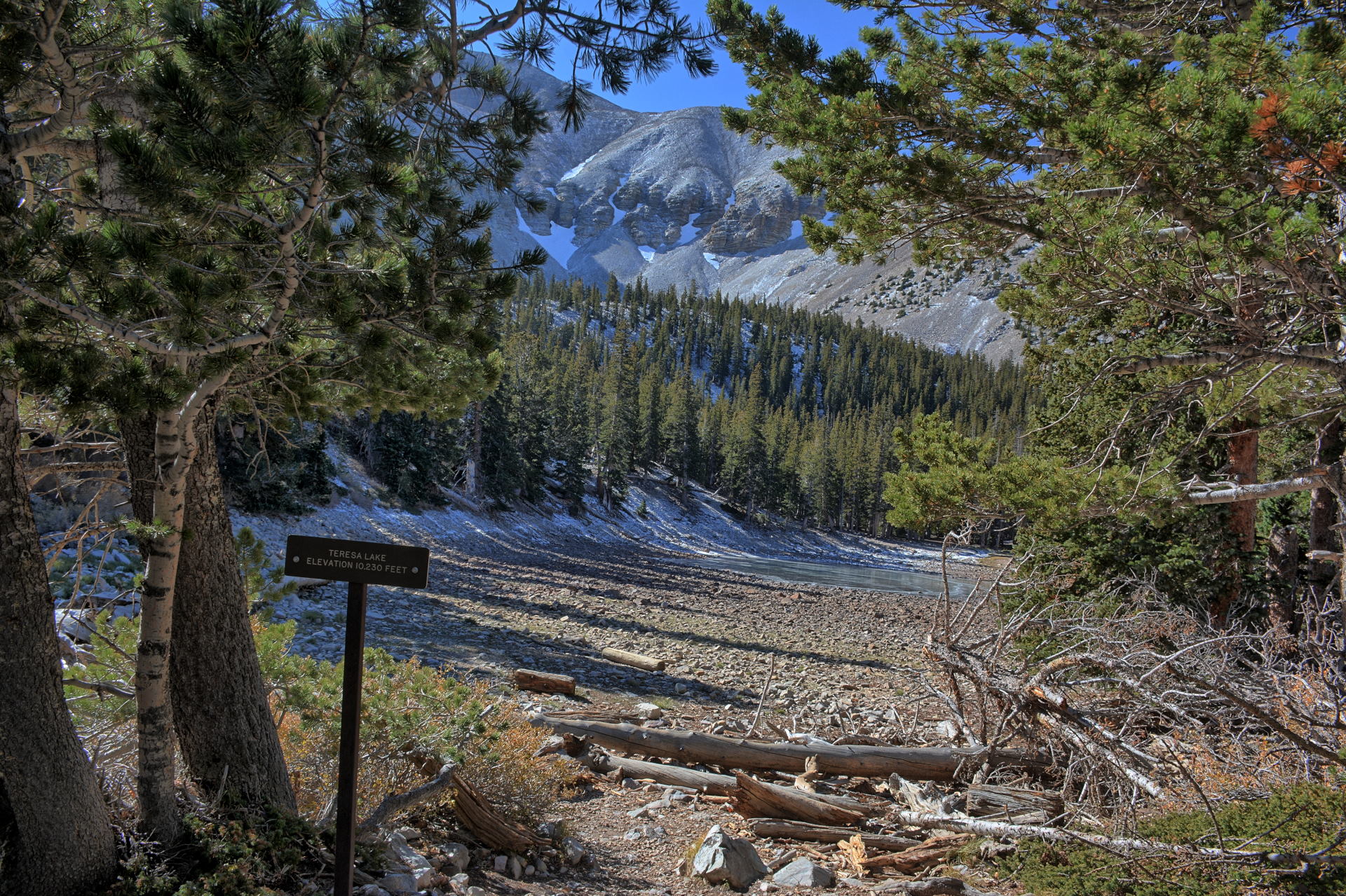
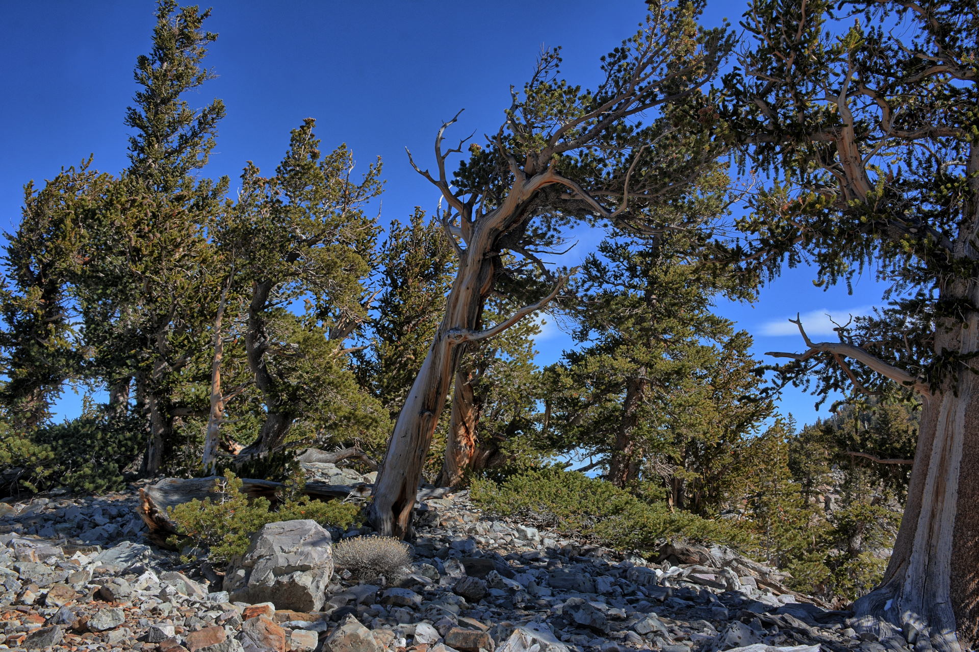
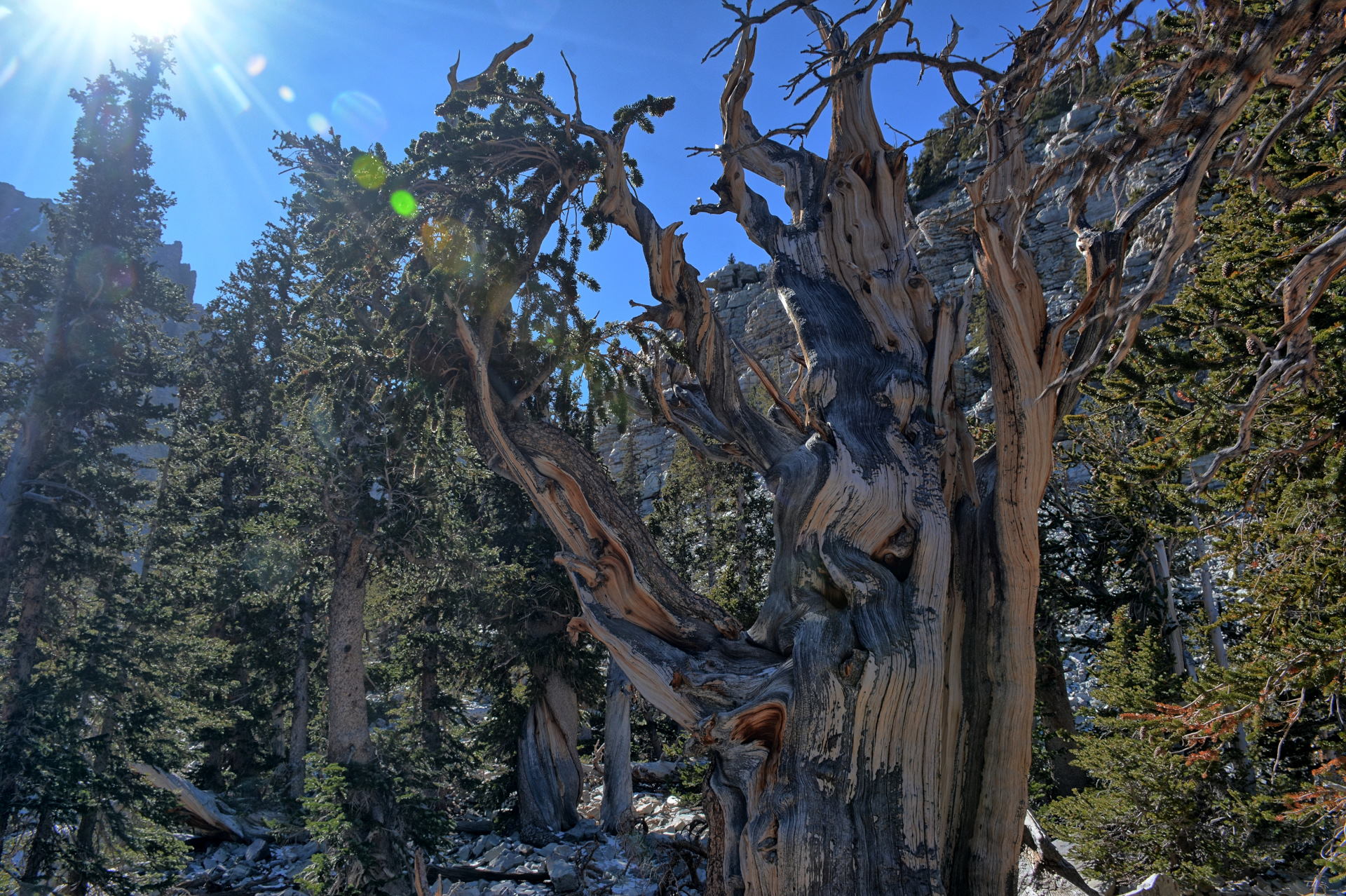
drove up the mountain road, and hiked on
Wheeler Peak to some sub-alpine lakes and to a
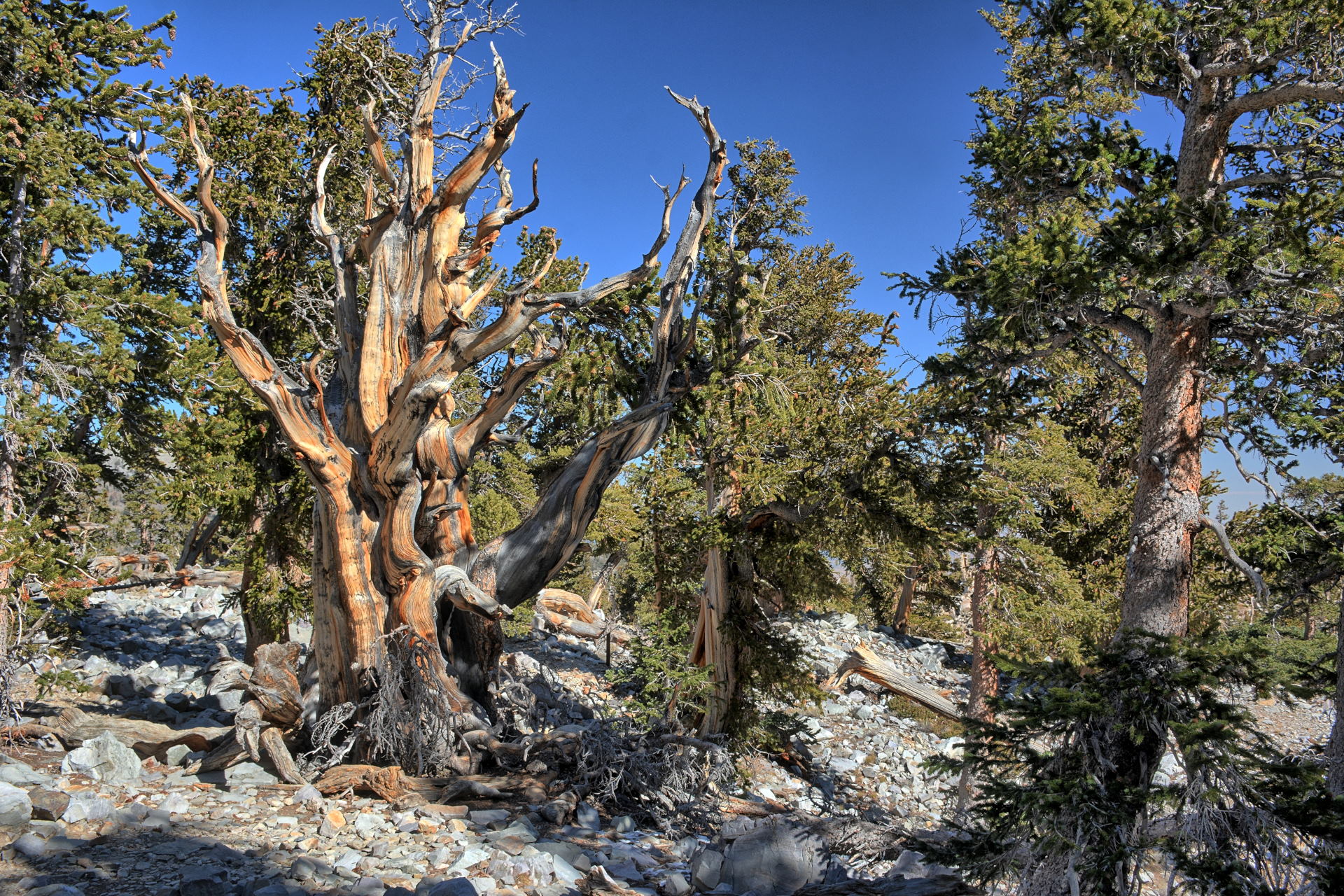
grove of ancient bristlecone pines. Many of these
trees were labeled with their ages, with several over 3000
years old. I had reservations for that
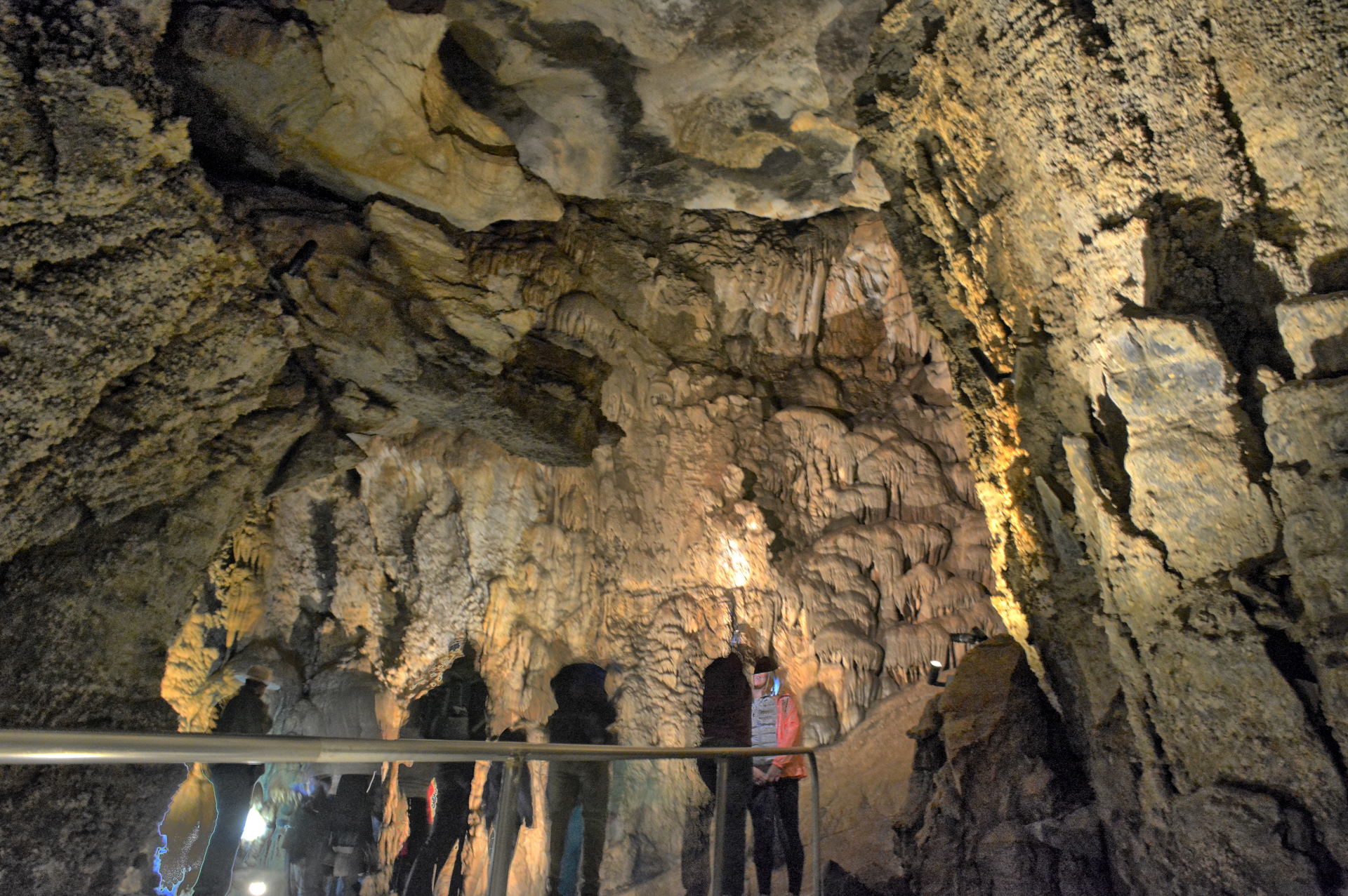
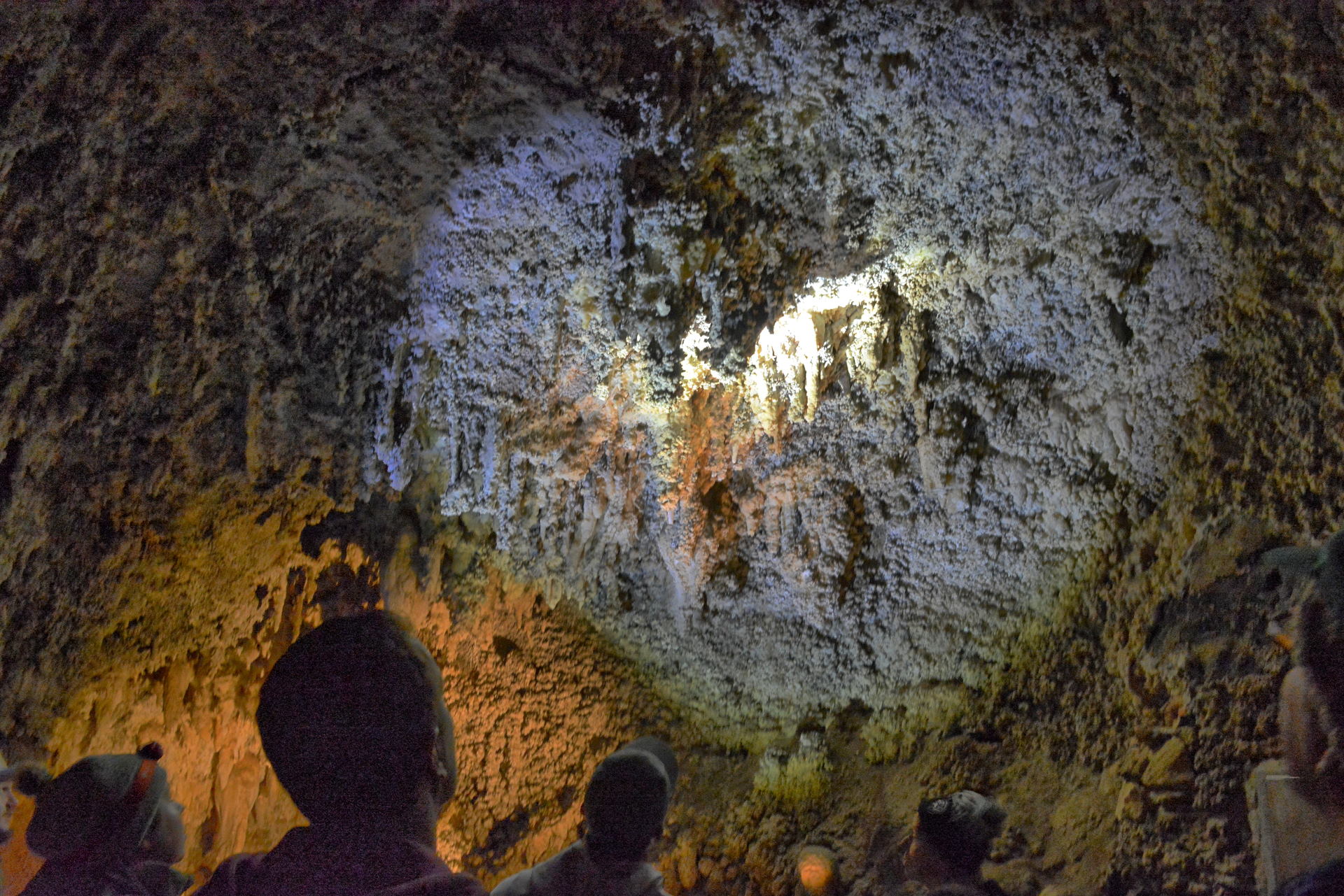
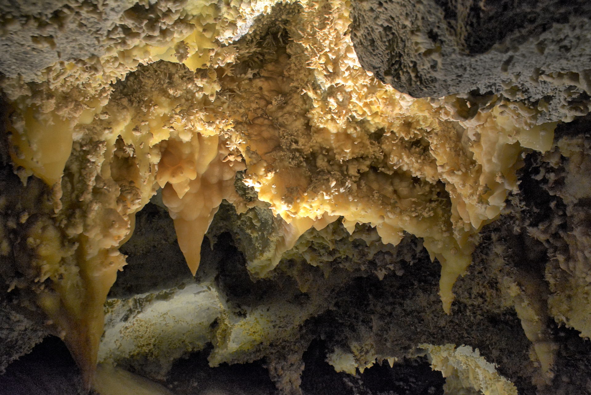
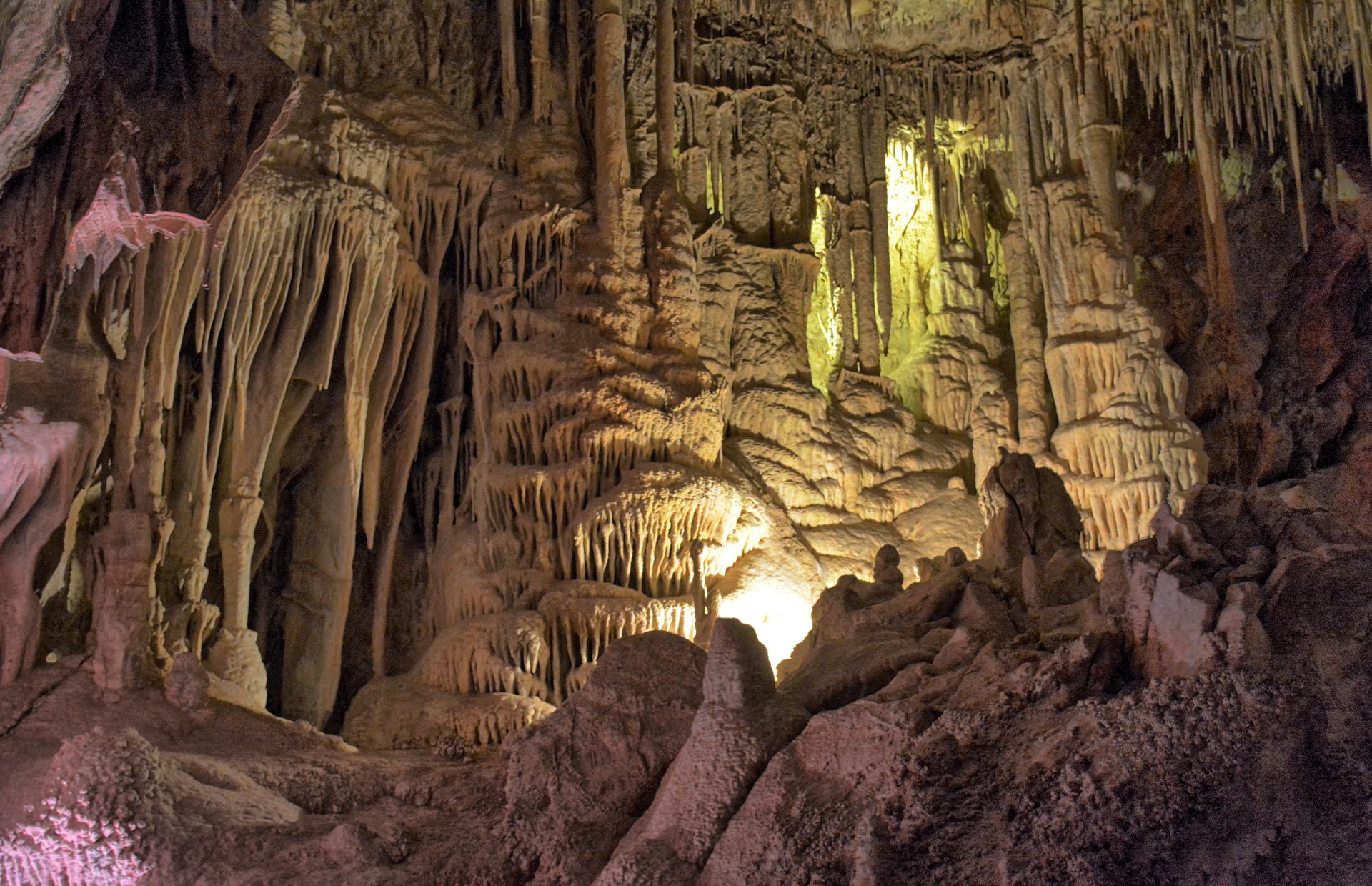
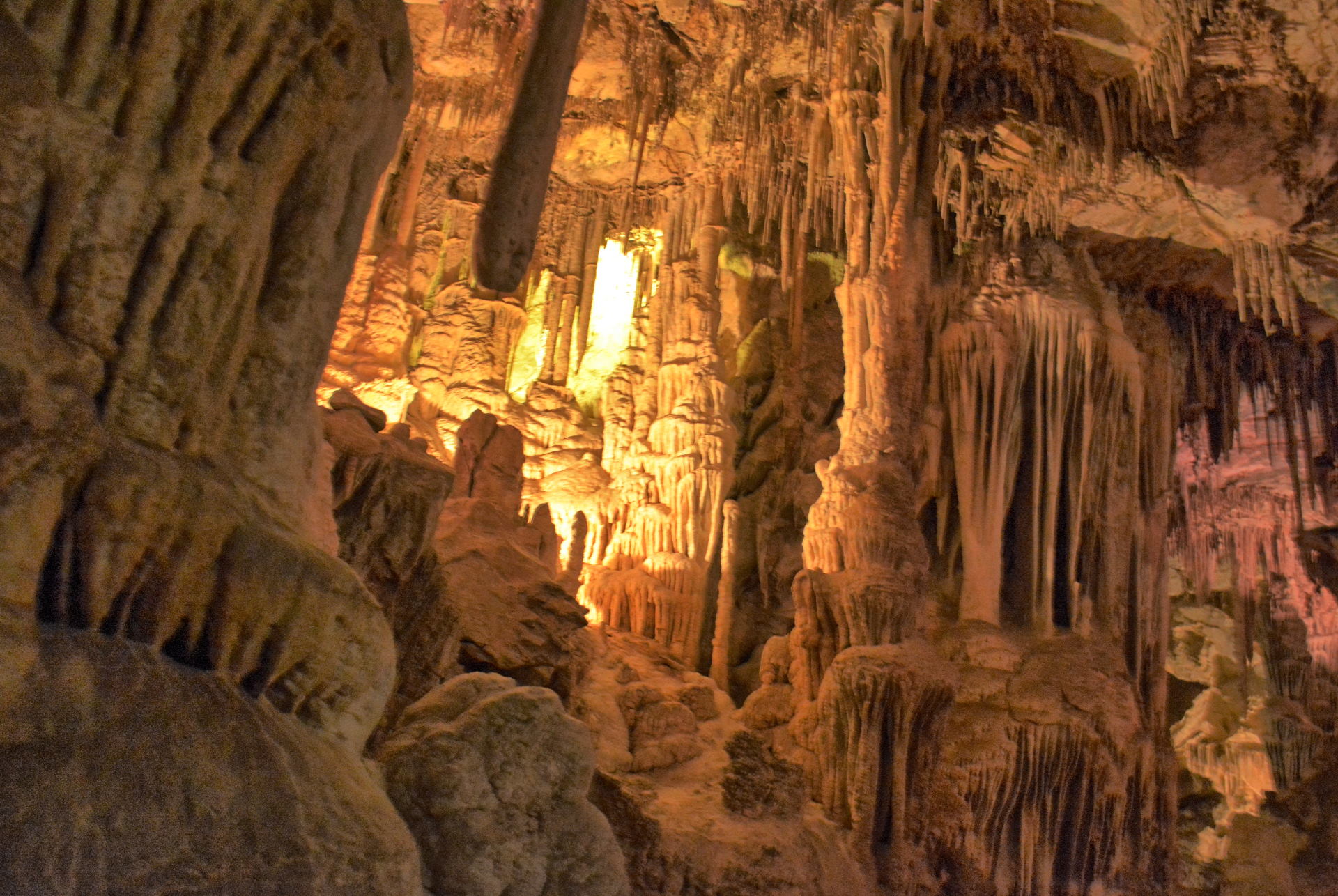
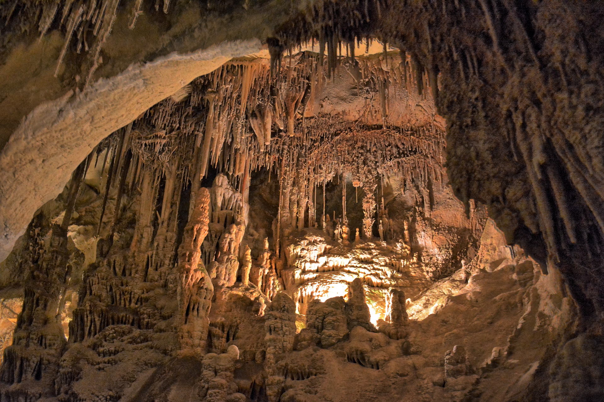
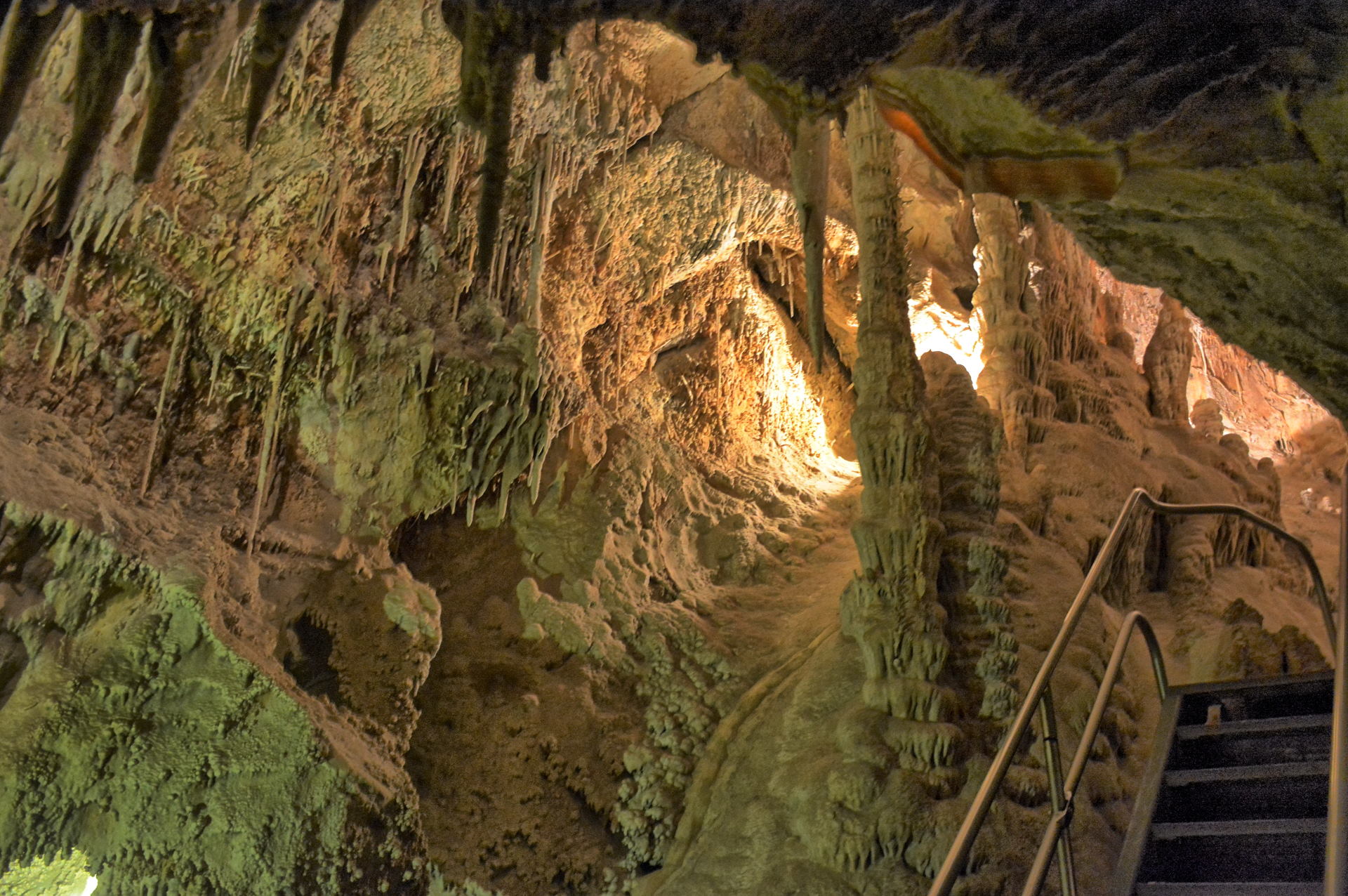
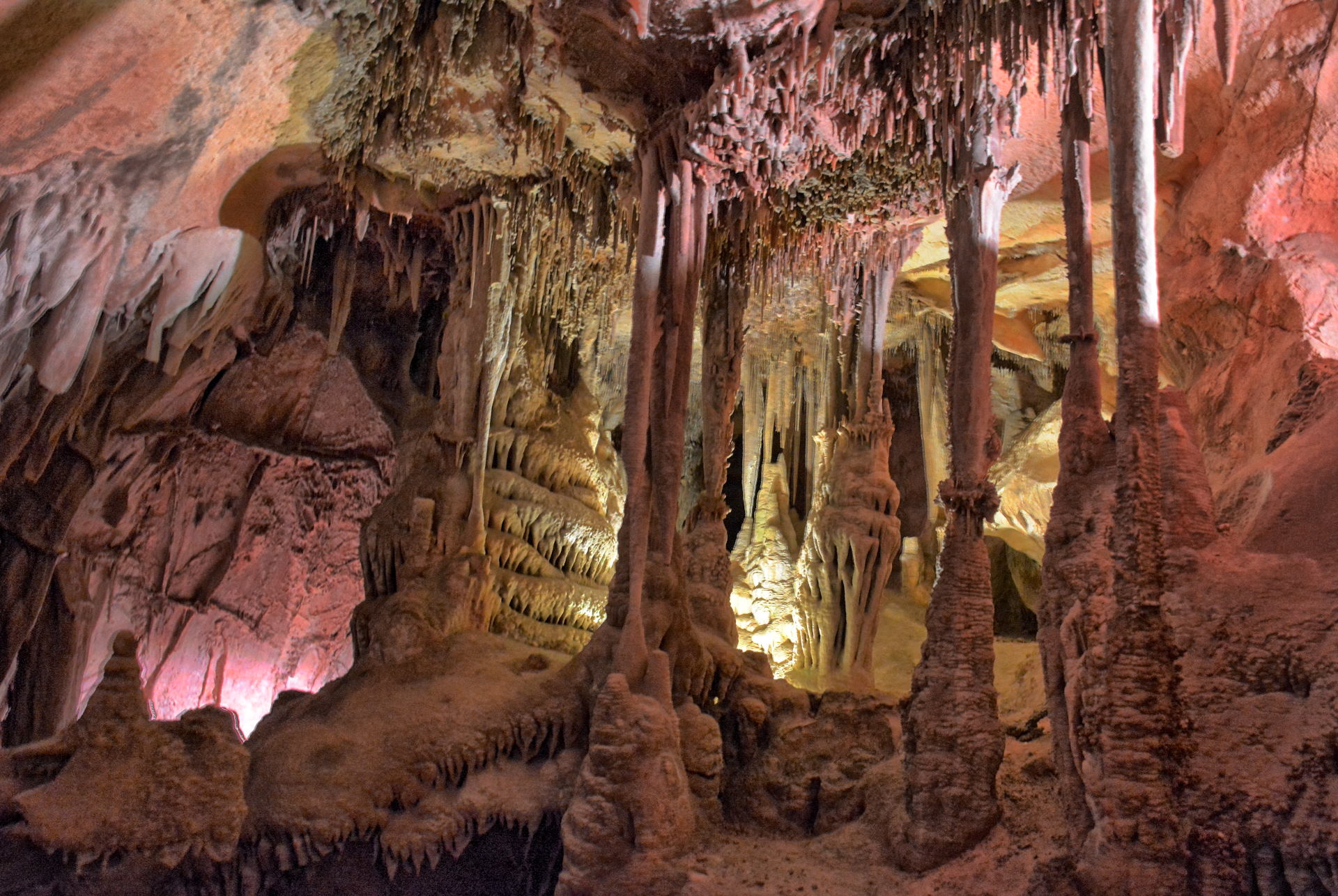
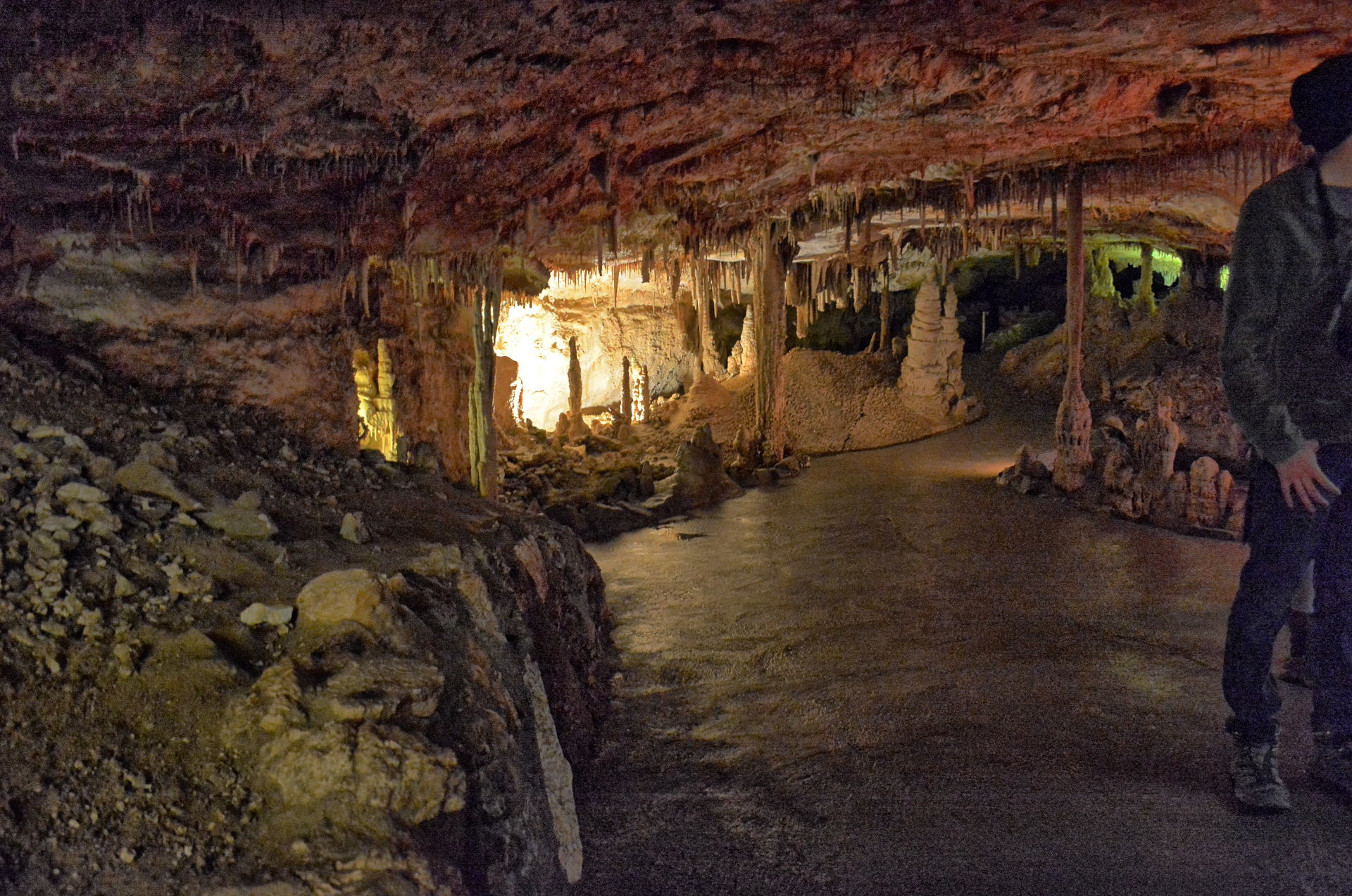
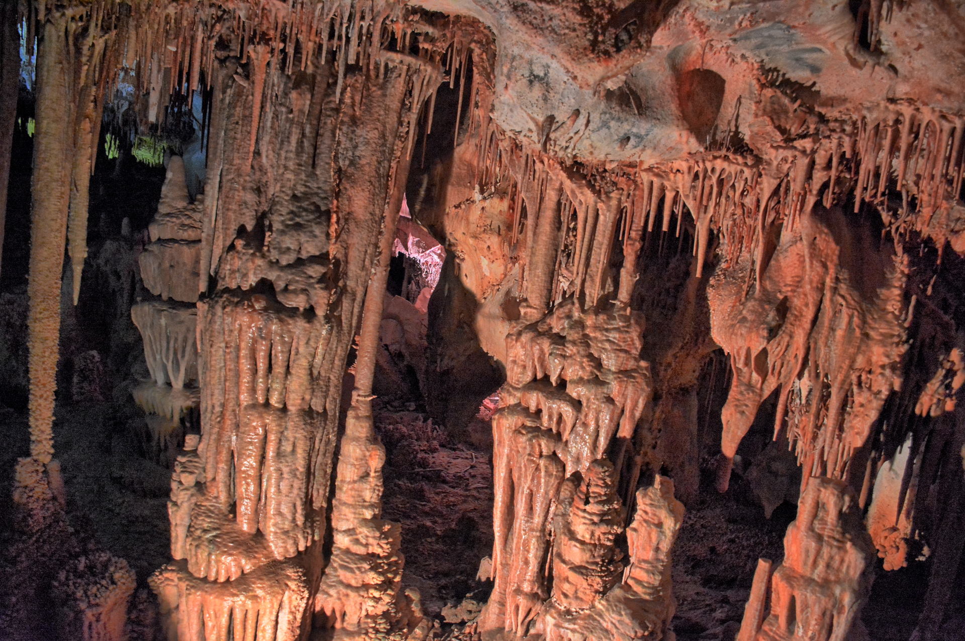
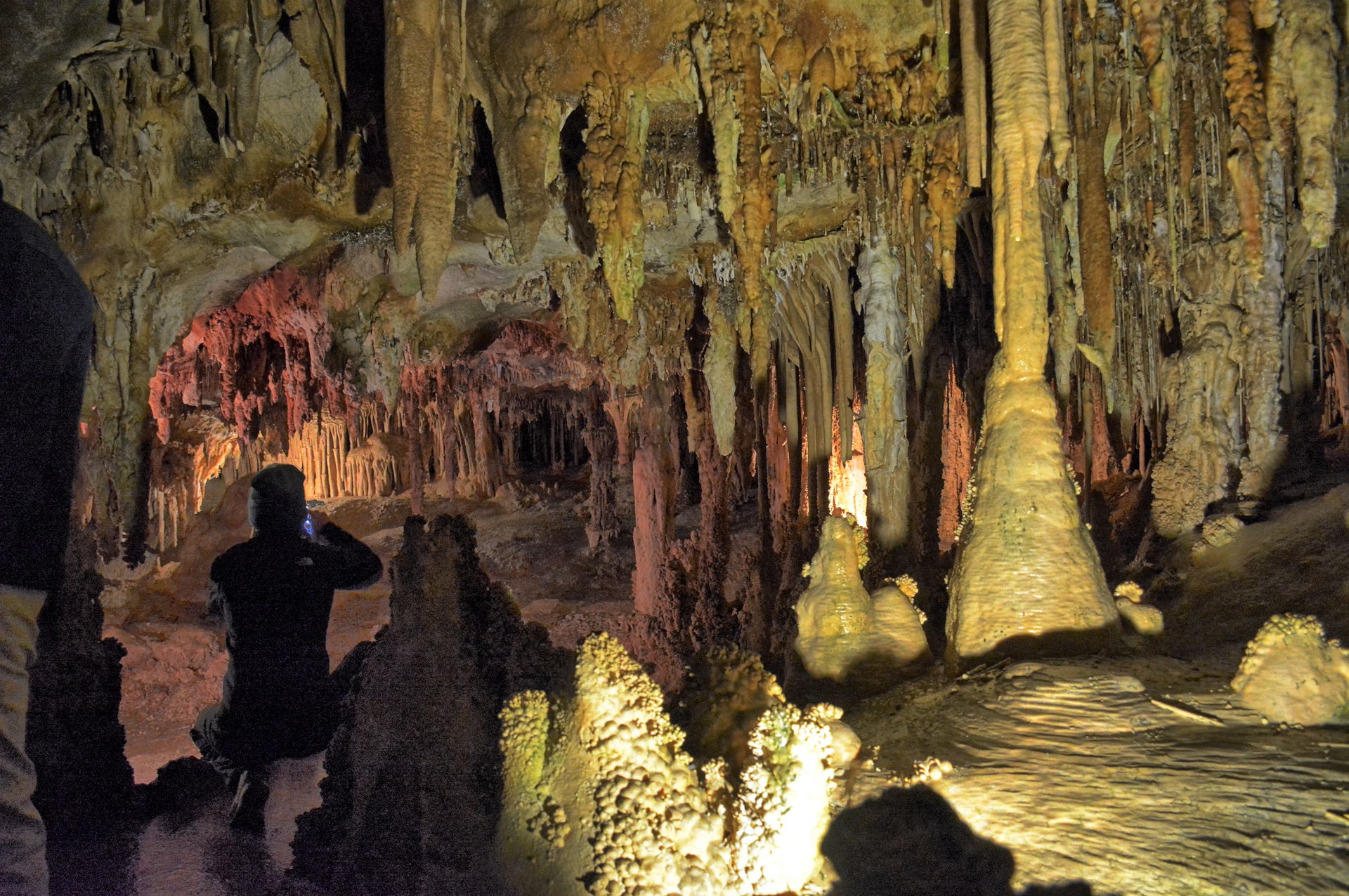
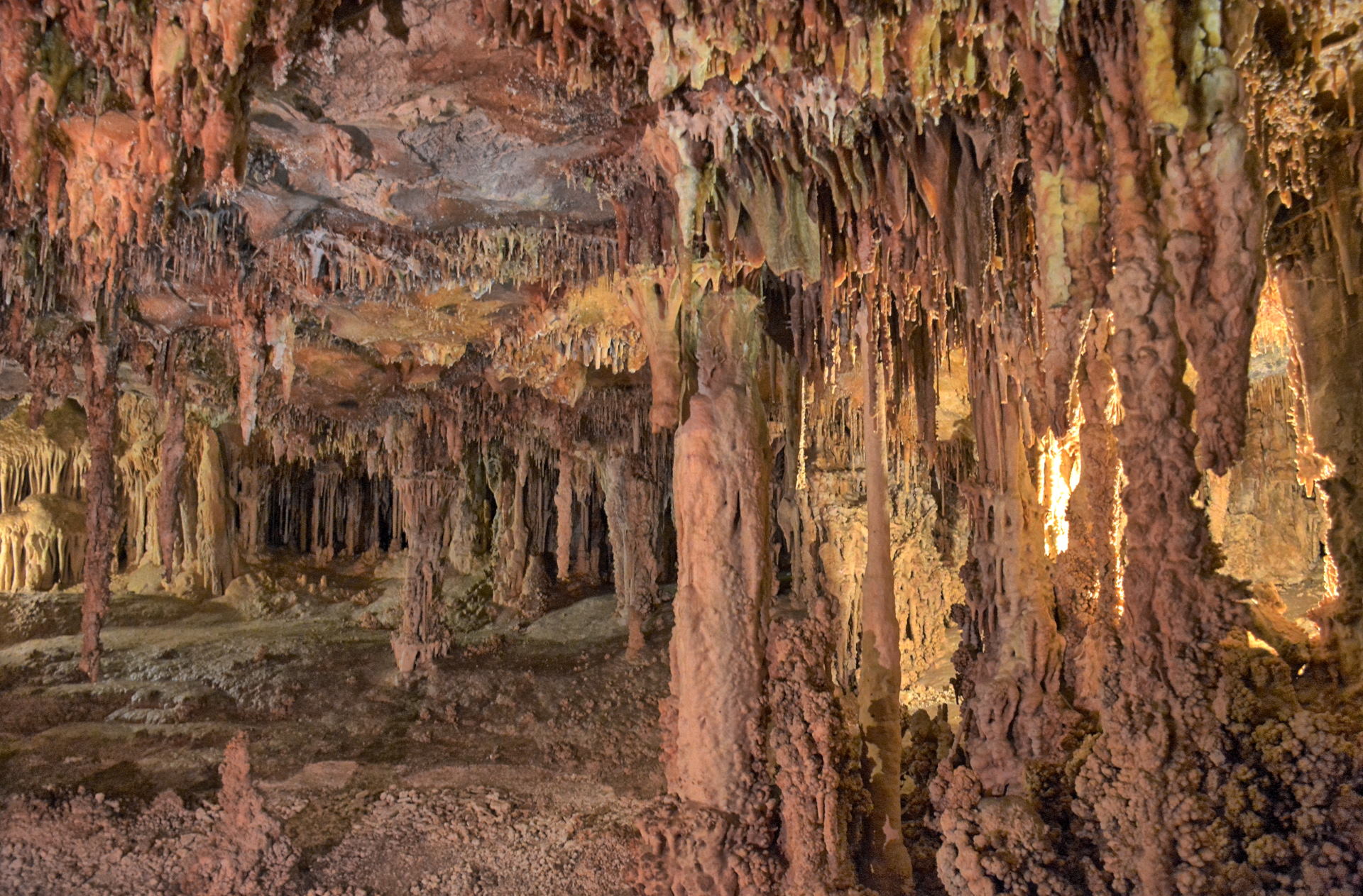
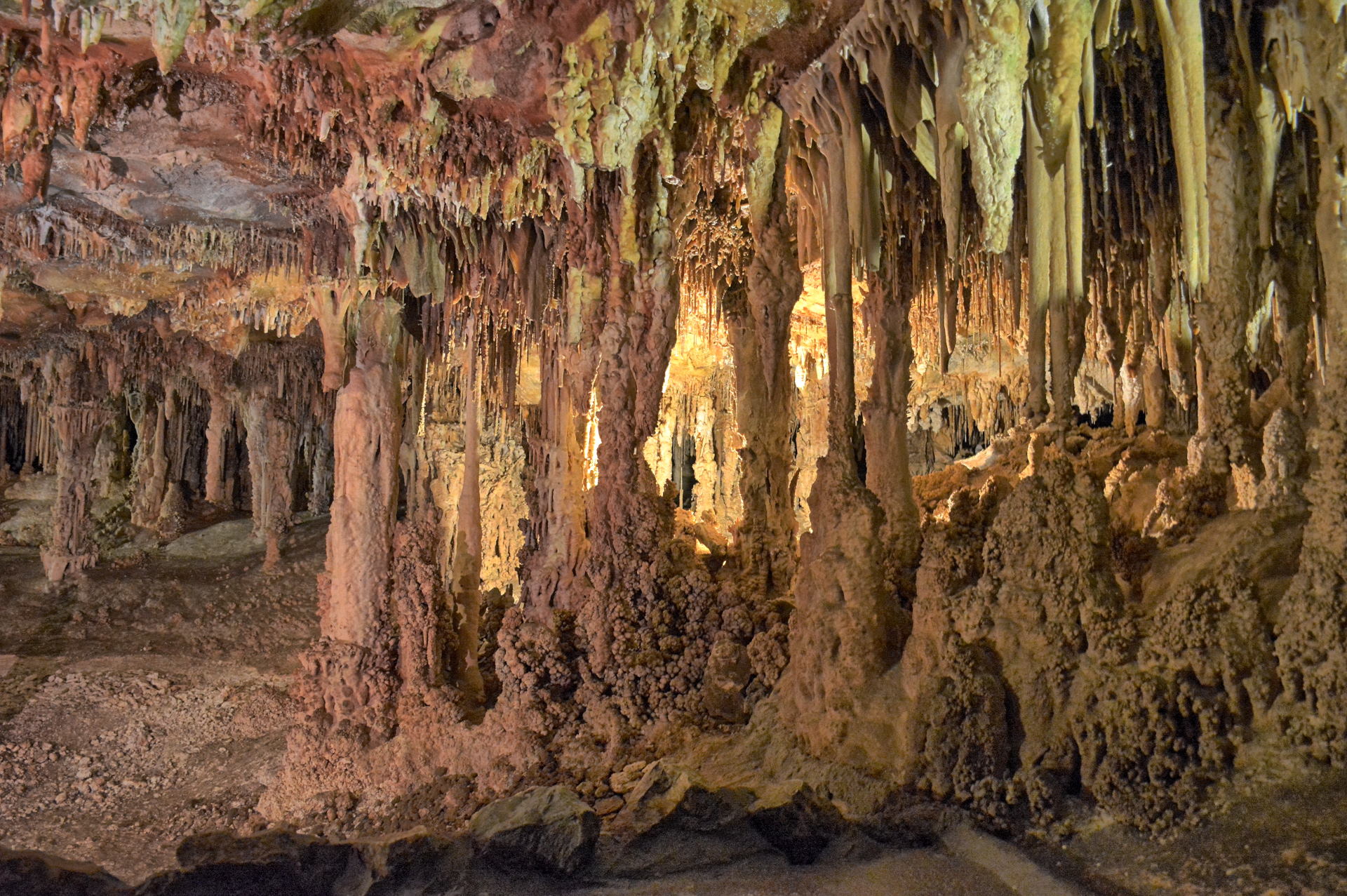
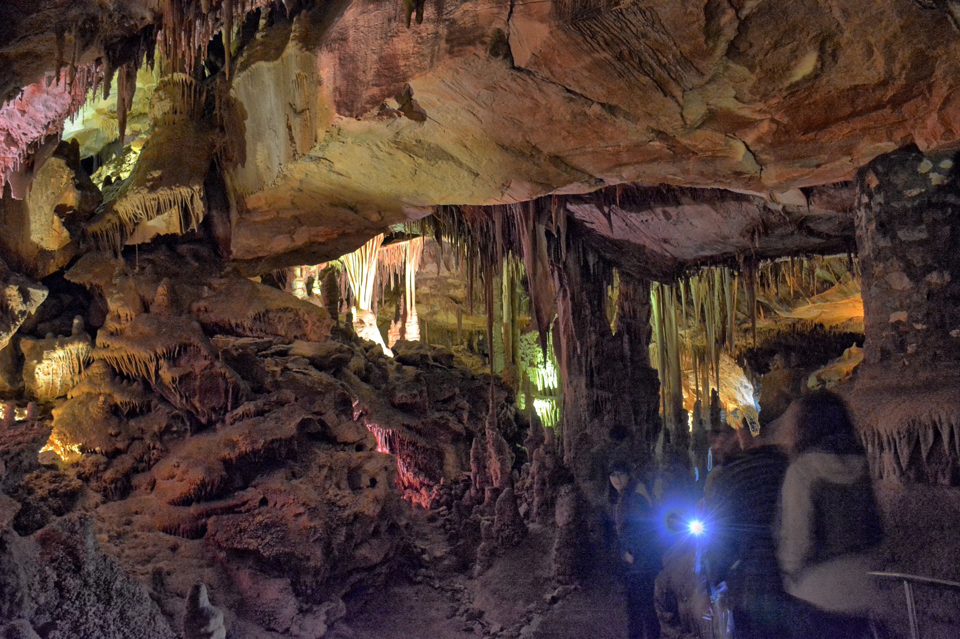
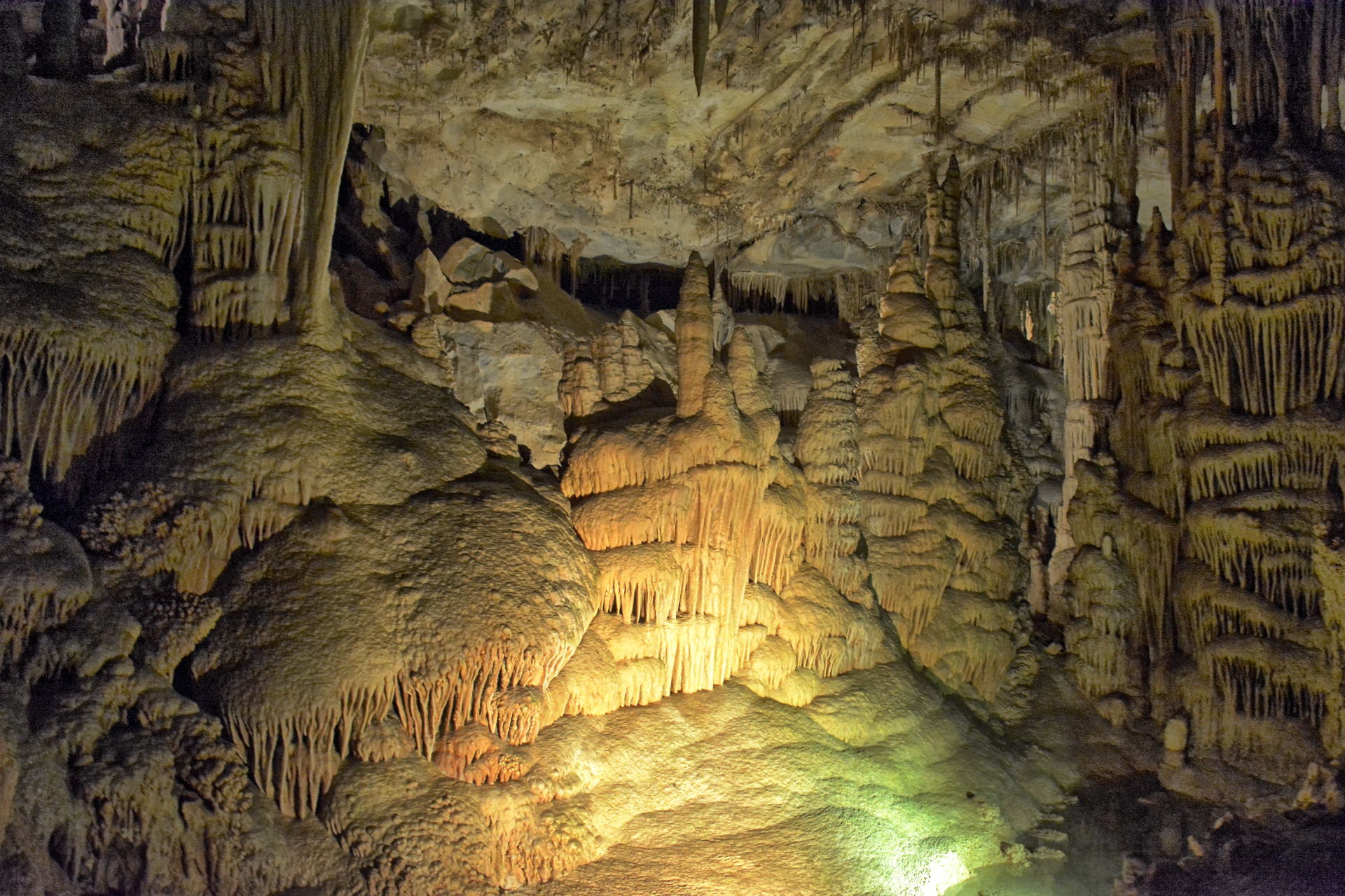
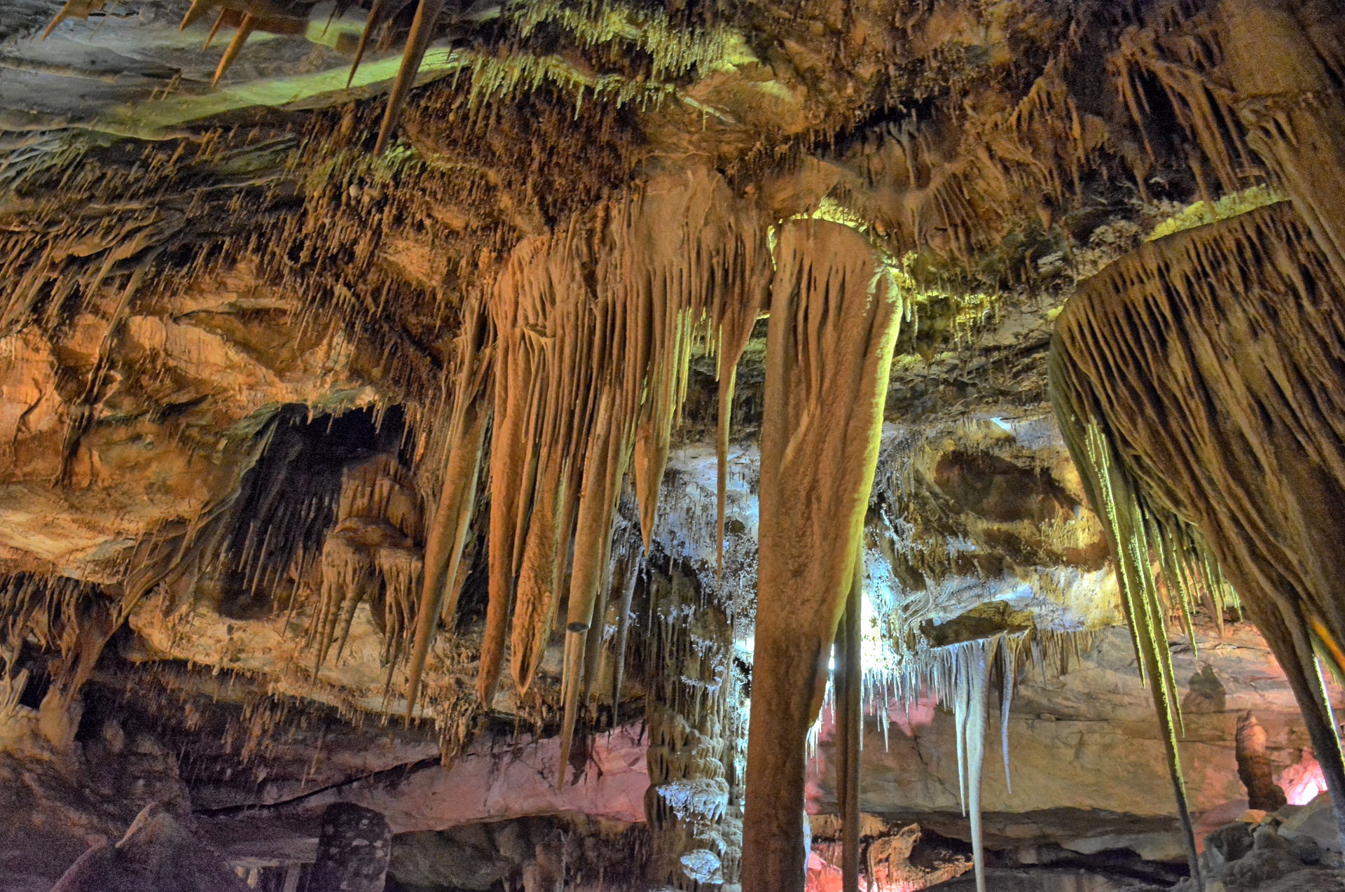
afternoon tour of Lehman Cave, which is at the
base of Wheeler Peak, so I drove off the
mountain and took the three hour tour. The cave has a lot of
beautiful rock formations, and the tour guide
was very knowledgeable and well spoken.
This tour is well worth it. I drove back to Dugway after the tour.
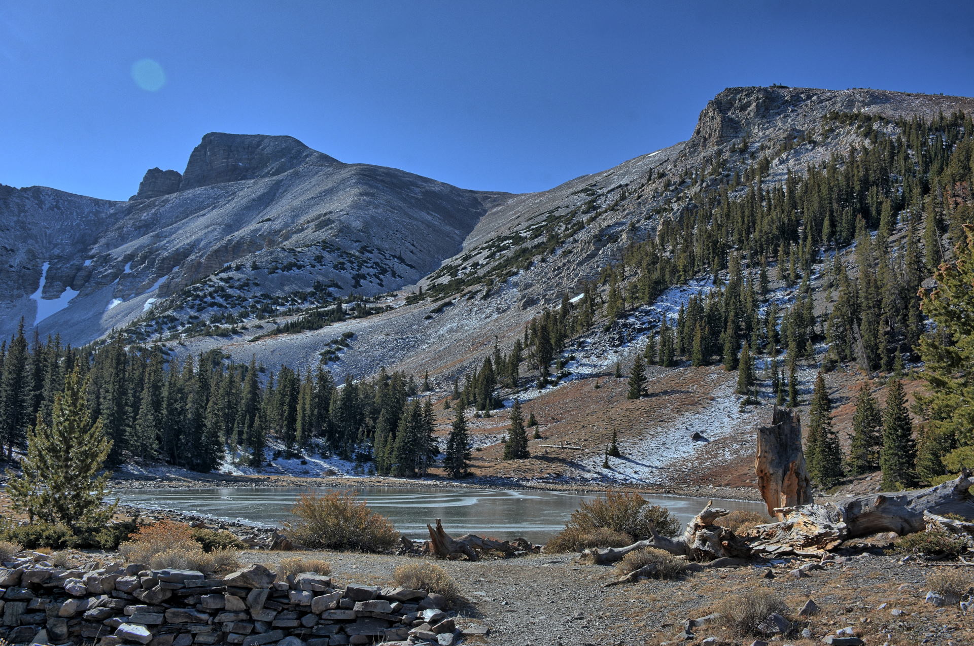
Wheeler Peak Drive, 20 October 2019
Aerial Video, Great Basin National
Park to Dugway, 20 October 2019
Great Basin National Park, Wheeler Peak, Bristlecone Pines, 20 October
2019
Lehman Cave,
Great Basin National Park, 20 October 2019
During weekend #5,
Saturday, 26 October to Sunday, 27 October, we
worked Saturday again.
On Sunday, I drove into Salt Lake City, visiting
a development called Daybreak that Tami was
interested in. A job position for flight
test lead had opened at Dugway, and I was
considering taking it. Tami liked what she saw
in the Daybreak postings on-line, and wanted to
know if it was accurate. I drove around
Daybreak and decided they still had A LOT of
work to do before it became what the developers
wanted to reach. I had dinner at Red Iguana 2
in Salt Lake City with friends.
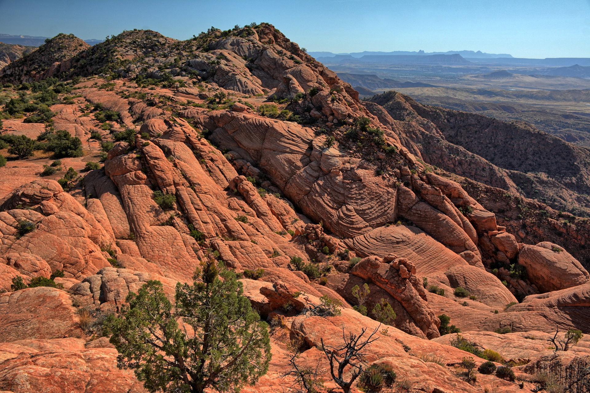
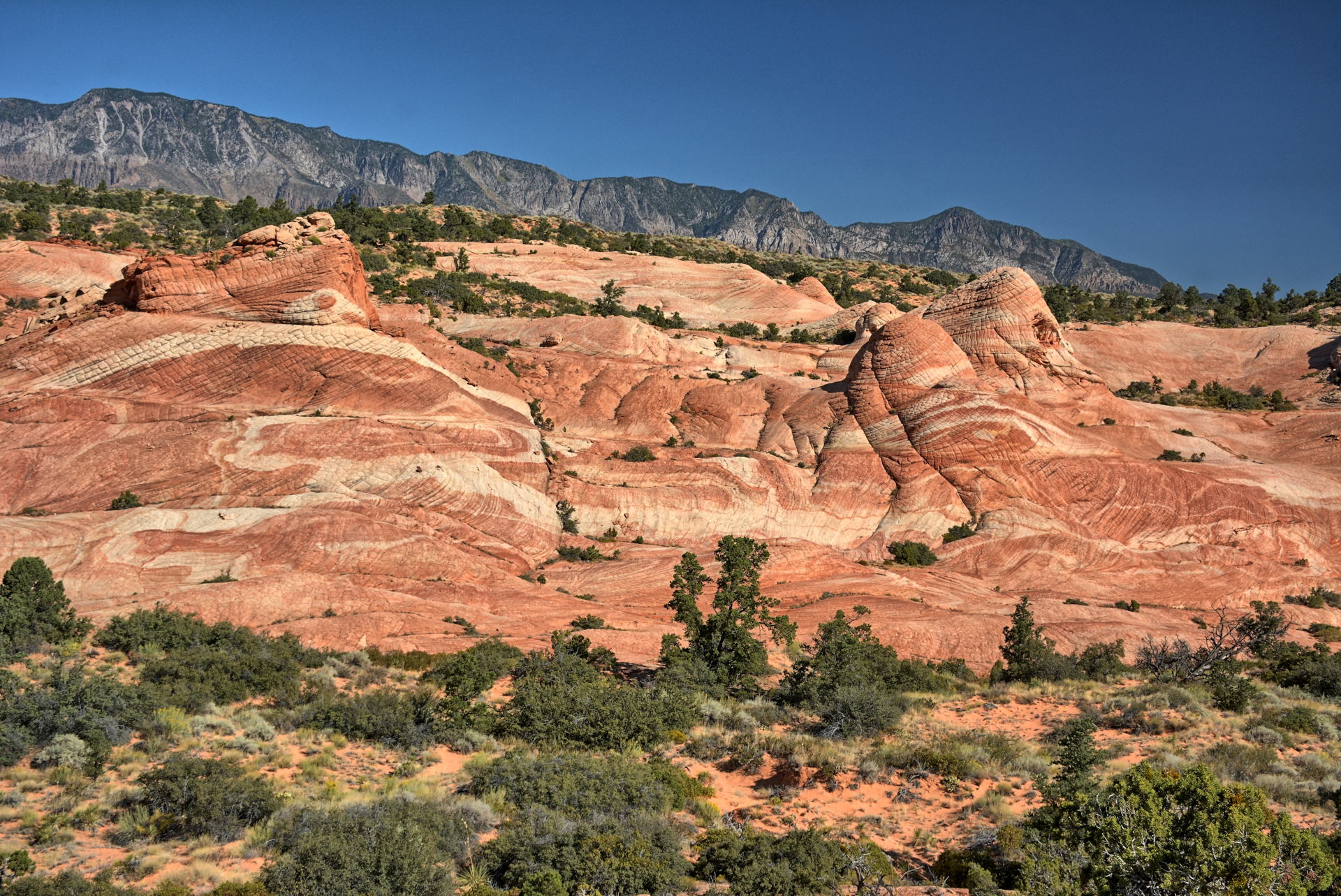
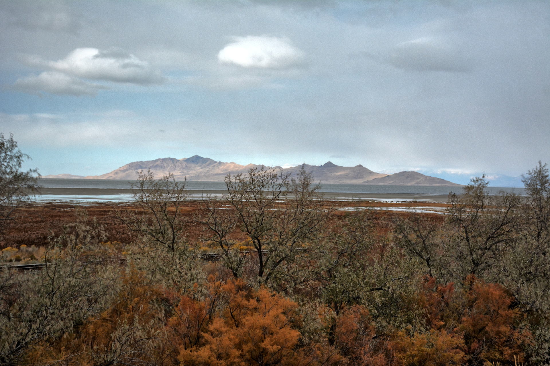
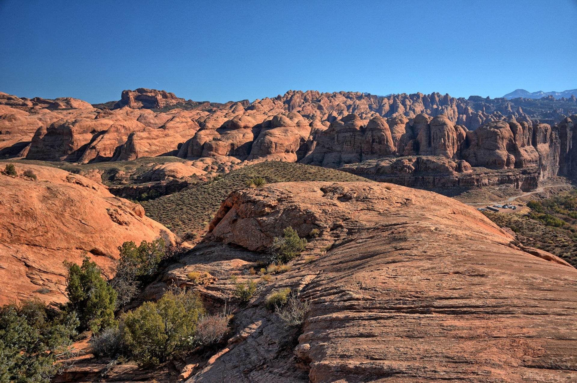
Antelope Island - Great Salt Lake, Johnson Pass, 27 October 2019
Aerial Video, Skull Valley, 26 October 2019
Aerial Video, Fisher/Johnson Pass, 27 October 2019
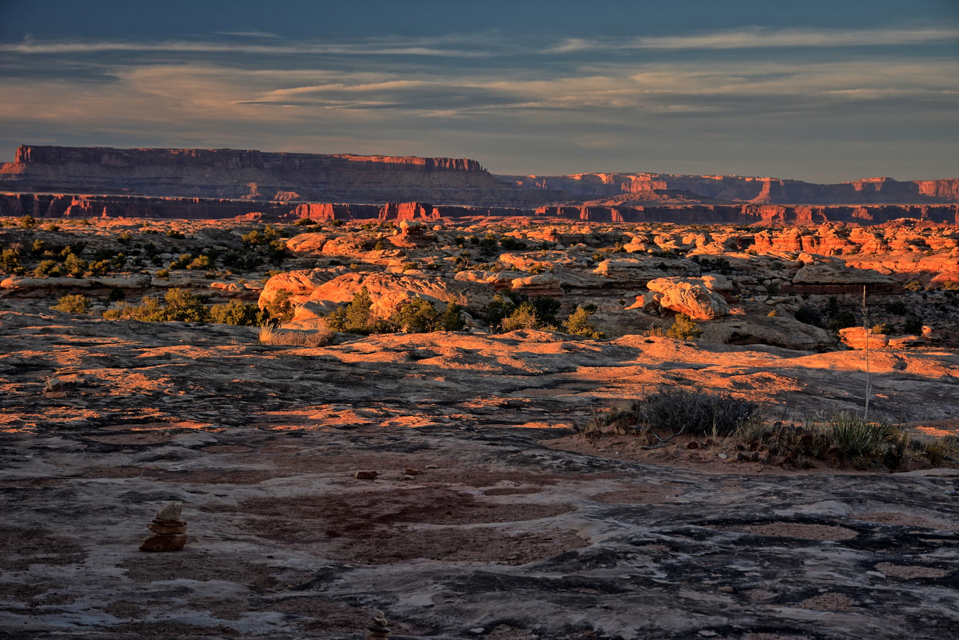
Weekend #6 was really four days long. We finished the engineering
development work on Friday, 1 November, and had to wait a couple weeks to
get the final production version of the software changes we had been testing.
With flight test over, I took a few days off and spent Saturday, 2 November to
Tuesday, 5 November visiting southern Utah before I flew home on Wednesday.
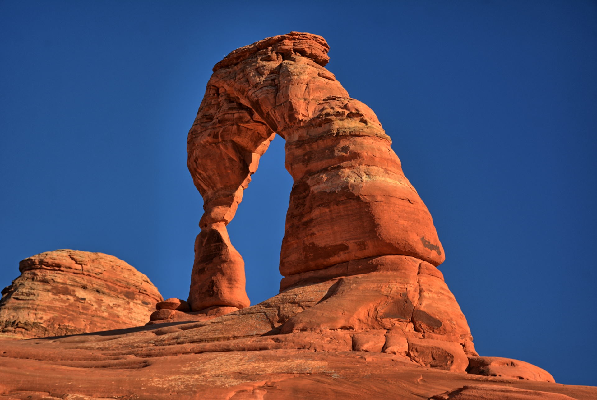
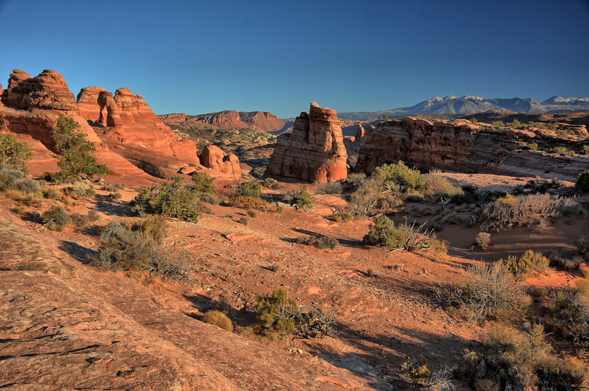
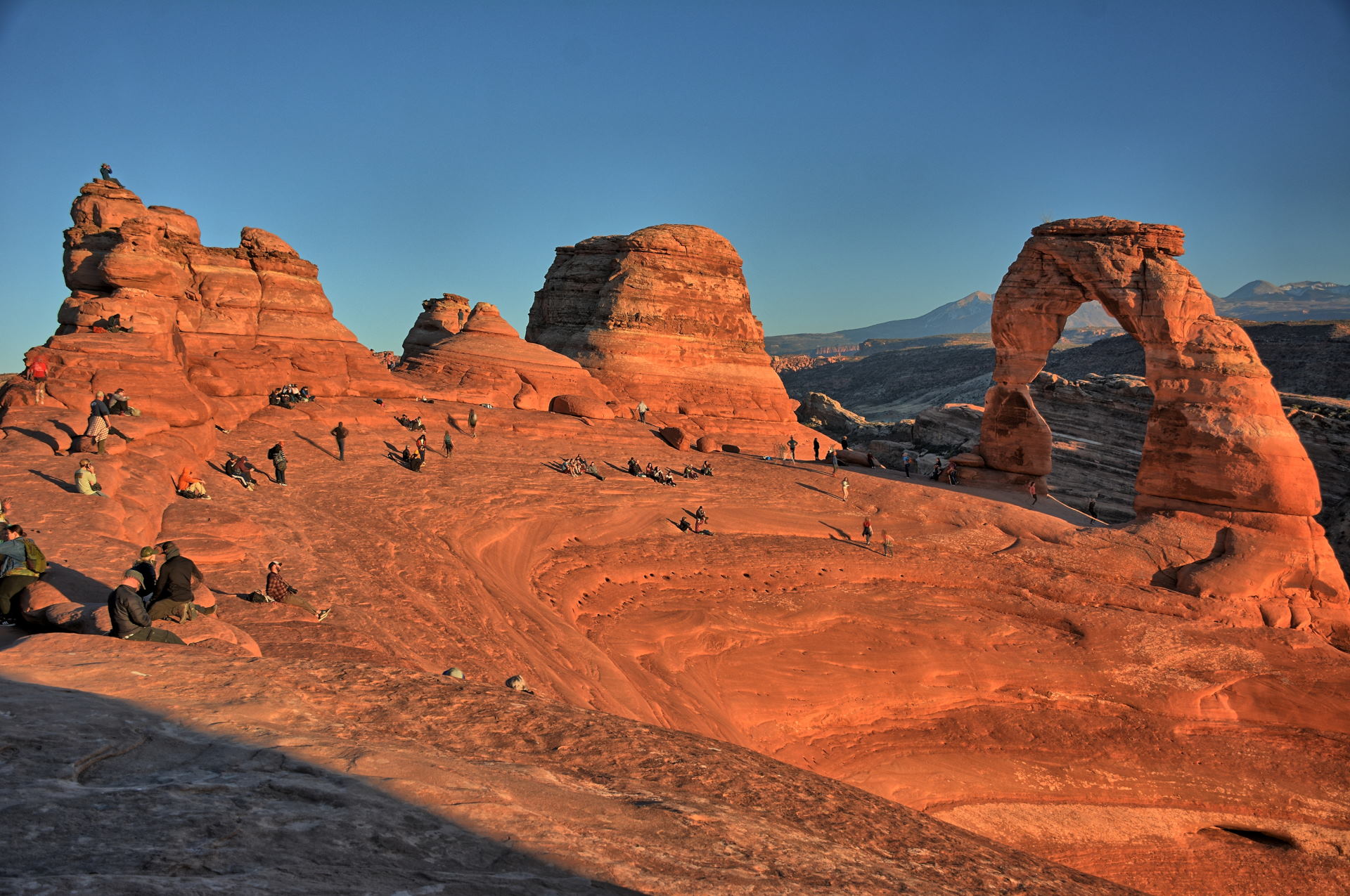
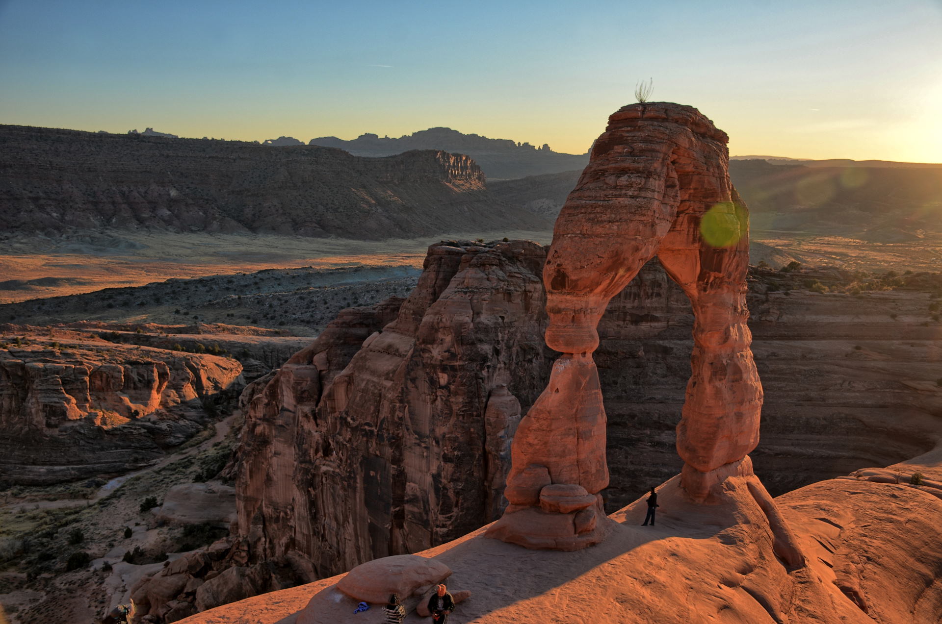
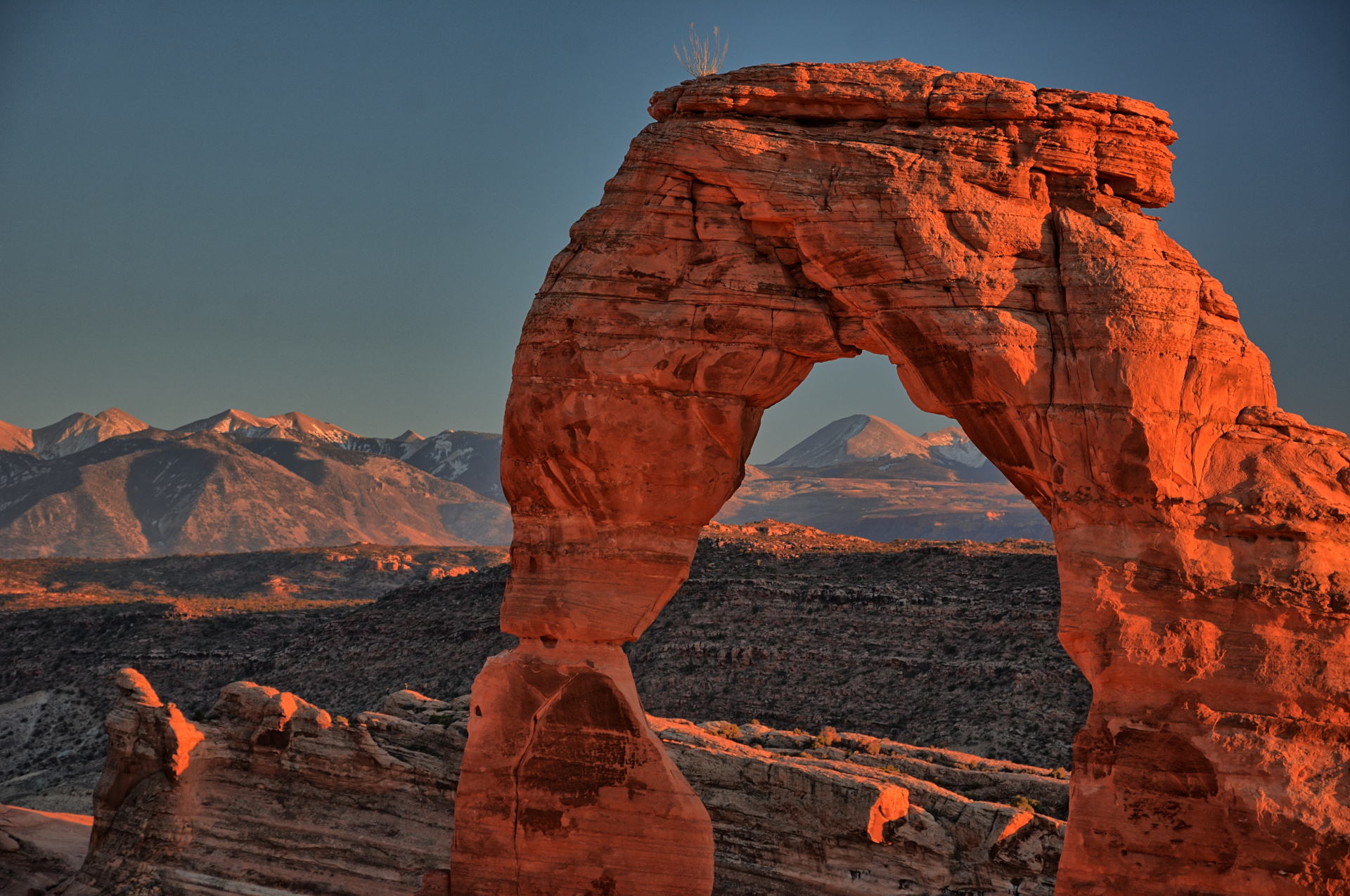
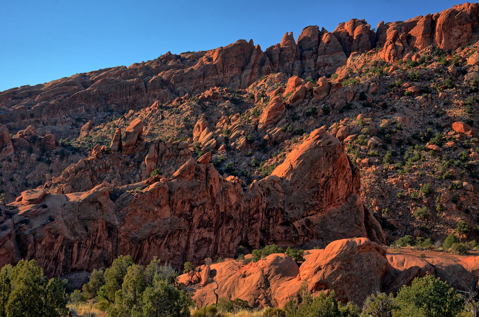
On Saturday, I drove from Dugway to Arches National Park and hiked up to
Delicate Arch. As I always do, I spent several hours hiking all over the cliffs
across, below, and above Delicate Arch. I drove into Moab for dinner at Zax's, and then camped at
Williams Bottom Campground on the Colorado River on
Potash Road.
On Sunday, I drove further out along Potash Road, up above the
potash settling ponds on the 4WD road, and flew my RC aircraft at a few different locations,
including out over the Colorado River. I returned to the paved road closer
to Moab and
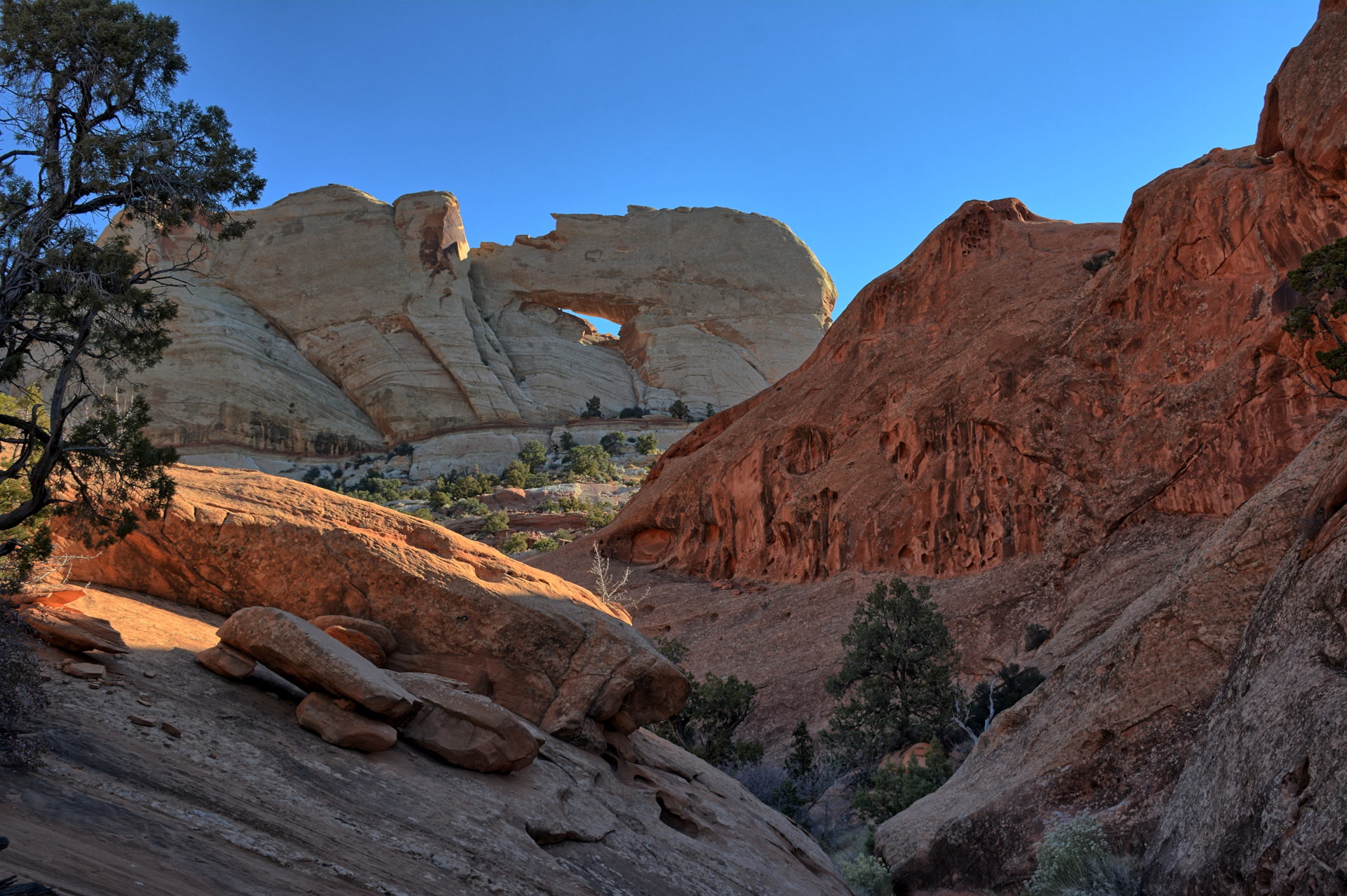
hiked out to Longbow Arch on the Poison Spider Mesa, flying one of my quadcopters a couple times on the trail. I then drove back into Moab for lunch,
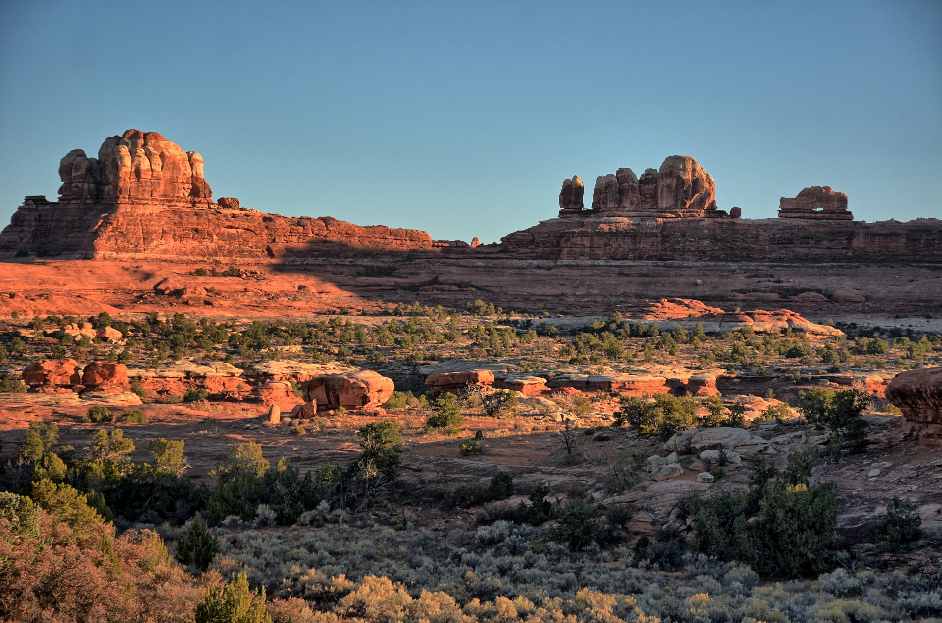
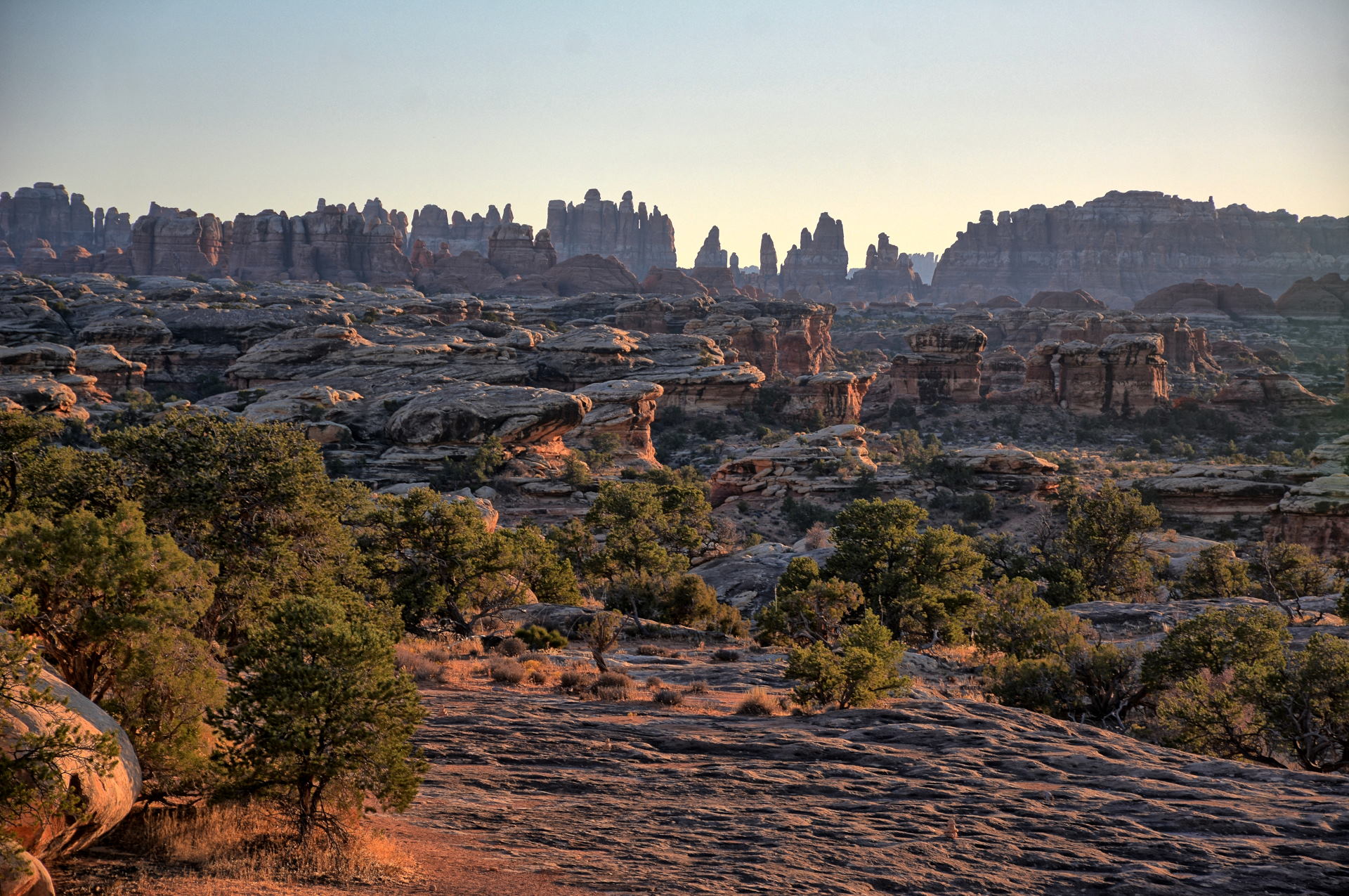
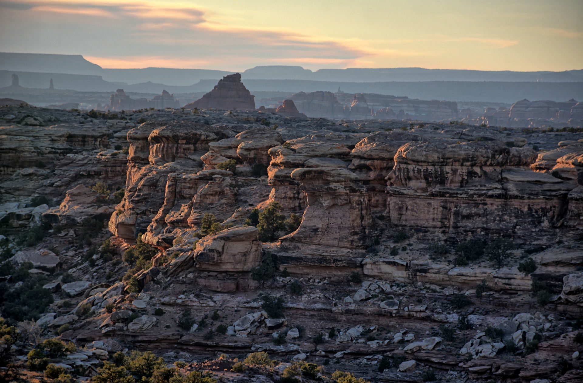
and then headed south towards the Needles section of Canyonlands National Park.
I stopped at Wilson Arch south of Moab, and also headed out east into some open
lands to fly my RC aircraft a few more times. I drove west towards Canyonlands, stopping at
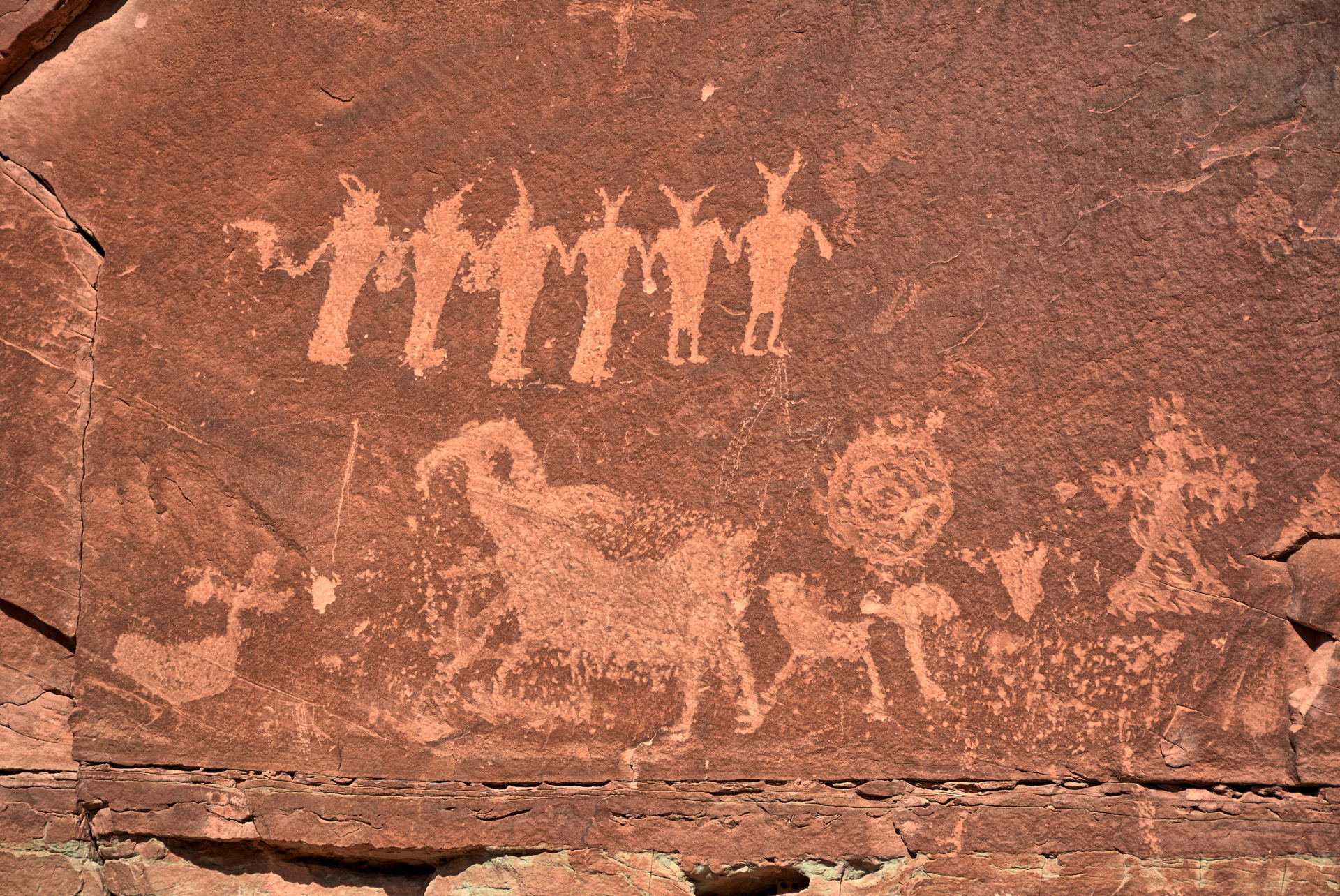
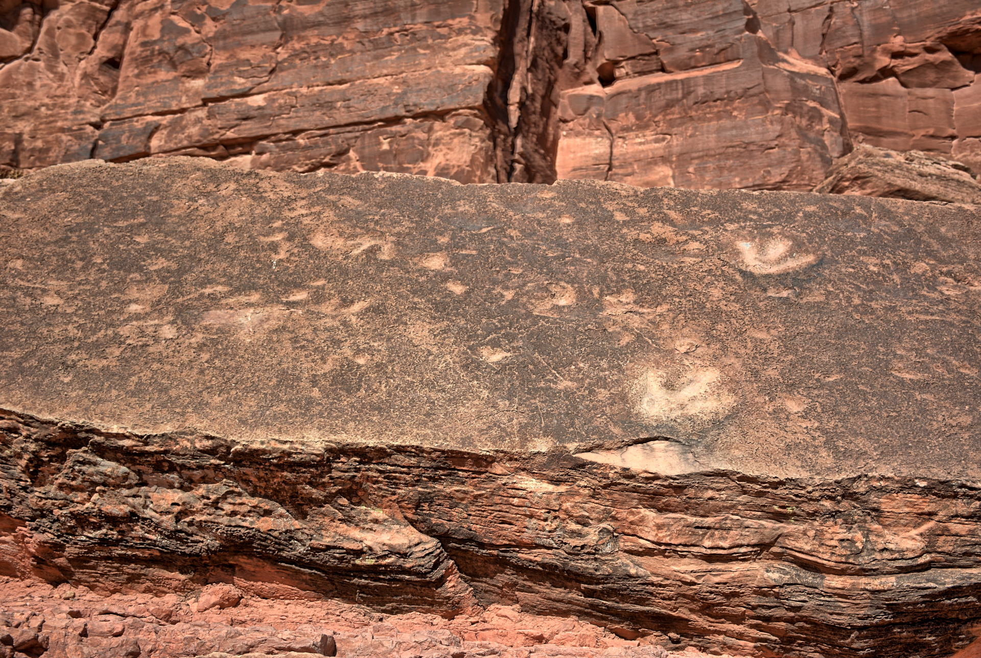
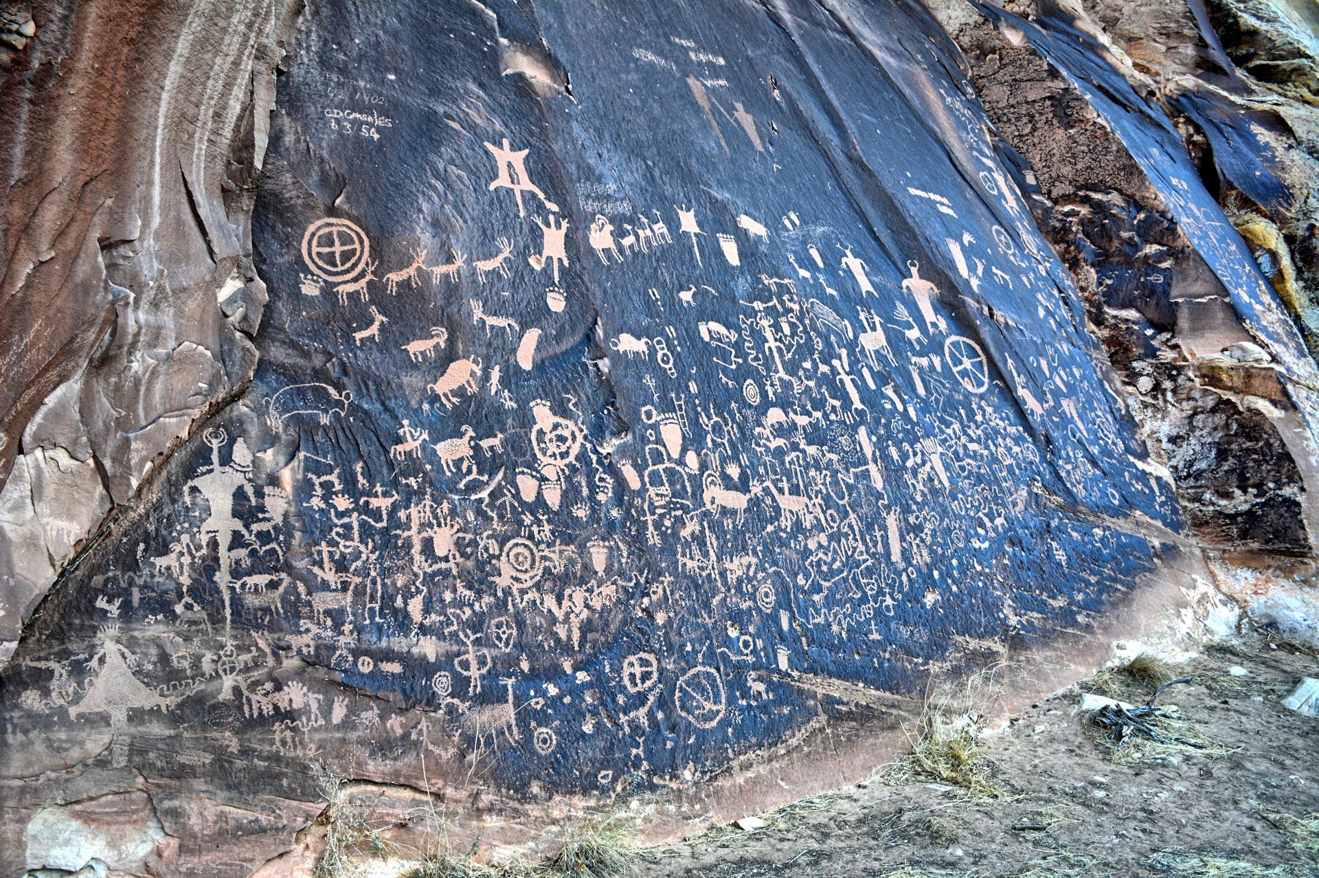
Newspaper Rock, and then flew in the canyon
before reaching the park. I spent the evening and sunset at several viewpoints in the Needles
section, before going back east and then south of Blanding, where I camped
for the night.
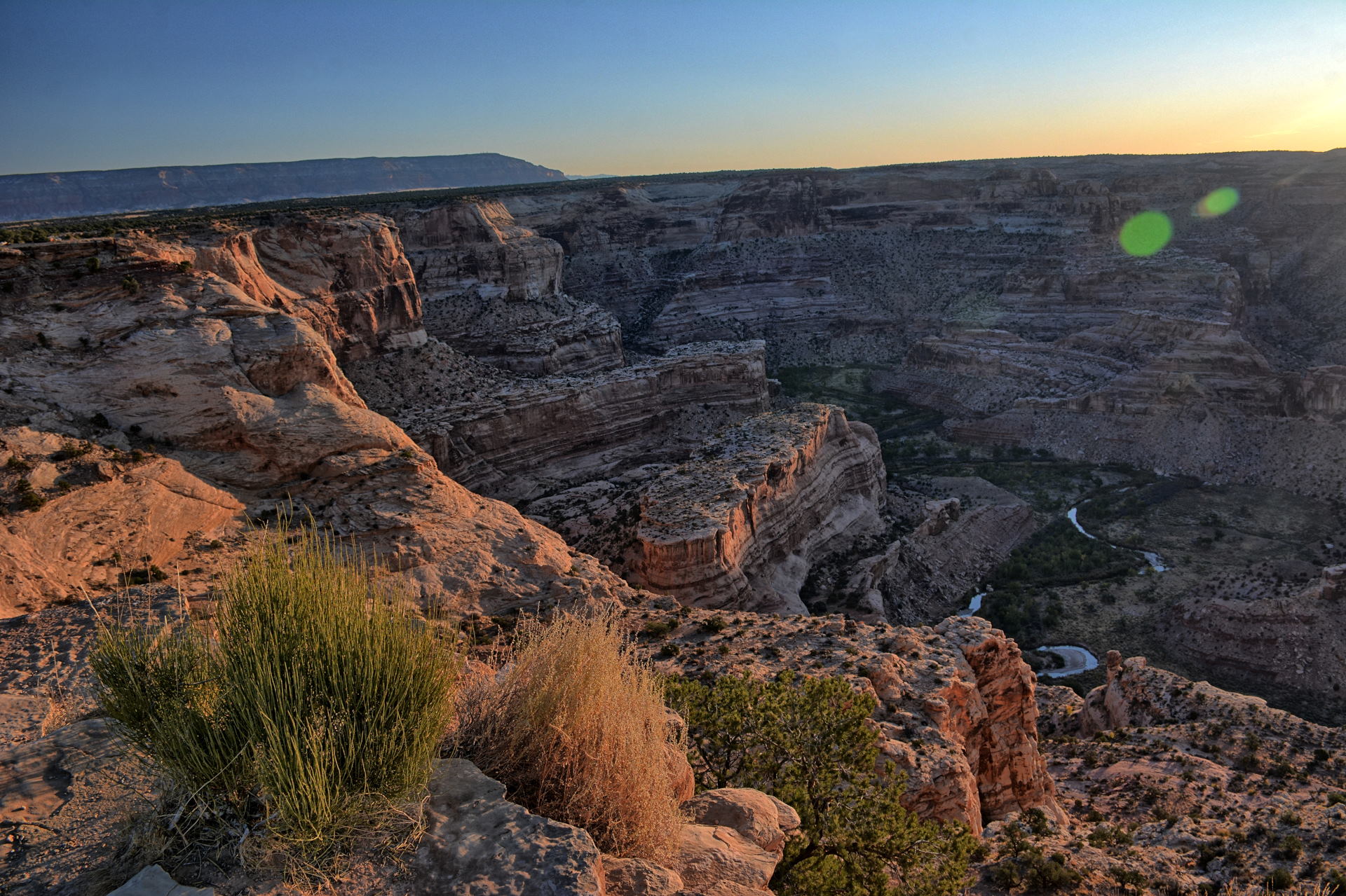
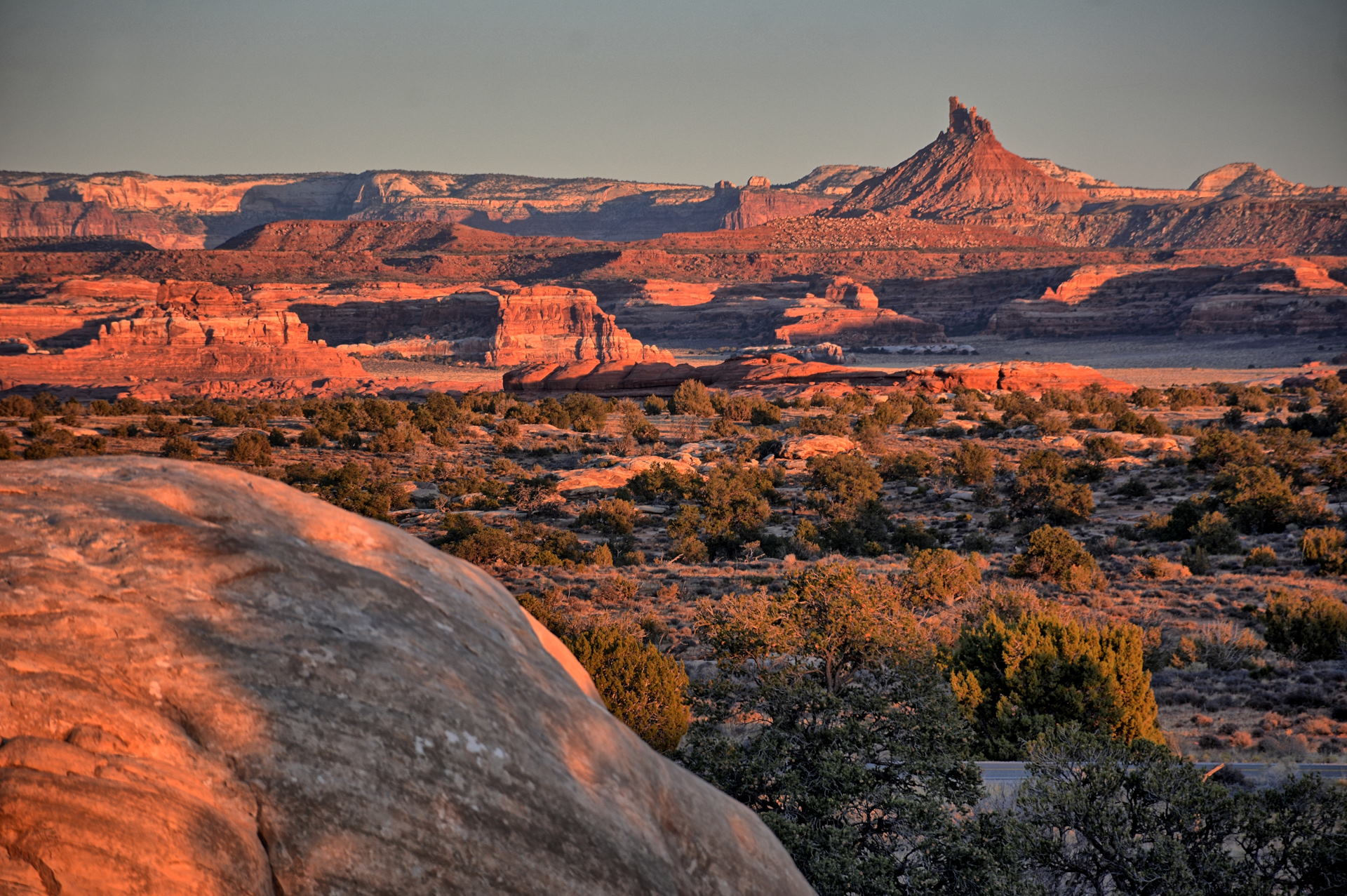
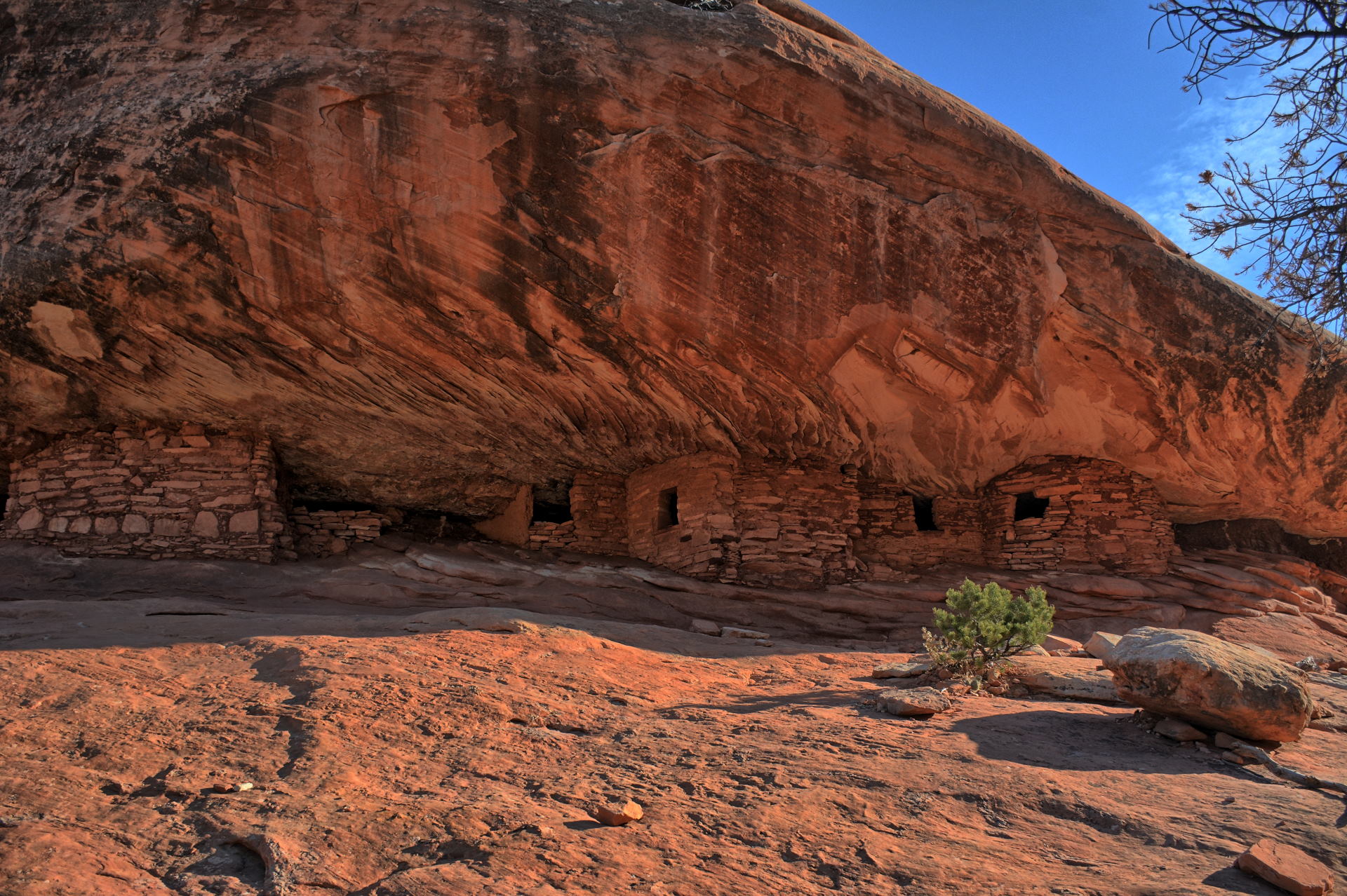
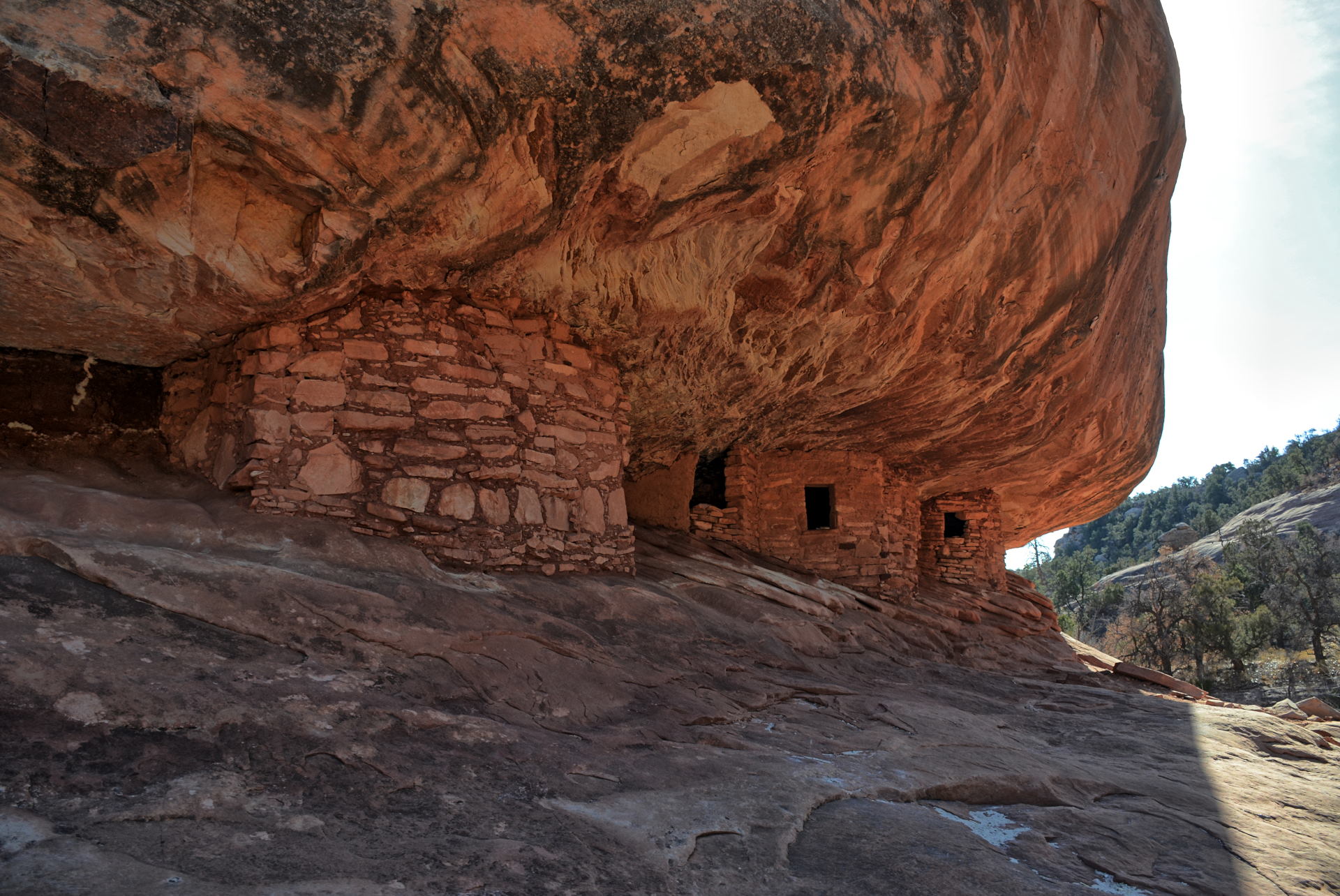
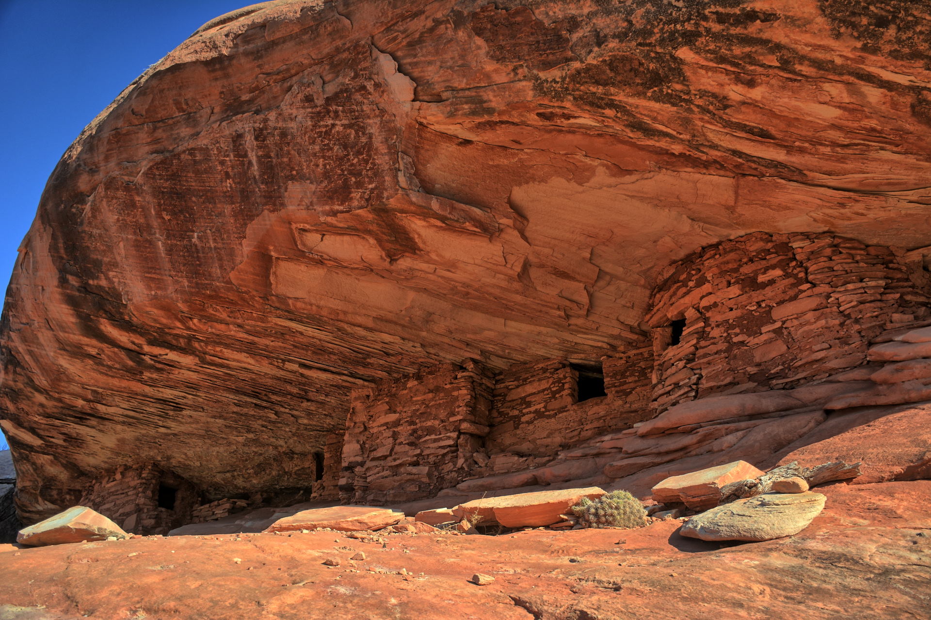
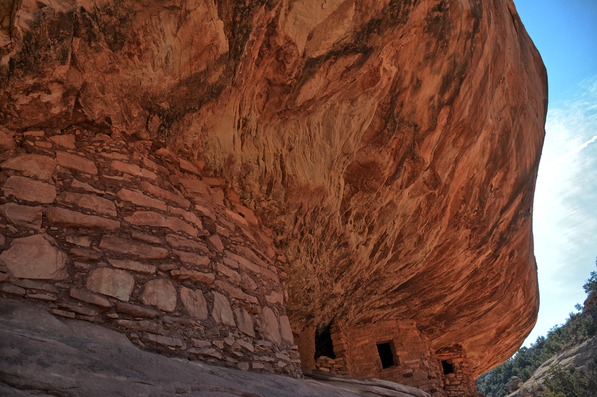
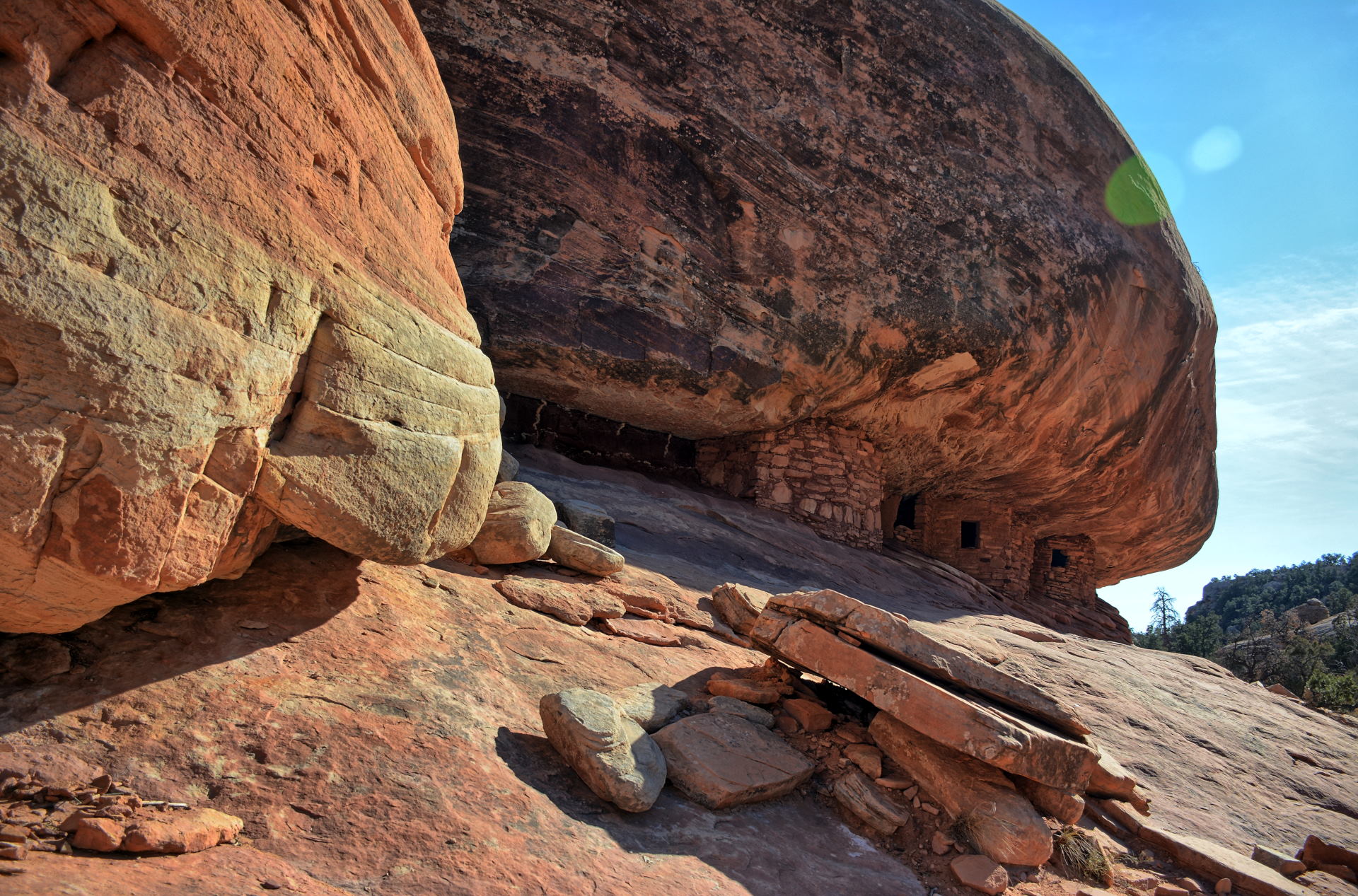
On
Monday I hiked out to the House On Fire Indian ruins, about halfway in between Blanding and Natural
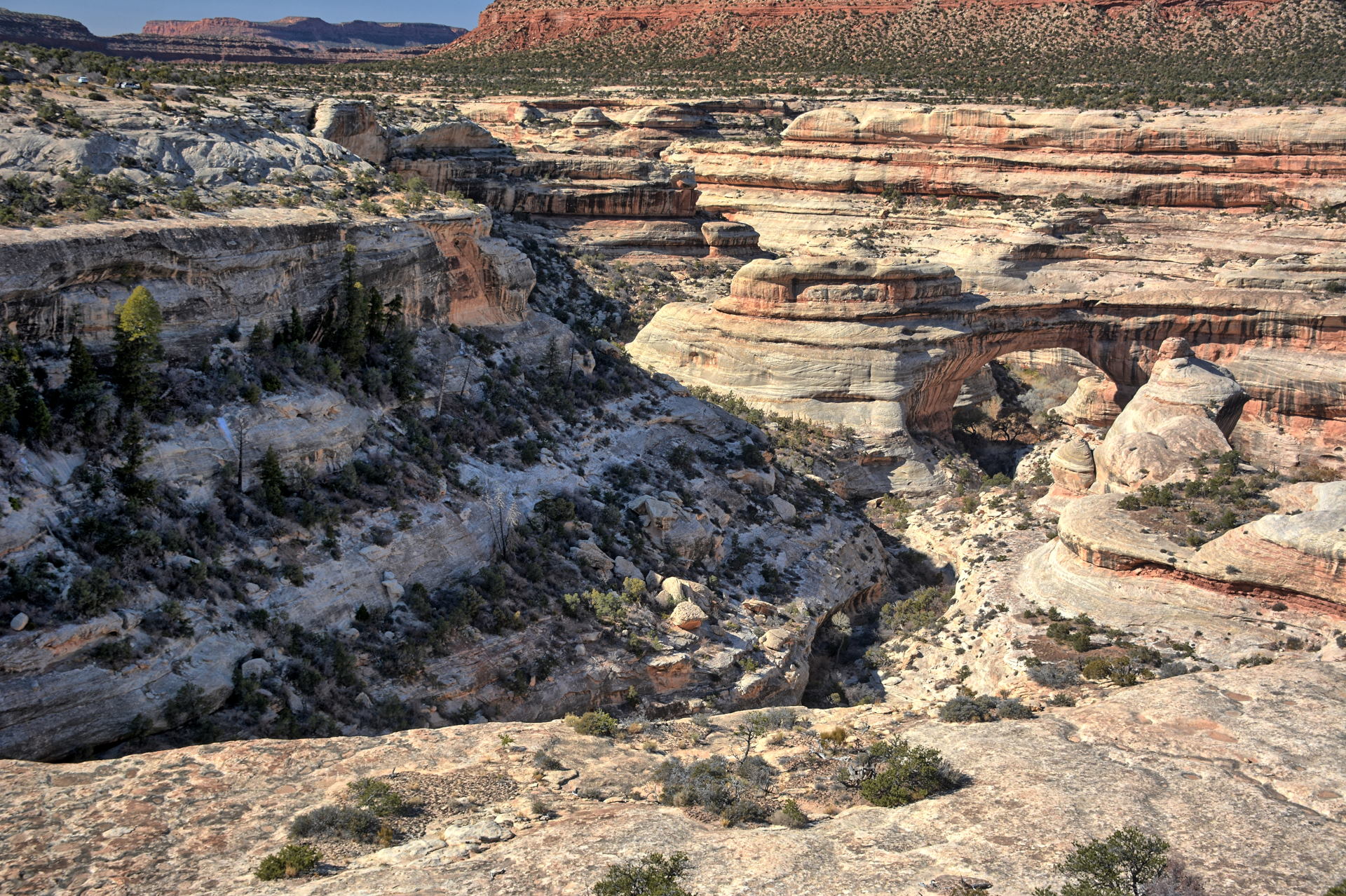
Bridges National Monument. I then continued on to
Natural Bridges National
Monument, hiking a few trails, before moving on further west past Fry
Canyon and to the
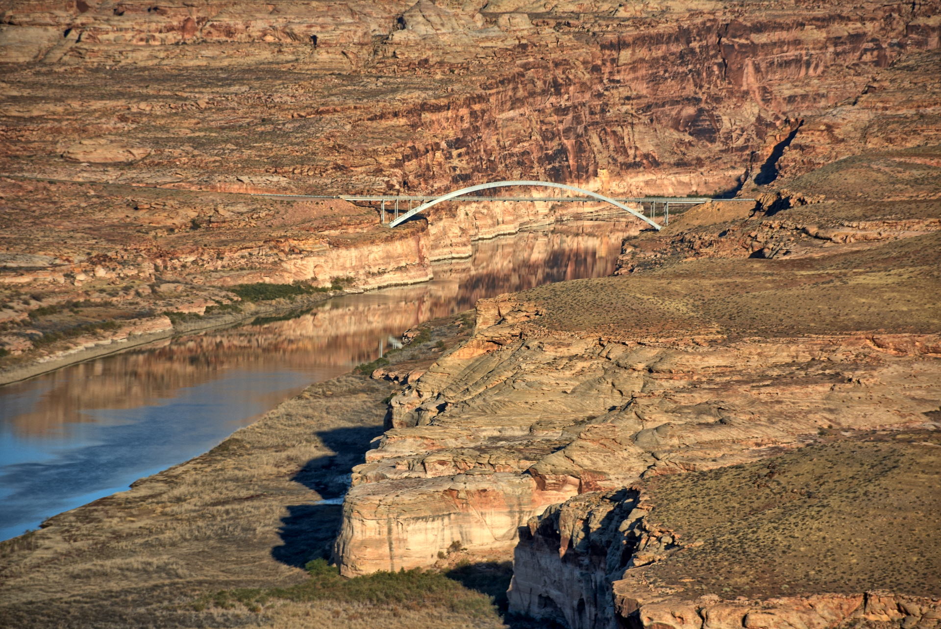
Glen Canyon National
Recreation Area. I stopped at the Hite overlook on the Colorado River in the late afternoon, and
drove north towards Hanksville. Before reaching Hanksville I
took the turn-off on Utah 276 to the southwest towards the Bullfrog marina. Just
before reaching Bullfrog, the Notom-Bullfrog Road branches off to the northwest.
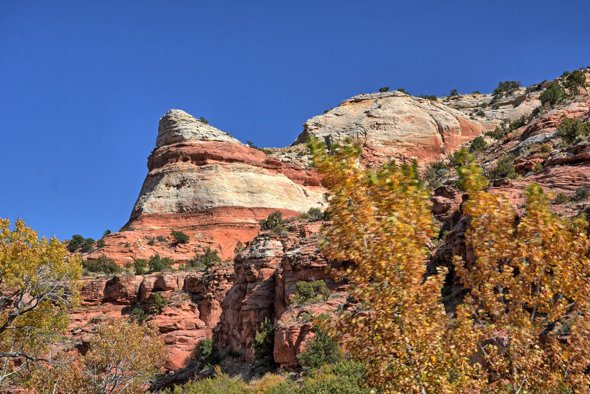
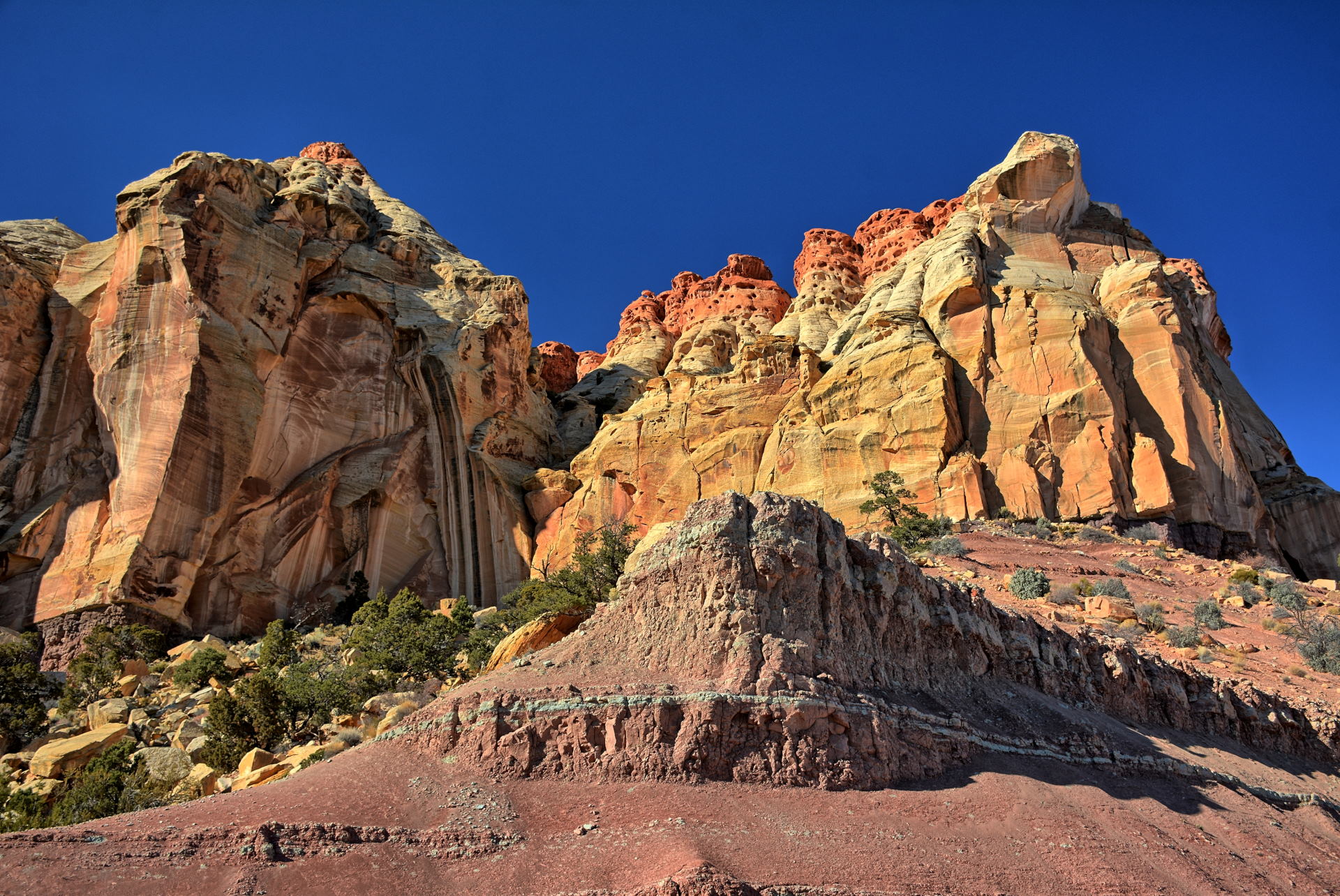
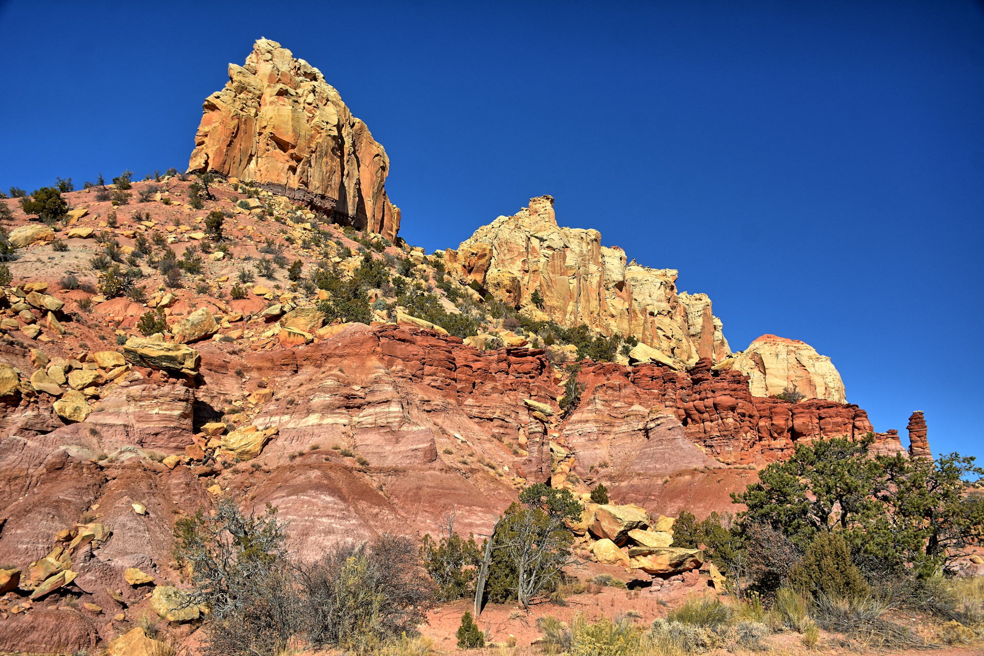
This road passes through the Waterpocket Fold in Capitol Reef National Park,
which has some incredible rock formations. I camped that evening
just off
that road here, about halfway to the Capitol Reef National Park boundary.
On Tuesday I continued the drive to Capitol Reef National Park, and then
took the Burr Trail Road switchbacks up, westbound out of
the Waterpocket Fold
towards Boulder. Just after the switchbacks, I stopped and
hiked out to the
Strike Valley Overlook. Any good 4WD vehicle can drive almost to the
overlook, but I did not have a 4WD rental vehicle at this point, so I did the entire Strike Valley overlook hike on foot. The view is worth the hike. I returned to my car, and continued on the Burr Trail
Road to Boulder, headed north over Boulder Mountain, and had a late lunch in
Torrey. There are lots of great views along the Burr Trail and Boulder
Mountain, so I stopped many times for photos and flying. I made it back to Salt
Lake City that evening, where I stayed in a hotel at the airport, and
caught a flight home on Wednesday morning.
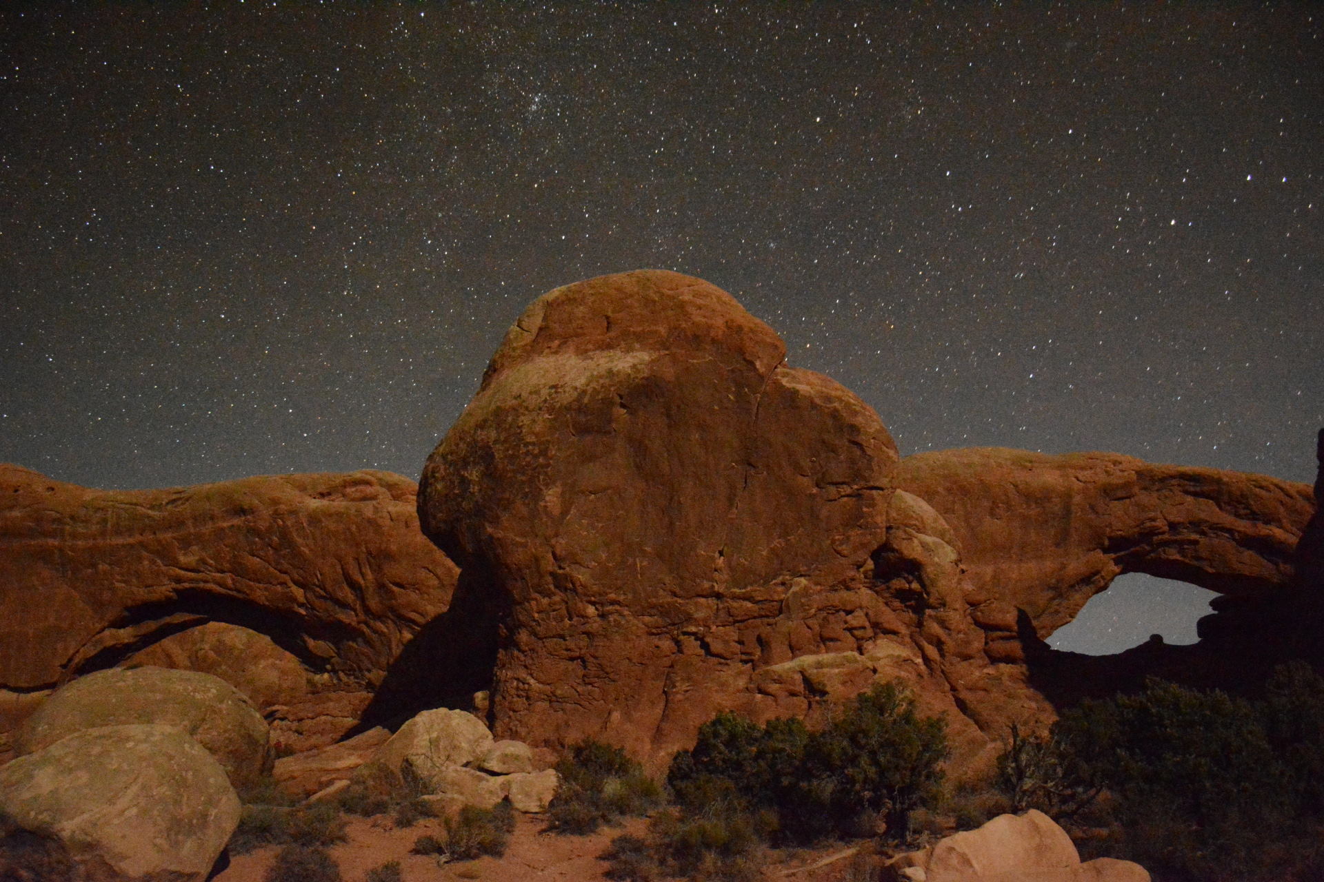
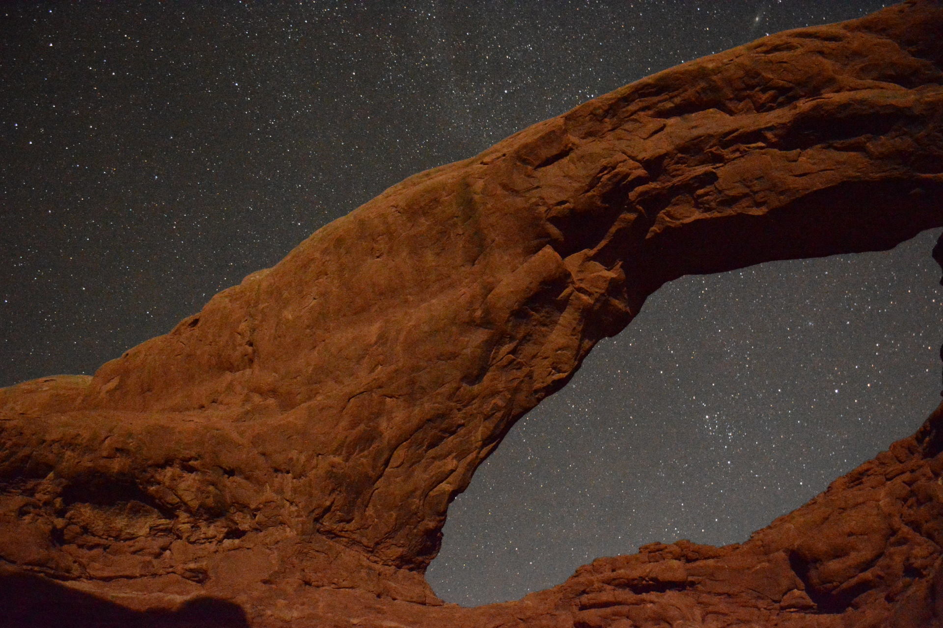
Arches National Park, Delicate Arch, North & South Windows at night, 2 November
2019
Moab, Potash Road - Colorado River, Poison Spider Mesa - Longbow Arch &
Petroglyphs & Dinosaur Tracks, 3 November 2019
Potash Road drive, 3 November 2019
Longbow Arch hike, 3 November 2019
Aerial Video,
Poison Spider Mesa - Moab, 3
November 2019
Aerial Video,
Potash Rd - settling ponds, 3 November
2019
Aerial Video,
Potash Rd - Colorado River, 3 November 2019
Aerial Video,
Moab to Needles: Utah-114 x2, Utah-211, 3 November 2019
Wilson Arch, Newspaper Rock, 3 November 2019
Canyonlands National Park, Needles Section, 3 November 2019
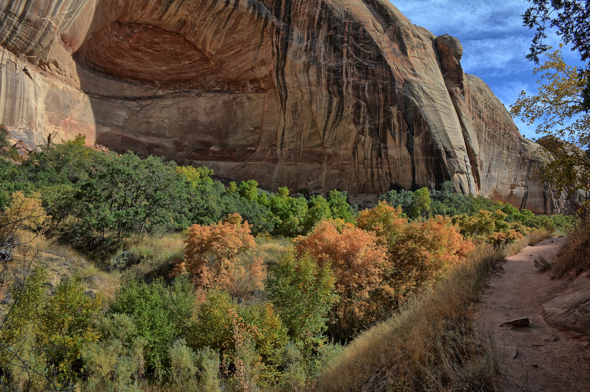
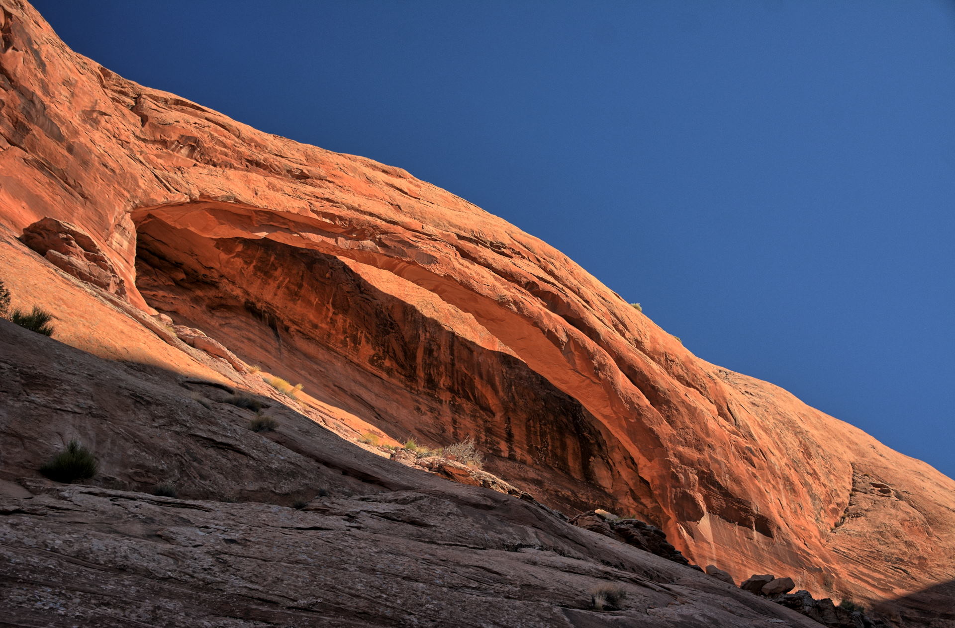
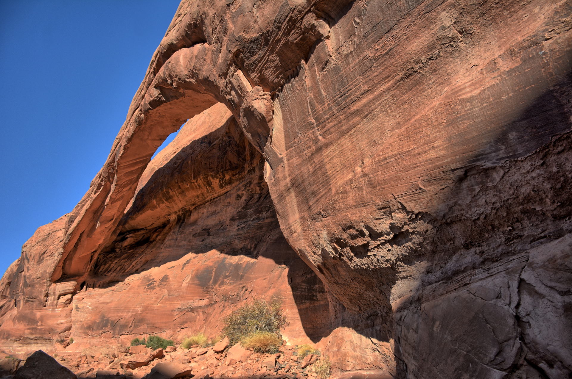
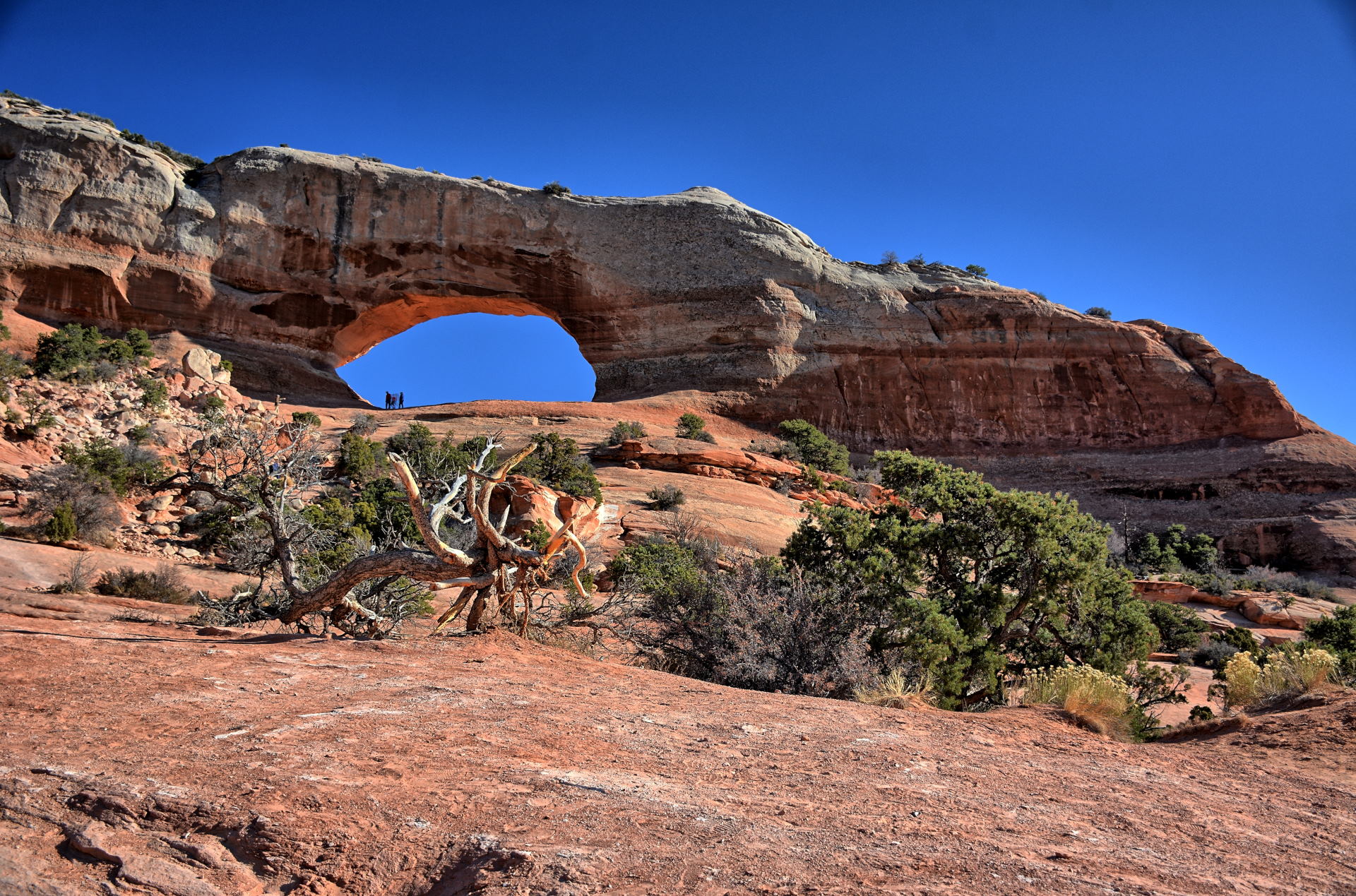
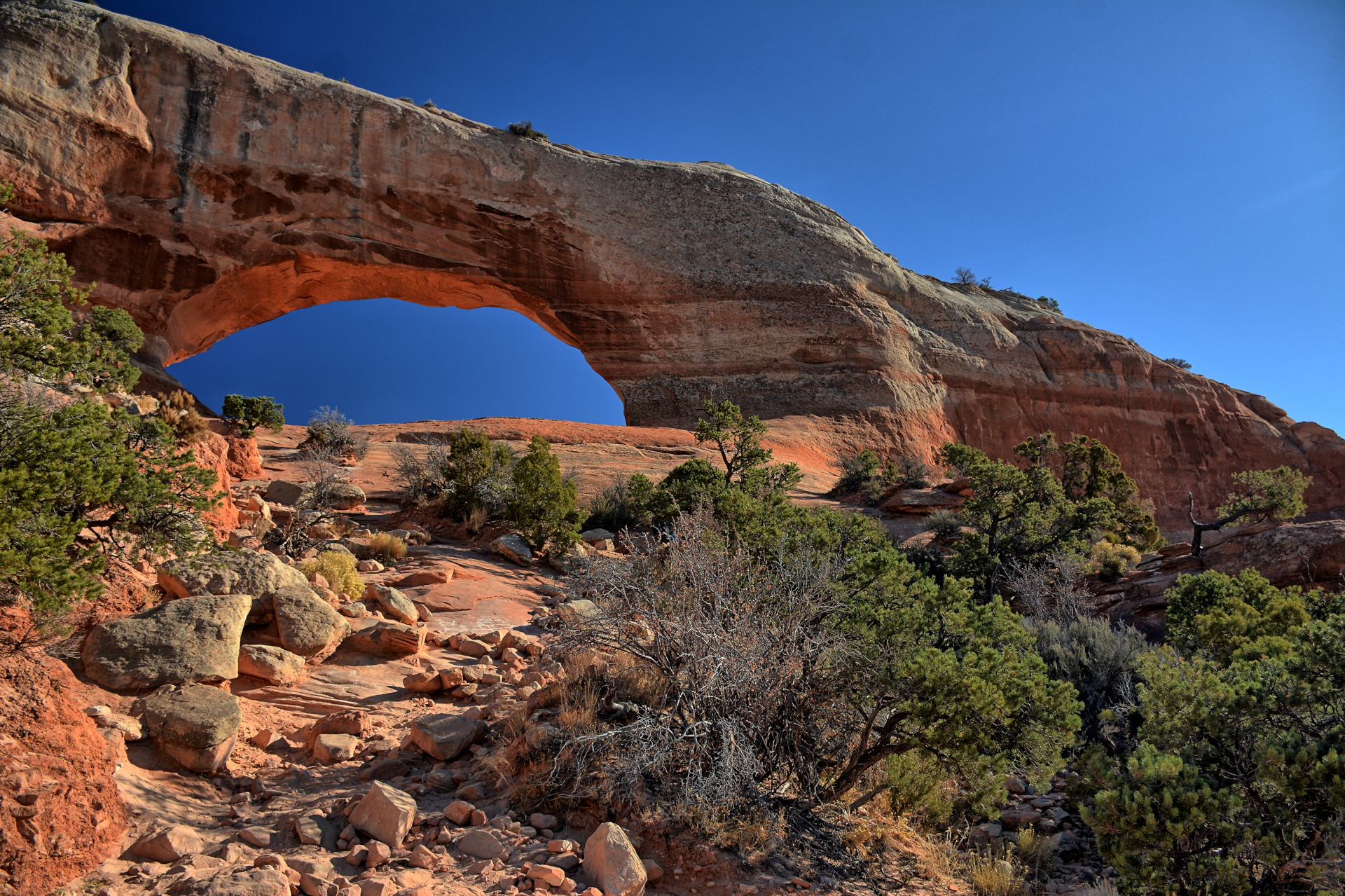
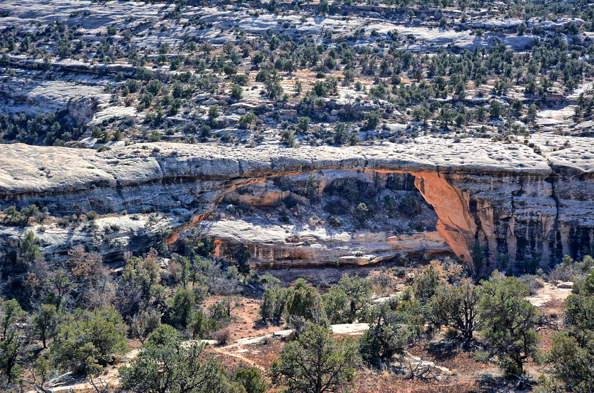
House On Fire Indian Ruins, 4 November 2019
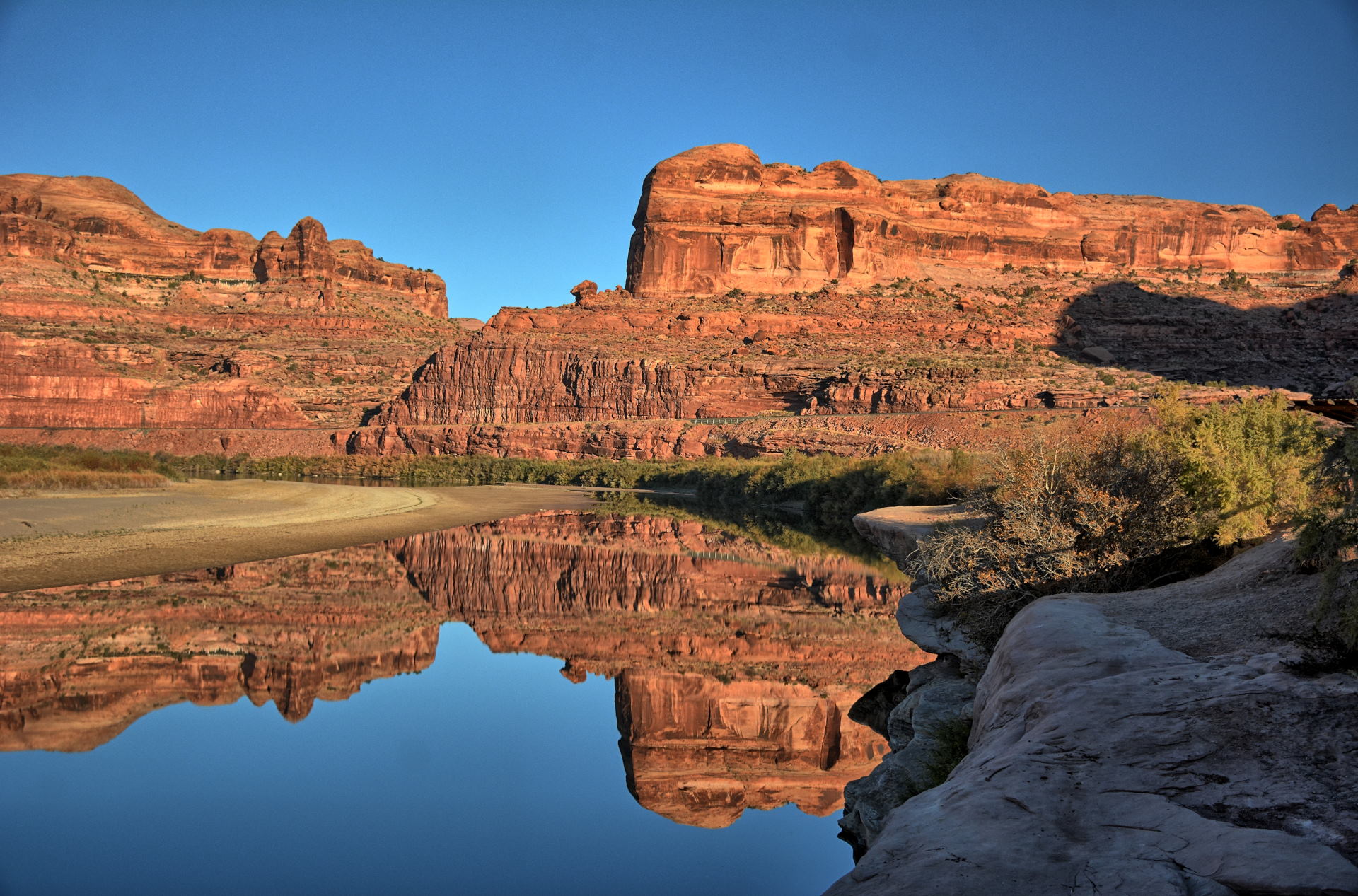
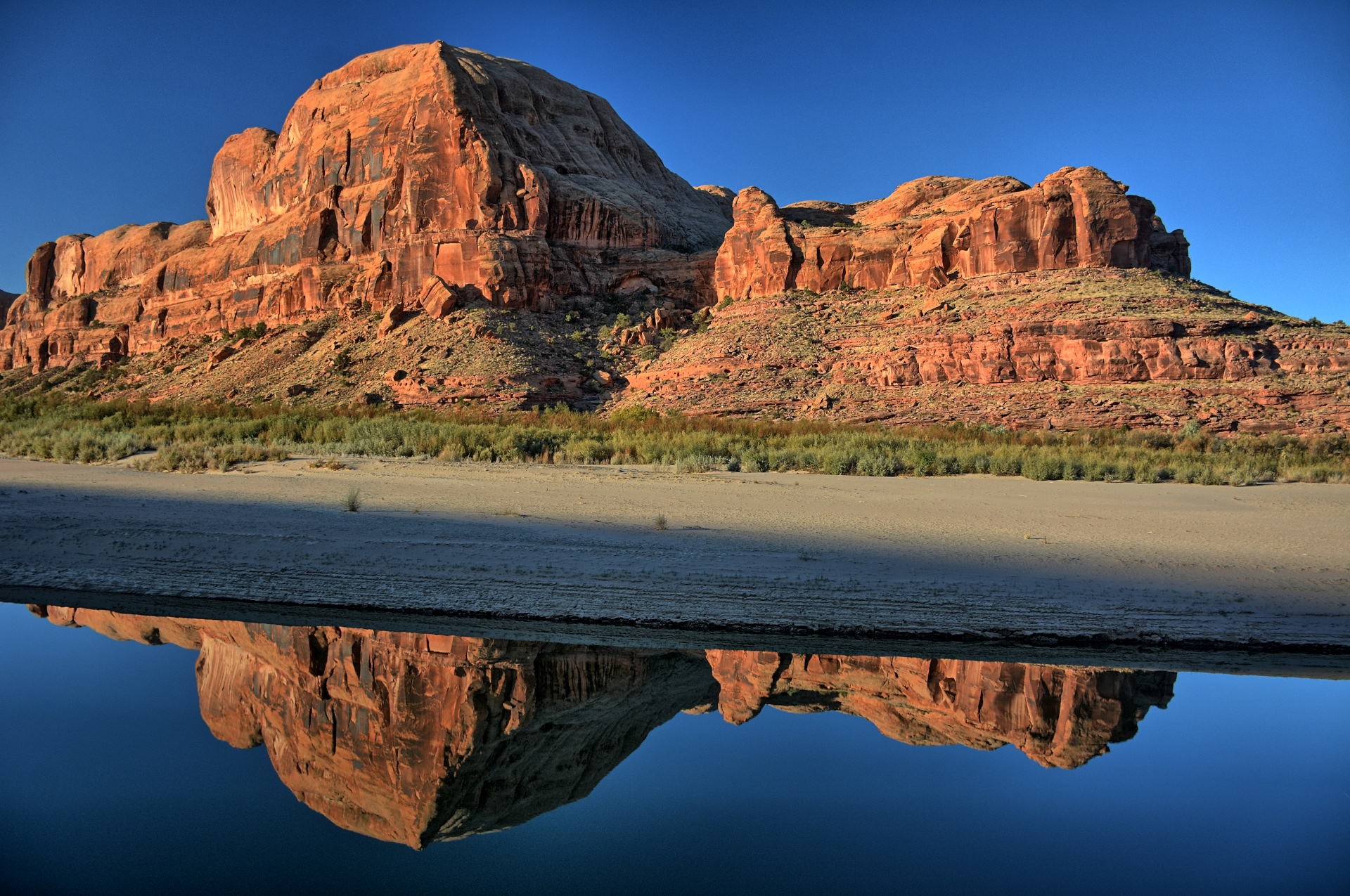
Natural Bridges National Monument, Hite Overlook, Glen Canyon National Recreation Area, 4
November 2019
Timelapse photos of House On Fire Indian
Ruins, 4 November 2019
Aerial Video,
Utah-95, Utah-276, 4 November 2019
Aerial Video,
House On Fire trailhead, White & Fry Canyons, 4 November 2019
Aerial Video,
White Canyon x2, Utah-95, 4 November 2019
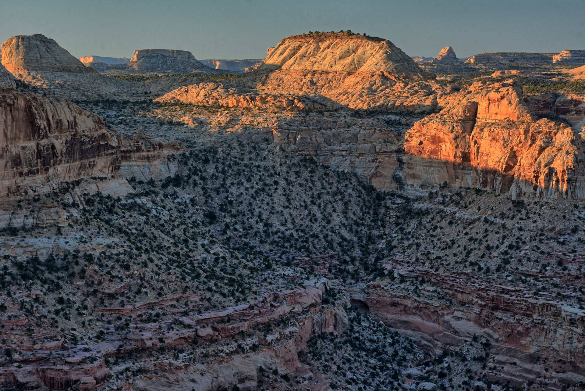
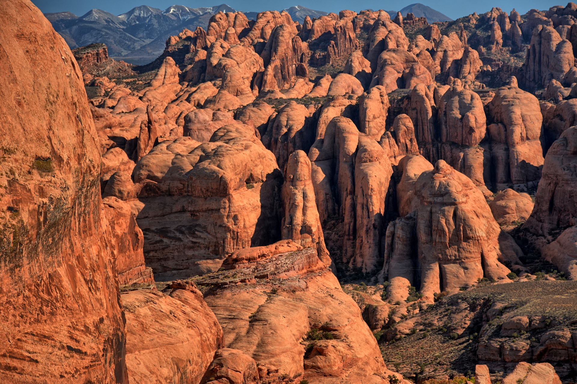
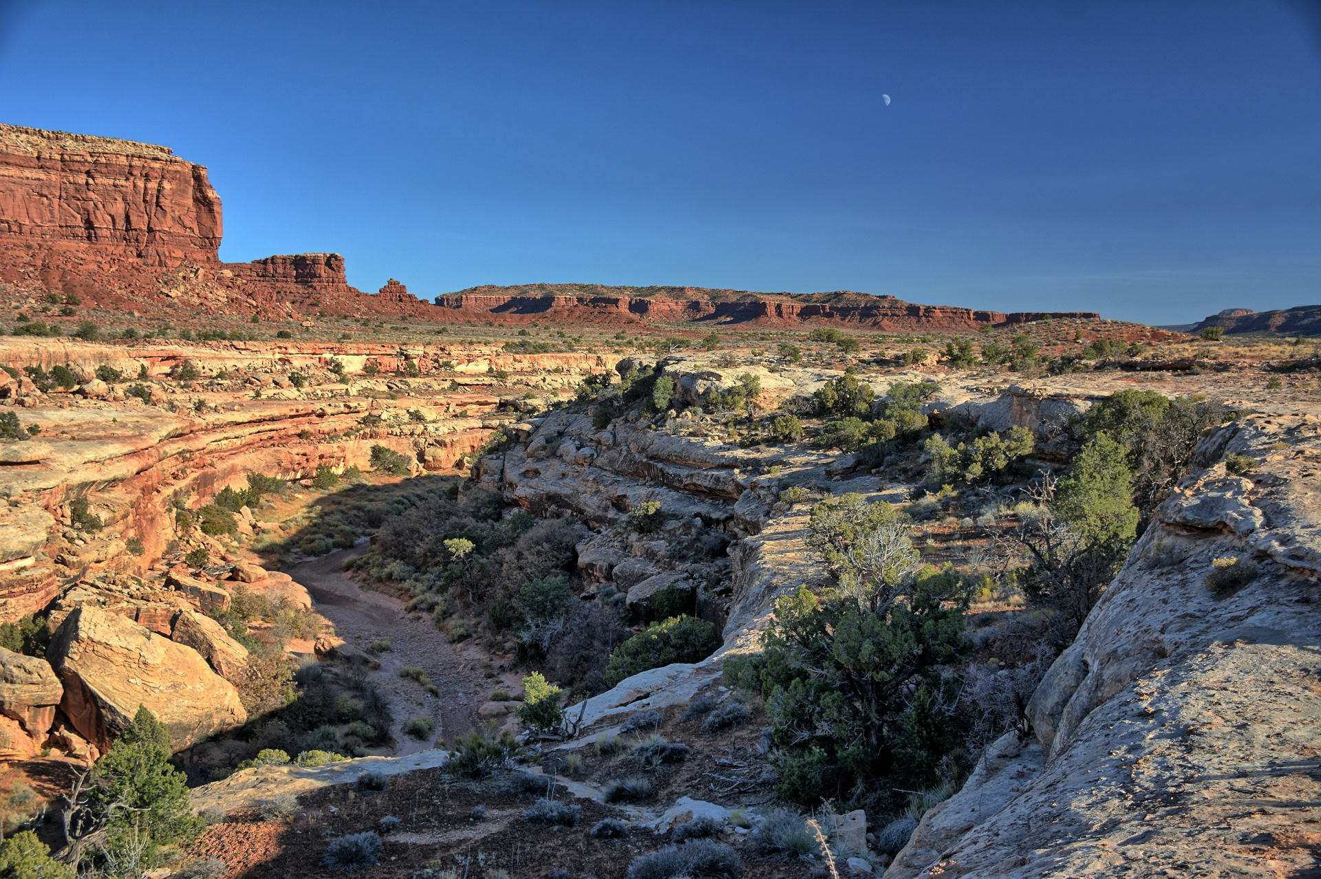
Capitol Reef National Park, Grand Staircase-Escalante National Monument, Strike
Valley Overlook, Burr
Trail Road, 5 November 2019
Burr Trail Road Switchbacks drive, 5 November
2019
I was home for about 10 days, then returned to Dugway for the final testing of
the new software. We flew Monday through Saturday the week before
Thanksgiving, but did not quite finish up all the flights we need, so I would be
coming back after Thanksgiving to complete everything.
Weekend #7 ended up much like weekend #6; I took a few days off after we finished
flying, but before I flew home. I had worked on Saturday, so this was a
three day weekend, Sunday, 24 November to Tuesday, 26 November. I had
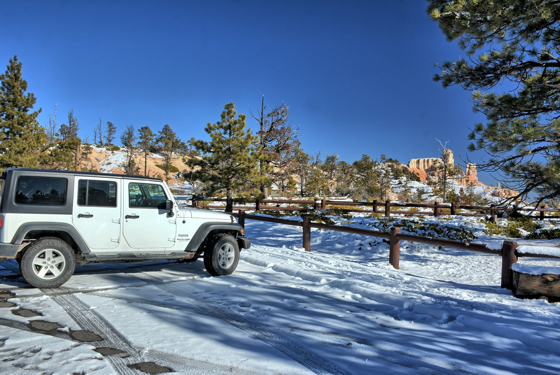
received a 4WD rental car for this week, so I planned to make use of it
when possible.
On
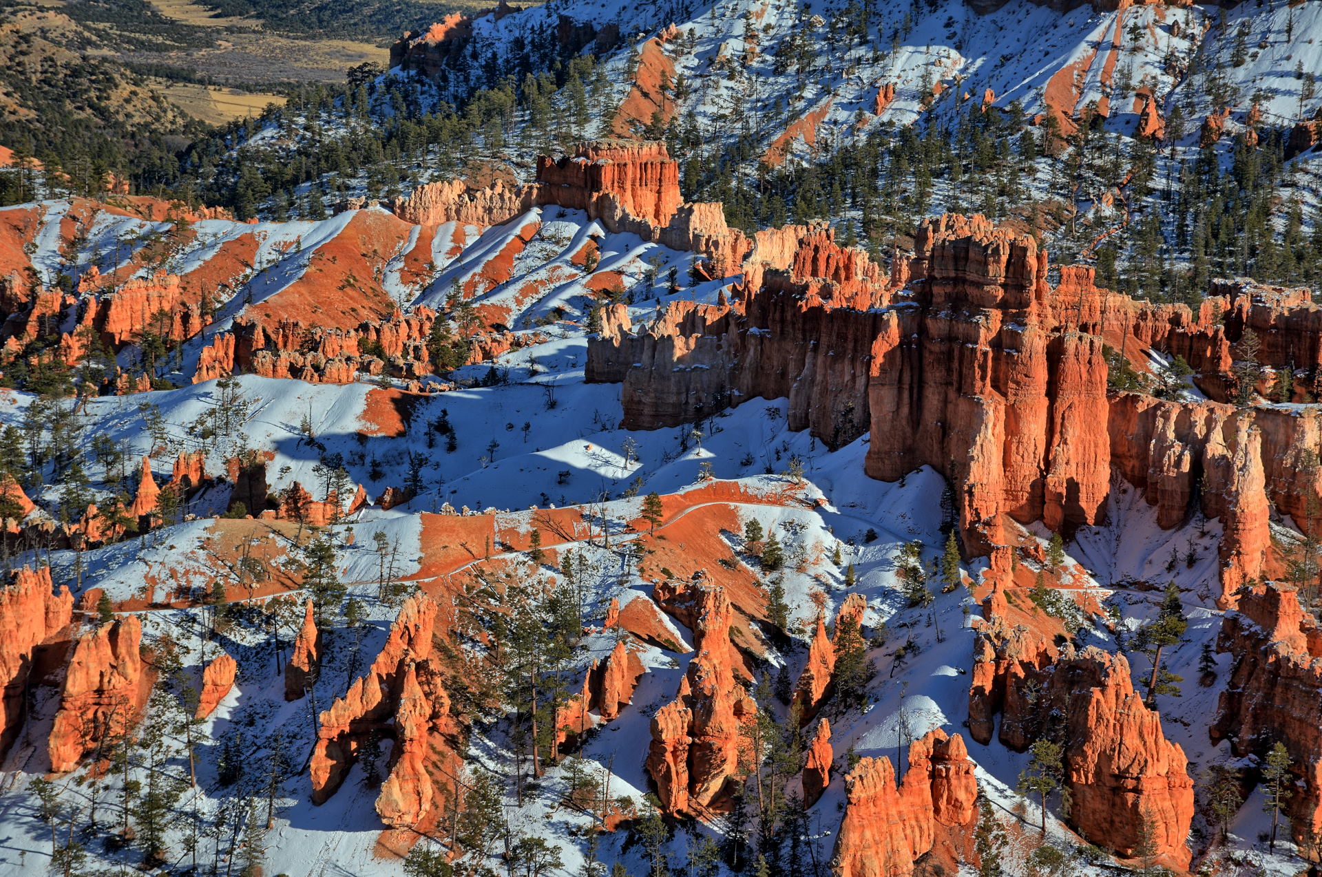
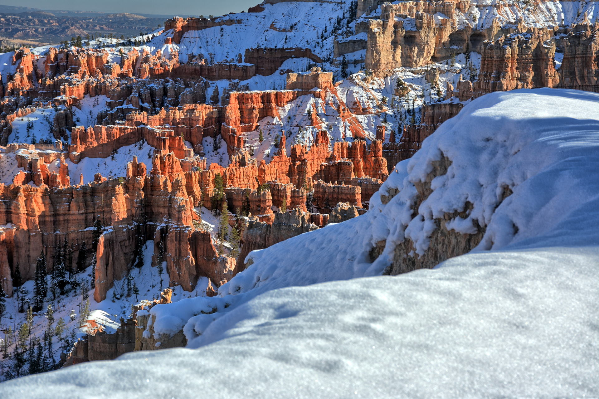
Sunday, I drove from Dugway to Bryce Canyon, planning on continuing east to
Kodachrome Basin State Park, and south along Cottonwood Canyon Road to Kanab.
However, the bad weather in the north of Utah was also hitting southern Utah as well, and rain
and snow had made
Cottonwood Canyon Road impassable. I spent the afternoon and sunset at Bryce
Canyon, had dinner at Ruby's, and decided to reverse the order of my last few
days. I drove back west, south and then west again through Zion National Park in
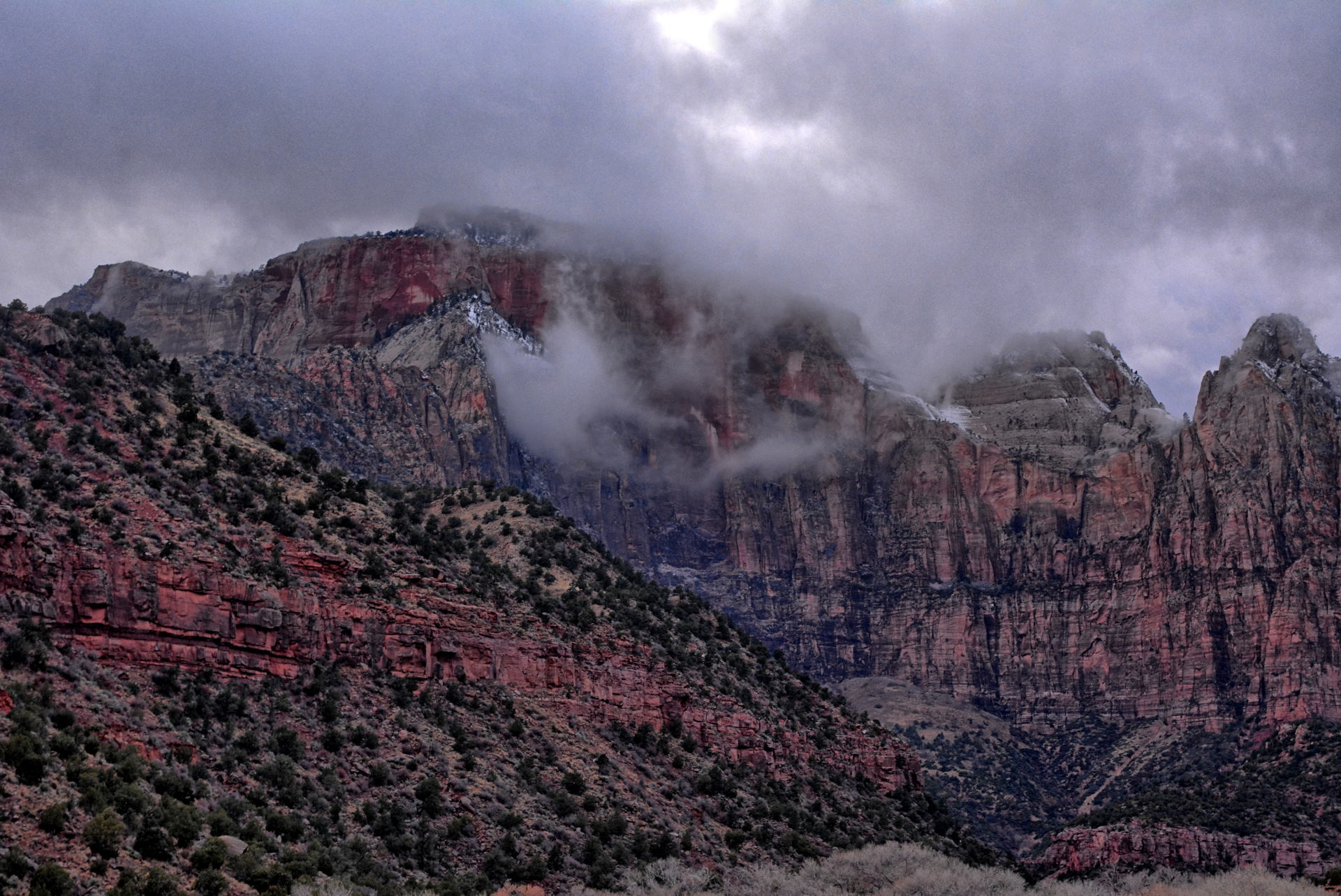
the dark, and to a St. George hotel for Sunday night.
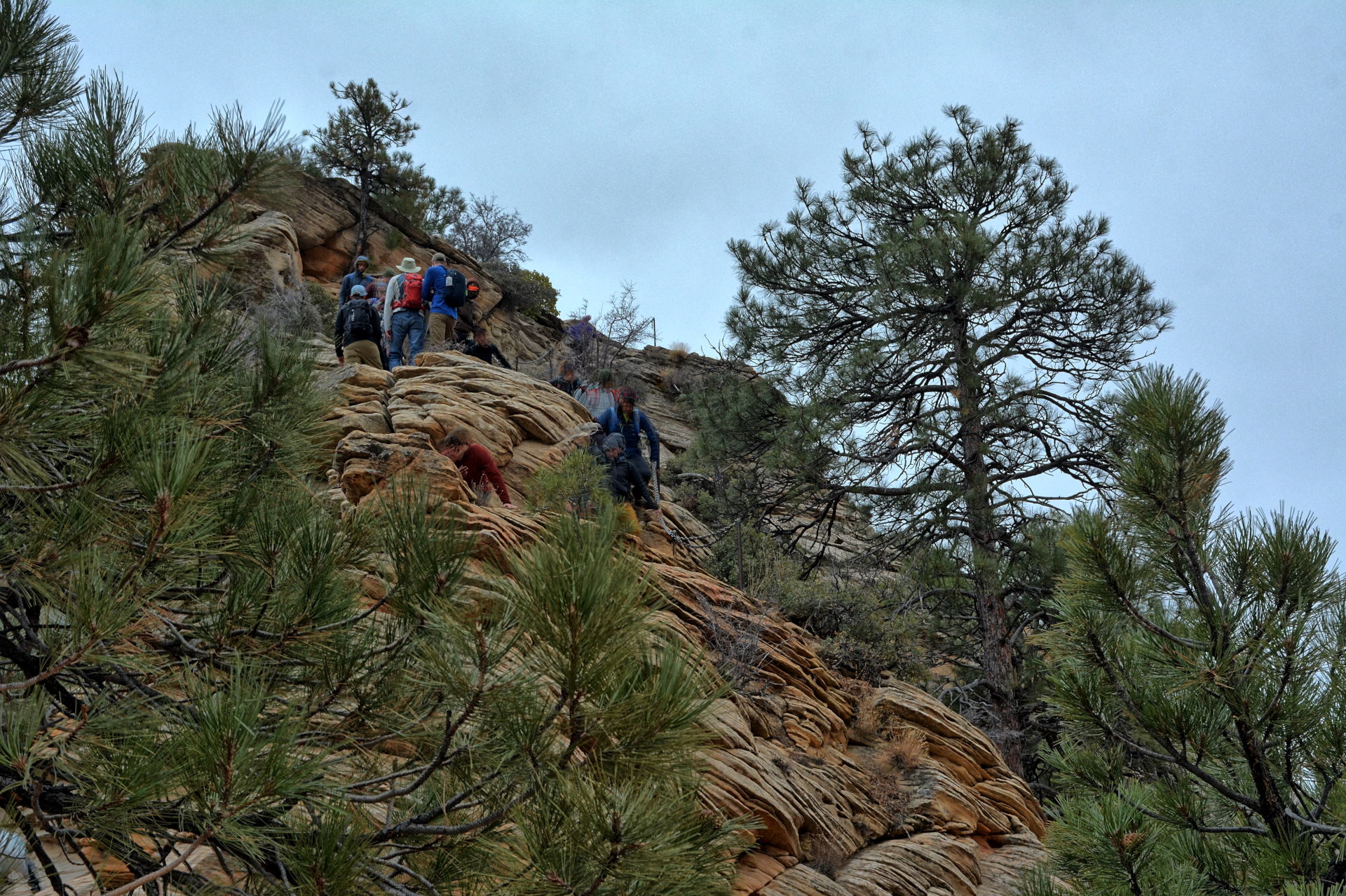
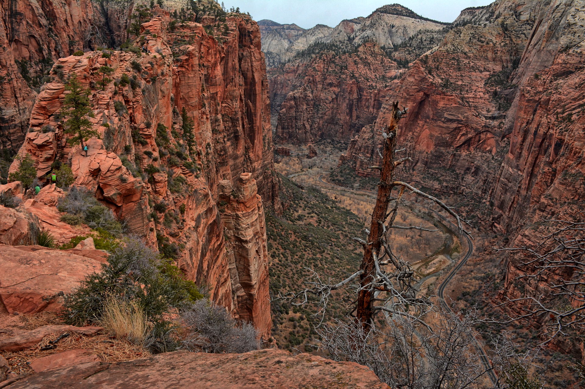
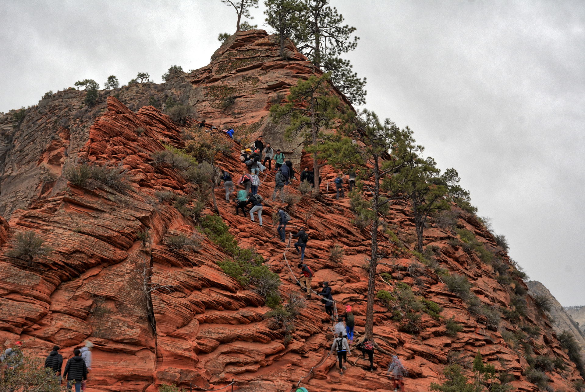
On Monday, I returned to Zion National Park, and took the park shuttle to the Grotto
to hike to the top of Angels Landing. I had checked at the Bryce
Canyon visitor center on Sunday to see if Angels Landing was safe, and the ranger said
she had been told it was not yet covered in ice, and people were still hiking
it. A hiker had just slipped and fell to her death on Angels Landing a few days
before, but the ranger said they were hiking in the rain, and those rocks are very
slippery when wet. Rain and snow were forecast to begin over Zion Canyon
around 3PM on this day, so I wanted to make sure I was off the rocks before that. This
was the fourth time I had climbed Angels Landing, and like my last climb, I had
my GoPro on a headmount
and my Gear 360 on a pole sticking 3 feet up above my daypack. The rocks were
wet in just a few places, but there was no ice yet. I completed the climb
and descent, and about 5 minutes after I was off the rocks at Scout Lookout, it
started to snow. The snow only lasted about 2 minutes, but then it started
raining, which continued. I was very happy to be off the dangerous section
of the climb. I proceeded down the trail back to the Grotto and took the shuttle back
to the visitor center. I drove into Springdale and had dinner at Pizza & Noodles, the same
restaurant we have been eating at for almost 25 years, whenever we visit Zion.
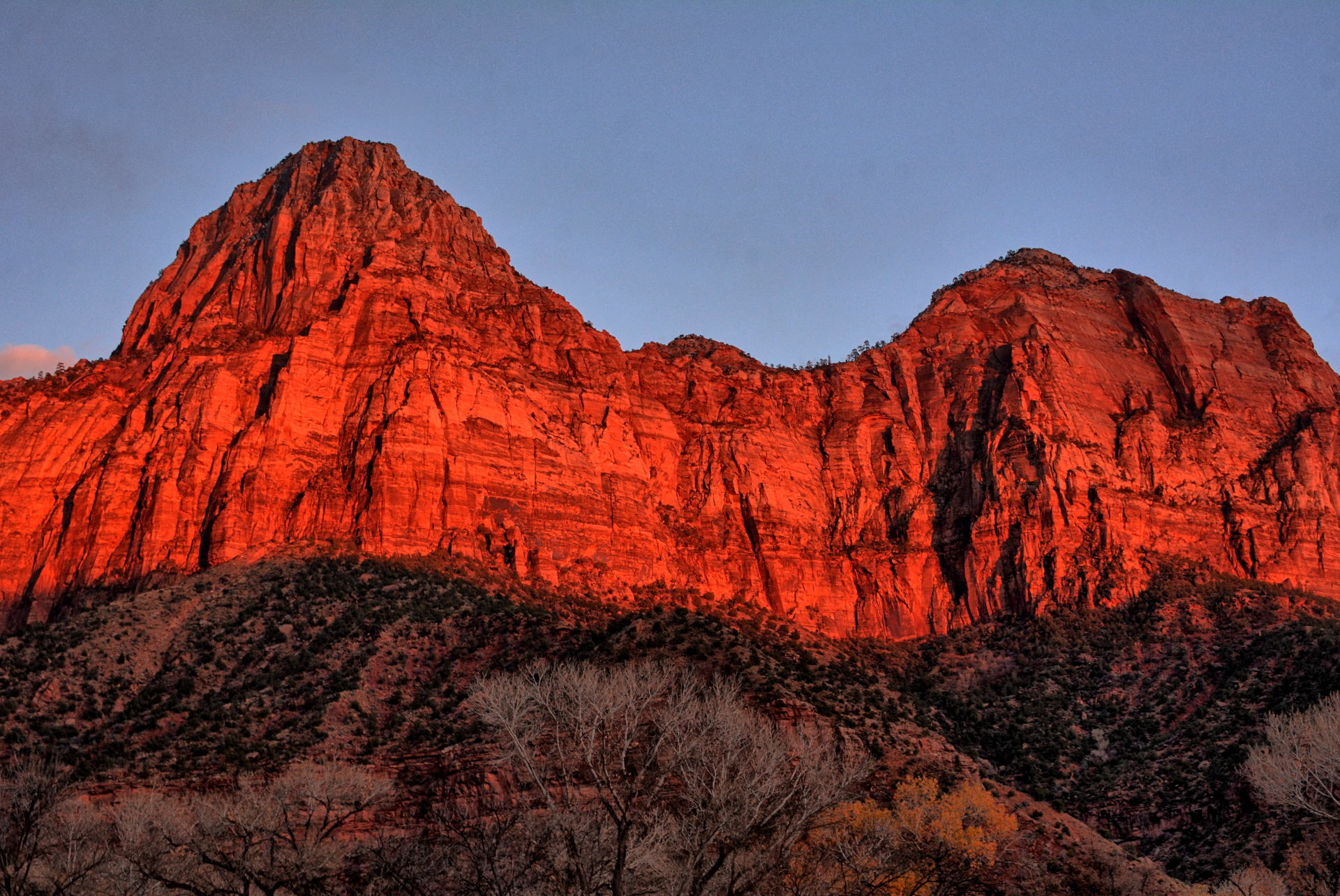
After I left Springdale to drive to Kanab, I saw the light from sunset bouncing off
the tops of the eastern rocks of Zion Canyon, stopped to take a few photos, and
several cars pulled up behind me to catch the same images. I drove on
east, up the Mt. Carmel Road, through the tunnel, to Mt. Carmel Junction and on to
Kanab. I had originally planned to camp at the
White House Campground east
of Kanab on the Paria River this evening, but I drove through a blizzard all the
way from the Zion east entrance to Kanab, so I decided I would get a hotel in
Kanab instead of camping in the snow and cold.
Tuesday was a very long day, with lots of driving, hiking, and things to see. I had breakfast at the hotel, drove east to House Rock
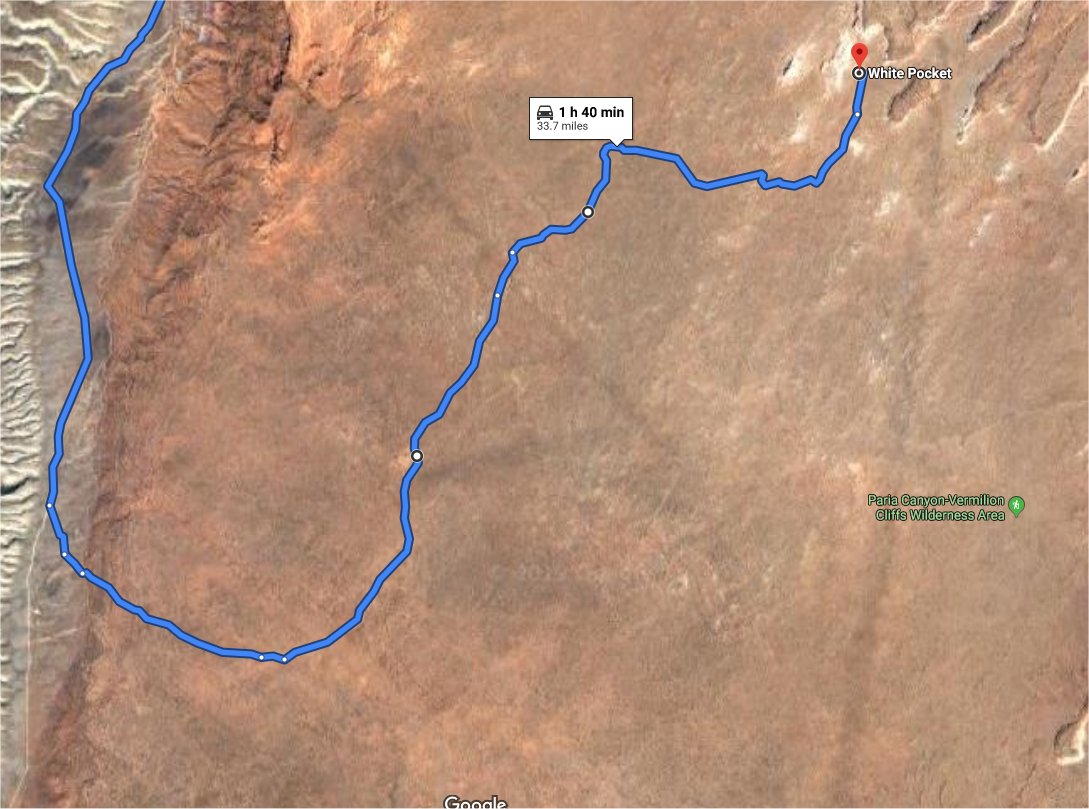
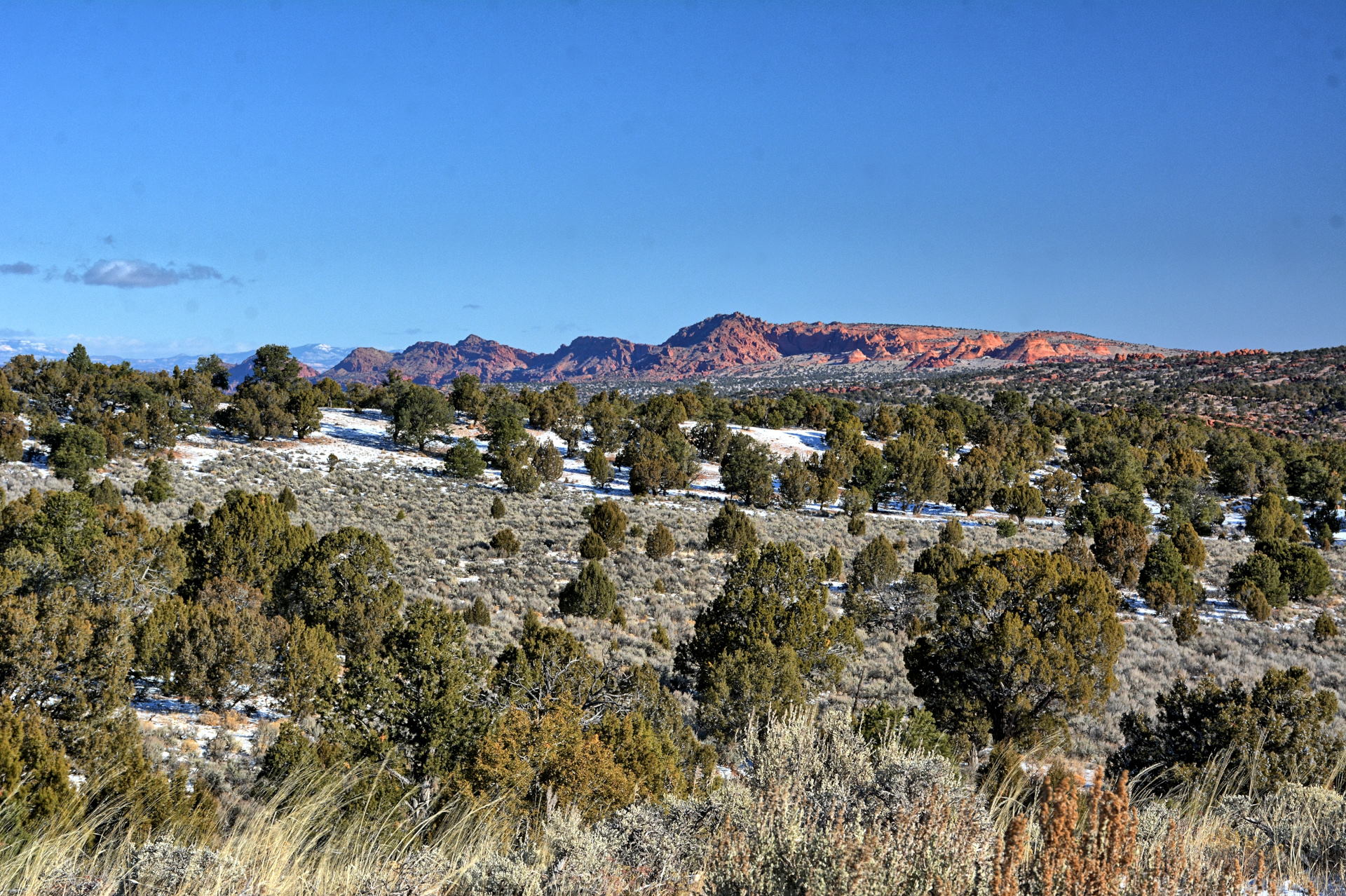
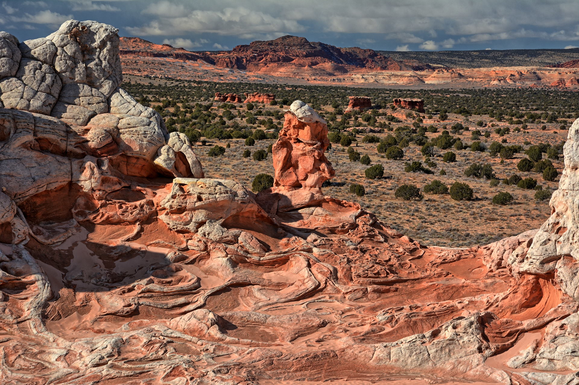
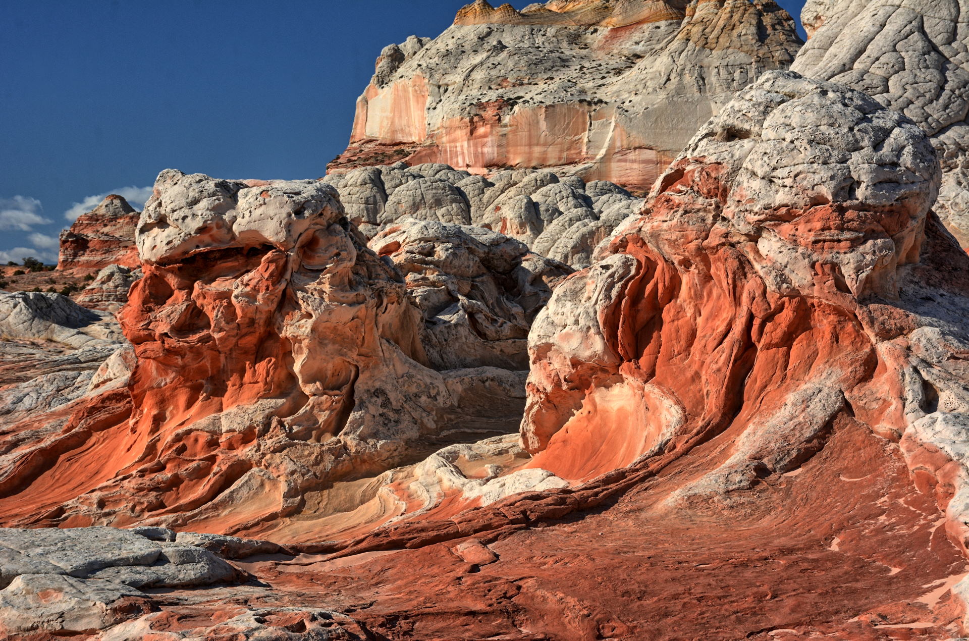
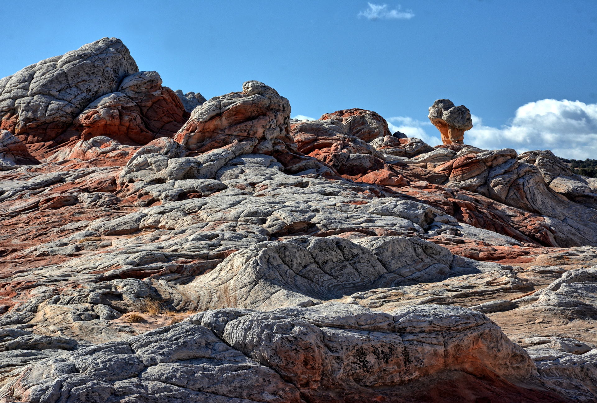
Valley Road, turned south and passed the trailhead for the Wave at Wire Pass. My
destination was White Pocket, which is an area of multicolored rocks on the Paria Plateau, part of the Vermillion Cliffs National Monument. House Rock
Valley Road is usually passable by almost any car, but you need a high clearance
4WD vehicle for the last few miles off of House Rock Valley Road to
reach White Pocket. I had visited White Pocket in 2018 with my son, my
sister and her husband, and wanted to see it again. It did not disappoint
at all the second time around. The light was different, it
was cooler for hiking, and there were fewer people this time. After
several hours of hiking and photography, I returned to House Rock Valley Road and
had to
decide if I wanted to go back north and west towards Kanab, or go south and see more sights; I
decided on south.
I made it back to
paved road,
Arizona 89A, just north of the Kaibab Plateau, drove west to
Jacob Lake, and then northwest towards Fredonia and Kanab. The road to the
North Rim of the Grand Canyon turns south from Jacob Lake, and was actually
still open when I arrived at Jacob Lake in the late afternoon. I did not
have time to make the last 50 miles (one-way) to the North Rim, and it is a good
thing I decided to pass up on that drive. I found out a few days later that a
snow storm hit the area that evening, and the road was closed for the rest of
the winter season as soon as the storm hit. I drove through Fredonia,
continued west, and
stopped at Pipe Spring National Monument about 20 minutes before they closed for
the day. I managed to walk through the small monument and take a few
photos before closing, and still had time to get a magnet. I continued on northwest
to Hurricane, stopping to fly for a few minutes and to take some sunset photos, and then drove to Salt Lake City
that evening. I stayed in a hotel
at the airport and flew home on Wednesday morning.
Aerial Video, Skull Valley, 21 November 2019
Aerial Video, Skull Valley - White Rock, 23 November 2019
Aerial Video,
Skull Valley - White Rock, 23 November 2019
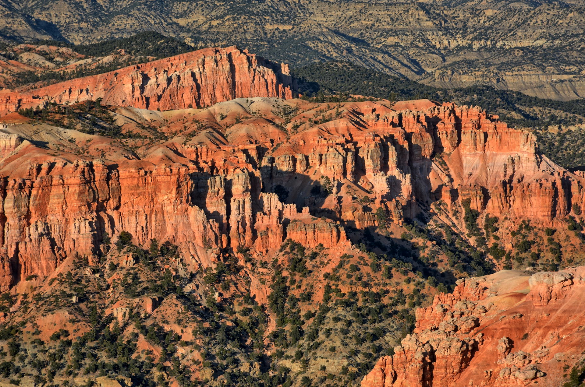
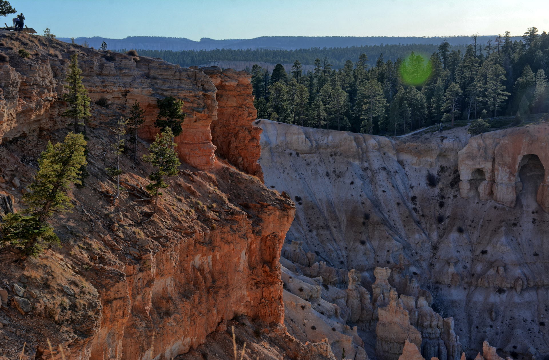
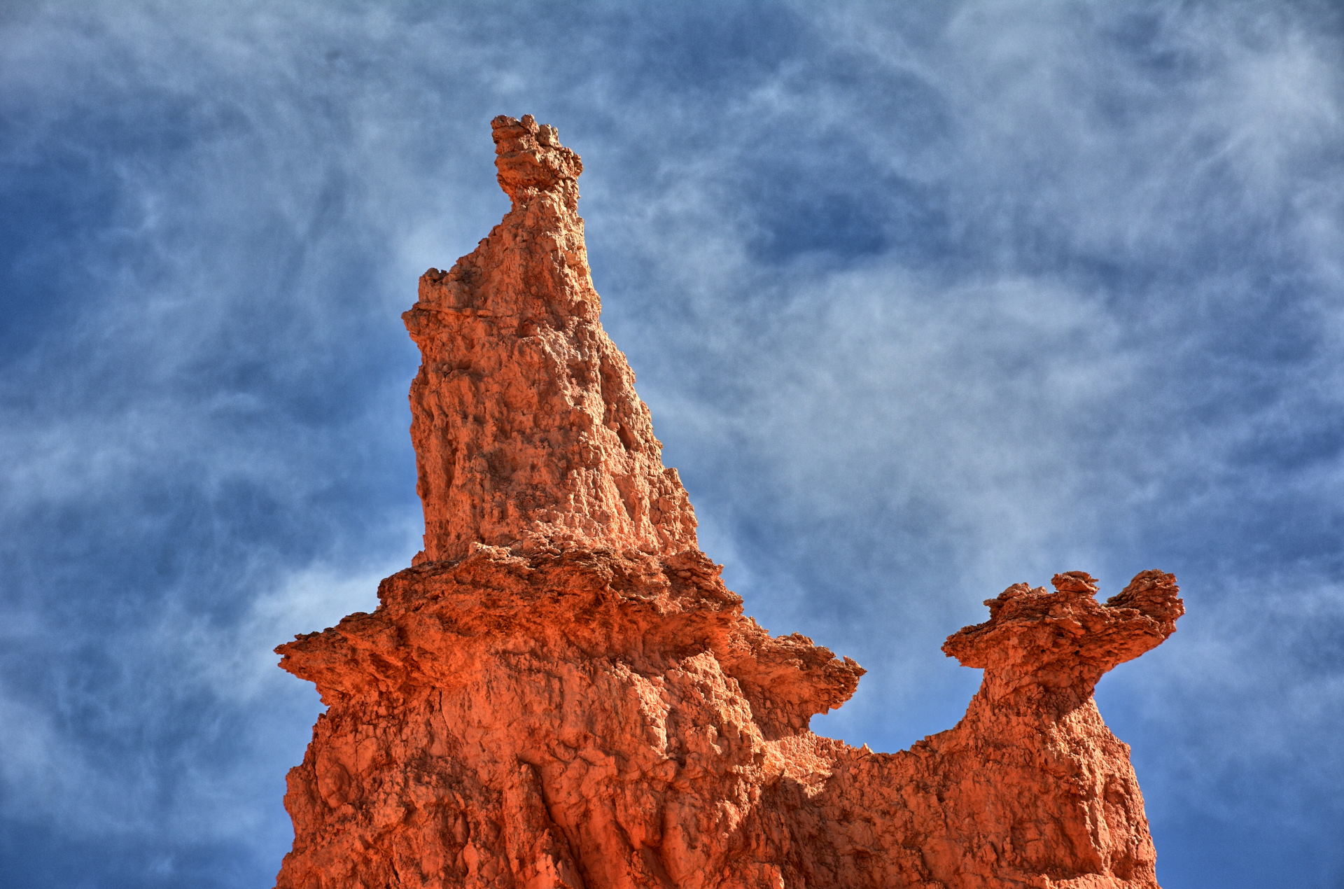
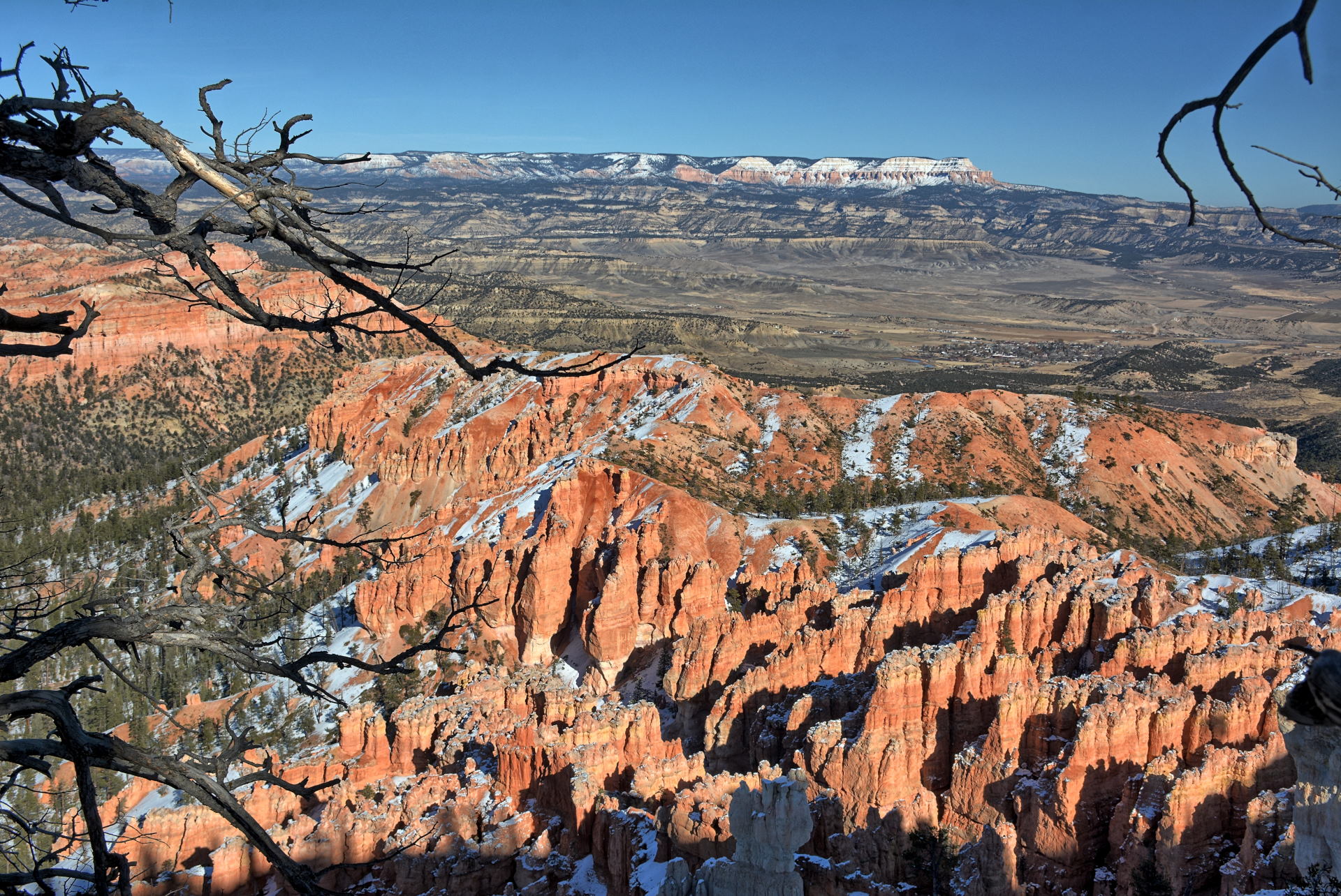
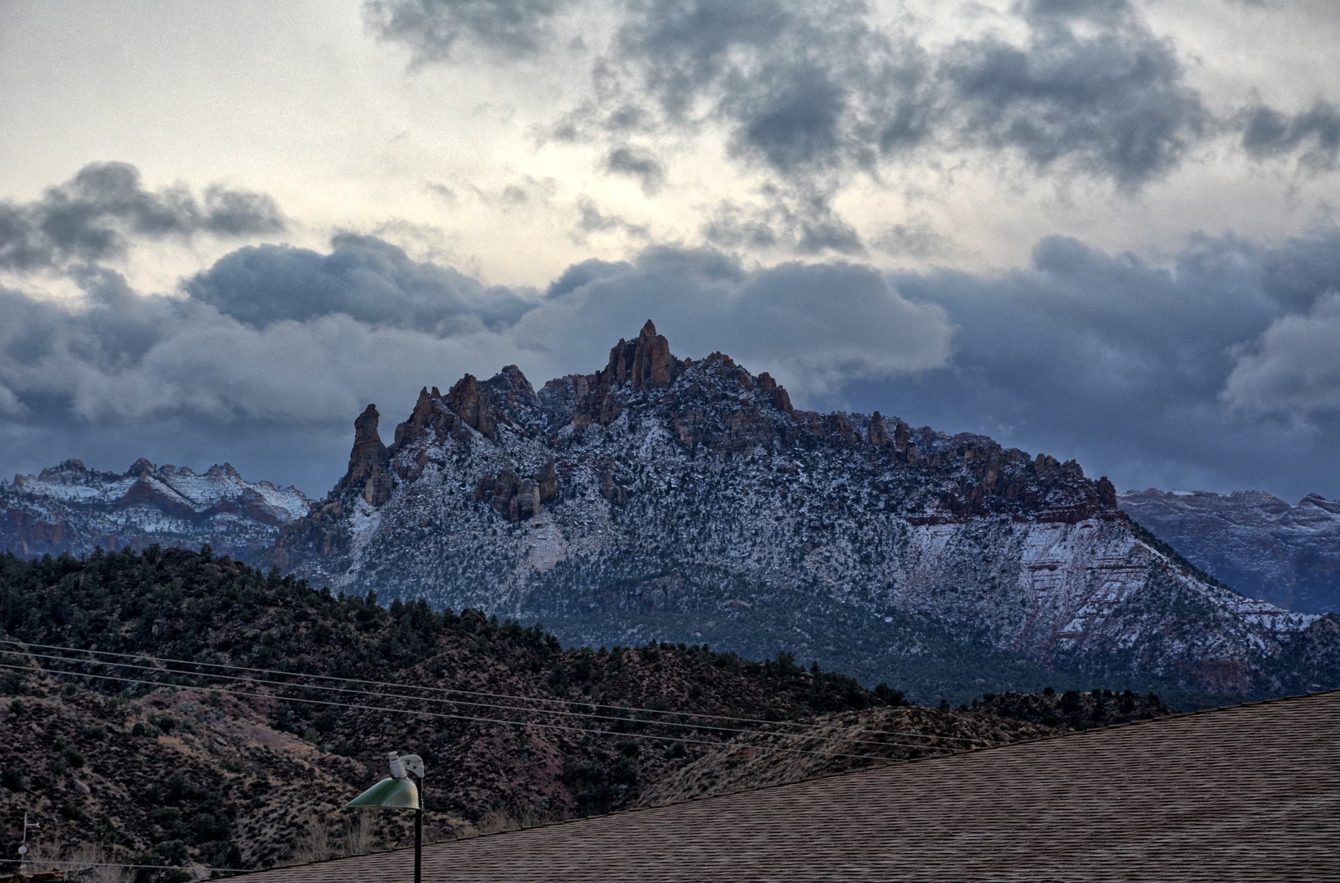
Bryce Canyon National Park, Paria View & Amphitheater, 24 November 2019
Angels Landing climb and descent, GoPro, 25 November 2019
Angels Landing climb to top, Gear360, 25 November
2019
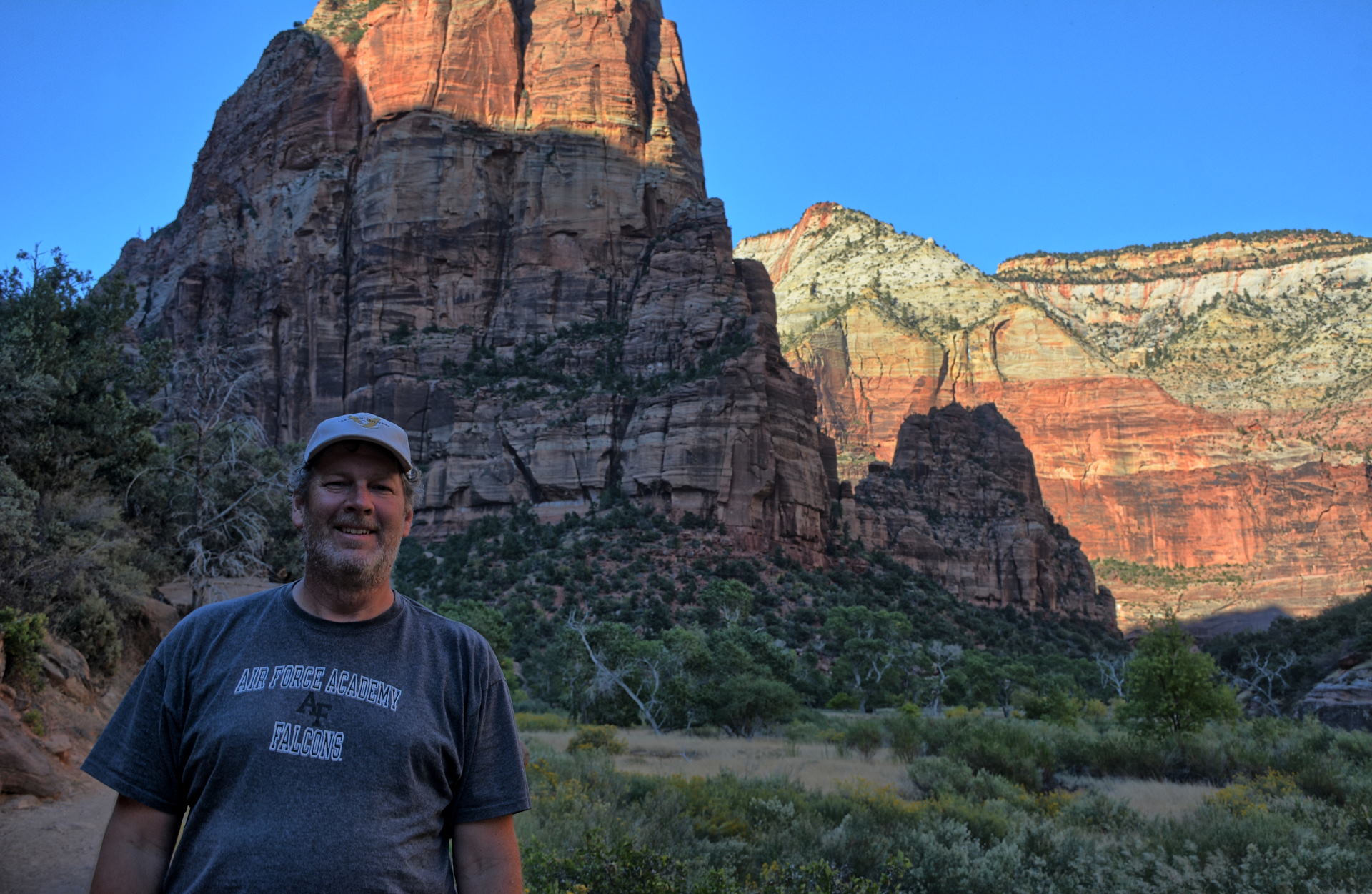
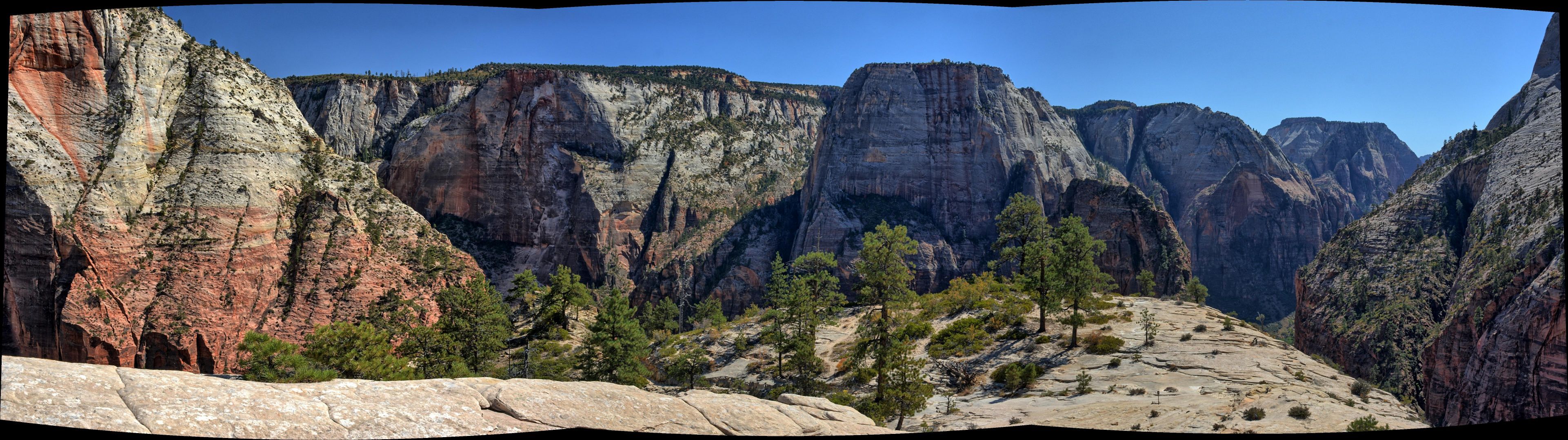
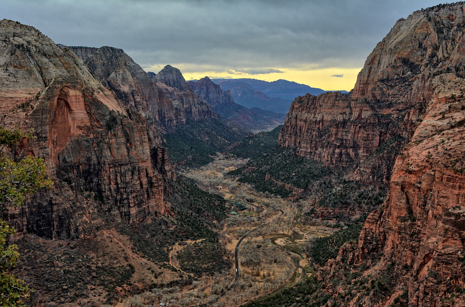
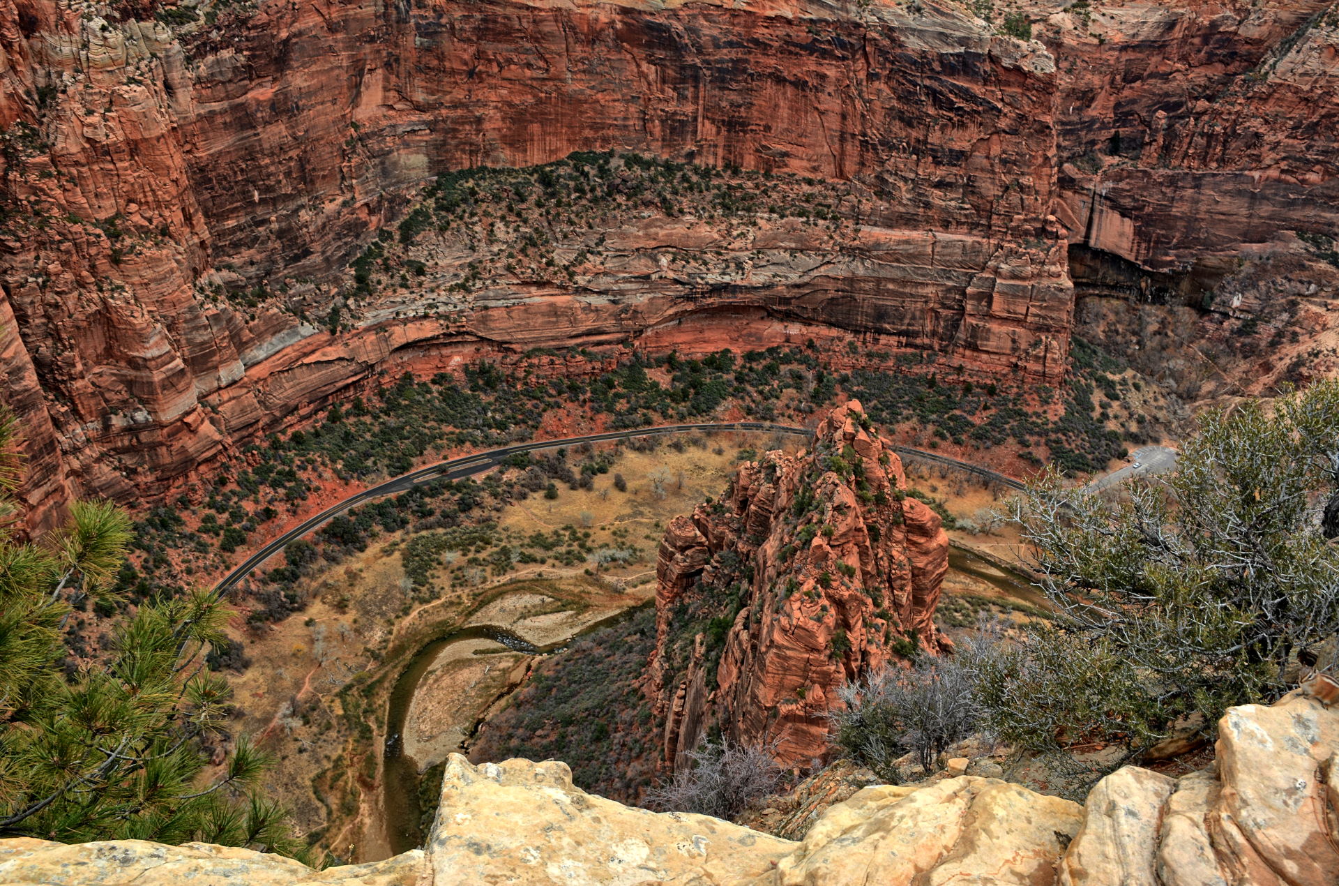
Zion National Park, Zion Canyon, Angels Landing, 25 November 2019
The White Pocket drive
video below on the left was filmed with a GoPro mounted to the windshield of my car on
26 November 2019. The drive goes from route 89A in Utah, south along House Rock
Valley Road. It passes the Wire Pass parking area, which is the entrance to the
Wave and Buckskin Gulch, and continues south into Arizona. The path to White
Pocket then turns to the east, and then north - northeast for the last 5 miles. Those last 5
miles are in deep sand and require a high clearance 4WD vehicle. The path shown
in this video on the left follows what Google Maps was telling me to drive on 26 Nov 2019 to get from
route
89A to White Pocket.
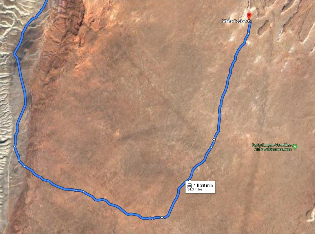
The White Pocket drive video
below on the right was filmed with a GoPro
mounted on the windshield of our car when I visited White Pocket on 23 May 2018
with my son, my sister and her husband. I
knew the Google-recommended route from November
2019 was slightly different from the path we took
in 2018, but decided to follow it to see what it
was like.
I found that the 2019 route was through much
deeper sand in a few places, was just more
difficult overall, and was not nearly as direct
as the 2018 route.
I recommend that anyone driving to White Pocket
follow the route we took in 2018. Both require a
4WD, but the 2018 route is easier and quicker.
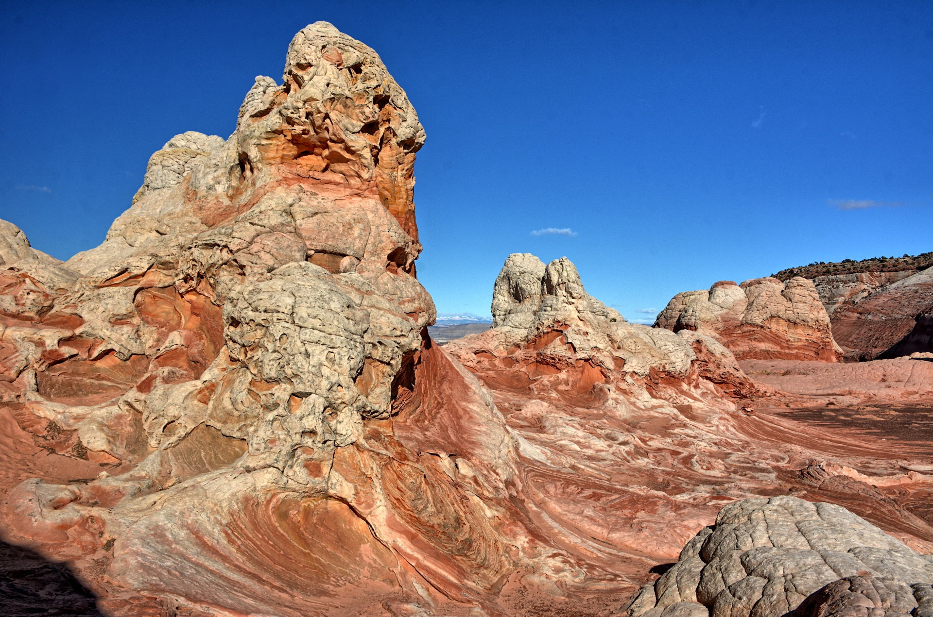
Coyote Buttes South, viewed from the southwest on House Rock Valley Road and
from the east at White Pocket
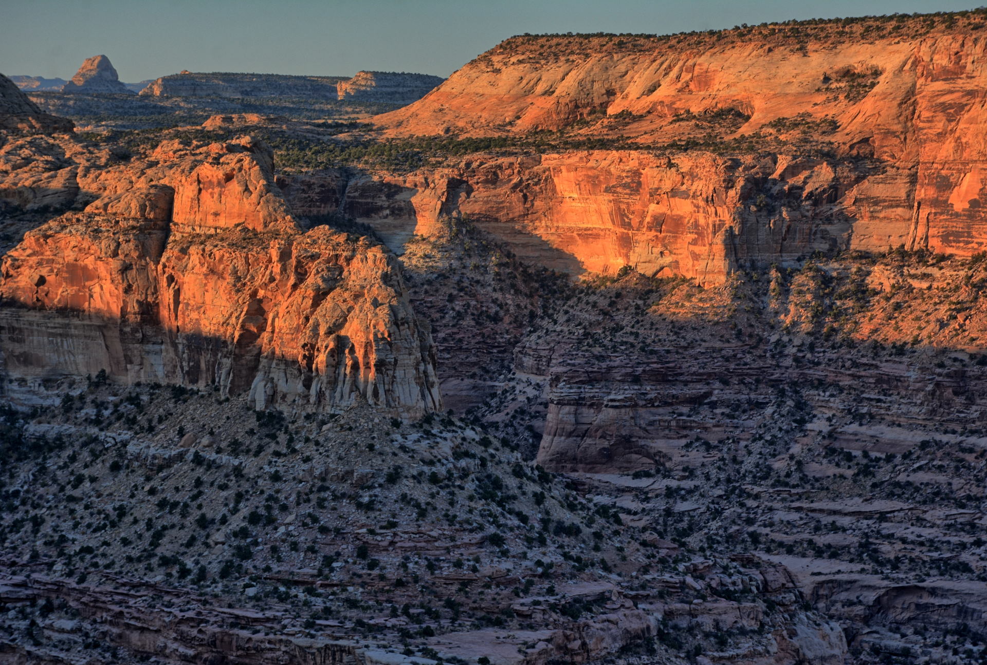
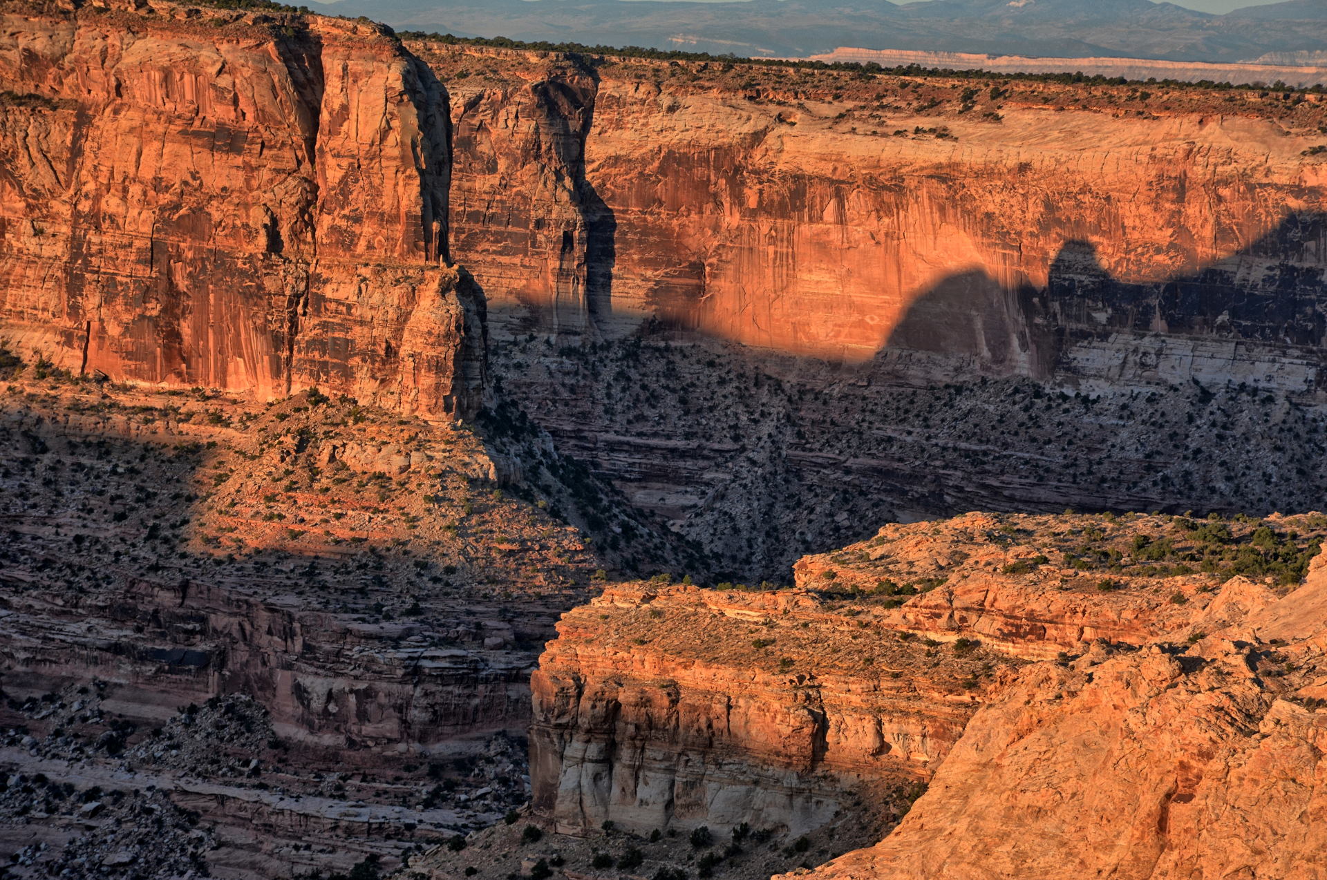
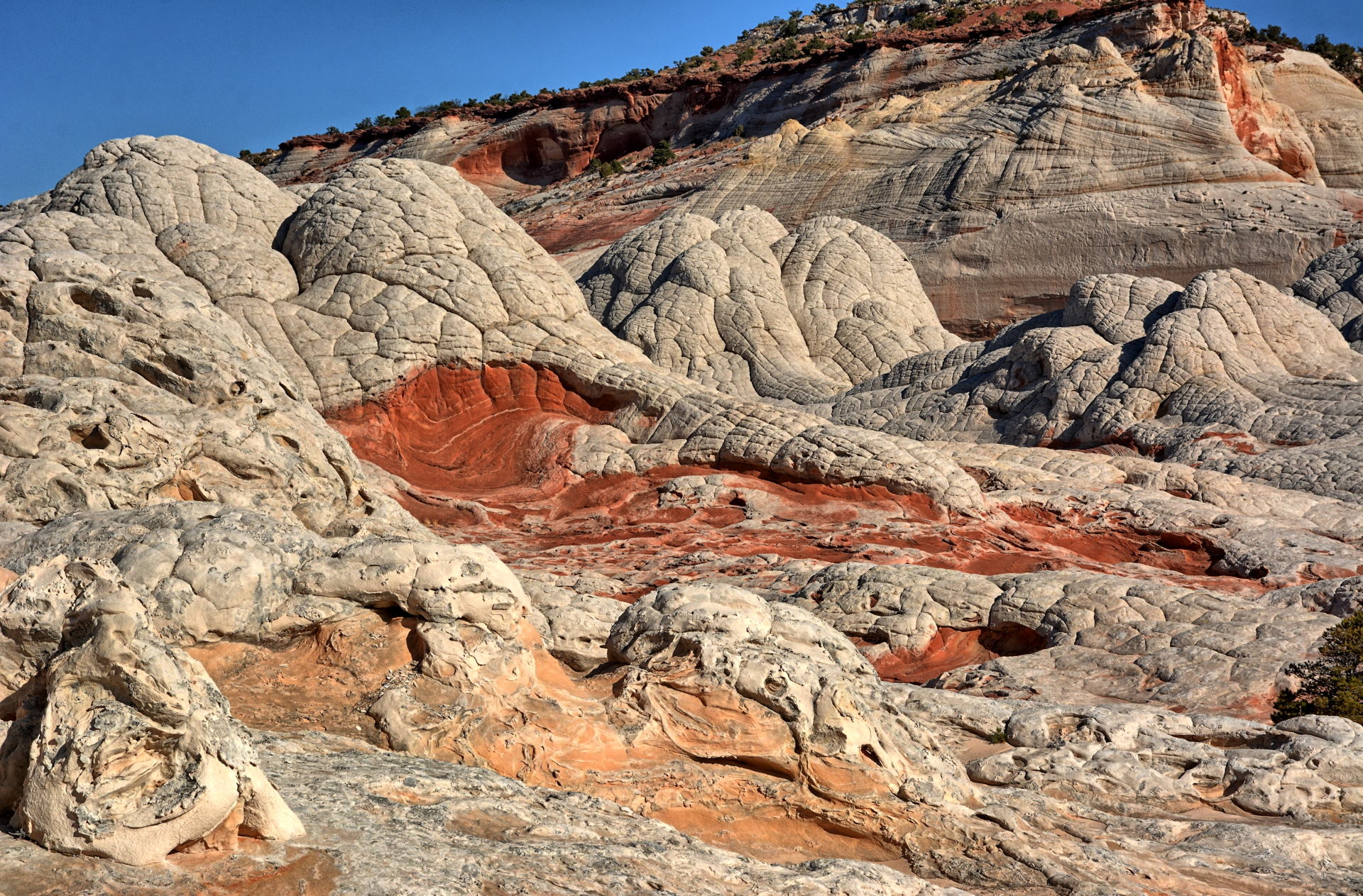
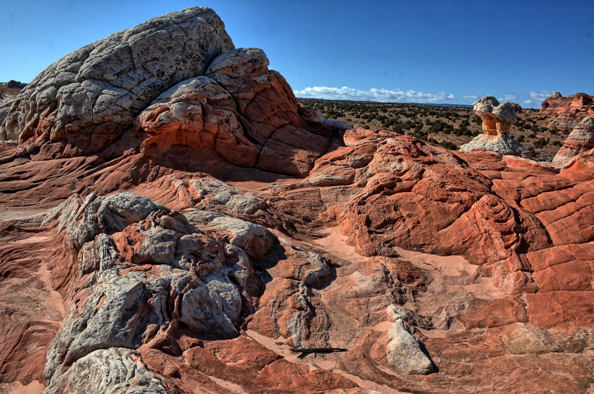
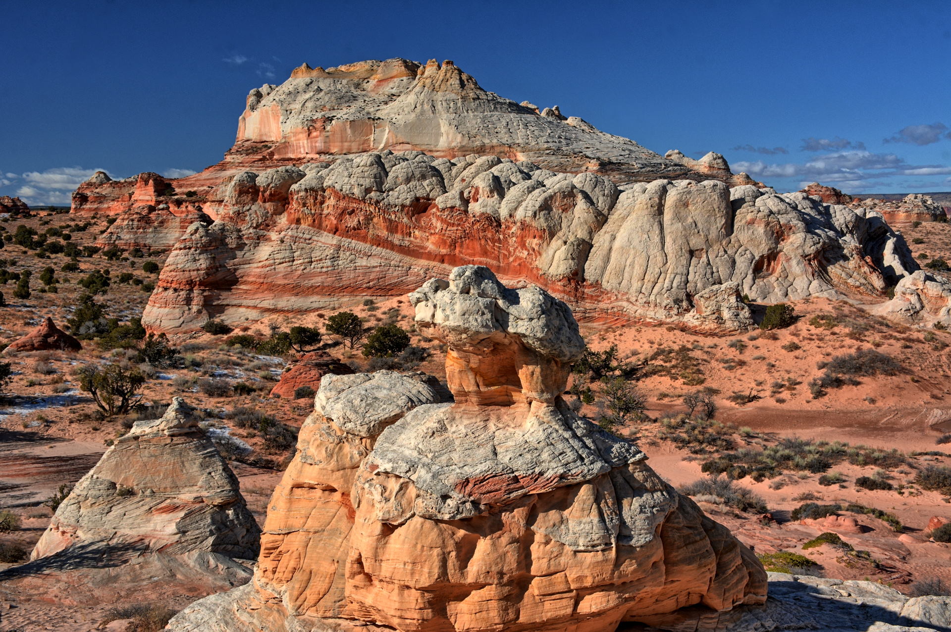
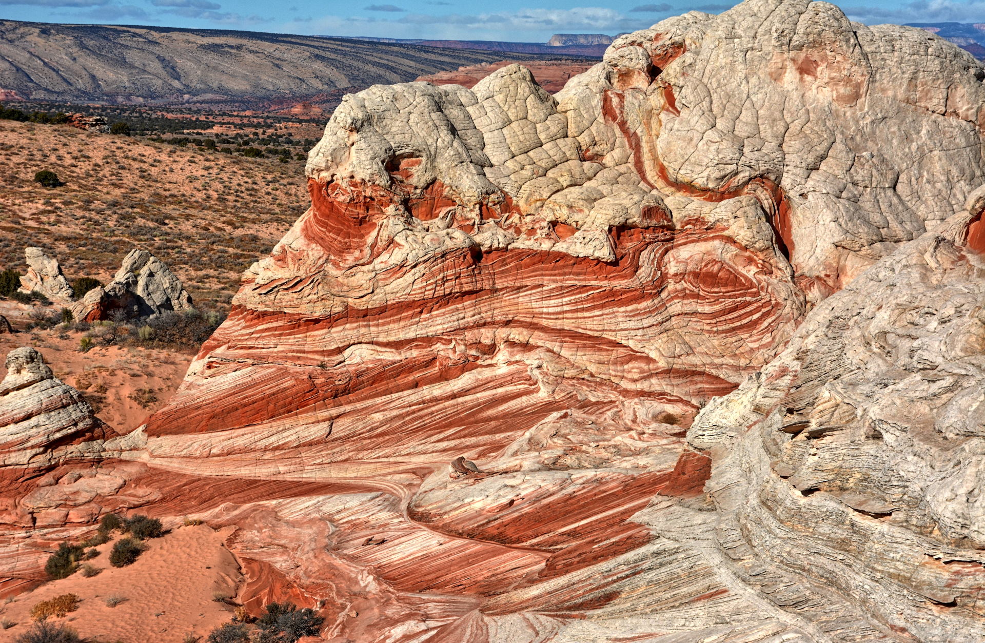
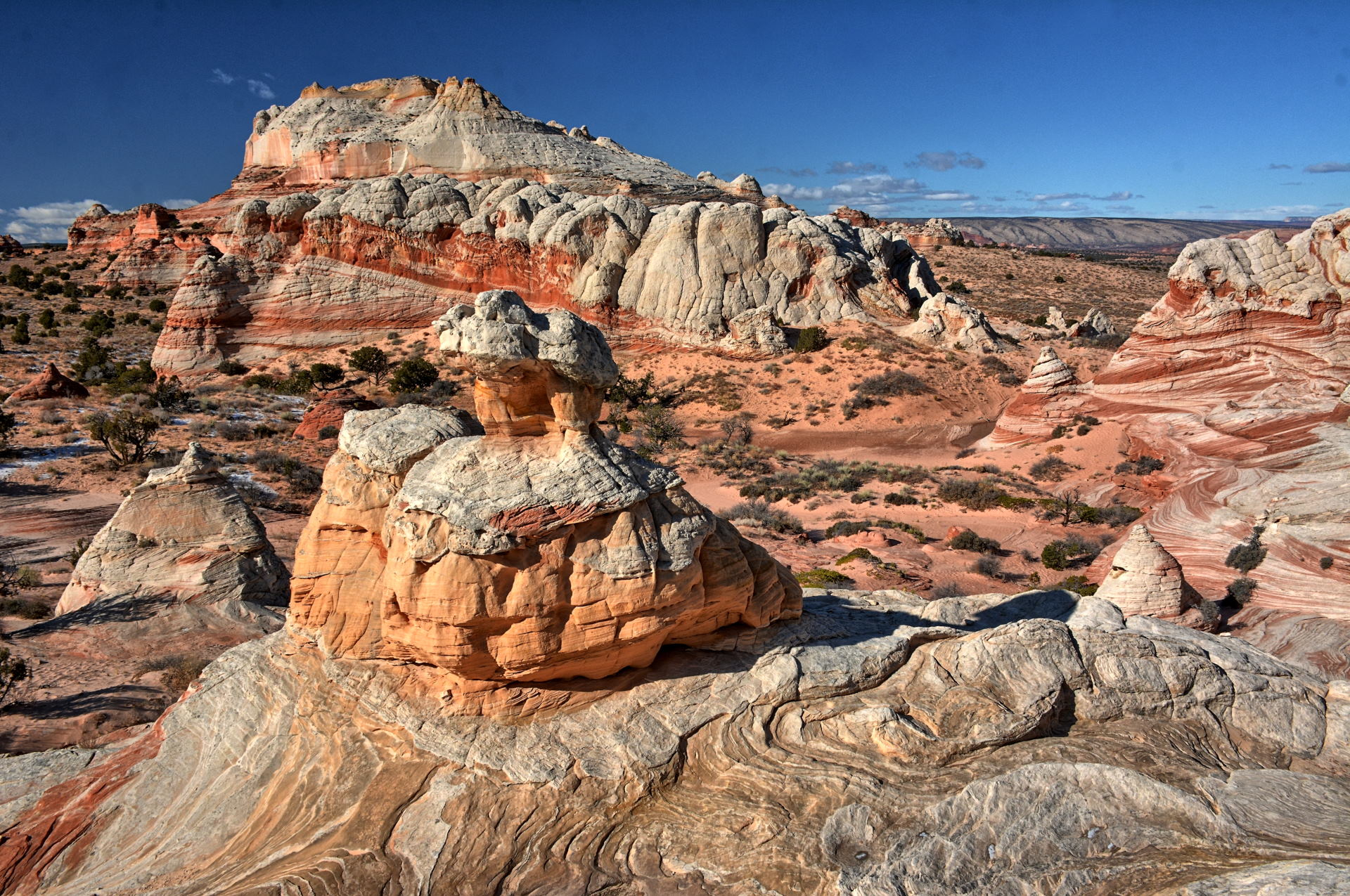
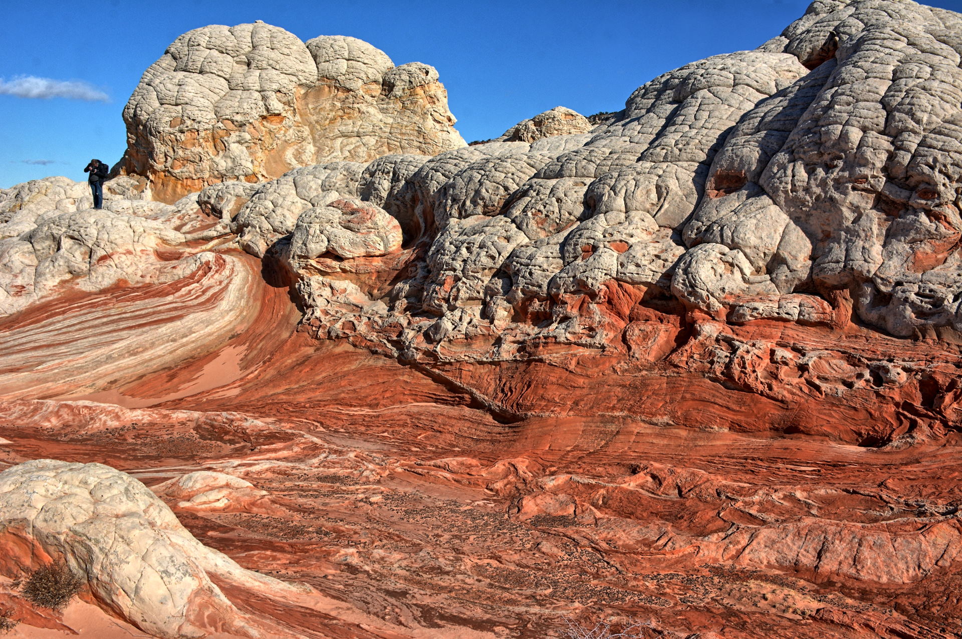
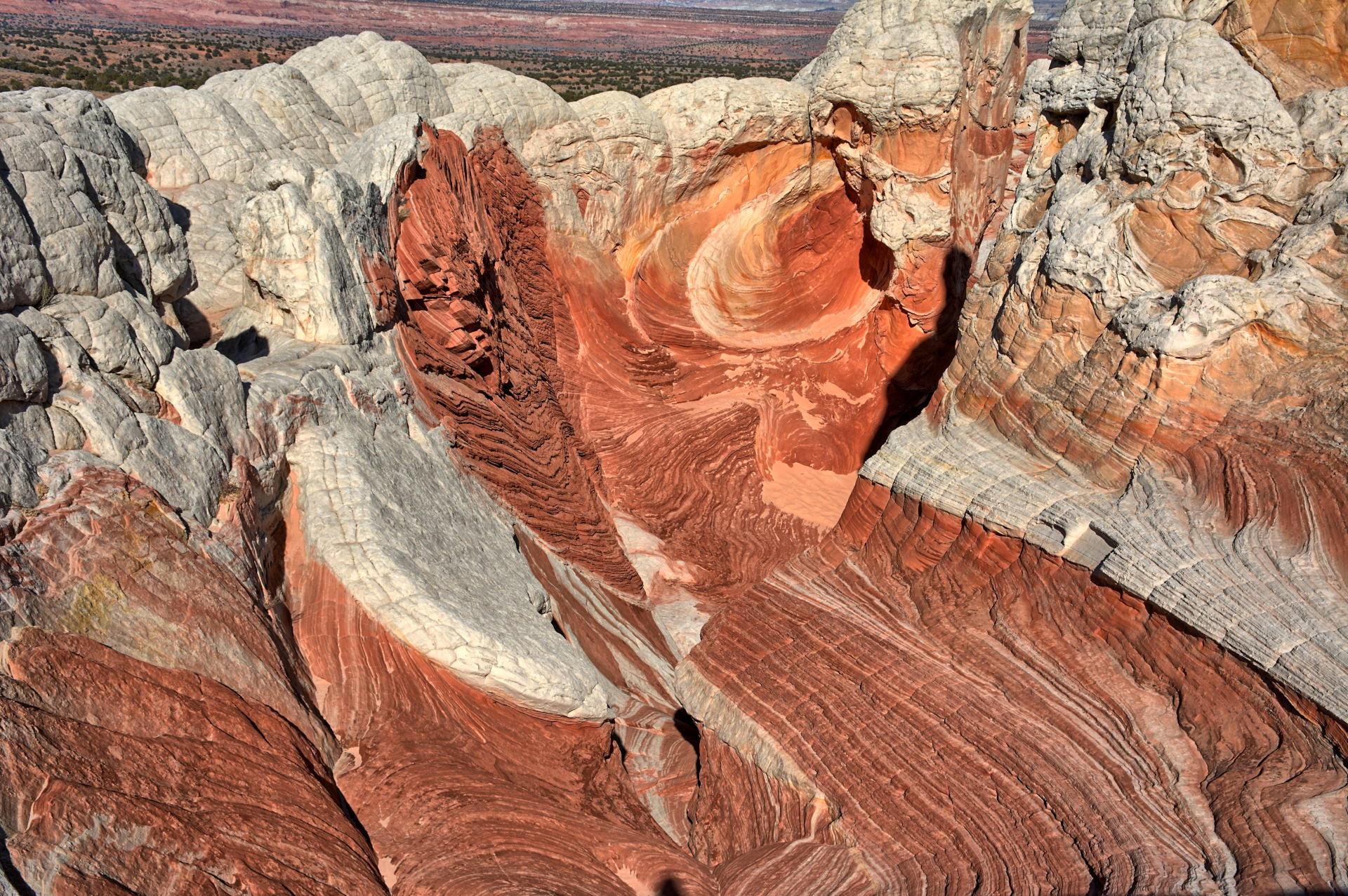
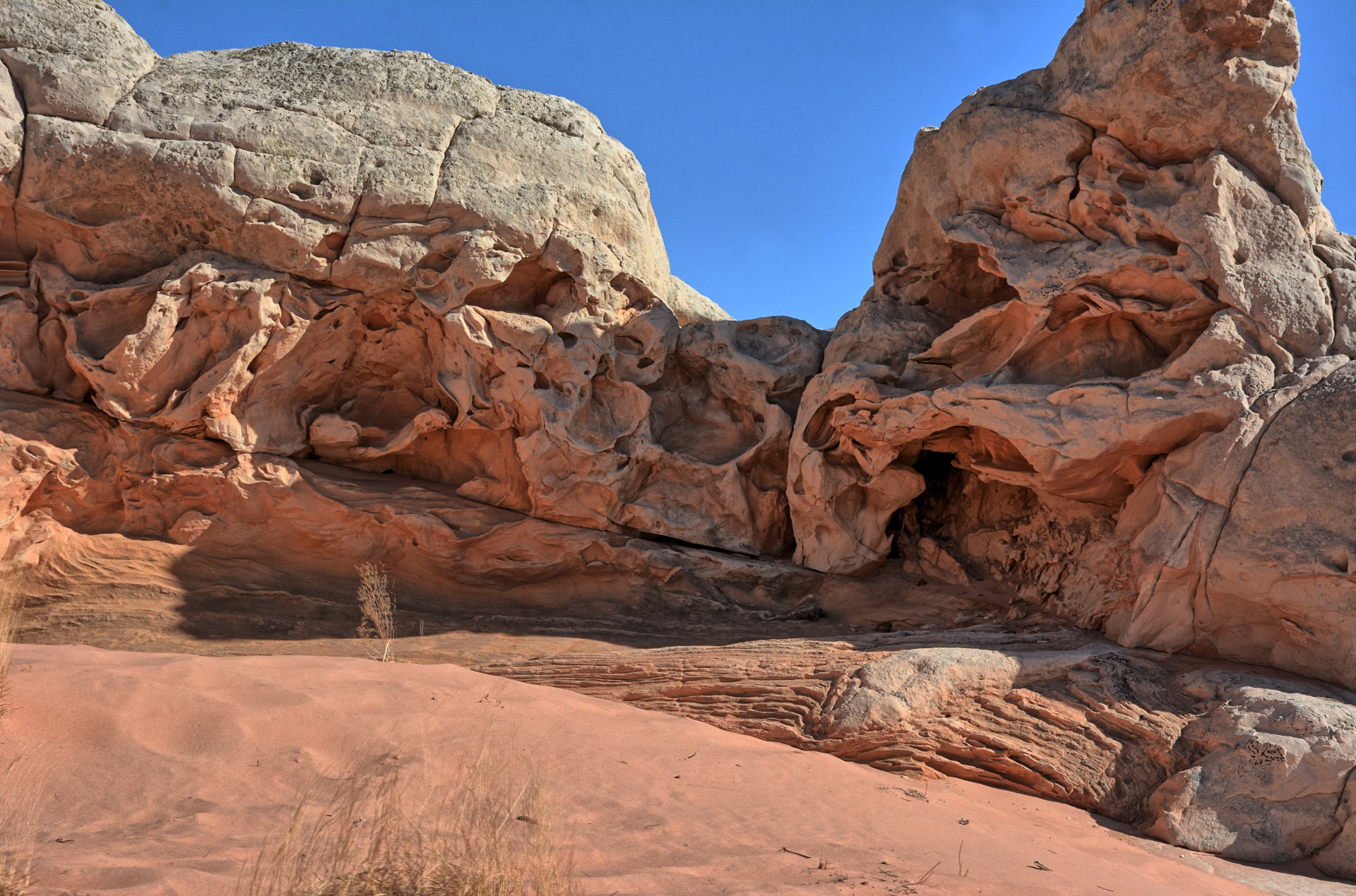
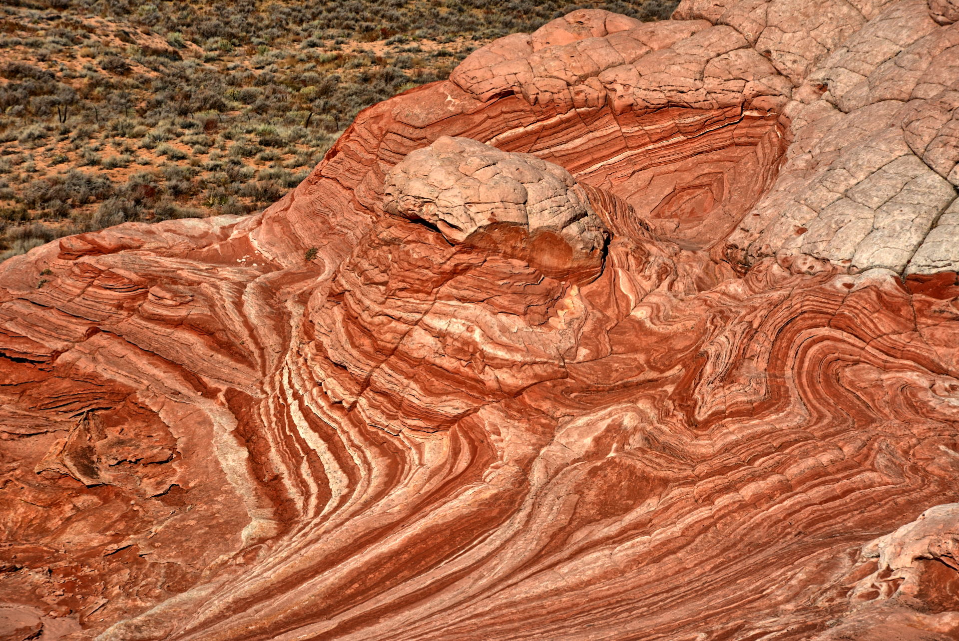
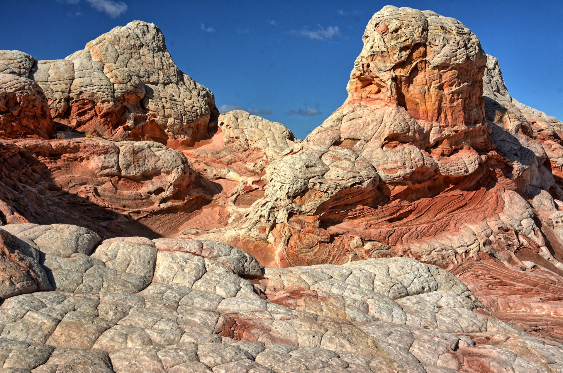
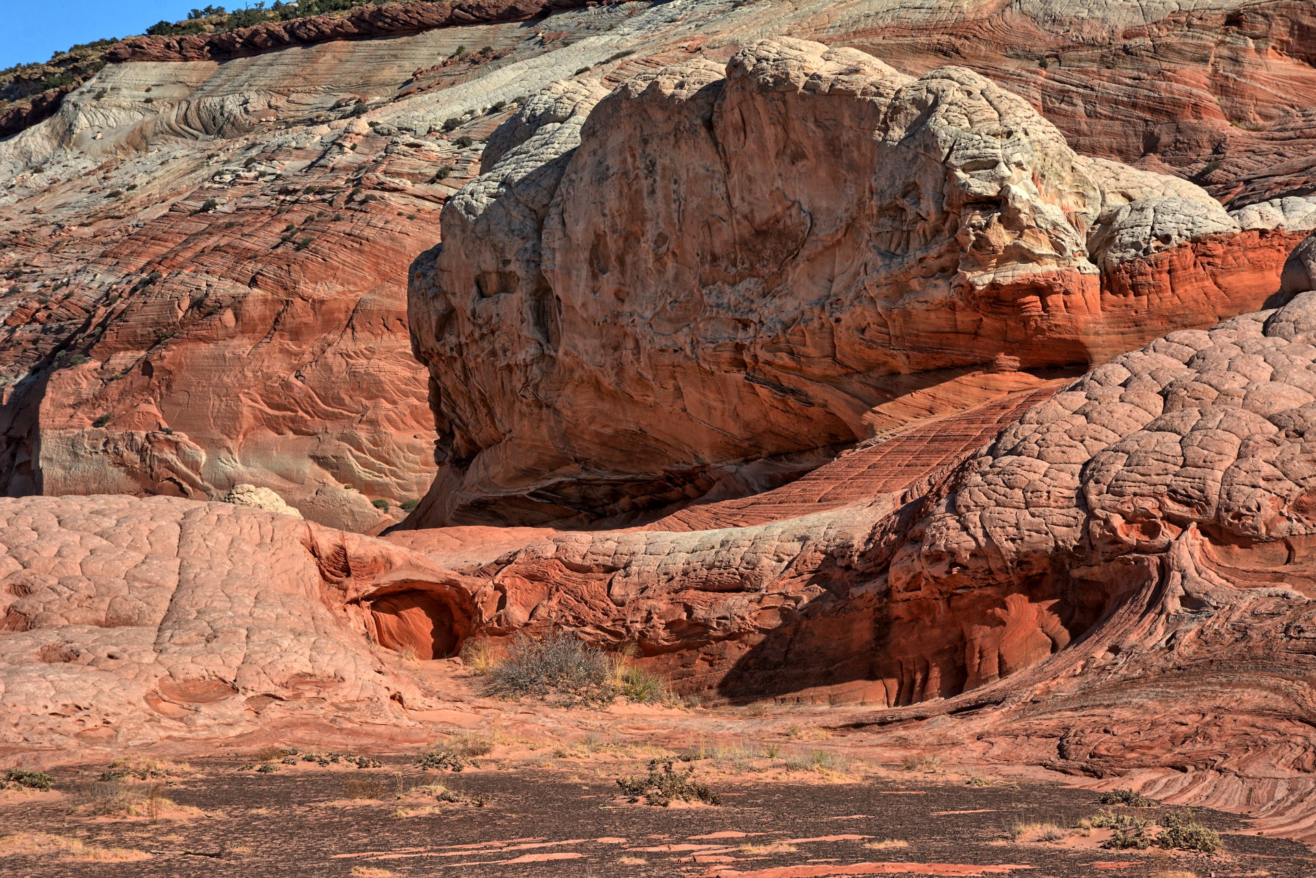
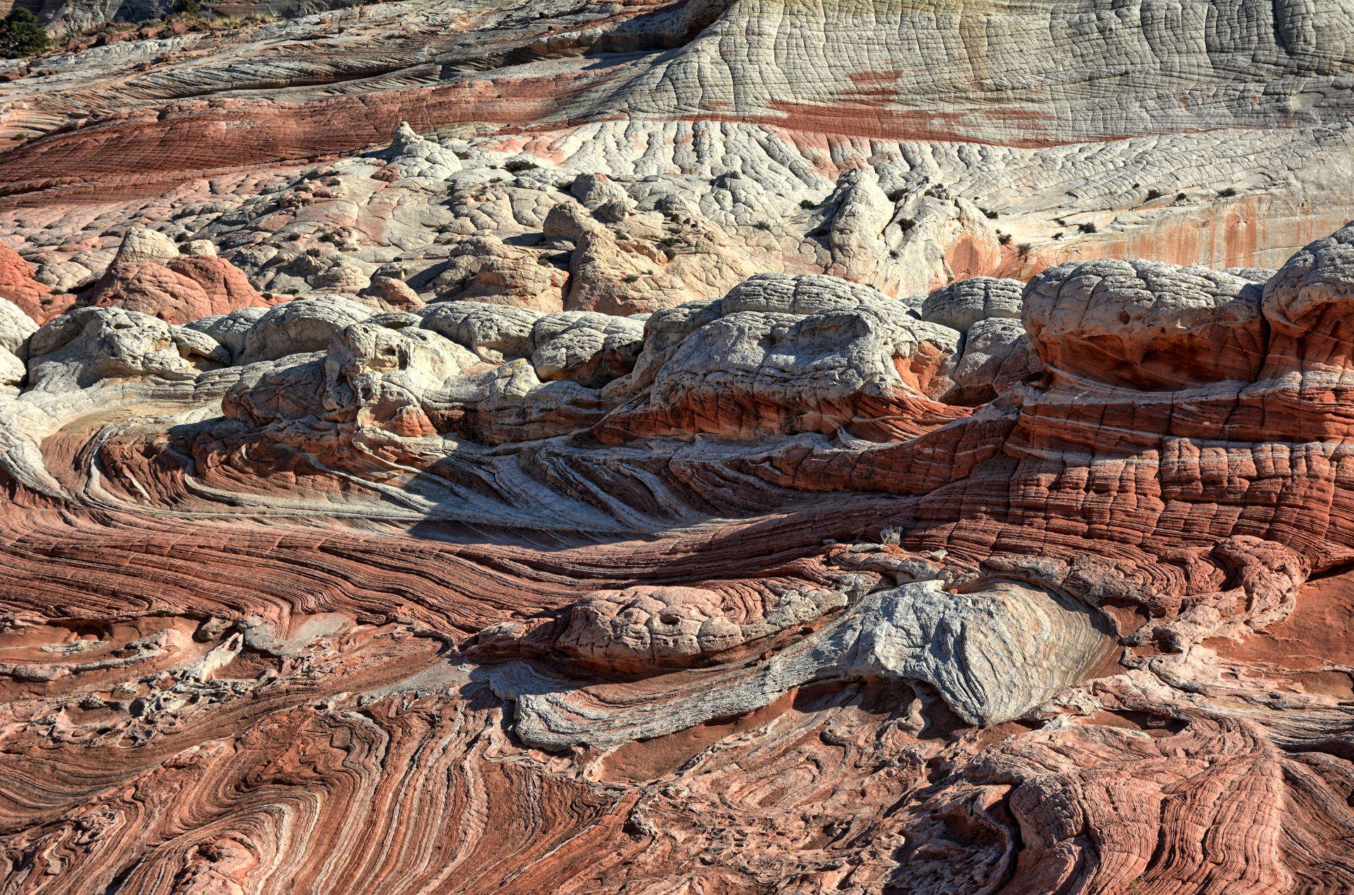
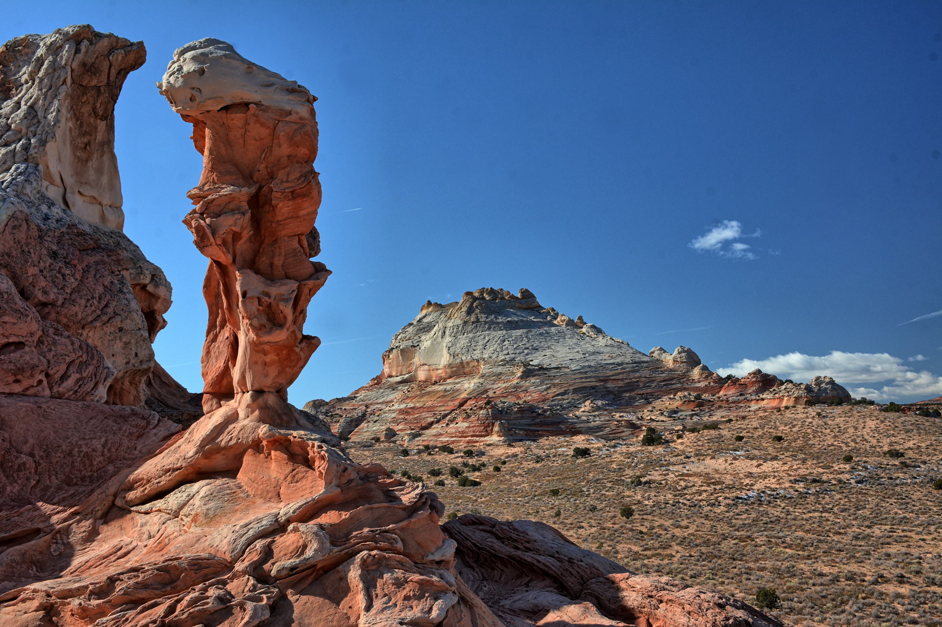
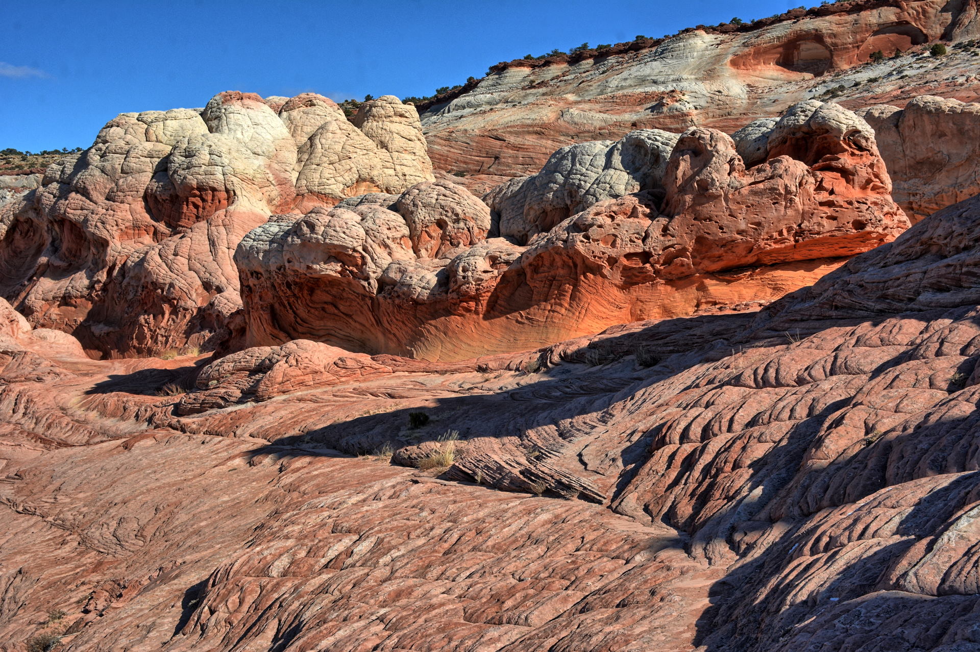
White Pocket, Vermillion Cliffs National Monument, Arizona, 26 November 2019
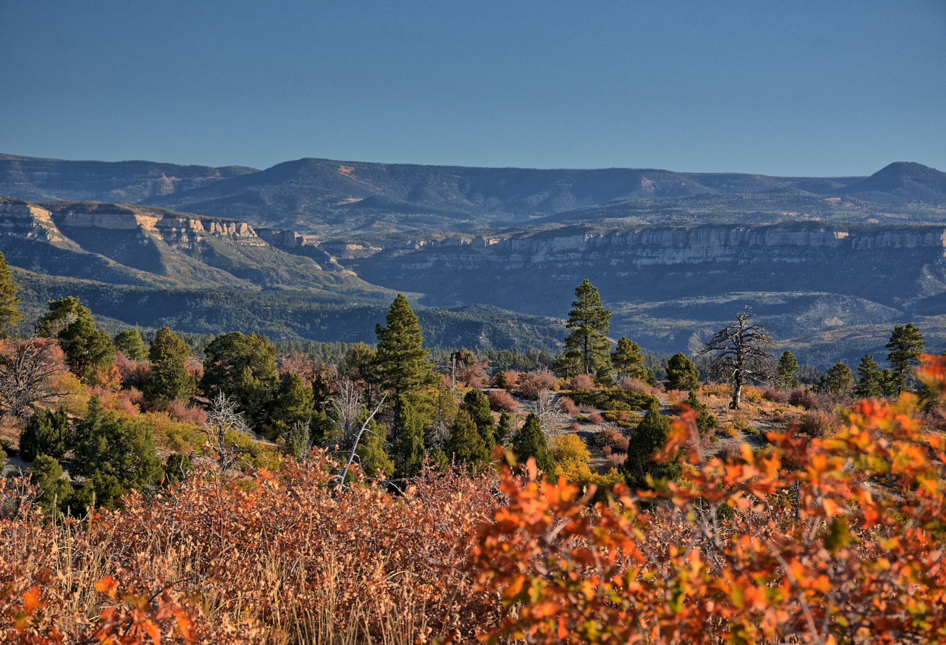
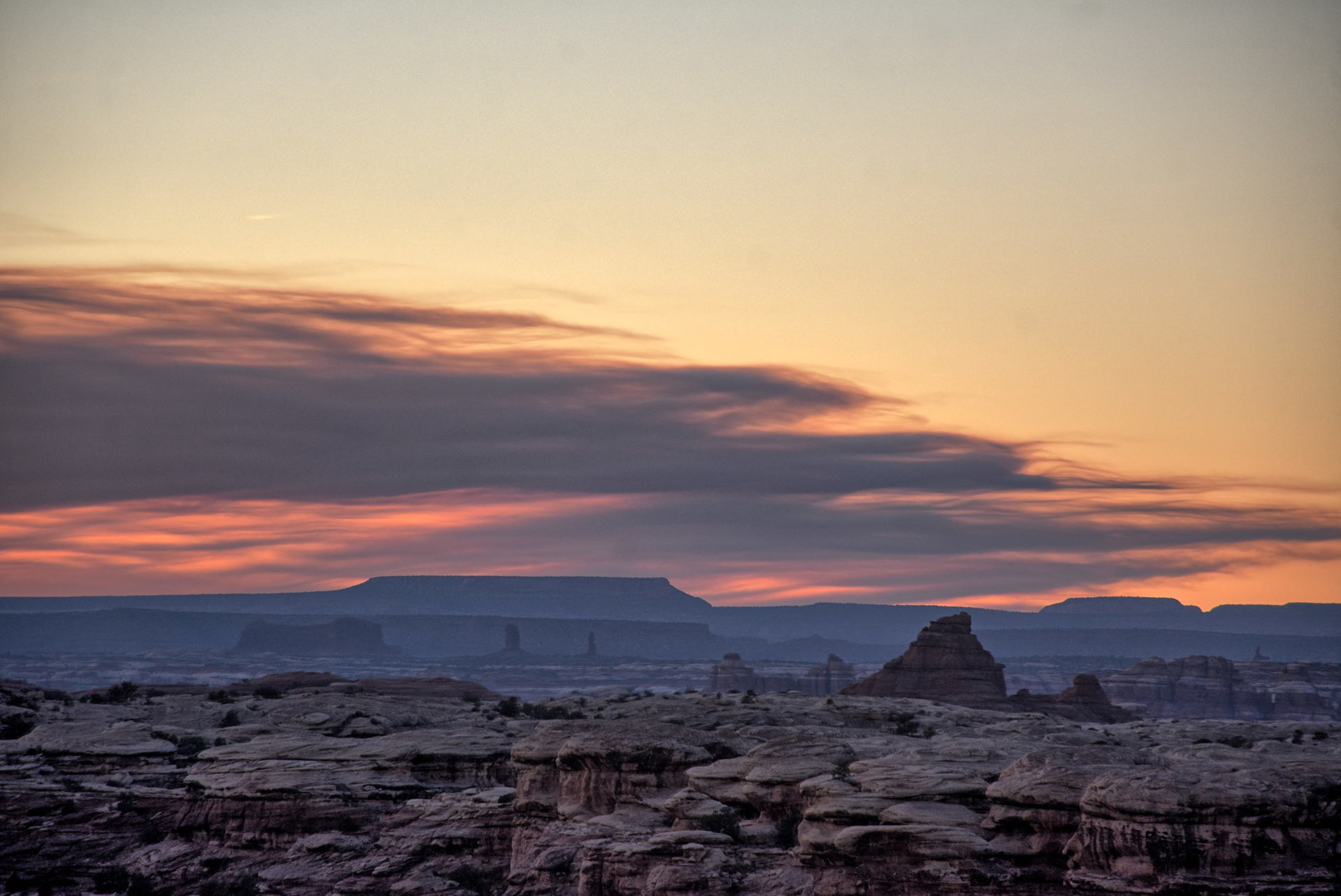
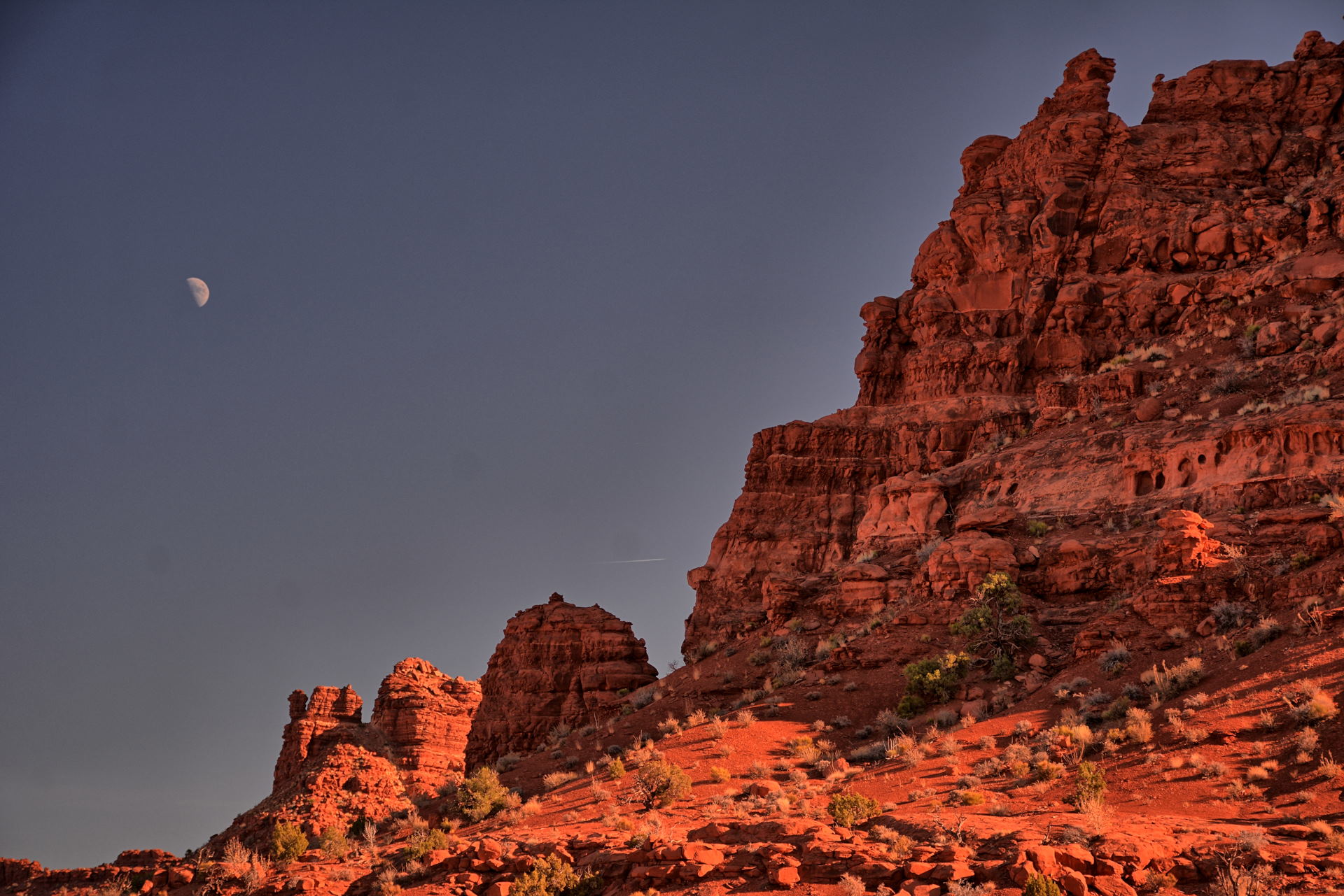
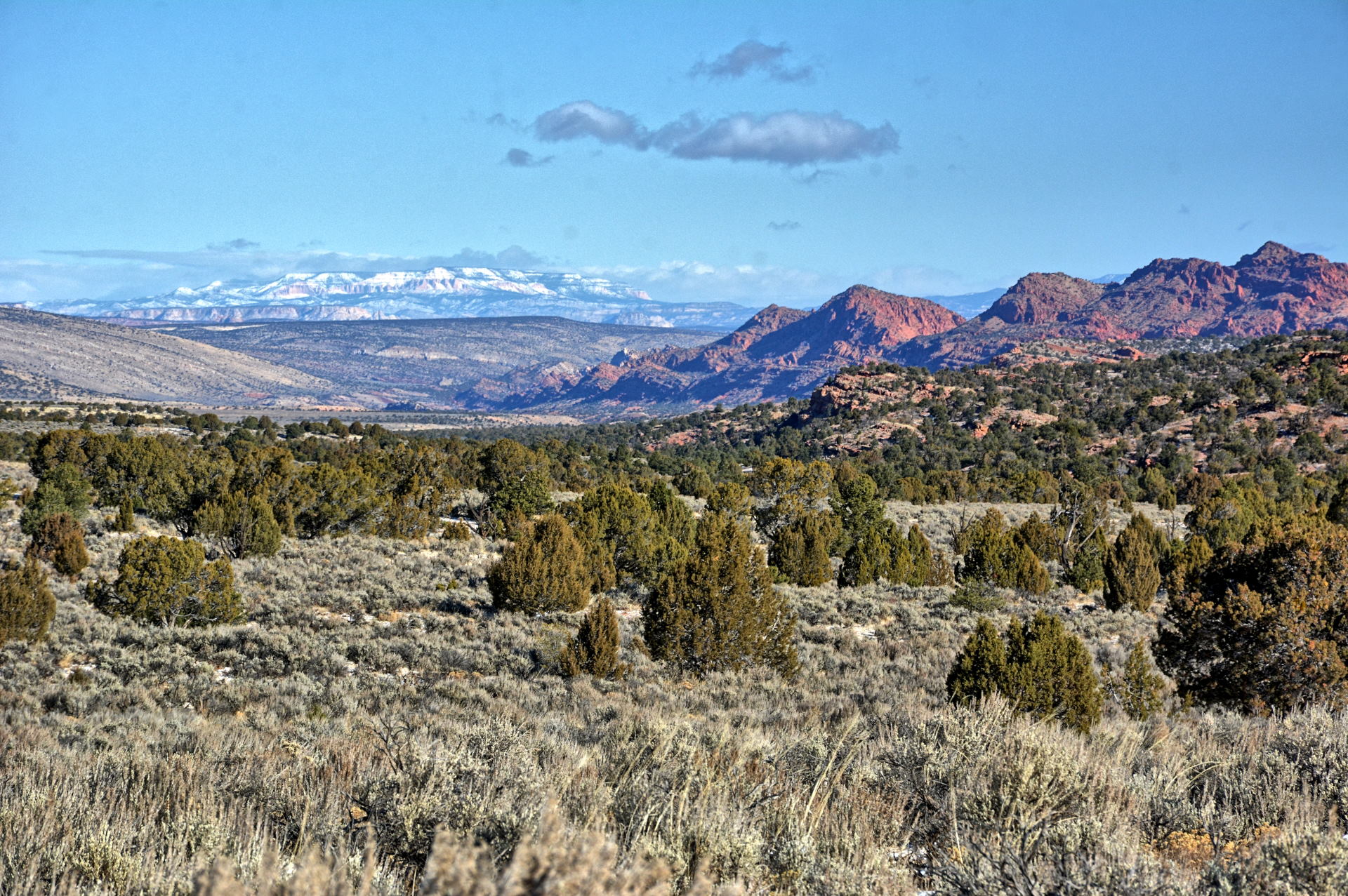
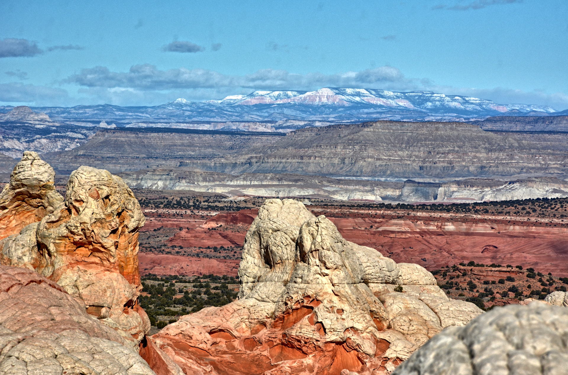
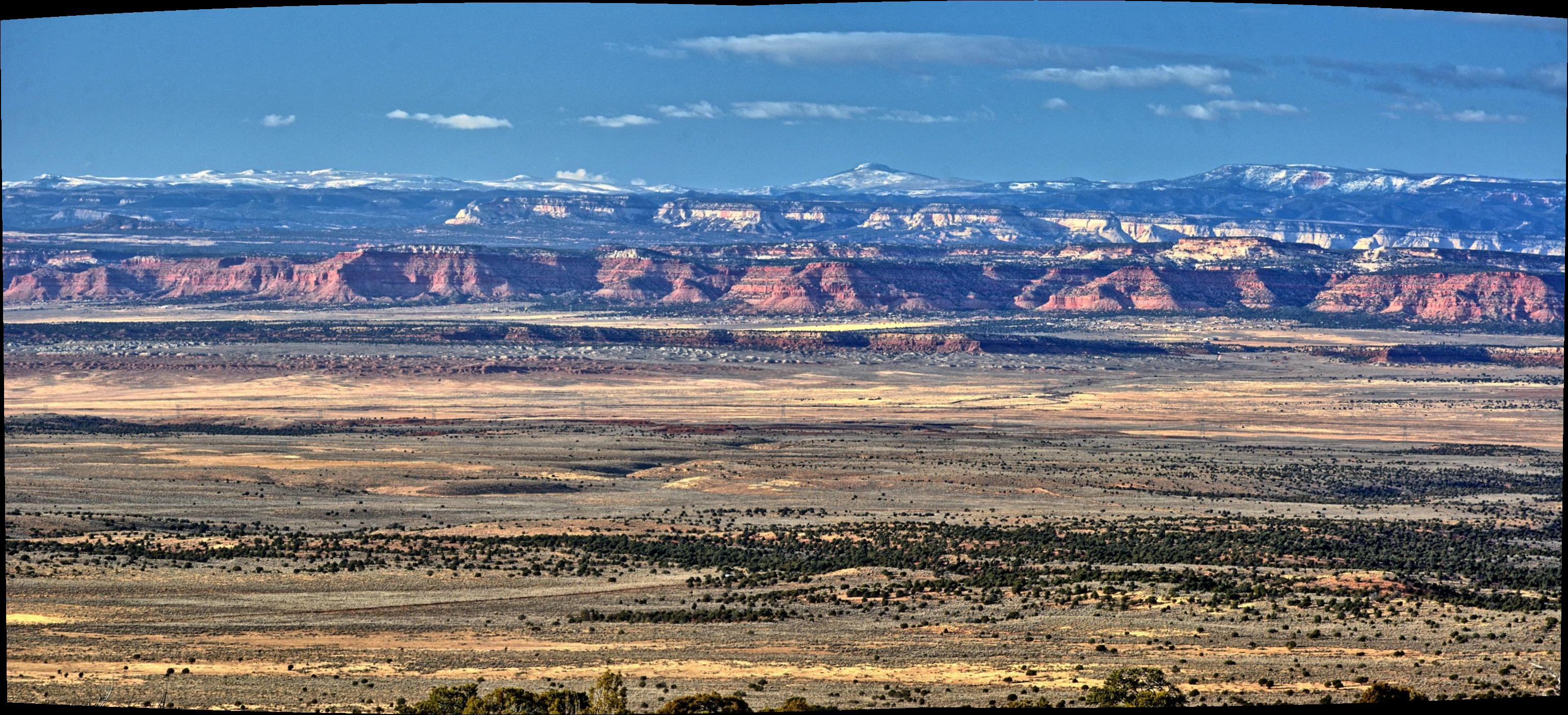
Looking east from edge of Kaibab Plateau, Vermillion Cliffs and Marble Canyon,
Arizona, 26 November 2019
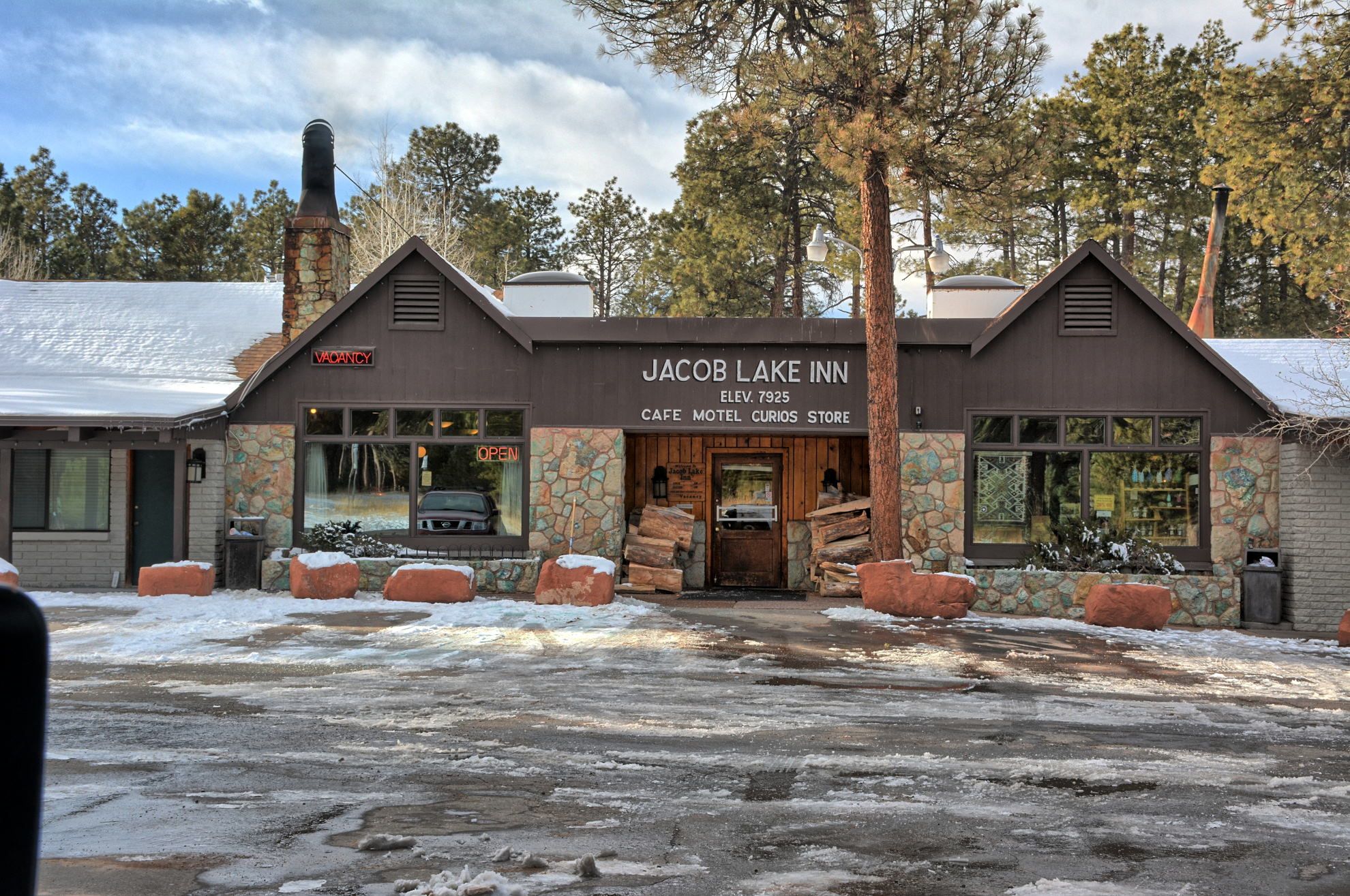
Jacob Lake Inn, Le Fevre Overlook, Kaibab Plateau, Arizona, 26 November 2019
Pipe Spring National Monument, Arizona, Sunset in Hurricane, Utah, 26 November 2019
Aerial Video,
White Pocket, Arizona, 26 November 2019
Aerial Video,
Southeast of Hurricane, Utah, 26 November 2019
Final Week: On Thursday, Thanksgiving, my wife and I drove from Baltimore to Charleston,
West Virginia to have Thanksgiving weekend with her family. We drove home
on Sunday, and I flew back to Dugway for one last week of flight testing on
Monday morning, 2 December. Flight testing lasted all week. I drove
back to Salt Lake City on Friday afternoon to catch a flight home on Saturday
morning. I managed to fly my RC aircraft in Skull Valley on the way to
Salt Lake City on Friday, 6 December 2019, and had dinner at Red Iguana 2 on Friday evening with a friend.
Skull Valley, 6 December 2019
Fisher/Johnson Pass, 6 December 2019
Aerial Video, Skull Valley, 6 December 2019
Aerial Video, Fisher/Johnson Pass, 6 December 2019
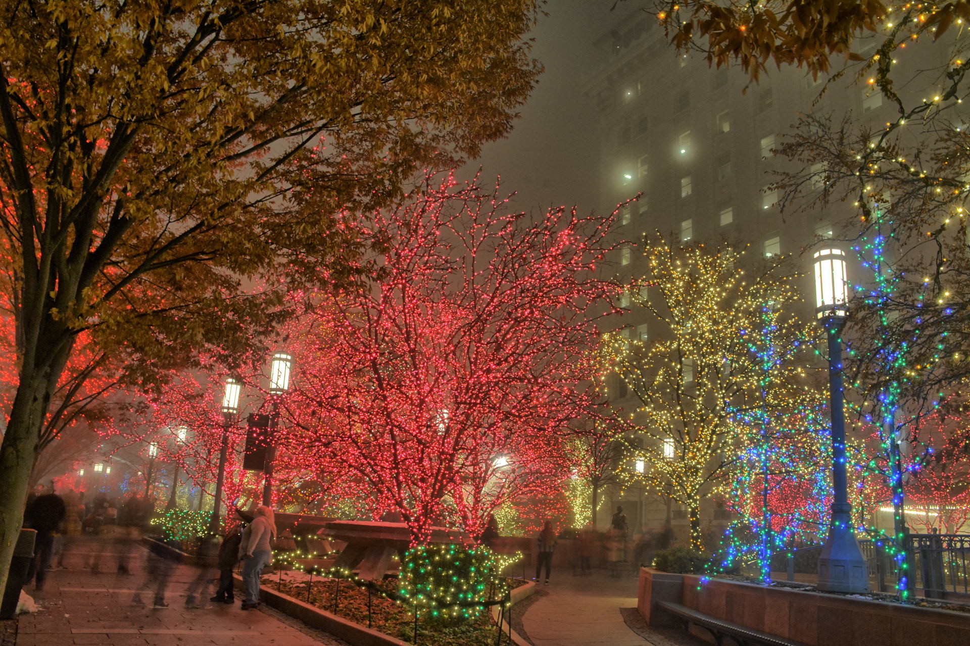
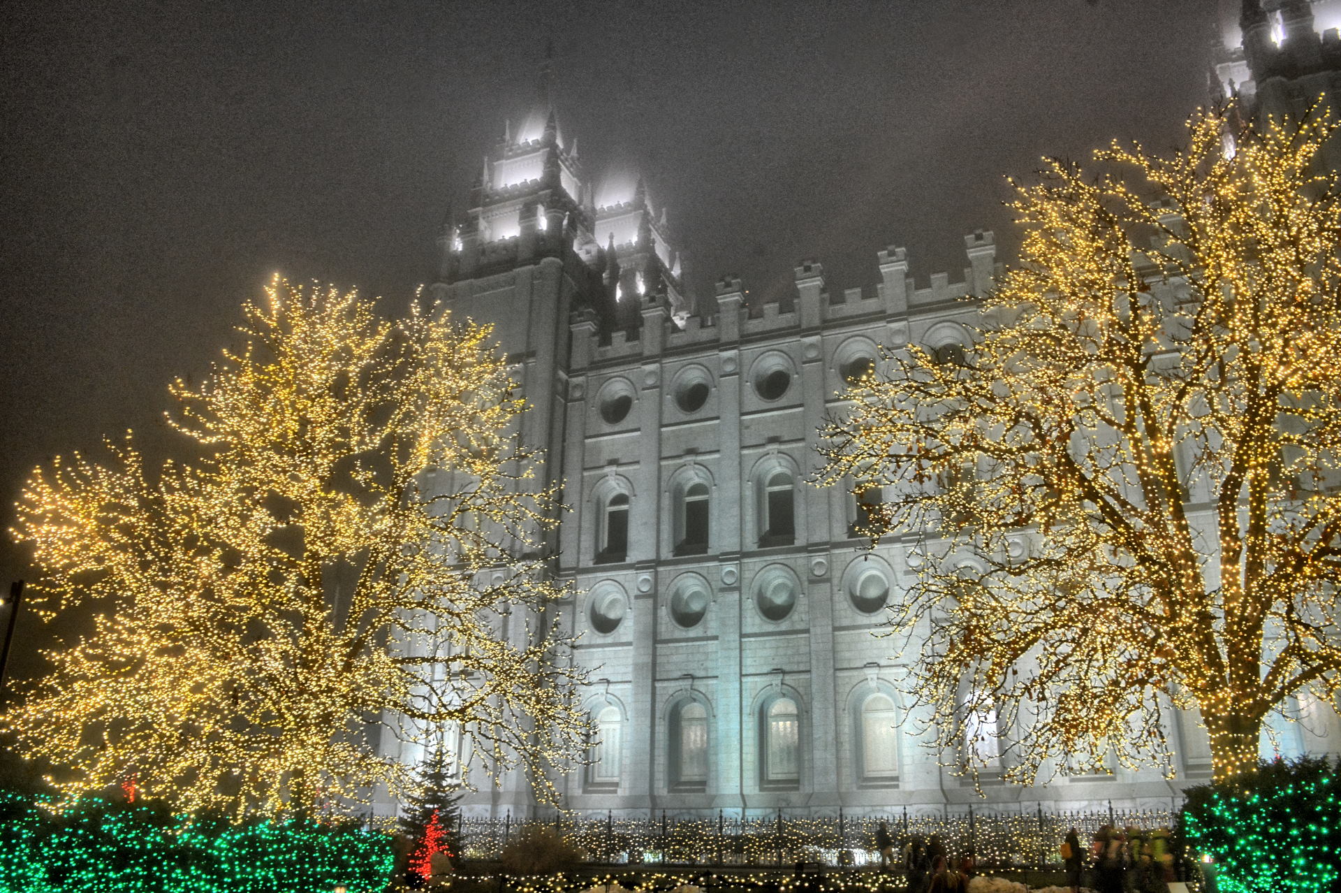
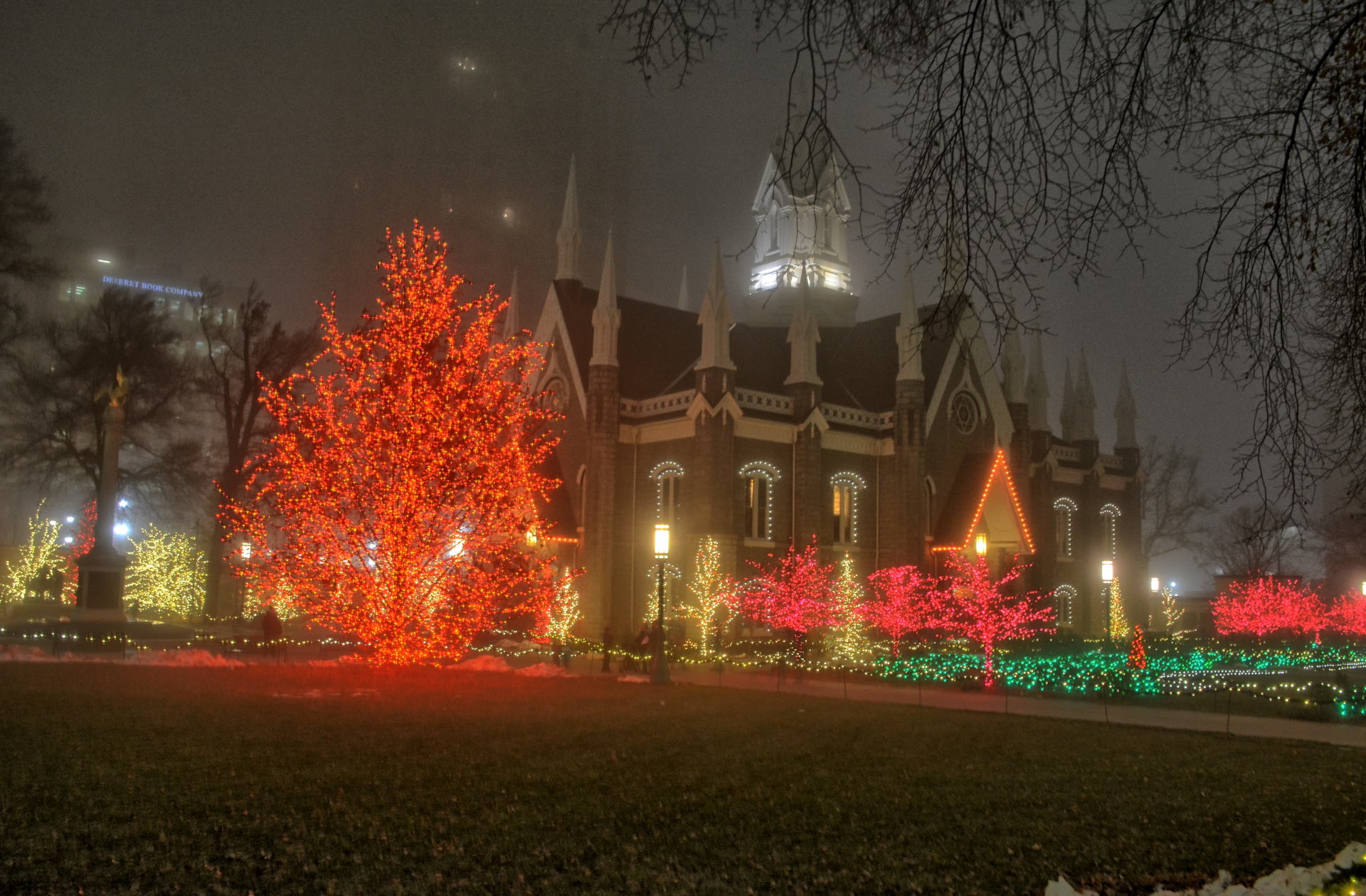
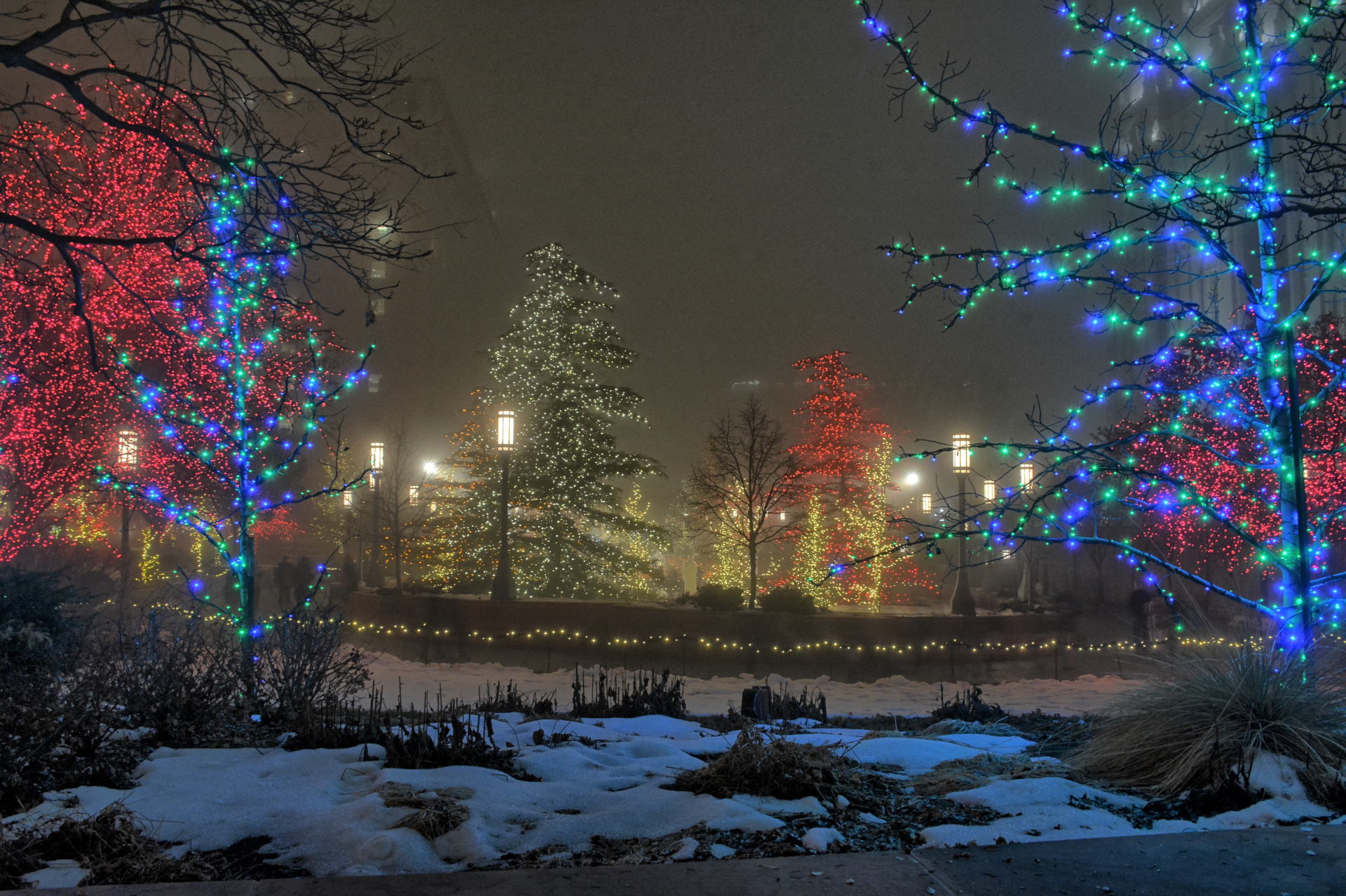
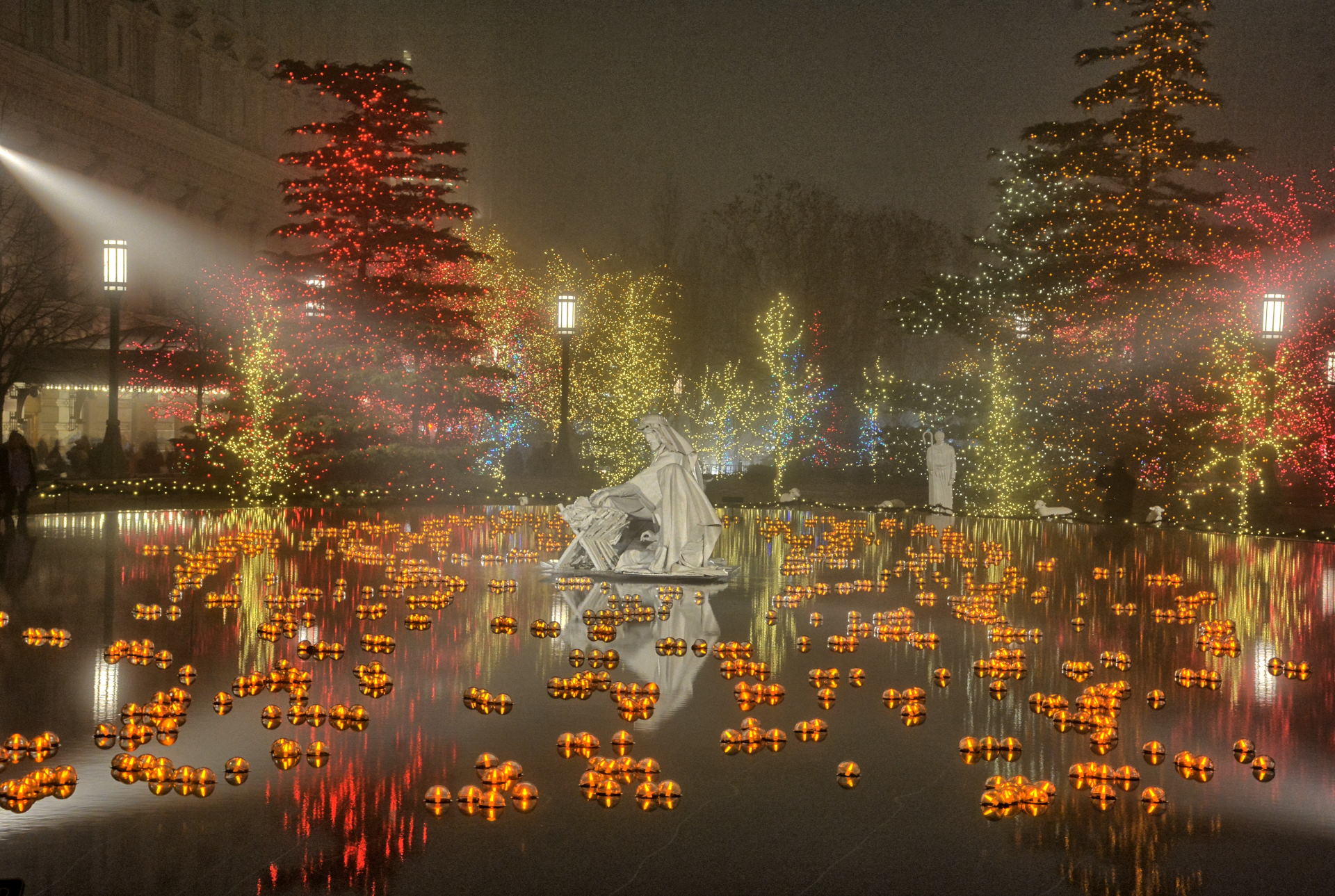
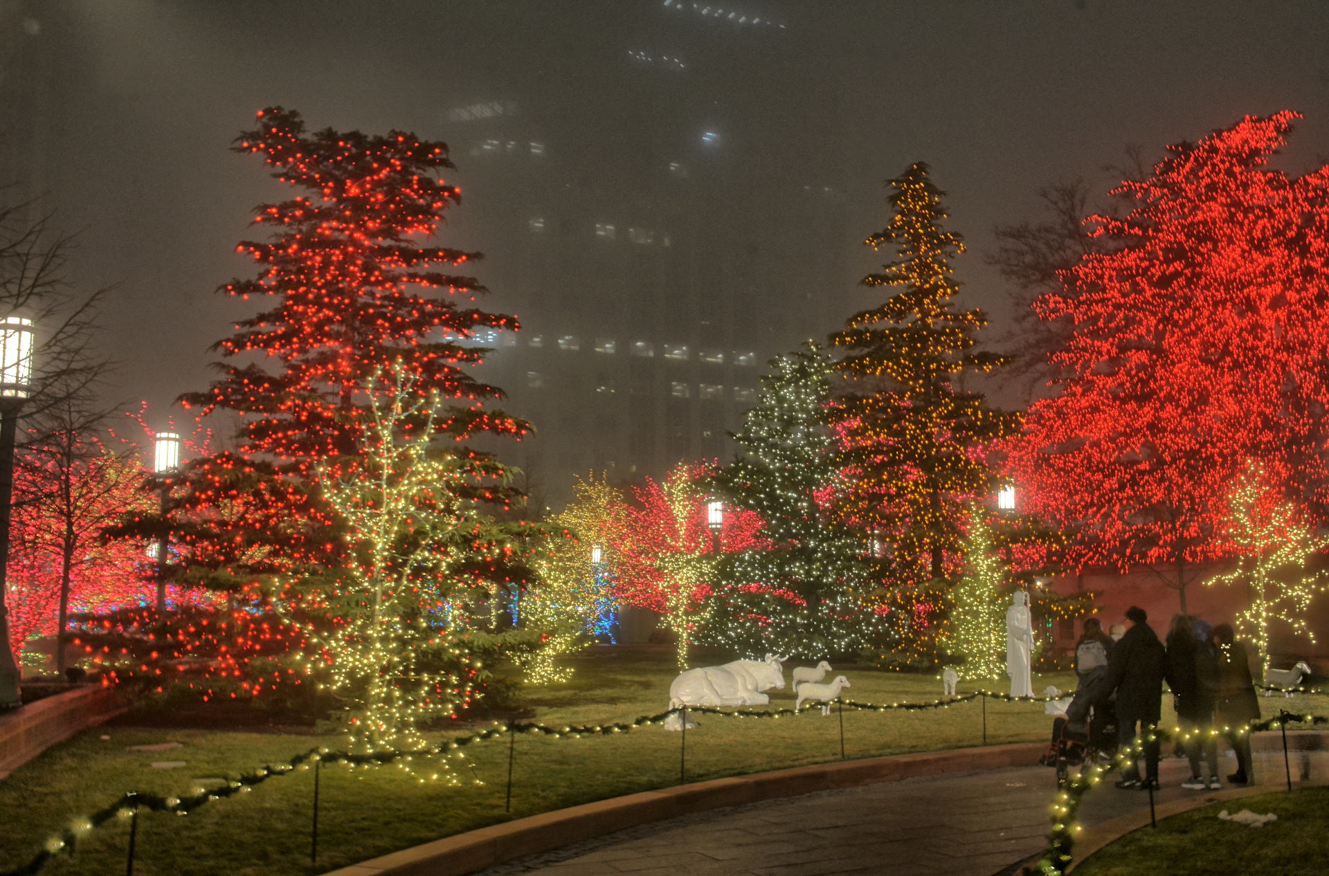
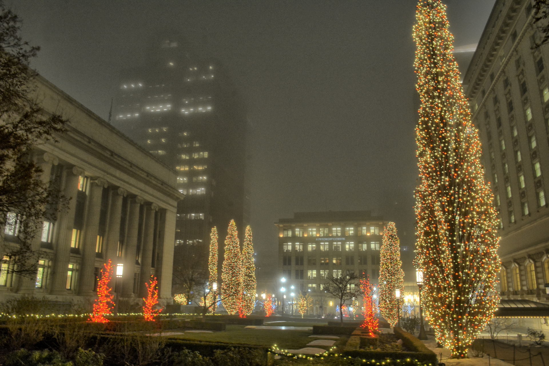
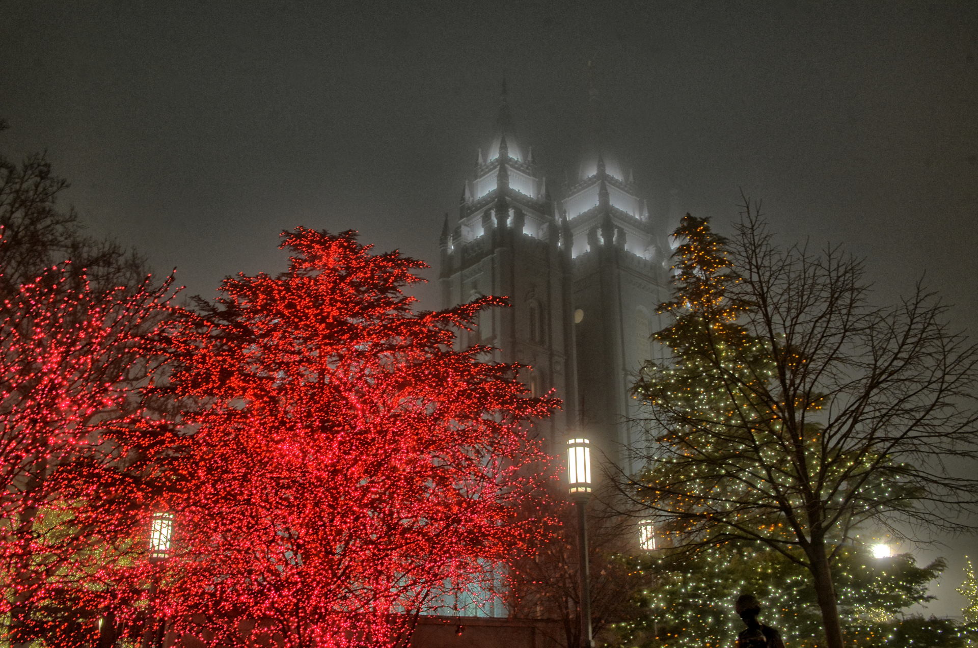
Before returning to my hotel, I drove up to Temple Square to walk around and
look at the Christmas lights that are put up every December. I finally
flew home for the rest of the year on Saturday, 7 December.
Temple Square, Salt Lake City, Utah, 6 December 2019